 Block
Ravenswood, Indiana
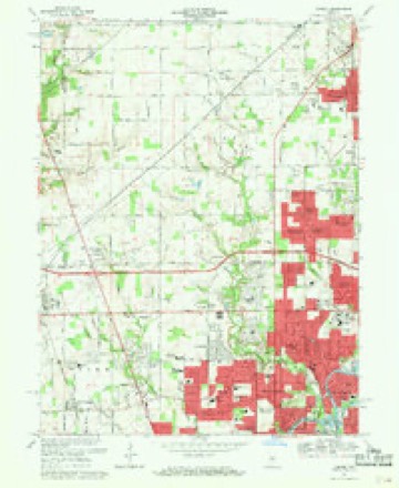
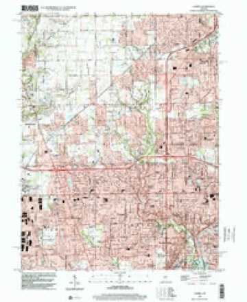
17 topographic sheets cover this place, the earliest surveyed in 1952 and the latest in 1998. It stands in Washington Township. It lies in ZIP code area 46240. It stands on Holly Creek. The Survey maps it on the Carmel quadrangle.
On record in Ravenswood
Buildings and businesses the archive holds for this place. Each opens its own page, with the source record it came from.
On the National Register within a mile 2 records
The National Register names another town for these. They stand within one mile of this settlement's coordinate.
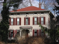 Hiram A. Haverstick Farmsteadlisted 1985 · 0.6 miles away
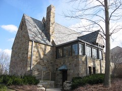 Foster Halllisted 2005 · 0.9 miles away
Topographic sheets covering this place
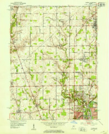
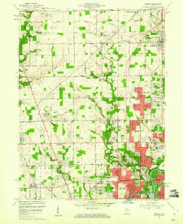
9 surveys from 17 printed sheetsMatched by testing this settlement's coordinate against the published boundary of every sheet in the United States Geological Survey's historical collection. Each opens the scanned sheet at the Survey.
- 1952 USGS Carmel quadrangle1:24000
- 1953 USGS Indianapolis quadrangle1:250000, 4 printings
- 1956 USGS Indianapolis quadrangle1:250000
- 1957 USGS Indianapolis quadrangle1:250000, 2 printings
- 1959 USGS Carmel quadrangle1:24000
- 1962 USGS Indianapolis quadrangle1:250000
- 1967 USGS Carmel quadrangle1:24000, 4 printings
- 1986 USGS Indianapolis quadrangle1:100000, 2 printings
- 1998 USGS Carmel quadrangle1:24000





In the county-history sources
15,135 words on this townshipHistory of Indianapolis and Marion County, Indiana, published 1884 has no passage naming this settlement, which was common for smaller places. Its township is covered in full.
The chapter on Washington Township covers the township.
Read the chapter on Washington Township - 15,135 words.
Mines and quarries near this place
6 within 5 milesRegional context, not property-specific evidence. The federal mineral resources record lists 6 workings within 5 miles of Ravenswood: 3 past producers, 3 producers. 3 still produce. What was taken out: Sand and Gravel, Construction, Stone, Crushed/Broken. Distance is straight-line from the map coordinates, so a quarry counted here may appear on a neighbouring settlement's page as well.
| Where | Site | Commodity | Status | Recorded |
|---|---|---|---|---|
| Indianapolis 521 Quarry | Stone, Crushed/Broken | Producer | ||
| Carmel 512 Pit | Sand and Gravel, Construction | Producer | ||
| Eighty-Sixth Street Sand | Sand and Gravel, Construction | Producer | ||
| Standard Materials Corp S&G Pit | Sand and Gravel, Construction | Past Producer | ||
| U. S. Aggregates, Inc. | Sand and Gravel, Construction | Past Producer | ||
| U. S. Allied Aggregates, Inc. | Sand and Gravel, Construction | Past Producer |
Storms near this place
20 since 1999Regional context, not property-specific evidence. The National Weather Service names Ravenswood in 20 storm reports between 1999 and 2024: 7 flash flood, 5 flood, 5 thunderstorm wind, 3 hail. No death or injury is recorded in these reports. Each account below is quoted exactly as the forecast office filed it, from the NOAA Storm Events Database, and each date opens the federal record of that event.
| When | Event | Place named | Harm | What the report says |
|---|---|---|---|---|
| February 2008 | Flood | Ravenswood | $10,000 | Flooding occurred along the White River in Marion County, including near Ravenswood, due to heavy rain and snow melt. |
| June 2011 | Flash Flood | Ravenswood | $8,000 | A car was stuck in flood waters at 54th Street and Keystone Avenue due to thunderstorm heavy rainfall. |
| May 2019 | Thunderstorm Wind | Ravenswood | $3,000 | A large tree and power lines were downed at 71st Street and Cranbrook Drive due to damaging thunderstorm wind gusts. |
| July 2015 | Flash Flood | Ravenswood | $2,000 | Flooding was reported along Kessler Boulevard due to heavy thunderstorm rainfall. |
| July 2020 | Thunderstorm Wind | Ravenswood | $1,000 | Power lines and power poles downed due to thunderstorm wind gusts. |
| May 2019 | Thunderstorm Wind | Ravenswood | $1,000 | A 50-foot, healthy tree was uprooted near this location due to damaging thunderstorm wind gusts. |
| August 2016 | Flash Flood | Ravenswood | $1,000 | Some side streets, south of Broad Ripple Avenue, had up to two feet of water on them due to heavy thunderstorm rainfall. |
| September 2014 | Flash Flood | Ravenswood | $1,000 | Flash flooding was reported at the intersection of Keystone Avenue and Kessler Boulevard due to heavy thunderstorm rainfall. |
| April 2014 | Flood | Ravenswood | $1,000 | Water was covering the roads at Rural Street and Kessler Boulevard due to heavy thunderstorm rainfall. |
| May 2012 | Flood | Ravenswood | $1,000 | Street flooding was observed along Keystone and Kessler Avenues due to thunderstorm heavy rainfall. |
| July 2010 | Flash Flood | Ravenswood | $1,000 | Multiple lanes were reported to be submerged at the intersection of 56th Street and Keystone Avenue due to heavy rainfall. The intersection was flooded up to the bumpers of vehicles. |
| June 2008 | Flash Flood | Ravenswood | $1,000 | Flash flooding was observed in the 5200 block of North Keystone avenue. |
| June 2011 | Flood | Ravenswood | $500 | Flooding blocked part of the road near the intersection of Kessler Boulevard and Keystone Avenue, due to thunderstorm heavy rainfall. |
| July 2017 | Thunderstorm Wind | Ravenswood | $250 | A tree branch, six inches in diameter, broke off a live tree due to strong thunderstorm wind gusts. |
| February 2024 | Thunderstorm Wind | Ravenswood | - | A couple of 60 mph thunderstorm wind gusts were measured at this location. |
| May 2009 | Hail | Ravenswood | - | Quarter size hail fell in the proximity of the intersection of Keystone and 74th Street in Indianapolis. |
| April 2009 | Flood | Ravenswood | - | Minor flooding occurred along the White River in and near Ravenswood, Indiana for about 1 day. The river crested half a foot above flood stage at the Ravenswood river gauge on April 7th at a reading of 6.5 feet. |
| July 2004 | Flash Flood | Ravenswood | - | Heavy rain flooded city streets and basements in Broad Ripple. |
| April 2006 | Hail | Ravenswood | - | no account filed |
| June 1999 | Hail | Ravenswood | - | no account filed |
Nearest settlements
The eight closest, with where each one stands in the county. Distances are straight-line, computed from the Geographic Names Information System coordinates.
| Map | Place | Distance | Sheets |
|---|---|---|---|
| Shore Acres | 0.9 miles | 17 | |
| Creekwood | 1.0 miles | 19 | |
| Glendale Heights | 1.1 miles | 19 | |
| Williams Creek | 1.3 miles | 17 | |
| Wellington | 1.3 miles | 19 | |
| Dawnbury | 1.4 miles | 17 | |
| Meridian Hills | 1.4 miles | 17 | |
| Broad Ripple | 1.5 miles | 19 |
Provenance
This settlement is recorded in the Geographic Names Information System as feature 441791. The sheet list is computed by point-in-boundary test against the United States Geological Survey's historical topographic inventory. Both are works of the United States government and carry no copyright under 17 U.S.C. 105.
Mines and quarries. USGS Mineral Resources Data System (MRDS) https://mrdata.usgs.gov/mrds/ A work of the United States government, no copyright under 17 U.S.C. 105.
Storms. NOAA National Centers for Environmental Information, Storm Events Database https://www.ncei.noaa.gov/stormevents/ A work of the United States government, no copyright under 17 U.S.C. 105. Narratives are quoted verbatim from the National Weather Service report and are not edited or summarised.