 Block
Royal Center, Indiana
9 topographic sheets cover this place, the earliest surveyed in 1953 and the latest in 1985. It stands in Boone Township. It lies in ZIP code area 46978. The Survey maps it on the Lucerne quadrangle. 802 people lived here at the 2020 count. It stands 735 feet above sea level.
Population over time
2 figuresRoyal Center fell from 861 to 802 between 2010 and 2020. These are the recorded population figures Wikidata holds for this place, reached through the Geographic Names Information System number this page is keyed on rather than by name, so they belong to this place and not to another of the same name. Most are census counts, but not all are: an early figure may be a founding or settlement estimate, and an estimate published within five years of a census is left out. The change column is computed, and is left blank where more than 20 years separate a figure from the one before it, because a gap that long is not a change between two counts.
| Year | People | Change |
|---|---|---|
| 2010 | 861 | |
| 2020 | 802 | -59 (-7%) |
Topographic sheets covering this place
5 surveys from 9 printed sheetsMatched by testing this settlement's coordinate against the published boundary of every sheet in the United States Geological Survey's historical collection. Each opens the scanned sheet at the Survey.
- 1953 USGS Danville quadrangle1:250000, 3 printings
- 1955 USGS Danville quadrangle1:250000
- 1956 USGS Danville quadrangle1:250000
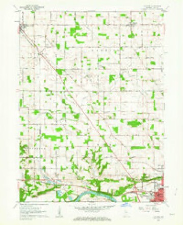
- 1960 USGS Lucerne quadrangle1:24000, 2 printings
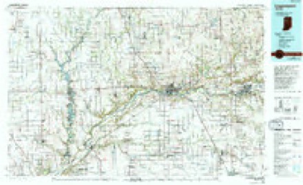
- 1985 USGS Logansport quadrangle1:100000, 2 printings



In the county-history sources
808 words on this townshipHistory of Cass County, Indiana, published 1878 names this settlement in its chapter on Boone Township. These are the passages that mention it, exactly as the scans read.
Until the year 1834, no permanent settlement was made within the borders of this township which bears the above name. In that year, several worthy men, as if guided by some unseen hand, deter¬ mined to try their fortunes in her deep forests. Ft remost among these was Andrew Kline, father of Henry Kline, now a citizen of Royal Center. Mr. K. select d for his future home what is now known as the Amos Fultz farm. From the most reliable authority at our command, before the close of the year 1834, the following men had become citizens of the township: John Henry, who settled .on the Shaffer farm; James Denton on the farm belonging to Mr. Brown ; Vincent Calvin, on the Mrs. David Foutz farm, and George D. Washburn, on the farm owned by Thomas Beekley and Joshua Kistler.
Passage source: History of Cass County, Indiana, published 1878.
At an early date in the history of the township, the citizens of Boone began to feel an interest in their spiritual welfare, which re¬ sulted in the holding of religious meetings at the residence of Martin Key, by the denomination known as Baptists. Soon after came the Methodists, and still later the United Brethren. The first church iu the township was built by the United Brethren in Royal Center, in 1862. The next was by the German Lutheran, known as the " Albright Chapel."
Passage source: History of Cass County, Indiana, published 1878.
Machine-read from a century-old scan, so expect the errors a machine makes: misspelled names, dropped words, stray characters.
Read the whole chapter on Boone Township - it names this place 1 more 1 time.
Storms near this place
24 since 1998Regional context, not property-specific evidence. The National Weather Service names Royal Center in 24 storm reports between 1998 and 2026: 17 thunderstorm wind, 7 hail. The reports record 7 injuries. Each account below is quoted exactly as the forecast office filed it, from the NOAA Storm Events Database, and each date opens the federal record of that event.
| When | Event | Place named | Harm | What the report says |
|---|---|---|---|---|
| March 2023 | Thunderstorm Wind | Royal Center | 7 hurt, $30,000 | A tree fell onto a van. Seven injuries total, 5 minor. |
| June 2025 | Thunderstorm Wind | Royal Center | $10,000 | Large tree down with powerlines across roadway. |
| April 2011 | Thunderstorm Wind | Royal Center | $10,000 | Emergency management officials reported a pole barn was destroyed by strong winds. |
| April 2026 | Thunderstorm Wind | Royal Center | $7,500 | Emergency manager reports that a roof was blown off of a barn. |
| March 2023 | Thunderstorm Wind | Royal Center | $5,000 | A semi truck was blown over on SR 16 at 1050 W. |
| July 2022 | Thunderstorm Wind | Royal Center | $5,000 | Trees and power lines over the road. |
| July 2008 | Hail | Royal Center | $5,000 | Emergency management officals reported hail broke out skylights in a residence and did some crop damage. Property damage is estimated at $5,000 and crop damage at $5,000. |
| June 2023 | Hail | Royal Center | $1,000 | no account filed |
| June 2015 | Thunderstorm Wind | Royal Center | - | Trees down between 700W and 500N. |
| July 2015 | Thunderstorm Wind | Royal Center | - | Tree down, relayed by county EMA. |
| September 2014 | Thunderstorm Wind | Royal Center | - | Emergency management officials reported wind gusts to 60 mph and several four to five inch diameter tree limbs down. |
| September 2012 | Thunderstorm Wind | Royal Center | - | Law enforcement officials reported a large limb, as well as power lines down. |
| June 2010 | Thunderstorm Wind | Royal Center | - | Cass County EM reports an estimated wind gust of 60 mph. |
| July 2008 | Thunderstorm Wind | Royal Center | - | Broadcast media outlets reported trees were blown down on both West and East Shafer streets in Royal Center. |
| August 2007 | Thunderstorm Wind | Royal Center | - | A few trees were blown down. |
| July 2003 | Thunderstorm Wind | Royal Center | - | Law enforcement reported trees and power lines down in Royal Center. |
| July 2003 | Hail | Royal Center | - | Law enforcement reported baseball size hail near Royal Center. |
| April 2001 | Thunderstorm Wind | Royal Center | - | One large tree blown down across the road along 400N and US 35. |
| May 1998 | Thunderstorm Wind | Royal Center | - | Utility pole blown down |
| May 1998 | Thunderstorm Wind | Royal Center | - | Multiple trees down |
| June 2015 | Hail | Royal Center | - | no account filed |
| May 2011 | Hail | Royal Center | - | no account filed |
| April 2006 | Hail | Royal Center | - | no account filed |
| May 1998 | Hail | Royal Center | - | no account filed |
Nearest settlements
The eight closest, with where each one stands in the county. Distances are straight-line, computed from the Geographic Names Information System coordinates.
| Map | Place | Distance | Sheets |
|---|---|---|---|
| Lucerne | 5.1 miles | 9 | |
| Leases Corner | 6.7 miles | 10 | |
| Lake Cicott | 7.0 miles | 9 | |
| Kenneth | 7.3 miles | 9 | |
| Verona | 7.4 miles | 10 | |
| Georgetown | 8.6 miles | 10 | |
| Mount Pleasant | 9.3 miles | 10 | |
| Dunkirk | 9.3 miles | 9 |
Elsewhere
Matched on this settlement's Geographic Names Information System number rather than its name, so it cannot be a different place of the same name in another state.
| Wikipedia article on Royal Center | An encyclopaedic summary. Its text is share-alike, so it is linked here rather than copied. |
| Wikidata item Q2913093 | The structured record the population and elevation above come from. Public domain (CC0). |
Provenance
This settlement is recorded in the Geographic Names Information System as feature 449723. The sheet list is computed by point-in-boundary test against the United States Geological Survey's historical topographic inventory. Both are works of the United States government and carry no copyright under 17 U.S.C. 105.
Storms. NOAA National Centers for Environmental Information, Storm Events Database https://www.ncei.noaa.gov/stormevents/ A work of the United States government, no copyright under 17 U.S.C. 105. Narratives are quoted verbatim from the National Weather Service report and are not edited or summarised.