 Block
Shelbyville, Indiana
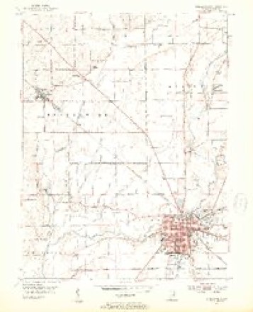
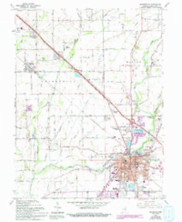
12 topographic sheets cover this place, the earliest surveyed in 1953 and the latest in 1986. It stands in Addison Township. It lies in ZIP code area 46176. It stands on Little Blue River. The Survey maps it on the Shelbyville quadrangle. 20,067 people lived here at the 2020 count. It stands 764 feet above sea level.
Research this city
On record in Shelbyville
Buildings and businesses the archive holds for this place. Each opens its own page, with the source record it came from.
On the National Register 8 records
 John Hamilton Houselisted 1979
 Lora B. Pearson Schoollisted 2009
 Porter Pool Bathhouselisted 2001
 Shelbyville Commercial Historic Districtlisted 1984
 Shelbyville High Schoollisted 1996
 West Side Historic Districtlisted 1990
- Clover Ford Iron Bridgelisted 2023
- Messick Masonic Templelisted 2024
Population over time
2 figuresShelbyville grew from 19,191 to 20,067 between 2010 and 2020. These are the recorded population figures Wikidata holds for this place, reached through the Geographic Names Information System number this page is keyed on rather than by name, so they belong to this place and not to another of the same name. Most are census counts, but not all are: an early figure may be a founding or settlement estimate, and an estimate published within five years of a census is left out. The change column is computed, and is left blank where more than 20 years separate a figure from the one before it, because a gap that long is not a change between two counts.
| Year | People | Change |
|---|---|---|
| 2010 | 19,191 | |
| 2020 | 20,067 | +876 (+5%) |
Topographic sheets covering this place
5 surveys from 12 printed sheetsMatched by testing this settlement's coordinate against the published boundary of every sheet in the United States Geological Survey's historical collection. Each opens the scanned sheet at the Survey.
- 1953 USGS Cincinnati quadrangle1:250000, 3 printings
- 1953 USGS Shelbyville quadrangle1:24000, 2 printings
- 1957 USGS Cincinnati quadrangle1:250000
- 1962 USGS Shelbyville quadrangle1:24000, 4 printings
- 1986 USGS New Castle quadrangle1:100000, 2 printings



Mines and quarries near this place
3 within 5 milesRegional context, not property-specific evidence. The federal mineral resources record lists 3 workings within 5 miles of Shelbyville: 2 producers, 1 past producer. 2 still produce. What was taken out: Sand and Gravel, Construction, Stone. Distance is straight-line from the map coordinates, so a quarry counted here may appear on a neighbouring settlement's page as well.
| Where | Site | Commodity | Status | Recorded |
|---|---|---|---|---|
| Shelby Co. Hwy. Dept. | Stone | Producer | ||
| Indiana Sand and Gravel Pit | Sand and Gravel, Construction | Past Producer | ||
| Shelby Gravel Pit and Mill | Sand and Gravel, Construction | Producer |
Storms near this place
60 of 95 shownRegional context, not property-specific evidence. The National Weather Service names Shelbyville in 95 storm reports between 1993 and 2025: 51 thunderstorm wind, 23 hail, 9 flood, 5 flash flood. The reports record 1 injury. Each account below is quoted exactly as the forecast office filed it, from the NOAA Storm Events Database, and each date opens the federal record of that event.
| When | Event | Place named | Harm | What the report says |
|---|---|---|---|---|
| March 2006 | Tornado (F2) | Shelbyville | 1 hurt, $5,000,000 | A tornado touched down just west of Interstate 65 and Main Street in Greenwood on the evening of 31 March 2006. This tornado was on the ground for 25 minutes, covered an area 17 miles long, and caused significant damage to several homes and businesses along its path, which continued into neighboring Shelby County. At its peak, near the small town of London in Shelby County, the tornado was a strong F2, with a width of four tenths of a mile. The tornado lifted near US 52 and State Road 9 in north central Shelby County. According to the American Red Cross of Greater Indianapolis, more than 140 homes were damaged, some of them severely. Fortunately, no fatalities or life-threatening injuries were reported, although at least one driver, Megan Mahoney of Chesterfield, MO, sustained a concussion when her car was rolled or tossed off of Interstate 74 in Shelby County and into the yard of a home over 150 feet away. This was the third significant tornado in just over three and a half years to affect the southern suburbs of the Indianapolis metropolitan area. |
| November 2001 | Tornado (F1) | Shelbyville | $1,000,000 | A weak F1 tornado embedded in a squall line cut a 16 mile path across Shelby County. 20 residences and an auto body shop were damaged in Gwynneville, while 7 businesses and 3 homes were damaged in or near Shelbyville. Damage was estimated around 1 million dollars. |
| April 1996 | Lightning | Shelbyville | $150,000 | no account filed |
| June 2008 | Flood | Shelbyville | $100,000 | Flooding occurred along the Big Blue River in Shelby County, including near Shelbyville, due to heavy rain. |
| June 2023 | Thunderstorm Wind | Shelbyville | $75,000 | Multiple trees and powerlines downed by thunderstorm wind gusts. The storm caused over 2500 power outages across the county. |
| July 2005 | Thunderstorm Wind | Shelbyville | $70,000 | A farmer's grain-leg assembly was taken down by thunderstorm winds. The damage amount is estimated. |
| July 2019 | Flash Flood | Shelbyville | $35,000 | Cars were reportedly flooded in intersections along with an estimated 8 to 12 inches on some roads due to heavy thunderstorm rainfall. The specific location of this event in Shelbyville is unknown. |
| August 2000 | Lightning | Shelbyville | $30,000 | no account filed |
| August 2025 | Thunderstorm Wind | Shelbyville | $25,000 | Thunderstorm winds downed multiple trees in Shelbyville, with one blown onto powerlines. |
| April 2020 | Thunderstorm Wind | Shelbyville | $25,000 | Numerous trees and power poles blown over or snapped due to thunderstorm wind gusts within Shelbyville and nearby communities. |
| May 2019 | Thunderstorm Wind | Shelbyville | $25,000 | A tree was downed on a house and 2 cars due to damaging thunderstorm wind gusts. No injuries were reported. |
| March 2008 | Flood | Shelbyville | $15,000 | Flooding occurred along the Big Blue River in Shelby County, including in Shelbyville, due to heavy rain. |
| March 2008 | Flood | Shelbyville | $15,000 | Flooding occurred along the Big Blue River in Shelby County, including in Shelbyville, due to heavy rain and snow melt. |
| August 2012 | Thunderstorm Wind | Shelbyville | $11,000 | A tree was down on top of a car on West Broadway Street and a tree was also down on a house on North Street due to damaging thunderstorm wind gust. |
| January 2008 | Flood | Shelbyville | $10,000 | Flooding occurred along the Big Blue River in Rush County, including near Shelbyville, due to heavy rain and snow melt. |
| February 2008 | Flood | Shelbyville | $10,000 | Flooding occurred along the Big Blue River in Shelby County, including near Shelbyville, due to heavy rain and snow melt. |
| January 2007 | Flood | Shelbyville | $10,000 | The Big Blue at Shelbyville briefly flooded. The river crested near four feet above flood stage. |
| June 2006 | Thunderstorm Wind | Shelbyville | $10,000 | A tree fell on a house, punching a hole in the roof. |
| May 2006 | Thunderstorm Wind | Shelbyville | $10,000 | A radio tower and some trees were downed, and a barn door was damaged. |
| July 2003 | Thunderstorm Wind | Shelbyville | $10,000 | no account filed |
| July 2015 | Flash Flood | Shelbyville | $8,000 | Ankle deep water was observed in a basement of a home in Shelbyville due to heavy thunderstorm rainfall. This was reported by CBS4. |
| June 1998 | Thunderstorm Wind | Shelbyville | $8,000 | Downed trees and power lines partially damaged a house roof. |
| June 2021 | Flash Flood | Shelbyville | $5,000 | Numerous roads were noticed to be closed later in the day by NWS employee. Roads were closed due to rapidly rising floodwaters earlier in the night. |
| July 2021 | Thunderstorm Wind | Shelbyville | $5,000 | Roofing material blown from a building at the intersection of South Pike Street and Howard Street. |
| May 2009 | Lightning | Shelbyville | $5,000 | A lightning strike started a fire in the attic of a Shelbyville, Indiana home on South West Street around 1:30 PM EST. Flames and smoke were visible from the roof. Firefighters gained access to the fire via the front door as well as by cutting through the roof. The fire was extinguished with minimal water, causing very little water damage. Smoke damage was reported to be minimal as well.||Lightning also struck an 80-foot sycamore tree at nearby Bear Chase Golf Course, near Morristown Road, causing it to catch fire and fall. The time of occurrence was simply described as late in the day. |
| May 2003 | Thunderstorm Wind | Shelbyville | $5,000 | Trees down, power lines down, barn damaged |
| April 1993 | Thunderstorm Wind | Shelbyville | $5,000 | no account filed |
| July 1995 | Thunderstorm Wind | Shelbyville | $3,000 | Numerous trees were downed. |
| June 2013 | Flash Flood | Shelbyville | $2,000 | Numerous streets were flooded on the east side of Shelbyville due to thunderstorm heavy rainfall. High water was also reported in horse barns at the County Fairgrounds. Interstate 74 was down to one lane near Shelbyville with high water in the medians. |
| July 2008 | Thunderstorm Wind | Shelbyville | $2,000 | Trees and utility lines were blown down on the north side of the city. Some street flooding was observed from heavy rainfall. |
| June 1997 | Lightning | Shelbyville | $1,500 | no account filed |
| October 1996 | Thunderstorm Wind | Shelbyville | $1,000 | no account filed |
| July 2019 | Flash Flood | Shelbyville | $500 | An intersection in Shelbyville was flooded due to heavy thunderstorm rainfall. This report was received via Twitter. |
| June 2013 | Flood | Shelbyville | $500 | Drainage ditches were overflowing and open fields near the Shelby County Fairgrounds were flooded due to thunderstorm heavy rainfall. |
| August 2019 | Thunderstorm Wind | Shelbyville | $200 | Small tree branches were snapped due to thunderstorm wind gusts. |
| October 2016 | Hail | Shelbyville | - | Most of the hail observed in this location was a half inch, with some as large as a penny. |
| June 2015 | Hail | Shelbyville | - | Hail stones up to 1 inch in diameter were reported. |
| June 2010 | Thunderstorm Wind | Shelbyville | - | A 60 mph thunderstorm wind gust was measured in this location. |
| February 2009 | Flood | Shelbyville | - | Flooding occurred along the Big Blue River in Shelby County, including in and near Shelbyville, due to heavy rain. |
| July 2008 | Thunderstorm Wind | Shelbyville | - | A tree was reported down by thunderstorm winds, blocking Knightstown Road at the Interstate 74 overpass. |
| July 2008 | Thunderstorm Wind | Shelbyville | - | Trees were blown down by thunderstorm winds. |
| June 2008 | Thunderstorm Wind | Shelbyville | - | Trees and power lines were knocked down due to damaging thunderstorm winds. Some of the trees fell onto a roadway. |
| June 2006 | Thunderstorm Wind | Shelbyville | - | Trees were downed. |
| June 2006 | Thunderstorm Wind | Shelbyville | - | Trees were downed. |
| June 2006 | Thunderstorm Wind | Shelbyville | - | Trees were downed. |
| June 2006 | Thunderstorm Wind | Shelbyville | - | Trees were downed. |
| April 2005 | Thunderstorm Wind | Shelbyville | - | Trees were blown down. |
| July 2005 | Thunderstorm Wind | Shelbyville | - | Trees were blown down near County Road 500 North and State Road 9. |
| July 2005 | Thunderstorm Wind | Shelbyville | - | Trees were downed. One reportedly fell on a home. No damage estimates were available. |
| September 2005 | Thunderstorm Wind | Shelbyville | - | Several trees were downed. |
| September 2003 | Thunderstorm Wind | Shelbyville | - | Law enforcement reported trees down. |
| May 2003 | Thunderstorm Wind | Shelbyville | - | Trees/Limbs down |
| August 2002 | Thunderstorm Wind | Shelbyville | - | Trees down |
| July 1999 | Thunderstorm Wind | Shelbyville | - | Law enforcement reported a line of thunderstorms produced downed trees. |
| March 2020 | Hail | Shelbyville | - | no account filed |
| July 2016 | Hail | Shelbyville | - | no account filed |
| February 2014 | Hail | Shelbyville | - | no account filed |
| May 2014 | Hail | Shelbyville | - | no account filed |
| April 2012 | Hail | Shelbyville | - | no account filed |
| May 2011 | Hail | Shelbyville | - | no account filed |
Nearest settlements
The eight closest, with where each one stands in the county. Distances are straight-line, computed from the Geographic Names Information System coordinates.
| Map | Place | Distance | Sheets |
|---|---|---|---|
| Wellington Heights | 0.8 miles | 12 | |
| Walkerville | 0.9 miles | 12 | |
| Crestmoor | 0.9 miles | 12 | |
| Riley Village | 1.1 miles | 12 | |
| Lantana Estate | 1.4 miles | 12 | |
| Brent Woods | 1.6 miles | 12 | |
| Rolling Ridge | 1.6 miles | 12 | |
| Hildebrand Village | 1.8 miles | 12 |
Elsewhere
Matched on this settlement's Geographic Names Information System number rather than its name, so it cannot be a different place of the same name in another state.
| Wikipedia article on Shelbyville | An encyclopaedic summary. Its text is share-alike, so it is linked here rather than copied. |
| Wikidata item Q608120 | The structured record the population and elevation above come from. Public domain (CC0). |
Provenance
This settlement is recorded in the Geographic Names Information System as feature 443347. The sheet list is computed by point-in-boundary test against the United States Geological Survey's historical topographic inventory. Both are works of the United States government and carry no copyright under 17 U.S.C. 105.
Mines and quarries. USGS Mineral Resources Data System (MRDS) https://mrdata.usgs.gov/mrds/ A work of the United States government, no copyright under 17 U.S.C. 105.
Storms. NOAA National Centers for Environmental Information, Storm Events Database https://www.ncei.noaa.gov/stormevents/ A work of the United States government, no copyright under 17 U.S.C. 105. Narratives are quoted verbatim from the National Weather Service report and are not edited or summarised.