 Block
From the record
15 National Register listings published here · the county-history sources tell 1 story.
Sources: the county history on the Internet Archive · the National Register database, National Park Service
61 topographic sheets cover 50 settlements here, and 15 properties are on the National Register of Historic Places.
15 National Register listings published here · the county-history sources tell 1 story.
Sources: the county history on the Internet Archive · the National Register database, National Park Service
Among them: Compaxy I, Eifty-First Regimext. These passages come from the identified county-history source books. Each inset names its own source and opens the exact section it comes from.
Aldridge. James, killed at Stone River. Deceml.cr 31, 1862. Burr. Lewis R.. died at Louisville. January 7. 1862. Creviston. Aaron, died at Xashville. Maxxh 26. 1862. Chambers. James died at New Orleans, July 14. 1865. Ellington. Albert, died at Bardstown, December 28. 1861. German. Cliarles E.. died at Bardstown. December 29.
Every property in this county listed on the National Register of Historic Places, with the year it was listed and the federal nomination document.
| Photograph | Property | Type | Listed | Reference |
|---|---|---|---|---|
| Clover Ford Iron Bridge | structure | 2023 | 100009015 | |
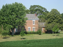 | Cooper-Alley House | building | 1982 | 82000074 |
 | John Hamilton House | building | 1979 | 79000043 |
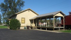 | Junction Railroad Depot | building | 1979 | 79000044 |
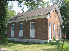 | Liberty Township Schoolhouse No. 2 | building | 1992 | 92001170 |
| Messick Masonic Temple | building | 2024 | 100010029 | |
 | Middletown Bridge | structure | 2009 | 09001135 |
 | Lora B. Pearson School | building | 2009 | 09001136 |
 | Porter Pool Bathhouse | building | 2001 | 01001348 |
 | George Rudicel Polygonal Barn | building | 1993 | 93000463 |
 | Shelby County Courthouse | building | 2011 | 11000917 |
 | Shelbyville Commercial Historic District | district | 1984 | 84001638 |
 | Shelbyville High School | building | 1996 | 95001535 |
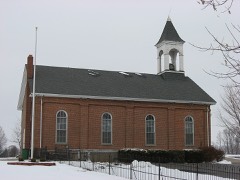 | St. George Lutheran Church | building | 1984 | 84001627 |
 | West Side Historic District | district | 1990 | 90000099 |
The NOAA Storm Events Database holds 357 reports for this county, causing no deaths, 13 injuries and about $55,491,450 in recorded property damage. Each settlement page carries the reports that name it.
| Kind of event | Reports |
|---|---|
| Thunderstorm Wind | 218 |
| Hail | 61 |
| Tornado | 35 |
| Flash Flood | 20 |
| Flood | 16 |
| Lightning | 7 |
The most serious of them, by death, then injury, then recorded damage. The accounts are quoted exactly as the forecast office filed them.
| When | Event | Place named | Harm | What the report says |
|---|---|---|---|---|
| March 1971 | Tornado (F2) | not stated | 5 hurt, $250,000 | no account filed |
| April 1974 | Tornado (F3) | not stated | 2 hurt, $25,000,000 | no account filed |
| March 2006 | Tornado (F2) | Shelbyville | 1 hurt, $5,000,000 | A tornado touched down just west of Interstate 65 and Main Street in Greenwood on the evening of 31 March 2006. This tornado was on the ground for 25 minutes, covered an area 17 miles long, and caused significant damage to several homes and businesses along its path, which continued into neighboring Shelby County. At its peak, near the small town of London in Shelby County, the tornado was a strong F2, with a width of four tenths of a mile. The tornado lifted near US 52 and State Road 9 in north central Shelby County. According to the American Red Cross of Greater Indianapolis, more than 140 homes were damaged, some of them severely. Fortunately, no fatalities or life-threatening injuries were reported, although at least one driver, Megan Mahoney of Chesterfield, MO, sustained a concussion when her car was rolled or tossed off of Interstate 74 in Shelby County and into the yard of a home over 150 feet away. This was the third significant tornado in just over three and a half years to affect the southern suburbs of the Indianapolis metropolitan area. |
| November 2005 | Tornado (F3) | Norristown | 1 hurt, $5,000,000 | A strong F3 tornado touched down in northern Bartholomew county on 15 November 2005, continuing into southeast Shelby county, where it would do the majority of its damage. No one was killed by this powerful tornado, despite areas of severe damage, and only one minor injury was reported. A resident sustained an ankle injury when moving quickly down into his basement with his family to take cover. The worst damage along the tornado's path took place along and near Vandalia Road just east of the town of Geneva, where a large hog farm was severely damaged, and an old farm house was blown off its foundation. The structural integrity of the destroyed home was insufficient to justify a violent rating. Around 25 properties were damaged in this largely rural area, with six declared total losses. |
| April 1961 | Tornado (F4) | not stated | 1 hurt, $2,500,000 | no account filed |
| May 2011 | Tornado (EF0) | Morristown | 1 hurt, $75,000 | An EF-0 tornado with maximum winds of 75 mph was discovered in northeast Shelby County to the north of Morristown. Numerous trees were snapped along and just east of the Big Blue River and Asbury Road from near County Road 1100 North to the Shelby-Hancock County line. Two homes sustained minor damage, and a gentleman sustained injuries from a tree falling on his automobile. |
| July 2021 | Thunderstorm Wind | Waldron | 1 hurt, $18,000 | Minor tree and roof damage at 5364 South County Road 425 East. One minor injury when homeowner walked outside during storm and was hit by flying debris 3 times leading to minor chest injury and minor lacerations. |
| June 2008 | Tornado (EF1) | Mt Auburn | 1 hurt, $15,000 | In Brown County near Peoga damaged occurred to twenty to thirty homes, a barn, powerlines, trees, and a carport due to a tornado. One indirect injury occurred when I firefighter suffered heat stroke. In Johnson County at Camp Atterbury forty buildings were damaged, dozens of vehicles including a 6,000 pound Humvee and a bus were tossed and crushed, the chapel was damaged, and a trailer was tossed on top of a building. Also in Johnson County in Edinburgh 59 buildings were damaged or destroyed. One woman suffered an ankle injury during the tornado. Damaged occurred in Shelby County to a gas station. One woman at the gas station sustained minor injuries when her car windows were blown out. The tornado touched down at 2024 EST in Brown County near the intersection of Sweetwater Trail and Beech Tree Road. The tornado tracked to the northeast for 2.83 miles before crossing into Johnson County approximately 1000 feet west of County Road 900 at 2030 EST. The tornado continued to track to the northeast for 7.19 miles until 2046 EST when the tornado entered Shelby County just south of the County Road 900 and West State Road 252 intersection. The tornado lifted at 2047 EST in Shelby County after tracking to the northeast and lifting at exit 80 on Interstate 65. The tornado was an EF-2 while in Brown County causing 200 thousand dollars in damage. The tornado was an EF-2 while in Johnson County causing 23 million dollars in damage. The tornado weakened to an EF-1 while in Shelby County causing 15 thousand dollars in damage. Based on damage indicators, at the tornadoes peak intensity wind speeds were around 130 miles per hour. The tornado formed from a supercell and was on the ground for 23 minutes or 10.59 miles. |
| November 1992 | Tornado (F3) | not stated | $2,500,000 | no account filed |
| March 1986 | Tornado (F3) | not stated | $2,500,000 | no account filed |
| March 1986 | Tornado (F2) | not stated | $2,500,000 | no account filed |
| March 1986 | Tornado (F2) | not stated | $2,500,000 | no account filed |
| February 1956 | Tornado (F2) | not stated | $2,500,000 | no account filed |
| November 2001 | Tornado (F1) | Shelbyville | $1,000,000 | A weak F1 tornado embedded in a squall line cut a 16 mile path across Shelby County. 20 residences and an auto body shop were damaged in Gwynneville, while 7 businesses and 3 homes were damaged in or near Shelbyville. Damage was estimated around 1 million dollars. |
| November 1992 | Tornado (F2) | not stated | $250,000 | no account filed |
| August 1969 | Tornado (F2) | not stated | $250,000 | no account filed |
| September 1961 | Tornado (F3) | not stated | $250,000 | no account filed |
| July 1957 | Tornado (F2) | not stated | $250,000 | no account filed |
| March 1955 | Tornado (F2) | not stated | $250,000 | no account filed |
| June 2008 | Tornado (EF0) | Waldron | $200,000 | The tornado touched down in Shelby County at 2004 EST 200 meters north of the County Road South 500 East and County Road East 500 South intersection. The tornado tracked to the east northeast for 2.93 miles before entering Rush County at 2012 EST near County Road South 1000 West just south of County Road East 450 South. The tornado continued to the northeast for 6.75 miles until lifting at 2030 EST. The tornado lifted 200 meters east of County Road South 400 West and 400 meters north of West State Road 244. The tornado was on the ground for a total of 9.68 miles and 26 minutes. The tornado was an EF-0 with wind speeds around 75 miles per hour while in Shelby County, however intensified to an EF-3 tornado while in Rush County with wind speeds around 150 miles per hour. The tornado had a width of 150 yards. The tornado formed from a supercell storm. While in Shelby County the tornado damaged 34 structures with the hardest hit areas being Middletown and Waldron. 27 of the damaged structures were in Middletown with 4 of these being completely destroyed. Trees and powerlines were also blown down and a semi-trailer was blown off Interstate 74. In Rush County 8 people were injured including a man and a woman who were pinned beneath a wall in Moscow. A 67 year old woman in Moscow was injured from a large tree limb that impaled her in the chest and later passed away due to those injuries on August 17th. The historic Moscow Covered Bridge was destroyed in addition to extensive damage to the Moscow school. Dozens of houses were severely damaged or destroyed including some houses that were swept completely off the foundation. Approximately 200,000 dollars in damage occurred in Shelby County and approximately one million dollars in damage occurred in Rush County. |
| May 2022 | Tornado (EF1) | Mt Auburn | $150,000 | The third tornado to impact central Indiana on May 21st, a long-track EF1, skipped along its entire path. Many trees were downed or uprooted, with the damage path maximized in town of Mount Auburn where tornado width reached 100 yards. Peak winds estimated at 110 mph. |
| June 2008 | Flash Flood | Waldron | $150,000 | Damage occurred to numerous homes and other structures, as well as bridges, culverts, and county roads due to heavy rain that caused flash flooding. Two hundred to three hundred homes were affected. |
| April 1996 | Lightning | Shelbyville | $150,000 | no account filed |
| March 2012 | Hail | Fountaintown | $125,000 | WTHR13 in Indianapolis reported hail up to the size of golf balls and hail piling up over four inches. Residents mentioned that the hail knocked birds out of the sky, stripped the bark off trees, and took and 18-foot piece of gutter off a house. ||The Shelby county emergency manager reported that the hail from this storm caused damage to approximately 100 homes from Fairland to Fountaintown. Mainly cosmetic damage was observed, with a few roof leaks, siding damage, a few broken windows, and roof damage. He also reported damage to the roof of the Fountaintown Volunteer Fire Department. |
| March 2012 | Hail | Fairland | $120,000 | The hail from this storm caused damage to approximately 100 homes from Fairland to Fountaintown. Mainly cosmetic damage was observed, with a few roof leaks, siding damage, a few broken windows, and roof damage. One commercial roof was damaged on the west side of Fairland. |
| May 2022 | Thunderstorm Wind | Mt Auburn | $100,000 | Widespread thunderstorm straight line winds of 80 to 90 mph downed or uprooted a significant number of trees within a wide area as well along the damage path of the long-track EF1 tornado. Tree damaged observed as far east as Waldron. |
| June 2008 | Flood | Shelbyville | $100,000 | Flooding occurred along the Big Blue River in Shelby County, including near Shelbyville, due to heavy rain. |
| March 2006 | Thunderstorm Wind | Flat Rock | $100,000 | Straight line winds toppled several high tension transmission towers and destroyed a church. Several other buildings were damaged as well. |
| June 2023 | Thunderstorm Wind | Shelbyville | $75,000 | Multiple trees and powerlines downed by thunderstorm wind gusts. The storm caused over 2500 power outages across the county. |
| October 1994 | Thunderstorm Wind | not stated | $75,000 | Downburst winds 3 miles southeast of the Johnson County tornado blew down half of a 50 yard long hog barn that was under construction. One hog was killed. |
| July 2005 | Thunderstorm Wind | Shelbyville | $70,000 | A farmer's grain-leg assembly was taken down by thunderstorm winds. The damage amount is estimated. |
| July 2008 | Thunderstorm Wind | Shelbyville Muni Arp | $68,000 | Six homes in the Beech Brook subdivision were damaged by trees that were blown down by thunderstorm winds. Three of those had roof damage, according to the Shelby County Sheriff's Department. One of the homes suffered damage primarily to two upstairs bedrooms. Another two doors down had three trees fall on it. A shed was crushed on a neighboring property. Another property had a tree fall on a 2007 H-3 Hummer while the home sustained damage to mostly over the garage, the living room, and the family room. |
| April 2025 | Flash Flood | Smithland | $50,000 | Near record flooding occurred on the Big Blue River near Shelbyville with numerous roads closed during the overnight hours due to flash flooding. Total rainfall ranged from 3.1 to 3.6 inches. |
| March 2022 | Thunderstorm Wind | Geneva | $50,000 | Several trees were blown over with minor roof damage at County Road 850 South at 350 East. Four to six nearby telephone poles were snapped at ground level. Everything fell to the east. |
| May 2022 | Thunderstorm Wind | Mt Auburn | $50,000 | Widespread thunderstorm straight line winds of 75 to 90 mph downed or uprooted numerous trees near and along the track of the brief EF1 tornado in far southern Shelby County. Thunderstorm winds also downed large tree limbs onto house per a report from Twitter. |
| July 2004 | Lightning | Fairland | $50,000 | Lightning destroyed a rental home in Fairland. |
| April 1994 | Thunderstorm Wind | Waldron | $50,000 | Part of a high school roof was blown off in Waldron. Two grain bins were also destroyed in Waldron. Numerous trees blown down throughout the county. |
| May 2002 | Flash Flood | Countywide | $50,000 | no account filed |
| May 2002 | Flash Flood | Countywide | $50,000 | no account filed |
| July 2021 | Tornado (EF1) | Prescott | $43,000 | Damage from this event began as a strong rear flank downdraft ripped the roof off a building in the southeast part of Shelbyville. Witnesses reported a funnel cloud nearby but damage was consistent with straight line winds. Witnesses reported that the funnel cloud continued southeast until it became a tornado northwest of a small subdivision off of CR 250 E. There it damaged numerous trees and damaged support beams on a porch. A masonry wall was also knocked down. The tornado continued to the southeast where it caused tree damage to a home on County Road 350 South. The most extensive tree damage would occur along County Road 375 East near County Road 500 South where two homes had widespread tree damage along with an antenna pole that was snapped. The tornado then lifted in a field to the southeast. Damage was not continuous along the tornado path, indicating the tornado did lift briefly at times. |
| April 2026 | Thunderstorm Wind | Fairland | $40,000 | Thunderstorm wind gusts knocked over irrigation leg and also caused damage to trees and powerlines. |
| July 2008 | Lightning | Fairland | $40,000 | Lightning struck a 4,700-square-foot house. Initial inspection revealed no evidence of damage/fire then 10 to 15 minutes later the attic was seen on fire. Fairland Volunteer Fire Department received the call to respond at 5:34 PM EST. Roughly 30 firefighters in at least nine trucks fought the blaze that ensued. Fire damage was contained to the upper story, however water damage was tremendous. Acting chief of the fire department said about 2,000 gallons of water per minute was used for at least an hour. By 6:51 PM EST the blaze was under control. Firefighters remained on the scene until 9 PM EST. |
| July 2019 | Flash Flood | Shelbyville | $35,000 | Cars were reportedly flooded in intersections along with an estimated 8 to 12 inches on some roads due to heavy thunderstorm rainfall. The specific location of this event in Shelbyville is unknown. |
| May 2024 | Tornado (EF0) | Middletown | $30,000 | This second of five central Indiana tornadoes tracked slightly south of east, from just west of County Road 725 East to just west of County Road 800 East (ending 200 feet west of the Rush County line). Numerous small to medium size trees were found uprooted or with large limbs broken off. Nearby homes along County Road 725 East had little damage other than some shingles off and gutters torn off. A very old barn had some roof damage. Drone footage showed a few trees had larger limbs broken/snapped close to ending point of this line. Winds were 74 to 85 mph; peak intensity occurred when it was first spawned and also just east of County Road 725. |
| August 2000 | Lightning | Shelbyville | $30,000 | no account filed |
| August 2025 | Thunderstorm Wind | Shelbyville | $25,000 | Thunderstorm winds downed multiple trees in Shelbyville, with one blown onto powerlines. |
| March 2024 | Thunderstorm Wind | Mt Auburn | $25,000 | Thunderstorm winds blew a semi across I-65 southbound. |
| June 2021 | Thunderstorm Wind | Clover Vlg | $25,000 | Mature tree snapped at base by thunderstorm wind gust. A few power lines and poles were blown over. Large segment of metal barn roof blown off. Several branches blown down. All of these occurred around the intersection of County Road 325 West and 800 North. |
| April 2020 | Thunderstorm Wind | Shelbyville | $25,000 | Numerous trees and power poles blown over or snapped due to thunderstorm wind gusts within Shelbyville and nearby communities. |
| May 2019 | Thunderstorm Wind | Shelbyville | $25,000 | A tree was downed on a house and 2 cars due to damaging thunderstorm wind gusts. No injuries were reported. |
| June 2018 | Thunderstorm Wind | Smithland | $25,000 | Trees and power lines were downed due to damaging thunderstorm wind gusts. There was also some structural damage to a barn, with some of the debris from the barn laying on three vehicles. |
| June 2010 | Thunderstorm Wind | Shelbyville Muni Arp | $25,000 | Damaging thunderstorm wind gusts caused damage to several hangers at the Shelbyville Airport. Over 2 inches of rain was also reported. |
| July 1989 | Tornado (F0) | not stated | $25,000 | no account filed |
| June 1973 | Tornado (F1) | not stated | $25,000 | no account filed |
| November 1961 | Tornado (F2) | not stated | $25,000 | no account filed |
| July 1958 | Tornado (F3) | not stated | $25,000 | no account filed |
| February 2023 | Thunderstorm Wind | Fairland | $20,000 | Thunderstorm winds downed a tree and a power pole into a house. |
| March 2023 | Thunderstorm Wind | Morristown | $20,000 | Thunderstorm winds downed gas station canopy in Morristown. |
| May 2022 | Tornado (EF1) | Mt Auburn | $20,000 | The fourth tornado to impact central Indiana on May 21st, an EF1, uprooted and snapped trees as the very small tornadic circulation moved through the Auburn Hills subdivision. |
| July 2021 | Tornado (EF1) | Waldron | $15,000 | The second tornado of the day was short lived. The tornado initially began near a river cabin and caused a narrow but intense swath of tree damage along County Road 500 East. The tornado then crossed the Flatrock River where it impacted the Van Pelt cemetery. Several grave stones were knocked over by the tornado with additional tree damage on the property. The tornado may have briefly lifted before occurring again in a field to the south then dissipating. |
The Survey's mineral resources record lists 10 workings inside this county. 6 still produce and 4 are closed or unrecorded. Each settlement page carries the workings within five miles of it.
| Commodity | Workings |
|---|---|
| Sand and Gravel, Construction | 5 |
| Stone, Crushed/Broken | 2 |
| Stone | 2 |
| Zinc | 1 |
| Sulfur | 1 |
The least common of them first, because a county's hundredth gravel pit says nothing its first ten did not.
| Where | Site | Commodity | Status | Recorded |
|---|---|---|---|---|
| Sphalerite Occurrence | Zinc, Sulfur | Occurrence | Sphalerite | |
| Cave Plant | Stone, Crushed/Broken | Producer | ||
| Corydon Quarry | Stone | Producer | ||
| Shelby Co. Hwy. Dept. | Stone | Producer | ||
| St. Paul Quarry | Stone, Crushed/Broken | Producer | ||
| Caldwell Pit and Mill | Sand and Gravel, Construction | Producer | ||
| Hartman Sand and Gravel Pit | Sand and Gravel, Construction | Past Producer | ||
| Indiana Sand and Gravel Pit | Sand and Gravel, Construction | Past Producer | ||
| Shelby Gravel Pit and Mill | Sand and Gravel, Construction | Producer | ||
| Shelbyville & Blue River Gravel Pit | Sand and Gravel, Construction | Past Producer |
History of Shelby County, Indiana : from the Earliest Time to the Present, with Biographical Sketches, Notes, Etc., Together with a Short History of the Northwest, the Indiana Territory, and the State of Indiana devotes a chapter to each township: its boundaries and streams, who settled it and when, the mills, the schools and the churches. All 2 are reproduced here in full. Each row shows the township's own shape and where it lies in the county, drawn from the Census Bureau's boundary. Which settlements belong to which township is computed from that same boundary, not taken from the book.
| Shape and position in the county | Township | Settlements in it | Length | Sections |
|---|---|---|---|---|
| Shelby Township | Fenns, Prescott | 8,998 words | 10 | |
| Union Township | Rays Crossing | 2,241 words | 1 |
2 books written about this county, cut here where the book itself is cut, at its printed chapters: 20 chapters in all. Every chapter is public domain, machine-read from the scan and reproduced complete. A chapter already given under one of the county's towns is not repeated in this list.
| Chapter | Length |
|---|---|
| Biographical sketches | 82,426 words in 6 parts |
| Chapter 1 | 5,493 words |
| Chapter 2 | 2,484 words |
| Chapter 3 | 8,293 words |
| Chapter 4 | 8,118 words |
| Chapter 5 | 15,821 words |
| Chapter with an unread heading (no. 6 of those read) | 17,477 words in 2 parts |
| Chapter 7: Compii.ed by William R. Norris | 67,528 words in 5 parts |
| Chapter 8 | 7,807 words |
| Chapter 9: By Douglas Dobbins, Ex-County Superintendent | 97,840 words in 7 parts |
| Chapter | Length |
|---|---|
| Discovery, Ixdiax Occltaxcv, Apmissiox As a Territory Thex As a State | 5,331 words |
| Chapter 2: Territurial. Iiistduv of Ixih.vxa | 2,075 words |
| Chapter 3: Indiana Organized As a State | 2,361 words |
| Chapter 4: Pwskeks | 10,935 words |
| Corxtv Goverxmex | 3,559 words |
| Ciu-Rcll Iiistokv | 31,290 words in 2 parts |
| Chapter with an unread heading (no. 8 of those read) | 18,553 words in 2 parts |
| Chapter with an unread heading (no. 9 of those read) | 11,280 words |
| City of St | 22,504 words in 2 parts |
| Biographical sketches | 69,935 words in 5 parts |
Named settlements recorded in the Geographic Names Information System, each with the topographic sheets covering it. Villages, hamlets and abandoned places alike. Each is shown with the nearest named watercourse or landform and the survey quadrangle it falls on.
Sugar Creek township · 46110 · On Snail Creek · Boggstown quadrangle
12 sheets, 1953 to 1986
Addison township · 46176 · On Little Blue River · Shelbyville quadrangle
12 sheets, 1953 to 1986
Addison township · 46176 · On Little Blue River · Shelbyville quadrangle
12 sheets, 1953 to 1986
Addison township · 46176 · On Little Blue River · Shelbyville quadrangle
12 sheets, 1953 to 1986
Addison township · 46176 · On Foreman Branch · Shelbyville quadrangle
12 sheets, 1953 to 1986
Liberty township · 46182 · On Little Conns Creek · Waldron quadrangle
12 sheets, 1942 to 1986
Addison township · 46176 · On Little Blue River · Shelbyville quadrangle
12 sheets, 1953 to 1986
Addison township · 46176 · On Little Blue River · Shelbyville quadrangle
12 sheets, 1953 to 1986
Hendricks township · 46176 · Near McCrea Hill · Lewis Creek quadrangle
14 sheets, 1942 to 1986
Sugar Creek township · 46126 · On Snail Creek · Boggstown quadrangle
12 sheets, 1953 to 1986
Addison township · 46176 · On Little Blue River · Shelbyville quadrangle
12 sheets, 1953 to 1986
Addison township · 46176 · On Little Blue River · Shelbyville quadrangle
12 sheets, 1953 to 1986