 Block
Sparta, Indiana
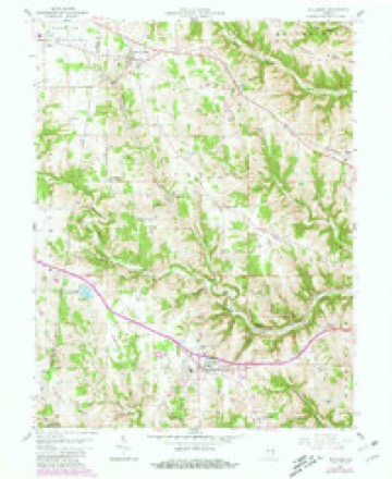
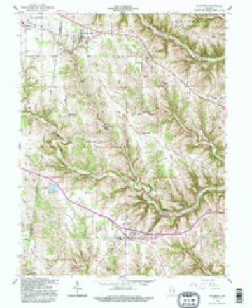
10 topographic sheets cover this place, the earliest surveyed in 1953 and the latest in 1992. It stands in Sparta Township. It lies in ZIP code area 47032. It lies near Mount Sinai Ridge. The Survey maps it on the Dillsboro quadrangle. It stands 915 feet above sea level.
Topographic sheets covering this place
5 surveys from 10 printed sheetsMatched by testing this settlement's coordinate against the published boundary of every sheet in the United States Geological Survey's historical collection. Each opens the scanned sheet at the Survey.
- 1953 USGS Cincinnati quadrangle1:250000, 3 printings
- 1957 USGS Cincinnati quadrangle1:250000
- 1958 USGS Dillsboro quadrangle1:24000, 3 printings
- 1986 USGS Greensburg quadrangle1:100000, 2 printings
- 1992 USGS Dillsboro quadrangle1:24000



In the county-history sources
2,127 words on this townshipHistory of Dearborn County Indiana, published 1915 names this settlement in its chapter on Sparta Township. These are the passages that mention it, exactly as the scans read.
The county records contain no reference to any townships previous to 1826, when the court house was burned, but in the entries a short time after that date is found this description of the township of Sparta. Commencing on the old Indian boundary line, on the township line between 6 and 7, range 3 west, thence eastwardly following the meanders of North Hogan creek to where the same strikes the line running north and south between sections 8 and 9, township 5, range 2 west; thence east with said line one mile; thence south to the southeast comer of section 21, township 5, range 2; thence west one mile ; thence south to the southeast corner of section 5, township 4, range 2 ; thence west to the old Indian boundary line ; thence northwardly with said line to the place of beginning. As herewith described it included some three and one-half sections that were afterwards set off to Hogan township, and the northwest tier of sections that were added to Qay township when it was cre¬ ated. The township is practically bounded on the north by Manchester, on the east by Hogan, on the south by Clay and on the west by Ripley county.
Passage source: History of Dearborn County Indiana, published 1915.
James Duncan emigrated from Maryland and settled in Sparta in 1815. Moses Musgrove emigrated from Virginia in 1816. Mr. Musgrove is said to have killed the last panther that was ever seen in Dearborn county. It was in the year 1817 and the animal is said to have weighed two hundred pounds and measured nine feet from the end of the nose to the tip of his tail. Mr. Musgrove died in 1819. Samuel and Demoss Moss emigrated from Massa¬ chusetts in 1816, but removed from the county. Riley Truitt emigrated from Maryland in 1817 and died in 1818.
Passage source: History of Dearborn County Indiana, published 1915.
Benjamin Johnson emigrated from Maryland and located in Sparta township in 1817. He was said to be a man of very positive opinions and a strong character. He was the father of Hon. John D. Johnson, who was elected to the Legislature in 1846, re-elected in 1848, and was also a member of the constitutional convention in 1851. He was also the father of Samuel J. Johnson, who was a doorkeeper in the House of Representatives at Wash¬ ington. Frank M. Johnson and Pern Johnson, of California, were his grand¬ sons.
Passage source: History of Dearborn County Indiana, published 1915.
Machine-read from a century-old scan, so expect the errors a machine makes: misspelled names, dropped words, stray characters.
Read the whole chapter on Sparta Township - it names this place 7 more 7 times.
Storms near this place
1 since 2004Regional context, not property-specific evidence. The National Weather Service names Sparta in 1 storm report in 2004: 1 thunderstorm wind. No death or injury is recorded in these reports. Each account below is quoted exactly as the forecast office filed it, from the NOAA Storm Events Database, and each date opens the federal record of that event.
| When | Event | Place named | Harm | What the report says |
|---|---|---|---|---|
| June 2004 | Thunderstorm Wind | Sparta | $3,000 | Several trees were downed. |
Nearest settlements
The eight closest, with where each one stands in the county. Distances are straight-line, computed from the Geographic Names Information System coordinates.
| Map | Place | Distance | Sheets |
|---|---|---|---|
| Moores Hill | 2.3 miles | 10 | |
| Chesterville | 2.6 miles | 10 | |
| Cold Springs | 2.8 miles | 10 | |
| Mount Sinai | 3.0 miles | 19 | |
| Manchester | 3.6 miles | 9 | |
| Kyle | 3.8 miles | 17 | |
| Wrights Corner | 5.1 miles | 17 | |
| Dillsboro Station | 5.2 miles | 10 |
Elsewhere
Matched on this settlement's Geographic Names Information System number rather than its name, so it cannot be a different place of the same name in another state.
| Wikipedia article on Sparta | An encyclopaedic summary. Its text is share-alike, so it is linked here rather than copied. |
| Wikidata item Q7573810 | The structured record the population and elevation above come from. Public domain (CC0). |
Provenance
This settlement is recorded in the Geographic Names Information System as feature 443917. The sheet list is computed by point-in-boundary test against the United States Geological Survey's historical topographic inventory. Both are works of the United States government and carry no copyright under 17 U.S.C. 105.
Storms. NOAA National Centers for Environmental Information, Storm Events Database https://www.ncei.noaa.gov/stormevents/ A work of the United States government, no copyright under 17 U.S.C. 105. Narratives are quoted verbatim from the National Weather Service report and are not edited or summarised.