 Block
Manchester, Indiana
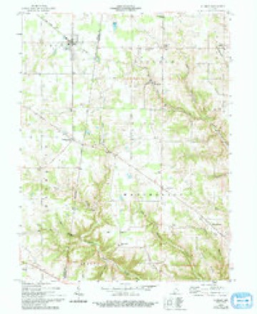
9 topographic sheets cover this place, the earliest surveyed in 1953 and the latest in 1986. It stands in Manchester Township. It lies in ZIP code area 47001. It lies near Union Ridge. The Survey maps it on the Sunman quadrangle. It stands 919 feet above sea level.
Topographic sheets covering this place
4 surveys from 9 printed sheetsMatched by testing this settlement's coordinate against the published boundary of every sheet in the United States Geological Survey's historical collection. Each opens the scanned sheet at the Survey.
- 1953 USGS Cincinnati quadrangle1:250000, 3 printings
- 1957 USGS Cincinnati quadrangle1:250000
- 1958 USGS Sunman quadrangle1:24000, 3 printings
- 1986 USGS Greensburg quadrangle1:100000, 2 printings



In the county-history sources
3,544 words on this townshipHistory of Dearborn County Indiana, published 1915 names this settlement in its chapter on Manchester Township. These are the passages that mention it, exactly as the scans read.
Manchester originally included considerable ot jackson township, a small portion of Kelso and the greater part of York. In 1831 twelve sections were taken off and added to Kelso township and in 1841 York township was created, and it again lost territory; and with the creation of Jackson, in 1832, another loss of territory was made; but with all its losses Manchester is the largest township in the county, and it is claimed that it has more square miles than any township in the state. Since York township was organized there has been but little change in its boundaries. In 1896 a small strip was taken off and added to York, which is the only change that the township has under¬ gone since the townships were all created.
Passage source: History of Dearborn County Indiana, published 1915.
The history of Manchester township dates back to the year 1815, when Mark McCracken and his brother Robert, with their mother, located on the present site of the village of Manchester. In 1852 Robert McCracken stated over his own signature that he, in 1815, cut the road seven miles, drove the first wagon that ever was on the ridge, and put up the first cabin that ever was in that neighborhood. It is supposed that he cut the road from Cam¬ bridge, which was at that time the nearest station where there was a settlement He also stated that his nearest neighbor was at that time some four or five miles away and that they were all living this side Or nearer the river than where he was located. Two years later, in 1817, he sold out to Rev. Daniel Plummer, but his brother, Mark McCracken, retained his portion until his death, and erected the large country mansion owned for so many years by William H. Baker.
Passage source: History of Dearborn County Indiana, published 1915.
During the year 1815 David, George and Joseph Johnston, from Fred¬ erick county, Virginia, located on north Hogan, in the township. They had left Virginia in 1810, settling first in Butler county, Ohio, and in 1812 re¬ moving to Vincennes, then they came to Louisville, Kentucky, and in 1814 to where Aurora was later built, and a year later to Manchester township.
Passage source: History of Dearborn County Indiana, published 1915.
Machine-read from a century-old scan, so expect the errors a machine makes: misspelled names, dropped words, stray characters.
Read the whole chapter on Manchester Township - it names this place 7 more 7 times.
Storms near this place
8 since 1995Regional context, not property-specific evidence. The National Weather Service names Manchester in 8 storm reports between 1995 and 2022: 7 thunderstorm wind, 1 flash flood. No death or injury is recorded in these reports. Each account below is quoted exactly as the forecast office filed it, from the NOAA Storm Events Database, and each date opens the federal record of that event.
| When | Event | Place named | Harm | What the report says |
|---|---|---|---|---|
| December 2013 | Thunderstorm Wind | Manchester | $5,000 | Scattered trees were reported down throughout Dearborn County due to thunderstorm winds. |
| July 2016 | Thunderstorm Wind | Manchester | $4,000 | Several trees and power lines were downed. |
| June 2008 | Flash Flood | Manchester | $4,000 | Five roads were flooded across the county. |
| July 2022 | Thunderstorm Wind | Manchester | $3,000 | A few trees were downed. |
| May 2006 | Thunderstorm Wind | Manchester | $3,000 | Trees were knocked down. |
| May 1995 | Thunderstorm Wind | Manchester | $3,000 | Trees downed. |
| June 2010 | Thunderstorm Wind | Manchester | $1,000 | Two trees were reported down due to damaging thunderstorm winds. |
| August 2009 | Thunderstorm Wind | Manchester | $1,000 | A large tree was reported to be down. |
Nearest settlements
The eight closest, with where each one stands in the county. Distances are straight-line, computed from the Geographic Names Information System coordinates.
| Map | Place | Distance | Sheets |
|---|---|---|---|
| Kyle | 1.6 miles | 17 | |
| Bonnell | 2.3 miles | 17 | |
| Wrights Corner | 3.1 miles | 17 | |
| Sparta | 3.6 miles | 10 | |
| Yorkville | 4.3 miles | 17 | |
| Kirschs Corner | 4.5 miles | 19 | |
| Moores Hill | 4.8 miles | 10 | |
| Weisburg | 4.9 miles | 9 |
Elsewhere
Matched on this settlement's Geographic Names Information System number rather than its name, so it cannot be a different place of the same name in another state.
| Wikipedia article on Manchester | An encyclopaedic summary. Its text is share-alike, so it is linked here rather than copied. |
| Wikidata item Q6747228 | The structured record the population and elevation above come from. Public domain (CC0). |
Provenance
This settlement is recorded in the Geographic Names Information System as feature 438509. The sheet list is computed by point-in-boundary test against the United States Geological Survey's historical topographic inventory. Both are works of the United States government and carry no copyright under 17 U.S.C. 105.
Storms. NOAA National Centers for Environmental Information, Storm Events Database https://www.ncei.noaa.gov/stormevents/ A work of the United States government, no copyright under 17 U.S.C. 105. Narratives are quoted verbatim from the National Weather Service report and are not edited or summarised.