 Block
Stewart, Indiana
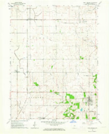
9 topographic sheets cover this place, the earliest surveyed in 1953 and the latest in 1987. It stands in Jordan Township. It lies in ZIP code area 47993. The Survey maps it on the West Lebanon quadrangle. It stands 712 feet above sea level.
Topographic sheets covering this place
6 surveys from 9 printed sheetsMatched by testing this settlement's coordinate against the published boundary of every sheet in the United States Geological Survey's historical collection. Each opens the scanned sheet at the Survey.
- 1953 USGS Danville quadrangle1:250000, 3 printings
- 1955 USGS Danville quadrangle1:250000
- 1956 USGS Danville quadrangle1:250000
- 1961 USGS West Lebanon quadrangle1:24000, 2 printings
- 1984 USGS Danville quadrangle1:100000
- 1987 USGS Danville quadrangle1:100000



In the county-history sources
76,744 words on this townshipCounties of Warren, Benton, Jasper and Newton, Indiana : Historical and Biographical, published 1883 names this settlement in its chapter on Jordan Township. These are the passages that mention it, exactly as the scans read.
This is emphatically a cattle and hog producing district, and probably more attention has been paid to the raising and improvement of these classes of stock than to any other of the branches of husbandry. The aim has been to produce beef to the neglect of milkers, lience short-horn breeds have been the favorite with cattle-growers. Large herds of cattle are less frequently met than formerly, not that there are fewer cattle bred, but they are scattered around more generally and not kept together in large bunches as in the days before the county was so thickly settled. Among those who have been prominent in this branch of industry, are A. J. Kent (deceased), William Russell, Thomas Barker, Joseph Law, Dr. Triplett, G. N. Stewart, T. S. Brecount, L V. Speck, Blake Wilson and others.
Passage source: Counties of Warren, Benton, Jasper and Newton, Indiana : Historical and Biographical, published 1883.
.Jaspei! Kkntox was born in tliis county in 1840. and resides on his father's old farm. In 1873. he married Miss Mary Catharine Wilcox, to which union have been bestowed three children - ilaggie. John Stewart and Charlie. Mr. Kenton owns 240 acres of fine land, besides 200 of timber.
Passage source: Counties of Warren, Benton, Jasper and Newton, Indiana : Historical and Biographical, published 1883.
Machine-read from a century-old scan, so expect the errors a machine makes: misspelled names, dropped words, stray characters.
Storms near this place
2 since 2009Regional context, not property-specific evidence. The National Weather Service names Stewart in 2 storm reports in 2009: 1 thunderstorm wind, 1 flash flood. No death or injury is recorded in these reports. Each account below is quoted exactly as the forecast office filed it, from the NOAA Storm Events Database, and each date opens the federal record of that event.
| When | Event | Place named | Harm | What the report says |
|---|---|---|---|---|
| May 2009 | Thunderstorm Wind | Stewart | - | Trees were knocked down by thunderstorm winds. |
| May 2009 | Flash Flood | Stewart | - | Numerous reports of flooding were received from Warren County Emergency Management Agency. Locations given of flooding were as following: Bristol Road; water and mud across State Road 28 West and 900 West; Road 125 South west of Williamsport; State Road 28 West and 100 West; Division Road east to State Road 263; State Road 28 and Oakwood Drive in Williamsport; Hospital Road and 41; 425 South and 500 West. |
Nearest settlements
The eight closest, with where each one stands in the county. Distances are straight-line, computed from the Geographic Names Information System coordinates.
| Map | Place | Distance | Sheets |
|---|---|---|---|
| Sycamore Corner | 2.0 miles | 9 | |
| Pence | 2.1 miles | 13 | |
| Tab | 3.5 miles | 11 | |
| Sloan | 4.0 miles | 9 | |
| Judyville | 4.1 miles | 9 | |
| Hedrick | 4.1 miles | 9 | |
| Carbondale | 6.6 miles | 10 | |
| Brisco | 7.0 miles | 9 |
Elsewhere
Matched on this settlement's Geographic Names Information System number rather than its name, so it cannot be a different place of the same name in another state.
| Wikipedia article on Stewart | An encyclopaedic summary. Its text is share-alike, so it is linked here rather than copied. |
| Wikidata item Q3499340 | The structured record the population and elevation above come from. Public domain (CC0). |
Provenance
This settlement is recorded in the Geographic Names Information System as feature 444145. The sheet list is computed by point-in-boundary test against the United States Geological Survey's historical topographic inventory. Both are works of the United States government and carry no copyright under 17 U.S.C. 105.
Storms. NOAA National Centers for Environmental Information, Storm Events Database https://www.ncei.noaa.gov/stormevents/ A work of the United States government, no copyright under 17 U.S.C. 105. Narratives are quoted verbatim from the National Weather Service report and are not edited or summarised.