 Block
Sunman, Indiana
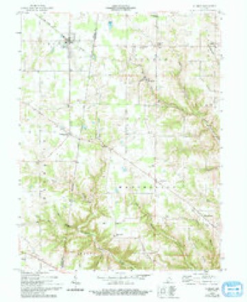
9 topographic sheets cover this place, the earliest surveyed in 1953 and the latest in 1986. It stands in Adams Township. It lies in ZIP code area 47041. The Survey maps it on the Sunman quadrangle. 914 people lived here at the 2020 count. It stands 1,020 feet above sea level.
Population over time
2 figuresSunman fell from 1,049 to 914 between 2010 and 2020. These are the recorded population figures Wikidata holds for this place, reached through the Geographic Names Information System number this page is keyed on rather than by name, so they belong to this place and not to another of the same name. Most are census counts, but not all are: an early figure may be a founding or settlement estimate, and an estimate published within five years of a census is left out. The change column is computed, and is left blank where more than 20 years separate a figure from the one before it, because a gap that long is not a change between two counts.
| Year | People | Change |
|---|---|---|
| 2010 | 1,049 | |
| 2020 | 914 | -135 (-13%) |
Topographic sheets covering this place
4 surveys from 9 printed sheetsMatched by testing this settlement's coordinate against the published boundary of every sheet in the United States Geological Survey's historical collection. Each opens the scanned sheet at the Survey.
- 1953 USGS Cincinnati quadrangle1:250000, 3 printings
- 1957 USGS Cincinnati quadrangle1:250000
- 1958 USGS Sunman quadrangle1:24000, 3 printings
- 1986 USGS Greensburg quadrangle1:100000, 2 printings



Storms near this place
26 since 1996Regional context, not property-specific evidence. The National Weather Service names Sunman in 26 storm reports between 1996 and 2026: 15 thunderstorm wind, 6 hail, 3 tornado, 2 flood. No death or injury is recorded in these reports. Each account below is quoted exactly as the forecast office filed it, from the NOAA Storm Events Database, and each date opens the federal record of that event.
| When | Event | Place named | Harm | What the report says |
|---|---|---|---|---|
| October 2017 | Tornado (EF0) | Sunman | $65,000 | The first evidence of the tornado touchdown was just west of the western most end of Industrial Drive, southwest of Sunman. Two trees were snapped approximately halfway up the trunks. Further east, on a property at the western end of Industrial Drive, an anchored mobile home was pushed approximately 3 to 4 feet off its foundation (up against a back porch). At the same property, two large sheet metal doors were blown off a barn. ||To the east-northeast, a large tree was knocked down, along with other miscellaneous limbs near the cul-de-sac of Brick Yard Drive. The large tree that was downed, fell partially through the roof of an unoccupied home. Other limbs of various sizes were knocked down on the property and nearby properties. A very small portion of siding was partially removed at an adjacent property. On the eastern end of Brick Yard Drive (approximately 100 feet west of Meridian Street), a large pine tree was snapped in half. A small tree limb was also downed just on the western side of Meridian Street north of Brick Yard Drive.||On the east side of Meridian Street, just north of Edgewood Lane, a property sustained fairly extensive tree damage, including numerous large limbs downed. The tree damage caused the partial collapse of a garage/barn shelter roof. ||Small tree limbs were knocked down on Edgewood Lane. The next evidence of damage was observed near North County Line Road on the Ripley/Dearborn County line. Just to the west of County Line Road (and therefore still in Ripley County), a tree limb was downed and a tractor trailer was partially tipped over and leaning against a tree. The path continued in Dearborn County and traveled approximately a mile and a quarter before lifting around 2009EST. |
| March 2009 | Tornado (EF1) | Sunman | $40,000 | The tornado briefly touched down in two locations just west and north of the intersection of Indiana State Routes 101 and 48. The first area of damage occurred on a property located along State Route 48 about a quarter mile west of the intersection of State Routes 48 and 101. A large two-story barn sustained roof damage and had both metal garage doors blown out. Much of the north-facing wall of the garage and several small objects in the barn were blown out and thrown into an adjacent cornfield to the northeast. A second smaller barn behind the home had the back part of its metal roof peeled or removed. Two cedar trees in the vicinity of the large barn were uprooted. The homeowner and his son both witnessed the tornado lift up in the cornfield and then come back down in the vicinity of State Route 101 just north of its intersection with State Route 48. It was in this location that the second area of damage was located.| |The most significant damage was in this location along State Route 101, to a stand-alone garage and the back portion of a house. The front part of the garage had its roof completely removed and deposited in a few parts in the field to the east of the property. Several pieces of the roof trusses and fiberglass were scattered behind the garage as well. Insulation was stuck to the entire south side of the garage, and the west-facing garage door was blown out. The back part of the garage remained largely intact with little roof damage. The homeowners indicated that this part of the garage was built at a later time than the front part of the garage. Additional damage occurred to a back room to the house. This was an addition to the house, built at the same time as the front portion of the garage which sustained the brunt of the damage. The entire room was shifted off the foundation by as much as six inches and the door was blown out. Several maple trees along the back edge of the property were knocked down. Based on the type of damage to the structures and their building quality, estimated maximum winds were 85 to 90 mph. |
| July 2016 | Thunderstorm Wind | Sunman | $5,000 | Multiple power poles and a tree were downed along State Route 48. |
| May 2011 | Tornado (EF0) | Sunman | $5,000 | The tornado initially touched down in Ripley County at 1743 near County Road 900. Numerous large trees were down in different directions and at least one power pole was snapped in this location. The tornado then continued to the northeast and passed into Dearborn County at 1745 just northwest of Tangman Road. Along Tangman Road, large trees were down in different directions, a metal roof was torn off of a large pole barn, and a barn was destroyed due to the tornado. A short distance to the northeast, trees were snapped near Hill Road. The tornado lifted in Dearborn County at 1747. Damage estimates for Ripley County were five thousand dollars. Damage estimates for Dearborn County were forty thousand dollars. Maximum estimated wind speed based on damage was around eighty miles per hour. The tornado was on the ground for 1.48 miles in Ripley County and 1.60 miles in Dearborn County. The entire path length of the tornado was 3.08 miles. |
| June 2010 | Thunderstorm Wind | Sunman | $5,000 | A National Weather Service storm survey indicated that a microburst occurred in this area. The microburst resulted in a large number of trees within a forested area being blown down or snapped off. Damage in the immediate vicinity of the microburst included trees down at two homes and a car port destroyed. |
| May 2025 | Thunderstorm Wind | Sunman | $4,000 | Several trees were downed and an outbuilding sustained some minor damage. |
| March 2025 | Thunderstorm Wind | Sunman | $3,000 | Several trees were downed. |
| May 2025 | Thunderstorm Wind | Sunman | $3,000 | A barn had some of its metal roof panels lifted up. Several trees had limbs torn off of them on the same property. |
| April 2025 | Thunderstorm Wind | Sunman | $3,000 | A few trees were downed along County Road 900 North. |
| August 2012 | Thunderstorm Wind | Sunman | $3,000 | Two outbuildings were destroyed and a few trees were downed near Sunman due to thunderstorm winds. |
| May 2005 | Thunderstorm Wind | Sunman | $3,000 | Trees were downed. |
| March 2026 | Thunderstorm Wind | Sunman | $2,000 | A power pole was downed across Meridian Street. |
| April 2025 | Thunderstorm Wind | Sunman | $1,000 | A tree fell onto a roadway. |
| July 2023 | Thunderstorm Wind | Sunman | $1,000 | A tree was downed in Sunman. |
| July 2021 | Thunderstorm Wind | Sunman | $1,000 | A tree was downed in Sunman. |
| July 2016 | Thunderstorm Wind | Sunman | $500 | A tree was downed across State Road 101 near County Road 900N. |
| July 2023 | Thunderstorm Wind | Sunman | $200 | A few large tree limbs were downed. |
| July 2024 | Flood | Sunman | - | High water was reported on Meridian Street. |
| December 2021 | Flood | Sunman | - | High water was reported along State Route 101. |
| June 2023 | Hail | Sunman | - | no account filed |
| July 2023 | Hail | Sunman | - | no account filed |
| February 2017 | Hail | Sunman | - | no account filed |
| May 2012 | Hail | Sunman | - | no account filed |
| April 2006 | Hail | Sunman | - | no account filed |
| April 2005 | Hail | Sunman | - | no account filed |
| March 1996 | Thunderstorm Wind | Sunman | - | no account filed |
Nearest settlements
The eight closest, with where each one stands in the county. Distances are straight-line, computed from the Geographic Names Information System coordinates.
| Map | Place | Distance | Sheets |
|---|---|---|---|
| Spades | 1.9 miles | 9 | |
| Penntown | 2.3 miles | 9 | |
| Clinton | 2.7 miles | 11 | |
| Negangards Corner | 3.2 miles | 9 | |
| Stumpke Corner | 4.5 miles | 11 | |
| Behlmer Corner | 4.6 miles | 11 | |
| Morris | 5.4 miles | 13 | |
| Old Milan | 6.6 miles | 11 |
Elsewhere
Matched on this settlement's Geographic Names Information System number rather than its name, so it cannot be a different place of the same name in another state.
| Wikipedia article on Sunman | An encyclopaedic summary. Its text is share-alike, so it is linked here rather than copied. |
| Wikidata item Q1905905 | The structured record the population and elevation above come from. Public domain (CC0). |
Provenance
This settlement is recorded in the Geographic Names Information System as feature 444410. The sheet list is computed by point-in-boundary test against the United States Geological Survey's historical topographic inventory. Both are works of the United States government and carry no copyright under 17 U.S.C. 105.
Storms. NOAA National Centers for Environmental Information, Storm Events Database https://www.ncei.noaa.gov/stormevents/ A work of the United States government, no copyright under 17 U.S.C. 105. Narratives are quoted verbatim from the National Weather Service report and are not edited or summarised.