 Block
From the record
17 National Register listings published here.
Sources: the National Register database, National Park Service
59 topographic sheets cover 41 settlements here, and 17 properties are on the National Register of Historic Places.
17 National Register listings published here.
Sources: the National Register database, National Park Service
Every property in this county listed on the National Register of Historic Places, with the year it was listed and the federal nomination document.
| Photograph | Property | Type | Listed | Reference |
|---|---|---|---|---|
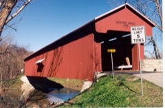 | Busching Covered Bridge | structure | 2019 | 100003509 |
 | Central Batesville Historic District | district | 2011 | 11000659 |
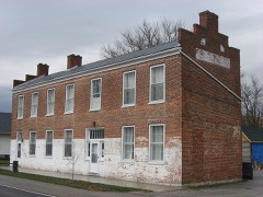 | Central House | building | 1982 | 82000071 |
 | Collin's Ford Bridge | structure | 1996 | 96000787 |
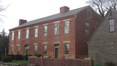 | Elias Conwell House | building | 1979 | 79000041 |
| Friendship Stone Arch Bridge | structure | 2019 | 100003510 | |
 | Marble Creek Bridge | structure | 1996 | 96000785 |
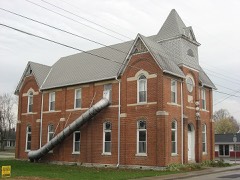 | Milan Masonic Lodge No. 31 | building | 2013 | 12001155 |
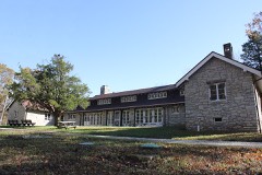 | Old Timbers | building | 1996 | 96000786 |
| Otter Creek Covered Bridge | structure | 2019 | 100003511 | |
 | John Linsey Rand House | building | 1994 | 94000582 |
 | Ripley County Courthouse | building | 2009 | 09000762 |
 | Straber Ford Bridge | building | 2009 | 09001132 |
 | Fernando G. Taylor House | building | 1986 | 86002710 |
 | Tyson United Methodist Church | building | 1994 | 94001106 |
| Versailles Courthouse Square Historic District | district | 2024 | 100010748 | |
 | Versailles School and Tyson Auditorium | building | 2006 | 06000309 |
Ripley County has 2 covered bridges on the National Register. Each is a listed structure with a federal nomination on file.
| Busching Covered Bridge | Listed 2019 |
| Otter Creek Covered Bridge | Listed 2019 |
Every wildfire the federal occurrence database records inside this county: 38 of them, burning about 3,116 acres. None started naturally and 15 were recorded as arson. Each settlement page carries the fires within five miles of it.
| Reported cause | Fires |
|---|---|
| Missing data/not specified/undetermined | 16 |
| Arson/incendiarism | 15 |
| Debris and open burning | 2 |
| Firearms and explosives use | 2 |
| Recreation and ceremony | 2 |
| Equipment and vehicle use | 1 |
The five largest, by the area the report gives. Five of them were set deliberately.
| Date | Cause | Size | Reported by | Name on the report |
|---|---|---|---|---|
| 6 November 2010 | Arson/incendiarism | 870 acres | Big Oaks National Wildlife Refuge | BLACKHAWK |
| 6 November 2010 | Arson/incendiarism | 450 acres | Big Oaks National Wildlife Refuge | TRACER |
| 2 April 2003 | Missing data/not specified/undetermined | 300 acres | Big Oaks National Wildlife Refuge | RANGE FIRE |
| 1 September 2011 | Arson/incendiarism | 280 acres | Big Oaks National Wildlife Refuge | K ROAD FIRE |
| 22 October 2015 | Missing data/not specified/undetermined | 220 acres | Big Oaks National Wildlife Refuge | TRIPLE A FIRE |
| 22 February 2001 | Arson/incendiarism | 200 acres | Big Oaks National Wildlife Refuge | AREA 25 |
| 2 November 2011 | Arson/incendiarism | 100 acres | Big Oaks National Wildlife Refuge | RANGE TOWER FIRE |
| 27 February 2018 | Missing data/not specified/undetermined | 74 acres | Big Oaks National Wildlife Refuge | SHUNK SOUTH |
Every settlement page carries the fires within five miles of it - see the settlement index below.
The NOAA Storm Events Database holds 488 reports for this county, causing 3 deaths, 12 injuries and about $5,832,104 in recorded property damage. Each settlement page carries the reports that name it.
| Kind of event | Reports |
|---|---|
| Thunderstorm Wind | 239 |
| Hail | 77 |
| Flash Flood | 77 |
| Flood | 65 |
| Tornado | 25 |
| Heavy Rain | 4 |
| Lightning | 1 |
The most serious of them, by death, then injury, then recorded damage. The accounts are quoted exactly as the forecast office filed them.
| When | Event | Place named | Harm | What the report says |
|---|---|---|---|---|
| March 2012 | Tornado (EF3) | Holton | 3 killed, 5 hurt, $275,000 | The tornado touched down approximately one half mile southwest of Holton as an EF0 tornado. The tornado quickly intensified as it approached the southwest corner of Holton, reaching EF1 to EF2 intensity. The path of the tornado moved nearly parallel to the north side of Highway 50 as it moved through Holton. Many of the homes and businesses east of Marion Street were damaged by EF2 intensity winds. The tornado then strengthened to low end EF3 intensity as it moved near the intersection of Highway 50 and Versailles Street. At this point, two fatalities occurred in a mobile home. Six injuries were also reported in the town of Holton. One of the individuals injured died many months later as a result of his injuries, bringing the total number of fatalities from this tornado to 3. This tornado then continued to the northeast from this point at high end EF2, low end EF3 intensity, damaging homes on Sleepy Road and Old Michigan Road. The tornado began to decrease in intensity east of Old Michigan Road and maintained EF1 intensity until it dissipated approximately one mile southeast of Osgood on Finks Road. Several homes and farms had minor damage along the track between Old Michigan Road and the end of the tornado track. Based on the damage surveyed, the maximum wind speed of this tornado was estimated at 145 miles per hour. |
| June 1990 | Tornado (F2) | not stated | 3 hurt, $250,000 | no account filed |
| April 1999 | Tornado (F3) | Rexville | 2 hurt, $1,400,000 | A tornado moved into Jefferson Proving Grounds from Jennings county and moved northeast across the county. Four mobile homes were destroyed and 4 were damaged. One house was destroyed while 8 had heavy damage and 20 minor damage. Twenty-one barns were destroyed, 6 had heavy damage, and 14 received minor damage. Seventeen outbuildings were destroyed while 4 had heavy damage and 11 minor damage. Four vehicles received major damage and 3 had minor damage. Five pieces of farm equipment were destroyed while 4 incurred major damage. Seven livestock were lost with 2 being killed and 2 injured. Trees were also downed in the path. |
| July 2004 | Tornado (F2) | Holton | 2 hurt, $465,000 | A tornado moved along a two mile path from southwest of Holton into town. One house, one mobile home and two small planes were destroyed. Thirty-six other structures sustained major damage. Numerous trees were uprooted along the path of the tornado. |
| November 1981 | Tornado (F1) | not stated | $250,000 | no account filed |
| April 1970 | Tornado (F1) | not stated | $250,000 | no account filed |
| March 2025 | Tornado (EF1) | Lookout | $200,000 | The first signs of concentrated damage were found along State Road 48 between North County Road 100 East and North County Road 200 East, where several trees and outbuildings were damaged on the southern side of State Road 48. The tornado then crossed State Route 48, damaging additional trees and continued east, where it destroyed an outbuilding.||Uprooted trees and minor home damage were then observed along North County Road 200 East. A barn was destroyed and multiple trees were snapped in this area. The tornado then continued eastward, causing additional tree and outbuilding damage near North County Road 500, 550, and 600 East. The tornado likely dissipated south of State Road 48 and east of North County Road 600 East. |
| March 2025 | Tornado (EF0) | Napoleon | $150,000 | Damage from the tornado was first noted west of North County Road 600 West, where trees, outbuildings, and one home were damaged. As the tornado continued northeast toward Napoleon, a few outbuildings were damaged south of West County Road 850 North. The final damage from the tornado was observed along North Old Michigan Road directly south of Napoleon, where it is believed to have dissipated. |
| March 2022 | Tornado (EF0) | Osgood | $100,000 | The first tornadic damage was observed along U.S. Route 421 near Jan-Cen-Del Community Schools and extended northeast and then east before dissipating just north of State Road 350, just west of Finks Road. There were several areas that sustained straight line wind damage of similar wind magnitude outside of this path.||The first notable damage was broken tree branches and chimney damage along U.S. Highway 421 just west of the school. The tornado caused roof damage at the school and damaged other light objects around the school. A light pole in the athletic fields north of the school was also knocked down. Blowing debris also caused damage to some buses parked at the school.||Further east, the tornado traveled just north of State Route 350, where additional trees were either uprooted or snapped. Snapped trees resulted in substantial damage to an outbuilding in the 700 block of West State Route 350.||While additional damage of similar strength was observed along West Fairground Road and other locations to the north and east of Osgood, this damage was attributed to wind damage from the line of strong storms that swept through the area at the same time as the tornado. |
| June 2021 | Tornado (EF1) | Lookout | $100,000 | The first evidence of tornadic damage was observed along East Prattsburg Road, just east of State Route 129, where several trees were knocked down. Additional damage was noted further southeast along East Prattsburg Road, where several additional trees were downed and a carport was destroyed. Tree damage continued along East Prattsburg Road to where it intersected with Old Mill Road and E County Road 475 N. One residence on East Prattsburg Road also experienced minor damage to the home, with some gutters and shingles removed. In a wooded area to the south of East County Road 475 N, the tree damage was more extensive, with numerous hardwood trees snapped.||The tornado moved into the town of Milan and produced sporadic damage, mainly along Josephine Street, Ellsworth Street, and West Ellis Street, where a few large tree limbs were knocked down and siding was also removed from a one story home. Winds in the town of Milan were estimated to be 80 mph, or EF0 in nature.||The tornado then strengthened as it moved just southeast of downtown Milan. Along Woolery Street and Rose Street, the most significant damage from this tornado was observed. The tree damage was much more extensive, with numerous hardwood trees snapped or completely knocked down. Significant tree damage continued southeast onto a residence on North County Road 750 E, where a garage was also destroyed. Damage in this area was consistent with winds of up to 110 mph, or reaching EF1 intensity.||The tornado then weakened and dissipated, with the only remaining damage to the southeast of this area on East 200 N, where one tree was blown down onto a house. |
| February 2014 | Tornado (EF1) | Napoleon | $100,000 | The tornado first touched down near a mobile home on North Finks Road just north of West County Road 700 North. The mobile home was moved up to 15 feet off its foundation and in the process this knocked down two brick walls that were two feet high. Windows were blown out on three sides of the mobile home. Major roof damage also occurred to the home. Insulation from this mobile home covered the east facing side of the structure, indicating strong rotating winds. Two small trees were snapped east of the home. Based on the damage surveyed, this portion of the tornado path had maximum estimated wind speeds of 90 miles per hour. Just before the tornado lifted, two pole barns were damaged. The southeast corner of the first barn completely collapsed. Some siding was missing on all four sides of this barn. The second barn, located just south of the first barn, had 20 to 30 percent of the roof missing and 10 to 20 percent of the siding missing on three of its sides. On the south side of this barn, up to 40 percent of the siding was missing. The damage surveyed along this portion of the track was indicative of an EF0 tornado with 70 mile per hour winds. |
| March 1997 | Thunderstorm Wind | Lookout | $100,000 | no account filed |
| April 2001 | Thunderstorm Wind | Countywide | $75,000 | Twelve houses and two mobile homes sustained minor damage. Seven barns were destroyed, five with heavy damage. A tree fell on a car. Nickel size hail also occurred. |
| August 1997 | Thunderstorm Wind | Versailles | $75,000 | Numerous trees were downed, many of which fell across power lines and one of which fell across a vehicle. A barn was damaged and a dozen campers and mobile homes suffered significant damage with two being destroyed. |
| October 2017 | Tornado (EF0) | Sunman | $65,000 | The first evidence of the tornado touchdown was just west of the western most end of Industrial Drive, southwest of Sunman. Two trees were snapped approximately halfway up the trunks. Further east, on a property at the western end of Industrial Drive, an anchored mobile home was pushed approximately 3 to 4 feet off its foundation (up against a back porch). At the same property, two large sheet metal doors were blown off a barn. ||To the east-northeast, a large tree was knocked down, along with other miscellaneous limbs near the cul-de-sac of Brick Yard Drive. The large tree that was downed, fell partially through the roof of an unoccupied home. Other limbs of various sizes were knocked down on the property and nearby properties. A very small portion of siding was partially removed at an adjacent property. On the eastern end of Brick Yard Drive (approximately 100 feet west of Meridian Street), a large pine tree was snapped in half. A small tree limb was also downed just on the western side of Meridian Street north of Brick Yard Drive.||On the east side of Meridian Street, just north of Edgewood Lane, a property sustained fairly extensive tree damage, including numerous large limbs downed. The tree damage caused the partial collapse of a garage/barn shelter roof. ||Small tree limbs were knocked down on Edgewood Lane. The next evidence of damage was observed near North County Line Road on the Ripley/Dearborn County line. Just to the west of County Line Road (and therefore still in Ripley County), a tree limb was downed and a tractor trailer was partially tipped over and leaning against a tree. The path continued in Dearborn County and traveled approximately a mile and a quarter before lifting around 2009EST. |
| June 2021 | Thunderstorm Wind | Versailles | $50,000 | Numerous trees and power lines were downed across the northern and eastern portions of Ripley County. |
| April 2020 | Tornado (EF1) | Versailles | $50,000 | A brief tornado touched down on the southwest side of Versailles. Damage occurred to some homes and tree. A shopping center received damage to part of the roof. Also, some power poles were knocked down. |
| April 2020 | Tornado (EF0) | Elrod | $50,000 | The tornado first touched down along S. Friendship Road in southeast Ripley County. The tornado caused roof and siding damge to homes and barns, as well as destroying silos, along with tree damage. The tornado damage ended just west of the Dearborn County line. |
| June 2016 | Lightning | Elrod | $50,000 | Lightning struck a house which caught fire and burnt down. |
| April 2011 | Thunderstorm Wind | Versailles | $50,000 | A tree was blown down onto a camper due to damaging thunderstorm winds. Three homes had extensive roof damage in addition to trees and power lines being reported down due to the winds. |
| July 2000 | Flash Flood | Osgood | $50,000 | Heavy rainfall caused flooding which washed out several roads between Osgood and Delaware. |
| April 1994 | Thunderstorm Wind | not stated | $50,000 | A mobile home was damaged and numerous trees were reported downed just south of Versailles. |
| September 1993 | Thunderstorm Wind | Morris | $50,000 | Trees and power lines were downed and one mobile home was also damaged. |
| May 2025 | Tornado (EF1) | Spades | $40,000 | The tornado developed near the intersection of E County Road 1150 N and N Spades Road, where large limbs were broken off from both softwood and hardwood trees. Similar tree damage was found near the intersection of E County Road 1200 N and N Spades Road. ||Numerous trees were downed at properties on the west side of Spades Road, south of E County Road 1300 N. A large cluster of tree damage was then observed at a property located near the intersection of E County Road 1300 N and N Spades Road. In addition to some large hardwood tree limbs broken off, several large healthy trees were either uprooted or snapped. Minor siding damage and missing shingles were observed from a nearby home. ||Additional uprooted trees were observed northeast of this property. The tornado continued northeast, where it produced damage at a property near the intersection of E County Road 1500 N and N County Road 1000 E. Here, a well-built outbuilding had a complete collapse of its exterior walls. Additional hardwood tree damage was noted through the field northeast of this property. From here, the tornado moved out of Ripley County, Indiana at 1909EST and entered into Dearborn County, Indiana just southwest of N County Line Road. The tornado then crossed into Franklin County, Indiana and dissipated at 1911EST near the county line. |
| March 2009 | Tornado (EF1) | Sunman | $40,000 | The tornado briefly touched down in two locations just west and north of the intersection of Indiana State Routes 101 and 48. The first area of damage occurred on a property located along State Route 48 about a quarter mile west of the intersection of State Routes 48 and 101. A large two-story barn sustained roof damage and had both metal garage doors blown out. Much of the north-facing wall of the garage and several small objects in the barn were blown out and thrown into an adjacent cornfield to the northeast. A second smaller barn behind the home had the back part of its metal roof peeled or removed. Two cedar trees in the vicinity of the large barn were uprooted. The homeowner and his son both witnessed the tornado lift up in the cornfield and then come back down in the vicinity of State Route 101 just north of its intersection with State Route 48. It was in this location that the second area of damage was located.| |The most significant damage was in this location along State Route 101, to a stand-alone garage and the back portion of a house. The front part of the garage had its roof completely removed and deposited in a few parts in the field to the east of the property. Several pieces of the roof trusses and fiberglass were scattered behind the garage as well. Insulation was stuck to the entire south side of the garage, and the west-facing garage door was blown out. The back part of the garage remained largely intact with little roof damage. The homeowners indicated that this part of the garage was built at a later time than the front part of the garage. Additional damage occurred to a back room to the house. This was an addition to the house, built at the same time as the front portion of the garage which sustained the brunt of the damage. The entire room was shifted off the foundation by as much as six inches and the door was blown out. Several maple trees along the back edge of the property were knocked down. Based on the type of damage to the structures and their building quality, estimated maximum winds were 85 to 90 mph. |
| August 2006 | Thunderstorm Wind | New Marion | $40,000 | Three barns and a pole barn were heavily damaged. Several trees up to ten feet in diameter were downed along South 1000 Road. A tree also fell on a vehicle, causing minor damage. |
| March 2022 | Thunderstorm Wind | Osgood | $30,000 | Numerous trees were downed across much of Ripley County, especially in the Holton, Osgood, Versailles and Milan areas. |
| April 2020 | Thunderstorm Wind | Versailles | $30,000 | Several barns were flattened in the 1300 block of S. Cave Road. Debris was scattered in nearby fields. Also, several nearby trees were knocked down. |
| June 2017 | Flash Flood | Rexville | $30,000 | A culvert was washed out on S County Road 75 near W County Road 1000 S. |
| August 2009 | Flash Flood | Napoleon | $30,000 | High water was over United States Route 421 in addition to county roads in the area. |
| April 1996 | Thunderstorm Wind | Napoleon | $30,000 | no account filed |
| July 2023 | Thunderstorm Wind | Milan | $25,000 | Several trees were downed in the Milan area, including one that fell onto a house and another that fell onto a truck. |
| November 2017 | Flash Flood | Holton | $25,000 | Rushing water damaged a 2400 foot culvert. |
| May 2011 | Thunderstorm Wind | Napoleon | $25,000 | A barn was destroyed and numerous trees were reported down due to damaging thunderstorm winds. |
| June 1978 | Tornado (F1) | not stated | $25,000 | no account filed |
| June 1957 | Tornado (F1) | not stated | $25,000 | no account filed |
| July 1956 | Tornado (F2) | not stated | $25,000 | no account filed |
| August 2021 | Thunderstorm Wind | Cross Plains | $20,000 | A roof was blown off of a barn and structural damage occurred to an out building. |
| April 2020 | Tornado (EF0) | Cross Plains | $20,000 | A brief tornado touched down in far southeast Ripley County in Cross Plains. The tornado damaged trees as well as roofs of homes and businesses. Based on the degree of damage, the tornado produced winds of around 65 mph. |
| February 2014 | Thunderstorm Wind | Versailles | $20,000 | The wall of a dwelling partially collapsed and shingles were torn off of a roof due to thunderstorm winds. |
| August 2009 | Flash Flood | Batesville | $20,000 | Portions of Interstate 74 were flooded near Batesville. |
| August 2000 | Thunderstorm Wind | Napoleon | $20,000 | Winds estimated to be 60-70 mph caused numerous trees and power lines to be downed. Dime size hail also fell around Napoleon. |
| June 1999 | Thunderstorm Wind | Osgood | $20,000 | Brief, strong winds caused minor damage to several buildings and major damage to the Indiana State Highway testing lab office. |
| August 2011 | Thunderstorm Wind | Batesville | $17,000 | A roof was blown off of a business and a few trees were down due to damaging thunderstorm winds. |
| February 2023 | Thunderstorm Wind | Batesville | $15,000 | Several trees and power lines were downed across northern portions of Ripley County. |
| April 2020 | Thunderstorm Wind | Friendship | $15,000 | The roof was ripped off a building and multiple trees were knocked down. |
| August 2007 | Flash Flood | New Marion | $15,000 | Numerous roads were flooded, with several automobiles stranded in the high water. A bridge was washed out along County Road 850. |
| April 2006 | Hail | Napoleon | $15,000 | Golf ball to hen egg size hail fell across the northwest part of the county. |
| November 2000 | Thunderstorm Wind | Countywide | $15,000 | Numerous trees and power lined knocked down across the county. |
| June 1998 | Flash Flood | Holton | $15,000 | Numerous roads flooded by heavy rainfall. One road was washed out. |
| June 1995 | Hail | Northwest Part | $15,000 | Large trees were downed at Holton, and golf ball-size hail damaged some automobiles at Osgood. Some crops were also destroyed. |
| June 1995 | Hail | Batesville | $15,000 | Golf ball-size hail shattered the windshields of some automobiles. |
| April 2006 | Thunderstorm Wind | Holton | $12,000 | Eight 24 inch diameter trees were knocked down. A tree fell into a house on County Road 850W. |
| May 2004 | Thunderstorm Wind | Versailles | $12,000 | A school sustained minor roof damage. Several trees were also downed. |
| May 2025 | Thunderstorm Wind | Milan | $10,000 | A tree was downed and fell onto a residence, causing damage. |
| June 2025 | Thunderstorm Wind | Napoleon | $10,000 | A barn was damaged on County Road 800 North. |
| April 2024 | Thunderstorm Wind | Versailles | $10,000 | Numerous trees were downed throughout Versailles State Park. |
| May 2024 | Flood | Lookout | $10,000 | A high water rescue occurred near Salem Road and County Road 1100 North due to lingering high water along Little Laughery Creek. |
| July 2022 | Thunderstorm Wind | New Marion | $10,000 | The sides of an old barn collapsed. |
| June 2022 | Thunderstorm Wind | Batesville | $10,000 | A power pole and lines were downed. |
The Survey's mineral resources record lists 4 workings inside this county. 3 still produce and 1 is closed or unrecorded. Each settlement page carries the workings within five miles of it.
| Commodity | Workings |
|---|---|
| Stone, Crushed/Broken | 3 |
| Sand and Gravel, Construction | 1 |
The least common of them first, because a county's hundredth gravel pit says nothing its first ten did not.
| Where | Site | Commodity | Status | Recorded |
|---|---|---|---|---|
| Schmaltz Ready-Mix Concrete | Sand and Gravel, Construction | Plant | ||
| Berry Materialsversailles Plntqy | Stone, Crushed/Broken | Producer | ||
| Napoleon Quarry | Stone, Crushed/Broken | Producer | ||
| South Eastern Materials Corp Quarry | Stone, Crushed/Broken | Past Producer |
Named settlements recorded in the Geographic Names Information System, each with the topographic sheets covering it. Villages, hamlets and abandoned places alike. Each is shown with the nearest named watercourse or landform and the survey quadrangle it falls on.
Laughery township · 47006 · On Little Laughery Creek · Batesville quadrangle
13 sheets, 1946 to 1986
Laughery township · 47006 · On Bobs Creek · Batesville quadrangle
13 sheets, 1946 to 1986
Brown township · 47042 · On Raccoon Creek · Cross Plains quadrangle
9 sheets, 1956 to 1990
Shelby township · 47250 · Near Bates Ridge · Rexville quadrangle
8 sheets, 1956 to 1990
Otter Creek township · 47023 · On Falling Timber Branch · Holton quadrangle
10 sheets, 1953 to 1986
Shelby township · 47023 · Near Hungry Hollow · Rexville quadrangle
8 sheets, 1956 to 1990
Center township · 47037 · On Castators Creek · Pierceville quadrangle
11 sheets, 1946 to 1986
Delaware township · 47041 · On North Branch Ripley Creek · Pierceville quadrangle
11 sheets, 1946 to 1986
Shelby township · 47023 · On Campfire Creek · Versailles quadrangle
9 sheets, 1946 to 1986
Washington township · 47031 · On South Hogan Creek · Milan quadrangle
13 sheets, 1946 to 1986