 Block
Syracuse, Indiana
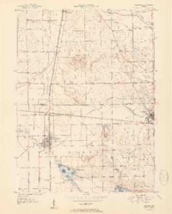
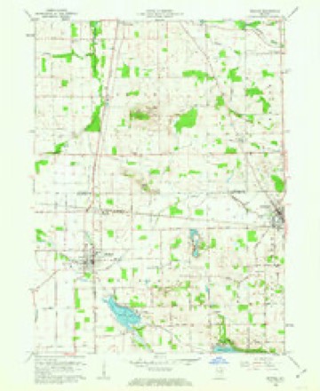
13 topographic sheets cover this place, the earliest surveyed in 1951 and the latest in 1994. It stands in Turkey Creek Township. It lies in ZIP code area 46567. It lies near Kale Island. The Survey maps it on the Milford quadrangle. 3,079 people lived here at the 2020 count. It stands 886 feet above sea level.
Population over time
2 figuresSyracuse grew from 2,810 to 3,079 between 2010 and 2020. These are the recorded population figures Wikidata holds for this place, reached through the Geographic Names Information System number this page is keyed on rather than by name, so they belong to this place and not to another of the same name. Most are census counts, but not all are: an early figure may be a founding or settlement estimate, and an estimate published within five years of a census is left out. The change column is computed, and is left blank where more than 20 years separate a figure from the one before it, because a gap that long is not a change between two counts.
| Year | People | Change |
|---|---|---|
| 2010 | 2,810 | |
| 2020 | 3,079 | +269 (+10%) |
Topographic sheets covering this place
6 surveys from 13 printed sheetsMatched by testing this settlement's coordinate against the published boundary of every sheet in the United States Geological Survey's historical collection. Each opens the scanned sheet at the Survey.
- 1951 USGS Milford quadrangle1:24000, 2 printings
- 1953 USGS Fort Wayne quadrangle1:250000, 4 printings
- 1956 USGS Fort Wayne quadrangle1:250000, 2 printings
- 1962 USGS Milford quadrangle1:24000, 3 printings
- 1984 USGS Fort Wayne quadrangle1:100000
- 1994 USGS Fort Wayne quadrangle1:100000




In the county-history sources
1,452 words on this townshipBiographical and Historical Reocrd of Kosciusko County, published 1887 names this settlement in its chapter on Turkey Creek Township. These are the passages that mention it, exactly as the scans read.
The towiislii]) abounds with lakes, some of wliich are more tliaii 100 feet deep. Syracuse Lake, one mile long and three-fourths of a mile wide, lies directly east of the village, and Nine-Mile Lake, about five miles long and one mile wide, is a beautiful body of water.
Passage source: Biographical and Historical Reocrd of Kosciusko County, published 1887.
The first settlers were Henry Ward and Samuel Crawson, who, in 1832, constructed a dam across Turke}- Creek, intending to erect a mill as soon as the lands were open for SI ttlemeiit. The mill was cumpleted in 1833, and in 1S3() the same ]iarties ei-ected a saw-mill. The township is bounded on the north by Elkhart County, cast by Koble County, south by Tippecanoe, and west by Vail r.ui-en Township. Before its organization in 1S36, a number of families had settled inside its boundaries, among whom were the fainiiies of John C. and Patrick Jolinson, William Cassidy, Andrew Guy, Robert War- Tier and others, all of whom came in 1834. Settlements from this date were made rapidly, and Samuel Crawson erected a log house and opened a stock of general merchandise in 1836. This store occupied the site of the Lake House, in Syracuse, which was erected by Jacob Renfro in 1853. Mr. Crawson being one of the first settlers and a man possessing both means and enterprise, was a prominent factor in the community. He donated one acre of ground west of Syracuse in 1836 for a cemetery, and the remains of a son of Harvey Veniinan were intei'red the same year.
Passage source: Biographical and Historical Reocrd of Kosciusko County, published 1887.
The first religious organization to build a church were IJaptists. In 1843 liev. James Martin organized a class, and a few years later a church was erected at Syracuse. The church, after a few years of prosperity, was disorganized and the building sold to the German Reformed congregation. In 1851 a German Baptist church was organized in the south part of the township, and in 1860 the society erected a church on section 14. Geoi'ge P. Rothenbarger and Conrad Brumbaugh were the first pastors. A Church of God was organized east of Nine-Mile Lake in 1858, by Rev. George Thomas. A union church was erected on the farm of N. Crow, on section 14, in 1860, and various denominations used it for religious worship. The United Brethren and Evangelical Association also have organized churches in the township, with regular services.
Passage source: Biographical and Historical Reocrd of Kosciusko County, published 1887.
Machine-read from a century-old scan, so expect the errors a machine makes: misspelled names, dropped words, stray characters.
Read the whole chapter on Turkey Creek Township - it names this place 6 more 6 times.
Mines and quarries near this place
4 within 5 milesRegional context, not property-specific evidence. The federal mineral resources record lists 4 workings within 5 miles of Syracuse: 3 producers, 1 past producer. 3 still produce. What was taken out: Sand and Gravel, Construction. Distance is straight-line from the map coordinates, so a quarry counted here may appear on a neighbouring settlement's page as well.
| Where | Site | Commodity | Status | Recorded |
|---|---|---|---|---|
| Elkhart Gravel Pit | Sand and Gravel, Construction | Producer | ||
| Goshen Sand & Gravel Pit | Sand and Gravel, Construction | Past Producer | ||
| Kosciusko County Pit | Sand and Gravel, Construction | Producer | ||
| Zimmerman Gravel Pit | Sand and Gravel, Construction | Producer |
Storms near this place
30 since 1997Regional context, not property-specific evidence. The National Weather Service names Syracuse in 30 storm reports between 1997 and 2025: 24 thunderstorm wind, 4 hail, 1 flash flood, 1 lightning. No death or injury is recorded in these reports. Each account below is quoted exactly as the forecast office filed it, from the NOAA Storm Events Database, and each date opens the federal record of that event.
| When | Event | Place named | Harm | What the report says |
|---|---|---|---|---|
| June 2022 | Thunderstorm Wind | Syracuse | $100,000 | A survey of damage indicated the swath of wind damage continued southeast from Elkhart county, first impacting Syracuse then progressing SSE into North Webster and points to the southeast towards the Noble county line. Tree damage was not widespread in Syracuse, but several tree limbs and trees were noted down across the city. The winds began to accelerate further as they moved off Lake Wawasee and just east of the NWS Northern Indiana office. One of the apartment complexes at Baypoint condos suffered roof damage as the winds caught a corner of the roof that was not properly anchored, causing loss of several pieces plywood and impacting 2 apartments with mainly water damage. The noted tree damage increased on the south side of North Webster and Webster Lake. While overall wind speeds of 60 to 70 mph were estimated, pockets of locally higher gusts likely occurred. |
| May 2009 | Flash Flood | Syracuse | $100,000 | Spotters and local officials reported between two and four inches of rain falling over a 3 to 5 hour period. This resulted in numerous roads becoming flooded with flowing water in several locations, especially south of Warsaw. At least 6 roads were reported closed due to the flowing water. Specific damage amounts werent available, but are estimated at $100,000. |
| August 1998 | Thunderstorm Wind | Syracuse | $50,000 | SEVERAL TREES AND POWER LINES DOWN. |
| November 2005 | Thunderstorm Wind | Syracuse | $10,000 | A large tree and power lines were blown down on State Route 13, near Syracuse. |
| June 2023 | Thunderstorm Wind | Syracuse | $5,000 | Trees and powerlines are down at the intersection of W Main St and N Dolan Drive. |
| May 2022 | Lightning | Syracuse | $5,000 | Lightning struck a home, causing a fire. |
| May 2025 | Thunderstorm Wind | Syracuse | $2,000 | Large tree uprooted at a residence. |
| July 2005 | Thunderstorm Wind | Syracuse | $2,000 | Several trees and power lines were blown down east of Syracuse. |
| July 2005 | Thunderstorm Wind | Syracuse | $1,000 | Very large limb, as well as power lines were blown down. |
| May 2018 | Hail | Syracuse | - | An off duty NWS employee reported hail to the size of dimes. |
| March 2017 | Thunderstorm Wind | Syracuse | - | The public reported a privacy fence was blown over. |
| June 2016 | Thunderstorm Wind | Syracuse | - | The public reported and photographed a tree down onto a home near State Route 13 in Syracuse. |
| July 2014 | Thunderstorm Wind | Syracuse | - | An off duty NWS employee observed a large tree down, blocking the roadway. |
| July 2013 | Thunderstorm Wind | Syracuse | - | An off duty NWS employee reported three tree branches that were one to two feet in diameter were found along State Route 14. A one foot diameter tree was snapped 15 feet above the base of the tree. |
| June 2012 | Thunderstorm Wind | Syracuse | - | A trained spotter reported a two foot diameter oak tree down onto a house on North Ogden Point Road. |
| July 2011 | Thunderstorm Wind | Syracuse | - | Trained spotters reported multiple telephone poles down. |
| June 2010 | Thunderstorm Wind | Syracuse | - | A tree fell down into a house with estimated 80 mph wind gusts. |
| June 2009 | Thunderstorm Wind | Syracuse | - | An off duty NWS employee reported numerous trees down throughout Syracuse. |
| May 2007 | Thunderstorm Wind | Syracuse | - | Recorded at the National Weather Service office. |
| July 2006 | Thunderstorm Wind | Syracuse | - | One tree, plus several tree limbs were blown down. |
| June 2005 | Thunderstorm Wind | Syracuse | - | A few large limbs were reported down in Syracuse. A spotter estimated a wind gust to 60 mph. |
| July 2004 | Thunderstorm Wind | Syracuse | - | Trees reported knocked down. |
| August 2001 | Thunderstorm Wind | Syracuse | - | Trees blown down. |
| September 2001 | Thunderstorm Wind | Syracuse | - | Numerous trees down. |
| September 2000 | Thunderstorm Wind | Syracuse | - | Large limbs blown down. |
| August 2000 | Thunderstorm Wind | Syracuse | - | Tree down. |
| July 1998 | Thunderstorm Wind | Syracuse | - | TREES DOWN. |
| July 1997 | Hail | Syracuse | - | Strong thunderstorms, producing downburst winds and heavy rains, developed over north central Indiana during the afternoon. Hail diameter ranging from one-inch to one and one-quarter inch was reported in Rochester and Syracuse. |
| August 2000 | Hail | Syracuse | - | no account filed |
| April 1999 | Hail | Syracuse | - | no account filed |
Nearest settlements
The eight closest, with where each one stands in the county. Distances are straight-line, computed from the Geographic Names Information System coordinates.
| Map | Place | Distance | Sheets |
|---|---|---|---|
| Wawasee Village | 1.0 miles | 13 | |
| Oakwood Park | 1.4 miles | 13 | |
| Pickwick Park | 1.6 miles | 13 | |
| South Park | 2.5 miles | 13 | |
| Wawasee | 3.0 miles | 13 | |
| Kanata Manayunk | 3.4 miles | 13 | |
| Redmon Park | 3.7 miles | 13 | |
| Sunrise Beach | 3.9 miles | 13 |
Elsewhere
Matched on this settlement's Geographic Names Information System number rather than its name, so it cannot be a different place of the same name in another state.
| Wikipedia article on Syracuse | An encyclopaedic summary. Its text is share-alike, so it is linked here rather than copied. |
| Wikidata item Q2486563 | The structured record the population and elevation above come from. Public domain (CC0). |
Provenance
This settlement is recorded in the Geographic Names Information System as feature 444529. The sheet list is computed by point-in-boundary test against the United States Geological Survey's historical topographic inventory. Both are works of the United States government and carry no copyright under 17 U.S.C. 105.
Mines and quarries. USGS Mineral Resources Data System (MRDS) https://mrdata.usgs.gov/mrds/ A work of the United States government, no copyright under 17 U.S.C. 105.
Storms. NOAA National Centers for Environmental Information, Storm Events Database https://www.ncei.noaa.gov/stormevents/ A work of the United States government, no copyright under 17 U.S.C. 105. Narratives are quoted verbatim from the National Weather Service report and are not edited or summarised.