 Block
Terre Haute, Indiana
17 topographic sheets cover this place, the earliest surveyed in 1941 and the latest in 1986. It stands in Harrison Township. It lies in ZIP code area 47807. The Survey maps it on the Terre Haute quadrangle. 58,389 people lived here at the 2020 count. It stands 499 feet above sea level.
Research this city
On record in Terre Haute
Buildings and businesses the archive holds for this place. Each opens its own page, with the source record it came from.
On the National Register 12 of 51 shown
- Eugene V. Debs HouseNational Historic Landmark · listed 1966
 Allen Chapel African Methodist Episcopal Churchlisted 1975
 Building at 23-27 S. Sixth Streetlisted 1983
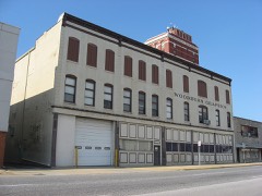 Building at 510-516 Ohio Streetlisted 1983
 Building at 810 Wabash Avenuelisted 1983
 Butternut Hilllisted 1993
 Carr's Halllisted 1983
 Chamber of Commerce Buildinglisted 1983
 Citizens' Trust Company Buildinglisted 1983
 Collett Parklisted 1981
 Collett Park Neighborhood Historic Districtlisted 2004
 Condit Houselisted 1973
Population over time
2 figuresTerre Haute fell from 60,785 to 58,389 between 2010 and 2020. These are the recorded population figures Wikidata holds for this place, reached through the Geographic Names Information System number this page is keyed on rather than by name, so they belong to this place and not to another of the same name. Most are census counts, but not all are: an early figure may be a founding or settlement estimate, and an estimate published within five years of a census is left out. The change column is computed, and is left blank where more than 20 years separate a figure from the one before it, because a gap that long is not a change between two counts.
| Year | People | Change |
|---|---|---|
| 2010 | 60,785 | |
| 2020 | 58,389 | -2,396 (-4%) |
Topographic sheets covering this place
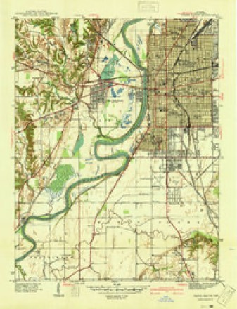
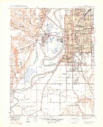
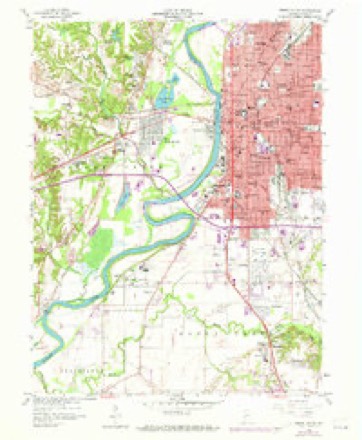
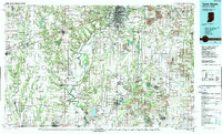
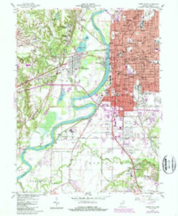
9 surveys from 17 printed sheetsMatched by testing this settlement's coordinate against the published boundary of every sheet in the United States Geological Survey's historical collection. Each opens the scanned sheet at the Survey.
- 1941 USGS Terre Haute quadrangle1:24000
- 1948 USGS Terre Haute quadrangle1:24000, 2 printings
- 1953 USGS Indianapolis quadrangle1:250000, 4 printings
- 1956 USGS Indianapolis quadrangle1:250000
- 1957 USGS Indianapolis quadrangle1:250000, 2 printings
- 1958 USGS Terre Haute quadrangle1:24000, 3 printings
- 1962 USGS Indianapolis quadrangle1:250000
- 1986 USGS Terre Haute quadrangle1:100000, 2 printings
- 1986 USGS Terre Haute quadrangle1:24000




Fires near this place
32 since 2001Regional context, not property-specific evidence. The federal wildfire occurrence database lists 32 fires within 5 miles of Terre Haute between 2001 and 2005, burning about 275 acres in total. None started naturally. 8 were recorded as arson. Distance is straight-line from the map coordinates, so a fire counted here may appear on a neighbouring settlement's page as well.
| Reported cause | Fires |
|---|---|
| Recreation and ceremony | 11 |
| Missing data/not specified/undetermined | 10 |
| Arson/incendiarism | 8 |
| Smoking | 2 |
| Equipment and vehicle use | 1 |
The most recent of them, most recent first, with the day each was reported and the service that recorded it.
| Date | Cause | Size | Reported by | Name on the report |
|---|---|---|---|---|
| 7 September 2005 | Missing data/not specified/undetermined | 1.0 acres | Indiana State Fire Marshal's Office | not named |
| 5 September 2002 | Equipment and vehicle use | 1.0 acres | Indiana State Fire Marshal's Office | not named |
| 11 September 2003 | Missing data/not specified/undetermined | under an acre | Indiana State Fire Marshal's Office | not named |
| 19 August 2003 | Arson/incendiarism | under an acre | Indiana State Fire Marshal's Office | not named |
| 10 August 2002 | Missing data/not specified/undetermined | under an acre | Indiana State Fire Marshal's Office | not named |
| 3 July 2005 | Arson/incendiarism | under an acre | Indiana State Fire Marshal's Office | not named |
| 23 June 2004 | Arson/incendiarism | under an acre | Indiana State Fire Marshal's Office | not named |
| 19 June 2004 | Smoking | under an acre | Indiana State Fire Marshal's Office | not named |
Settlements close enough to share some of these fires:
Mines and quarries near this place
5 within 5 milesRegional context, not property-specific evidence. The federal mineral resources record lists 5 workings within 5 miles of Terre Haute: 2 past producers, 2 producers, 1 unknown. 2 still produce. What was taken out: Sand and Gravel, Construction, Stone. Distance is straight-line from the map coordinates, so a quarry counted here may appear on a neighbouring settlement's page as well.
| Where | Site | Commodity | Status | Recorded |
|---|---|---|---|---|
| Terre Haute City Eng. | Stone | Producer | ||
| Harlan Farm | Sand and Gravel, Construction | Producer | ||
| Standard Materials Pit | Sand and Gravel, Construction | Past Producer | ||
| Terre Haute North Dredge | Sand and Gravel, Construction | Past Producer | ||
| Whitlock Gravel Pit | Sand and Gravel, Construction | Unknown |
Storms near this place
60 of 175 shownRegional context, not property-specific evidence. The National Weather Service names Terre Haute in 175 storm reports between 1994 and 2025: 83 thunderstorm wind, 52 hail, 18 flood, 17 flash flood. No death or injury is recorded in these reports. Each account below is quoted exactly as the forecast office filed it, from the NOAA Storm Events Database, and each date opens the federal record of that event.
| When | Event | Place named | Harm | What the report says |
|---|---|---|---|---|
| June 2008 | Flood | Terre Haute | $50,000,000 | Flooding occurred along the Wabash River in Vigo County, including in Terre Haute, due to heavy rain. |
| May 2002 | Flash Flood | Terre Haute | $200,000 | Bridge washed out |
| May 2002 | Flash Flood | Terre Haute | $150,000 | Numerous roads flooded |
| March 2006 | Flood | Terre Haute | $100,000 | no account filed |
| April 2000 | Thunderstorm Wind | Terre Haute | $100,000 | no account filed |
| July 2008 | Thunderstorm Wind | Terre Haute | $53,000 | Thunderstorm winds blew down a large tree onto a Toyota Corolla on 16th Street near Sixth Avenue, collapsing the roof and smashing windows. The hardest hit areas were north and east of Terre Haute. High winds broke utility poles and caused problems with some major transmission lines. |
| August 2020 | Thunderstorm Wind | Terre Haute | $50,000 | Power lines downed due to thunderstorm wind gusts along south 7th st and across the rest of town. |
| July 2008 | Thunderstorm Wind | Terre Haute | $50,000 | A high voltage power pole was snapped off. |
| May 2002 | Flash Flood | Terre Haute | $50,000 | no account filed |
| May 2002 | Flash Flood | Terre Haute | $50,000 | no account filed |
| April 2006 | Thunderstorm Wind | Terre Haute | $30,000 | The roof was blown off a skating rink and trees were downed. |
| June 2008 | Thunderstorm Wind | Terre Haute | $25,500 | Three utility poles that crossed 19th Street from Ohio Boulevard to Poplar Street were blown down. One of the poles cracked and fell on a car with a woman inside. |
| April 2020 | Thunderstorm Wind | Terre Haute | $20,000 | Thunderstorm wind gusts led to widespread power outages in Terre Haute with several reports of snapped tree limbs and power poles. |
| April 2018 | Flash Flood | North Terre Haute | $20,000 | Numerous roads were closed due to flowing water across northern Vigo County from heavy thunderstorm rainfall. |
| May 2011 | Thunderstorm Wind | Terre Haute | $20,000 | There were numerous reports of trees down with power outages due to damaging thunderstorm wind gusts in Terre Haute. |
| June 1998 | Thunderstorm Wind | Terre Haute | $20,000 | Thunderstorm winds to 70 mph blew down several dozen trees and numerous power lines in the Terre Haute area. |
| May 2000 | Thunderstorm Wind | Terre Haute | $20,000 | no account filed |
| June 2019 | Thunderstorm Wind | Terre Haute | $16,000 | A large, healthy tree fell on two cars in Terre Haute due to damaging thunderstorm wind gusts. This report was received via social media. |
| July 2024 | Thunderstorm Wind | Terre Haute | $15,000 | Thunderstorm winds downed several large trees and tree limbs across Terre Haute. |
| May 2011 | Thunderstorm Wind | Terre Haute | $15,000 | A hole was torn in the roof of the community theater in Terre Haute due to damaging thunderstorm wind gusts. |
| March 2008 | Flood | Terre Haute | $15,000 | Flooding occurred along the Wabash River in Vigo County, including near Terre Haute, due to heavy rain and snow melt. Flooding continued until April 9th at 05:10. |
| October 2007 | Thunderstorm Wind | Terre Haute | $15,000 | Damaging thunderstorm winds caused trees to fall around Vigo County, especially in the Terre Haute area. Over 7,400 people were without power. One tree fell onto a house and damaged the roof and caused a leak over a bedroom. Another tree crashed through a carport and damaged a pickup truck. |
| June 2025 | Thunderstorm Wind | North Terre Haute | $10,000 | Thunderstorm wind gusts downed numerous trees across northern Vigo County. |
| July 2016 | Thunderstorm Wind | Terre Haute | $10,000 | A 12 to 18 inch diameter tree limb was downed on several vehicles at the public library on 7th Street and Poplar Street. |
| June 2008 | Flash Flood | Terre Haute | $10,000 | High water signs are posted across the county due to extremely heavy rain that has caused flash flooding. |
| February 2007 | Flood | Terre Haute | $10,000 | The Wabash River flooded in Vigo County. The river remained in flood into March. Crests were as high as nearly 5 feet above flood stage. |
| January 2007 | Flood | Terre Haute | $10,000 | The Wabash River in Vigo County remained high through most of January. The maximum crest was just over 8 feet above flood stage. |
| March 2007 | Flood | Terre Haute | $10,000 | The Wabash River in Vigo County remained above flood from February through March, dipping below flood stage only briefly during the month. Crests were over 6 feet above flood stage. |
| May 2006 | Thunderstorm Wind | Terre Haute | $10,000 | More windows were blown out of the building that was damaged at 6:30 PM EST. |
| May 2006 | Thunderstorm Wind | Terre Haute | $10,000 | Windows were blown out of a building in downtown Terre Haute. Several trees were also downed in city streets. |
| December 2006 | Flood | Terre Haute | $10,000 | The Wabash River flooded in Vigo County. Water remained high into January. |
| December 2006 | Flood | Terre Haute | $10,000 | The Wabash River flooded in Vigo County. The river crested nearly four feet above flood stage. |
| March 2008 | Lightning | Terre Haute | $8,000 | Lightning struck a hospital fitness center Monday afternoon. The time listed is approximate. The lightning hit the top floor of the hospital professional office building sending pieces of brick falling five stories to the parking lot below. The falling bricks damaged two cars. The hospital also lost about 40 percent of its phone service temporarily. The professional office building of the hospital was evacuated for 15 minutes. |
| October 2010 | Thunderstorm Wind | Terre Haute | $6,000 | A 70 mph thunderstorm wind gust was measured in Terre Haute with trees reported down as well. |
| June 2014 | Thunderstorm Wind | Terre Haute | $5,000 | The top of a tree was blown down due to damaging thunderstorm wind gusts. It took out a power line and damaged a car. |
| June 2009 | Thunderstorm Wind | Terre Haute | $5,000 | Power lines and several trees were downed due to thunderstorm wind gusts at a federal prison in Terre Haute. |
| January 2008 | Thunderstorm Wind | West Terre Haute | $5,000 | Pieces of roofing material were blown off buildings due to damaging thunderstorm winds. |
| April 2008 | Flood | Terre Haute | $5,000 | Flooding occurred along the Wabash River in Vigo County, including near Terre Haute, due to heavy rain. |
| May 2008 | Flood | Terre Haute | $5,000 | Flooding occurred along the Wabash River in Vigo County, including near Terre Haute, due to heavy rain. |
| June 2008 | Flash Flood | Terre Haute | $5,000 | Roadways were covered and previous flooding conditions were exacerbated due to heavy rainfall that caused renewed flash flooding. |
| June 2006 | Thunderstorm Wind | Terre Haute | $5,000 | A tree fell on a house. |
| November 2005 | Thunderstorm Wind | Terre Haute | $5,000 | An overhang on a building was torn off by high winds. |
| April 1994 | Thunderstorm Wind | Terre Haute | $5,000 | Several trees were blown down in the city. |
| July 2018 | Flood | Terre Haute | $3,000 | Some localized flooding was noted in Terre Haute due to heavy rainfall. Some lanes of local streets were not safely passable. |
| June 2008 | Hail | Terre Haute | $3,000 | Local media relayed a report from a trucker of hail causing a broken windshield on Interstate 70. |
| July 2008 | Thunderstorm Wind | Terre Haute | $3,000 | Thunderstorm winds blew trees and utility lines down. |
| August 2023 | Thunderstorm Wind | Terre Haute | $2,000 | Thunderstorm winds downed a tree and eight inch diameter limbs across Park Avenue between 13th Street and Lafayette Avenue. |
| May 2010 | Thunderstorm Wind | West Terre Haute | $2,000 | Numerous eight inch diameter limbs and power lines were reported down along US Highway 40 West. |
| February 2008 | Thunderstorm Wind | Terre Haute | $2,000 | Multiple power lines were reported down due to damaging thunderstorm winds. |
| February 2008 | Thunderstorm Wind | Terre Haute | $2,000 | Numerous trees and power lines were reported down in the northern parts of Terre Haute due to damaging thunderstorm winds. |
| January 2008 | Thunderstorm Wind | Terre Haute | $2,000 | Trees and power lines were reported down due to damaging thunderstorm winds. |
| June 2008 | Thunderstorm Wind | Terre Haute | $2,000 | Trees and power lines were down due to damaging thunderstorm winds. |
| November 2017 | Thunderstorm Wind | Terre Haute | $1,500 | Several 6 to 8 inch tree limbs were snapped due to damaging thunderstorm wind gusts. |
| July 2013 | Thunderstorm Wind | Terre Haute | $1,500 | Tree limbs and power lines were reported down on Highway 41 due to strong thunderstorm wind gusts. |
| April 2025 | Thunderstorm Wind | Terre Haute | $1,000 | Tree branches downed by thunderstorm wind gusts onto a house. |
| March 2021 | Flood | Terre Haute | $1,000 | Areas of standing water noted along streets in Terre Haute. |
| October 2020 | Flood | Terre Haute | $1,000 | High standing water on 25th Street between 1st and 4th Avenues. |
| August 2019 | Thunderstorm Wind | Terre Haute | $1,000 | Utility line downed due to thunderstorm wind gusts. |
| November 2011 | Thunderstorm Wind | Terre Haute | $1,000 | A downed tree was observed in this location, along with a 65 mph thunderstorm wind gust. |
| May 2011 | Flash Flood | Terre Haute | $1,000 | Flash flooding was occurring in central Terre Haute at the intersection of Third Street and Poplar Street. |
Nearest settlements
The eight closest, with where each one stands in the county. Distances are straight-line, computed from the Geographic Names Information System coordinates.
| Map | Place | Distance | Sheets |
|---|---|---|---|
| Taylorville | 0.6 miles | 17 | |
| West Terre Haute | 1.9 miles | 17 | |
| Twelve Points | 2.0 miles | 17 | |
| Duane Yards | 2.4 miles | 17 | |
| Ferguson Hill | 2.5 miles | 17 | |
| Marion Heights | 2.6 miles | 17 | |
| Whitcomb Heights | 2.6 miles | 17 | |
| Toad Hop | 2.7 miles | 17 |
Elsewhere
Matched on this settlement's Geographic Names Information System number rather than its name, so it cannot be a different place of the same name in another state.
| Wikipedia article on Terre Haute | An encyclopaedic summary. Its text is share-alike, so it is linked here rather than copied. |
| Wikidata item Q492478 | The structured record the population and elevation above come from. Public domain (CC0). |
Provenance
This settlement is recorded in the Geographic Names Information System as feature 444648. The sheet list is computed by point-in-boundary test against the United States Geological Survey's historical topographic inventory. Both are works of the United States government and carry no copyright under 17 U.S.C. 105.
Wildfire. Short, Karen C. 2022. Spatial wildfire occurrence data for the United States, 1992-2020 [FPA_FOD_20221014]. 6th Edition. Fort Collins, CO: Forest Service Research Data Archive. https://doi.org/10.2737/RDS-2013-0009.6 Collected with United States Government funding and usable without additional permissions or fees.
Mines and quarries. USGS Mineral Resources Data System (MRDS) https://mrdata.usgs.gov/mrds/ A work of the United States government, no copyright under 17 U.S.C. 105.
Storms. NOAA National Centers for Environmental Information, Storm Events Database https://www.ncei.noaa.gov/stormevents/ A work of the United States government, no copyright under 17 U.S.C. 105. Narratives are quoted verbatim from the National Weather Service report and are not edited or summarised.