 Block
Valparaiso, Indiana
14 topographic sheets cover this place, the earliest surveyed in 1953 and the latest in 1992. It stands in Center Township. It lies in ZIP code area 46383. It stands on Beauty Creek. The Survey maps it on the Valparaiso quadrangle. 34,151 people lived here at the 2020 count. It stands 794 feet above sea level.
Research this city
On record in Valparaiso
Buildings and businesses the archive holds for this place. Each opens its own page, with the source record it came from.
On the National Register 12 of 17 shown
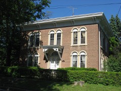 Conrad and Catherine Bloch Houselisted 2011
 Haste-Crumpacker Houselisted 2010
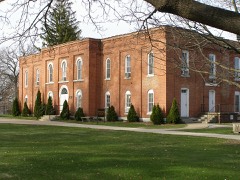 Heritage Halllisted 1976
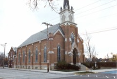 Immanuel Lutheran Churchlisted 1982
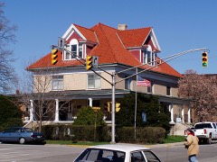 Dr. David J. Loring Residence and Cliniclisted 1984
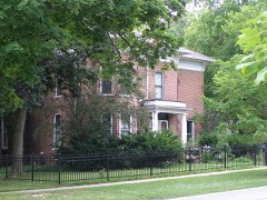 William McCallum Houselisted 2007
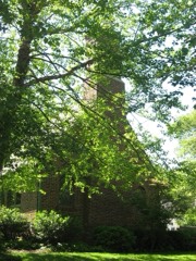 Charles S. and Mary McGill Houselisted 2013
 Porter County Jail and Sheriff's Houselisted 1976
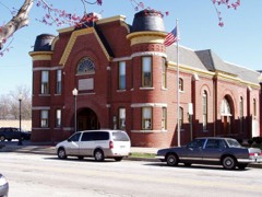 Porter County Memorial Halllisted 1984
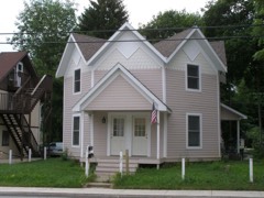 David Garland Rose Houselisted 1980
 DeForest Skinner Houselisted 2008
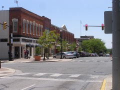 Valparaiso Downtown Commercial Districtlisted 1990
Population over time
2 figuresValparaiso grew from 31,730 to 34,151 between 2010 and 2020. These are the recorded population figures Wikidata holds for this place, reached through the Geographic Names Information System number this page is keyed on rather than by name, so they belong to this place and not to another of the same name. Most are census counts, but not all are: an early figure may be a founding or settlement estimate, and an estimate published within five years of a census is left out. The change column is computed, and is left blank where more than 20 years separate a figure from the one before it, because a gap that long is not a change between two counts.
| Year | People | Change |
|---|---|---|
| 2010 | 31,730 | |
| 2020 | 34,151 | +2,421 (+8%) |
Topographic sheets covering this place
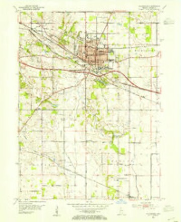
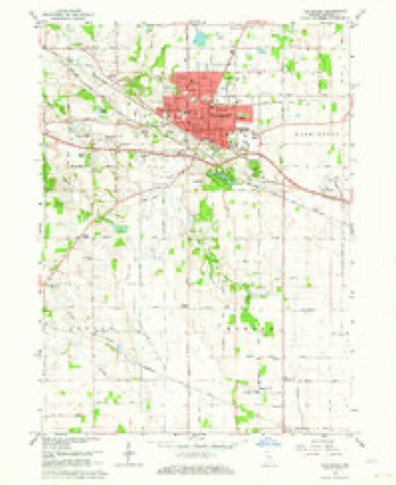
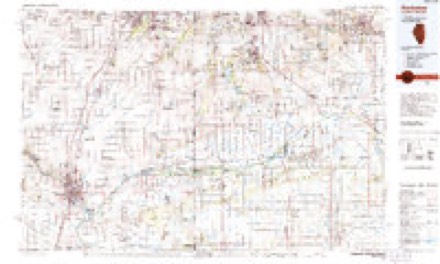
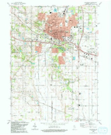
7 surveys from 14 printed sheetsMatched by testing this settlement's coordinate against the published boundary of every sheet in the United States Geological Survey's historical collection. Each opens the scanned sheet at the Survey.
- 1953 USGS Chicago quadrangle1:250000, 5 printings
- 1953 USGS Valparaiso quadrangle1:24000
- 1957 USGS Chicago quadrangle1:250000
- 1962 USGS Valparaiso quadrangle1:24000, 4 printings
- 1984 USGS Kankakee quadrangle1:100000
- 1991 USGS Kankakee quadrangle1:100000
- 1992 USGS Valparaiso quadrangle1:24000


Fires near this place
33 since 1995Regional context, not property-specific evidence. The federal wildfire occurrence database lists 33 fires within 5 miles of Valparaiso between 1995 and 2004, burning about 81 acres in total. None started naturally. 4 were recorded as arson. Distance is straight-line from the map coordinates, so a fire counted here may appear on a neighbouring settlement's page as well.
| Reported cause | Fires |
|---|---|
| Missing data/not specified/undetermined | 16 |
| Recreation and ceremony | 8 |
| Arson/incendiarism | 4 |
| Debris and open burning | 4 |
| Railroad operations and maintenance | 1 |
The most recent of them, most recent first, with the day each was reported and the service that recorded it.
| Date | Cause | Size | Reported by | Name on the report |
|---|---|---|---|---|
| 27 September 2002 | Missing data/not specified/undetermined | under an acre | Indiana State Fire Marshal's Office | not named |
| 27 September 2002 | Missing data/not specified/undetermined | under an acre | Indiana State Fire Marshal's Office | not named |
| 14 September 2002 | Missing data/not specified/undetermined | 1.0 acres | Indiana State Fire Marshal's Office | not named |
| 7 August 2002 | Missing data/not specified/undetermined | under an acre | Indiana State Fire Marshal's Office | not named |
| 10 August 2002 | Missing data/not specified/undetermined | 1.0 acres | Indiana State Fire Marshal's Office | not named |
| 31 July 2002 | Arson/incendiarism | 1.0 acres | Indiana State Fire Marshal's Office | not named |
| 5 June 2003 | Arson/incendiarism | 1.5 acres | Indiana State Fire Marshal's Office | not named |
| 6 May 2004 | Missing data/not specified/undetermined | under an acre | Indiana State Fire Marshal's Office | not named |
Settlements close enough to share some of these fires:
Mines and quarries near this place
2 within 5 milesRegional context, not property-specific evidence. The federal mineral resources record lists 2 workings within 5 miles of Valparaiso: 2 producers. All of them still produce. What was taken out: Stone. Distance is straight-line from the map coordinates, so a quarry counted here may appear on a neighbouring settlement's page as well.
| Where | Site | Commodity | Status | Recorded |
|---|---|---|---|---|
| Porter Co. Hwy Dept. | Stone | Producer | ||
| Valparaiso Supt. of Streets | Stone | Producer |
Storms near this place
60 of 72 shownRegional context, not property-specific evidence. The National Weather Service names Valparaiso in 72 storm reports between 1995 and 2025: 39 thunderstorm wind, 18 hail, 6 flood, 5 lightning. The reports record 4 injuries. Each account below is quoted exactly as the forecast office filed it, from the NOAA Storm Events Database, and each date opens the federal record of that event.
| When | Event | Place named | Harm | What the report says |
|---|---|---|---|---|
| July 2011 | Lightning | Valparaiso | 2 hurt | An employee at a drugstore was using the telephone when lightning struck nearby. The employee reported feeling a jolt and was taken to the hospital as a precaution. A dispatcher at the 911 center also reported a jolt after lightning struck the center. Sparks were reportedly seen inside the center just after the lightning strike. |
| May 2011 | Lightning | Valparaiso | 1 hurt | A woman in Jackson Township was injured when lightning struck nearby while she was closing a metal window. |
| July 2005 | Lightning | Valparaiso | 1 hurt | A worker at the Porter County Fairgrounds was struck by lightning. |
| August 2014 | Flash Flood | Valparaiso | $250,000 | Street and basement flooding was reported over portions of Valparaiso. |
| August 2006 | Thunderstorm Wind | Valparaiso | $100,000 | no account filed |
| November 2013 | Thunderstorm Wind | Valparaiso | $25,000 | On the east side of Valparaiso, numerous power poles were snapped and trees were blown down. County Road 600N was closed between 300E and 400E due to several high tension poles and power lines down across the road. |
| August 2012 | Lightning | Valparaiso | $25,000 | Two houses were set on fire after lightning strikes. |
| August 2008 | Thunderstorm Wind | Valparaiso | $25,000 | Several trees and tree limbs were blown down. One tree was blown onto a house. A large tree was blown down in Tower Park. The roof of a restaurant was blown off a sandwich shop. |
| August 2007 | Flood | Valparaiso | $25,000 | A van drove into eight inches of flood water, lost control, crossed the median into westbound lanes and was hit by a semi-trailer. Two passengers were killed and the driver was critically injured. |
| May 2011 | Lightning | Valparaiso | $5,000 | Lightning struck a garage on Roosevelt Road. About an hour later, smoke was seen billowing from the detached garage. The fire was quickly put out by firefighters. |
| July 2007 | Thunderstorm Wind | Valparaiso | $5,000 | Trees and power lines blown down. |
| June 1995 | Thunderstorm Wind | Valparaiso | $3,000 | Large tree limbs fell on cars at Chesterton and Valparaiso. A tree also fell across Route 12 in Porter County. |
| August 2017 | Thunderstorm Wind | Valparaiso | $1,000 | Two trees were blown down onto power lines. |
| July 2025 | Flood | Valparaiso | - | Multiple streets in Valparaiso were flooded with a few inches of water. |
| July 2024 | Thunderstorm Wind | Valparaiso | - | Trees and power lines were blown down on Union Street. |
| July 2024 | Thunderstorm Wind | Valparaiso | - | Trees and tree limbs were blown down on and around the Valparaiso University campus. |
| March 2023 | Hail | Valparaiso | - | A photo shared of hail in Valparaiso showed the largest hailstones were approximately quarter sized. |
| July 2023 | Thunderstorm Wind | Valparaiso | - | A photo shared via social media shows a 2 to 4 inch diameter tree branch had been snapped near Oak St and Garfield St. Wind speed was estimated using radar. |
| August 2022 | Thunderstorm Wind | Valparaiso | - | Tree limbs were blown down on power lines. |
| June 2022 | Thunderstorm Wind | Valparaiso | - | Scattered large tree limbs were blown down in Valparaiso. |
| June 2021 | Thunderstorm Wind | Valparaiso | - | A photo was shared on social media of a large tree limb snapped. |
| June 2021 | Thunderstorm Wind | Valparaiso | - | Tree damage was reported. |
| April 2020 | Flood | Valparaiso | - | Minor flooding of low lying areas was reported. |
| June 2020 | Thunderstorm Wind | Valparaiso | - | Trees were blown down in Valparaiso. |
| August 2020 | Thunderstorm Wind | Valparaiso | - | Four tree limbs, 8 to 10 inches in diameter, were snapped. |
| August 2020 | Thunderstorm Wind | Valparaiso | - | A semi truck was blown over near Valparaiso. |
| June 2020 | Thunderstorm Wind | Valparaiso | - | Numerous reports of trees and wires blown down around Valparaiso were received. |
| June 2019 | Flood | Valparaiso | - | Standing water was reported in a yard along with nearby fields partially flooded. Storm total rainfall of 2.50 inches was measured. |
| May 2018 | Thunderstorm Wind | Valparaiso | - | A large tree limb and a power line were blown down in Jackson Township. Other large tree limbs were blown down in parts of Porter County. |
| September 2018 | Thunderstorm Wind | Valparaiso | - | A large tree was split on the southeast side of Valparaiso. |
| June 2017 | Hail | Valparaiso | - | Quarter to half dollar size hail was reported in Valparaiso. |
| August 2016 | Flood | Valparaiso | - | Standing water over Route 2 one mile east of Valparaiso. |
| June 2015 | Flash Flood | Valparaiso | - | Numerous streets and bridges had to be closed due to flooding. |
| August 2015 | Thunderstorm Wind | Valparaiso | - | Powerlines were blown down across portions of Valparaiso. |
| September 2014 | Thunderstorm Wind | Valparaiso | - | Tree limbs and branches were blown down across portions of Valparaiso. |
| June 2014 | Thunderstorm Wind | Valparaiso | - | Numerous trees were blown down. |
| June 2013 | Flood | Valparaiso | - | Porter County Highway Department reported numerous roads and subdivisions flooded throughout the County. Approximately two inches of rain fell in 37 minutes. |
| July 2012 | Thunderstorm Wind | Valparaiso | - | Wind gusts were estimated to 75 mph. |
| May 2011 | Thunderstorm Wind | Valparaiso | - | Several trees were blown down in the Valparaiso area. |
| August 2010 | Thunderstorm Wind | Valparaiso | - | A one foot diameter tree was blown down near Joliet Road and Route 130. |
| August 2009 | Heavy Rain | Valparaiso | - | Rainfall of 2.20 inches was reported in the past 24 hours. |
| July 2008 | Thunderstorm Wind | Valparaiso | - | Wind gusts were estimated to 60 mph one mile east of Valparaiso. |
| June 2008 | Hail | Valparaiso | - | Penny to quarter size hail was reported. |
| August 2007 | Flash Flood | Valparaiso | - | Roadways covered by water. |
| August 2007 | Hail | Valparaiso | - | Quarter size hail reported on the west side of Valparaiso. |
| August 2007 | Hail | Valparaiso | - | Nickel size hail reported at Sweetbriar Road. |
| August 2007 | Thunderstorm Wind | Valparaiso | - | Trees blown down near Route 30 and Horseprairie Road, winds estimated to 80 mph. |
| August 2007 | Thunderstorm Wind | Valparaiso | - | Estimated gust to 80 mph in rural Washington Township. |
| May 2007 | Thunderstorm Wind | Valparaiso | - | A two and half foot diameter tree was snapped at it's base. |
| October 2007 | Hail | Valparaiso | - | Quarter size hail was reported at Route 2 and Route 30. |
| July 2006 | Thunderstorm Wind | Valparaiso | - | Small trees were uprooted and large limbs were blown down near County Road 325 and County Road 400. |
| July 2006 | Thunderstorm Wind | Valparaiso | - | A 30 foot tall tree was blown down along the county line, 2 miles west of Westville in Porter County. |
| June 2005 | Hail | Valparaiso | - | Penny size hail fell for about 10 minutes. |
| May 2004 | Thunderstorm Wind | Valparaiso | - | In Morgan Township several old trees were blown down. |
| June 2003 | Thunderstorm Wind | Valparaiso | - | Large tree limbs were blown down across parts of eastern Valparaiso. |
| May 1997 | Thunderstorm Wind | Valparaiso | - | Trees and limbs downed throughout the county, especially southwest of Valparaiso. |
| March 2025 | Thunderstorm Wind | Valparaiso | - | no account filed |
| March 2023 | Hail | Valparaiso | - | no account filed |
| April 2020 | Hail | Valparaiso | - | no account filed |
| May 2020 | Hail | Valparaiso | - | no account filed |
Nearest settlements
The eight closest, with where each one stands in the county. Distances are straight-line, computed from the Geographic Names Information System coordinates.
| Map | Place | Distance | Sheets |
|---|---|---|---|
| Marian Manor | 1.5 miles | 14 | |
| Crestview | 1.5 miles | 14 | |
| Coolwood Acres | 1.7 miles | 14 | |
| Westhill | 2.0 miles | 14 | |
| Burlington Beach | 2.4 miles | 17 | |
| Lincoln Hills | 2.5 miles | 14 | |
| Sylvan Manor | 2.6 miles | 14 | |
| Williamsburg Manor | 2.9 miles | 14 |
Elsewhere
Matched on this settlement's Geographic Names Information System number rather than its name, so it cannot be a different place of the same name in another state.
| Wikipedia article on Valparaiso | An encyclopaedic summary. Its text is share-alike, so it is linked here rather than copied. |
| Wikidata item Q868888 | The structured record the population and elevation above come from. Public domain (CC0). |
Provenance
This settlement is recorded in the Geographic Names Information System as feature 449849. The sheet list is computed by point-in-boundary test against the United States Geological Survey's historical topographic inventory. Both are works of the United States government and carry no copyright under 17 U.S.C. 105.
Wildfire. Short, Karen C. 2022. Spatial wildfire occurrence data for the United States, 1992-2020 [FPA_FOD_20221014]. 6th Edition. Fort Collins, CO: Forest Service Research Data Archive. https://doi.org/10.2737/RDS-2013-0009.6 Collected with United States Government funding and usable without additional permissions or fees.
Mines and quarries. USGS Mineral Resources Data System (MRDS) https://mrdata.usgs.gov/mrds/ A work of the United States government, no copyright under 17 U.S.C. 105.
Storms. NOAA National Centers for Environmental Information, Storm Events Database https://www.ncei.noaa.gov/stormevents/ A work of the United States government, no copyright under 17 U.S.C. 105. Narratives are quoted verbatim from the National Weather Service report and are not edited or summarised.