Block
From the record
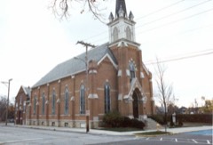
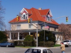
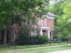
42 National Register listings published here, 1 of them a National Historic Landmark.
Sources: the county history on the Internet Archive · the National Register database, National Park Service
73 topographic sheets cover 73 settlements here, and 42 properties are on the National Register of Historic Places.
42 National Register listings published here, 1 of them a National Historic Landmark.
Sources: the county history on the Internet Archive · the National Register database, National Park Service
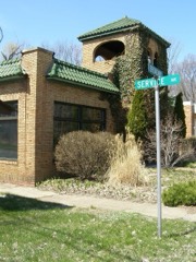
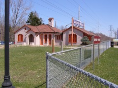
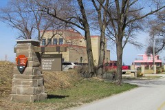
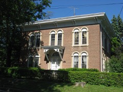
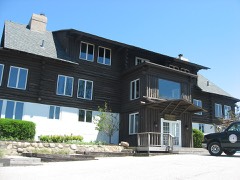
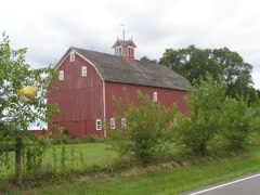
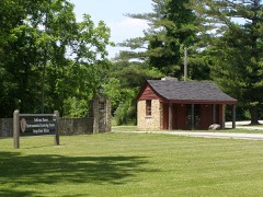
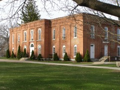
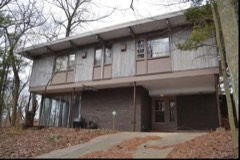
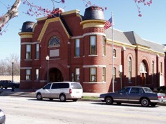
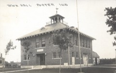
Every property in this county listed on the National Register of Historic Places, with the year it was listed and the federal nomination document.
Every wildfire the federal occurrence database records inside this county: 527 of them, burning about 640 acres. 18 started naturally and 38 were recorded as arson. Each settlement page carries the fires within five miles of it.
| Reported cause | Fires |
|---|---|
| Missing data/not specified/undetermined | 145 |
| Railroad operations and maintenance | 84 |
| Debris and open burning | 65 |
| Recreation and ceremony | 55 |
| Arson/incendiarism | 38 |
| Fireworks | 36 |
| Equipment and vehicle use | 24 |
| Power generation/transmission/distribution | 24 |
| Misuse of fire by a minor | 19 |
| Natural | 18 |
| Smoking | 12 |
| Other causes | 7 |
The five largest, by the area the report gives. Two of them were set deliberately.
| Date | Cause | Size | Reported by | Name on the report |
|---|---|---|---|---|
| 20 May 1992 | Missing data/not specified/undetermined | 48 acres | Indiana Dunes National Lakeshore | MT. HOLDEN |
| 1 April 2015 | Arson/incendiarism | 48 acres | Indiana Dunes National Lakeshore | COUNTY LINE |
| 12 March 1995 | Railroad operations and maintenance | 30 acres | Indiana Dunes National Lakeshore | FINGERS |
| 26 April 2003 | Missing data/not specified/undetermined | 25 acres | Indiana State Fire Marshal's Office | not named |
| 1 May 2001 | Railroad operations and maintenance | 25 acres | Indiana Dunes National Lakeshore | CO. WEST |
| 10 April 2006 | Missing data/not specified/undetermined | 25 acres | Indiana Dunes National Lakeshore | STATE PARK |
| 3 September 2000 | Arson/incendiarism | 25 acres | Indiana Dunes National Lakeshore | HANDCREW |
| 25 March 1995 | Railroad operations and maintenance | 22 acres | Indiana Dunes National Lakeshore | UNION |
Every settlement page carries the fires within five miles of it - see the settlement index below.
The NOAA Storm Events Database holds 435 reports for this county, causing 8 deaths, 10 injuries and about $49,763,280 in recorded property damage. Each settlement page carries the reports that name it.
| Kind of event | Reports |
|---|---|
| Thunderstorm Wind | 242 |
| Hail | 90 |
| Flood | 28 |
| Tornado | 26 |
| Flash Flood | 25 |
| Lightning | 16 |
| Heavy Rain | 4 |
| Rip Current | 2 |
| Funnel Cloud | 2 |
The most serious of them, by death, then injury, then recorded damage. The accounts are quoted exactly as the forecast office filed them.
| When | Event | Place named | Harm | What the report says |
|---|---|---|---|---|
| September 2008 | Flash Flood | Ogden Dunes | 2 killed, $2,000,000 | Flash flooding or significant flooding was reported across most of Porter County, including street closures due to flooding, basement flooding and creek, stream and river flooding. Two men were sucked into a culvert while trying to rescue a boy in flood waters in Chesterton. The boy survived but both men drowned. A sinkhole developed and swallowed the back of a fire truck in Valparaiso. |
| July 2005 | Rip Current | Beverly Shrs | 2 killed | A 16 year old female and a man in his mid-20s were swimming in Lake Michigan, 80 to 100 yards offshore of Beverly Shores. At 4 pm CST, Michigan City had a north-northeast wind with gusts to 30 mph. These strong winds likely produced waves of 4 feet or higher as well as rip currents. Both people were found about an hour and half later, but had drowned. |
| May 2007 | Thunderstorm Wind | South Haven | 1 killed, $15,000 | A tree was blown down onto a pickup truck on State Road 149, north of US Route 6, killing the driver. |
| March 2025 | Thunderstorm Wind | (Vpz) Porter County Regional Airport | 1 killed | A 34 year old male semi truck driver was killed when severe thunderstorm winds blew the truck over and onto the driver as he was standing outside of the cab. The incident occurred at Pratt Industries in Valparaiso. The ASOS at the nearby Porter County Airport recorded an 81 mph gust around the time of the incident. |
| August 1999 | Rip Current | Beverly Shrs | 1 killed | no account filed |
| May 1980 | Tornado (F1) | not stated | 1 killed | no account filed |
| April 1975 | Tornado (F0) | not stated | 4 hurt, $25,000 | no account filed |
| July 2011 | Lightning | Valparaiso | 2 hurt | An employee at a drugstore was using the telephone when lightning struck nearby. The employee reported feeling a jolt and was taken to the hospital as a precaution. A dispatcher at the 911 center also reported a jolt after lightning struck the center. Sparks were reportedly seen inside the center just after the lightning strike. |
| April 1960 | Tornado (F1) | not stated | 1 hurt, $30 | no account filed |
| May 2011 | Lightning | Valparaiso | 1 hurt | A woman in Jackson Township was injured when lightning struck nearby while she was closing a metal window. |
| July 2005 | Lightning | Valparaiso | 1 hurt | A worker at the Porter County Fairgrounds was struck by lightning. |
| August 2000 | Thunderstorm Wind | Countywide | 1 hurt | no account filed |
| April 1965 | Tornado (F3) | not stated | $25,000,000 | no account filed |
| August 2014 | Flash Flood | South Haven | $10,000,000 | Significant flooding occurred in South Haven requiring at least 18 boat evacuations in the predawn hours and at least three homes were declared uninhabitable. Basements across town were flooded and destroyed. Neighborhoods had around four feet of water which the fire department was trying to pump out. The Duck Creek subdivision in particular was hard hit. The entry into the subdivision was impassable. One resident was treated for a minor injury. The intersections of County Road 700 North and Indiana 149 along with U.S. 6 and Indiana 149 were closed due to flooding. Portions of County Road 250 West between Indiana 130 and U.S. 30 were washed away. |
| February 2018 | Flood | Clanricarde | $3,550,000 | Significant flooding occurred in Porter County which caused flood damage to approximately 190 homes. Flooding closed several roads and damaged public infrastructure, including roads, culverts, bridges, levees and stream and ditch banks. Storm total rainfall amounts included 4.50 inches in Portage and 4.20 inches in Valparaiso. |
| August 2007 | Thunderstorm Wind | Hurlburt | $2,500,000 | Widespread wind damage from near Lakes of The Four Seasons along the Lake/Porter County line, through central Porter County, ending southeast of Kouts, near the Porter LaPorte County line. Numerous trees were uprooted and blown over. At least 50 houses across the county were damaged. The most intense damage was near Kouts where large hardwood trees were uprooted or snapped. Twenty three large metal truss towers for high tension power lines were blown down along a four mile path east of Kouts. Winds with the most intense damage were estimated at 100 to 120 mph. |
| August 2009 | Tornado (EF2) | Chesterton | $1,500,000 | A tornado touched down in southern Chesterton east of 11th Street and southwest of South Park Drive. The tornado quickly intensified as it moved to the northeast and caused the partial collapse of a gymnasium roof at the Chesterton Junior High School. A wind gust to 105 mph was measured by an anemometer near the school. This damage along with numerous trees that were either uprooted or sheared off was caused by tornado winds reaching 110 mph. The tornado was rated EF1 at this point with a path width of 40 yards. The tornado continued to track to the northeast across the New York Central railroad tracks toward Grant Avenue where the roof of a warehouse had been peeled off and thrown about 15 yards behind the building to the north. The tornado continued to the northeast where an apartment building on Brown Avenue lost its entire roof. This damage was caused by tornado winds reaching 120 mph. The tornado damage was rated EF2 through this area with a path width of 60 yards. In the city of Chesterton, 211 structures sustained damage; 8 were completely destroyed; 54 suffered major damage, such as trees falling through roofs. The remaining 149 structures sustained damage such as missing shingles or damaged gutters. Multiple vehicles were damaged by falling debris from buildings or trees. Numerous power lines were blown down along with utility poles blown down or snapped. This EF2 damage continued northeast where an entire field of healthy old hardwood tree trunks were snapped off or uprooted. The tornado then started to slightly weaken as it approached the Interstate 94 eastbound exit/westbound entrance ramps at Indiana Highway 49. A home south of the interstate had a garage roof blown off with still numerous trees uprooted or sheared off. Tornado wind speeds here were estimated at 100 mph with an EF1 rating. Similar tree damage was noted along a path that continued to go to the northeast across Highway 49 and toward Highway 20 near Hadenfelt Road where some aluminum roofing material of a storage facility had been peeled off. Tornado wind speeds were estimated at 95 mph here and was rated EF1 with a path width of 30 yards. The tornado continued to move through a heavily forested area in the Indiana Dunes National Lakeshore, eventually crossing Highway 12. Radar imagery and an aerial survey suggests that the tornado dissipated north of Highway 12. |
| September 2008 | Flash Flood | Hebron | $1,000,000 | Basement and street flooding was reported in Valparaiso. Water was waist high in some locations with some roads impassible. Street flooding was also reported in South Haven. Route 2 near the Lake County Line was flooded and closed. |
| August 2006 | Thunderstorm Wind | Beverly Shrs | $1,000,000 | no account filed |
| August 2006 | Thunderstorm Wind | Town Of Pines | $1,000,000 | no account filed |
| August 2006 | Hail | Chesterton | $500,000 | Golf ball size hail was reported at Route 20 and Bean Road. |
| August 2014 | Flash Flood | Valparaiso | $250,000 | Street and basement flooding was reported over portions of Valparaiso. |
| March 1976 | Tornado (F3) | not stated | $250,000 | no account filed |
| February 2018 | Flood | Hebron | $155,000 | Record flooding occurred along the Kankakee River. The river crested at 13.65 feet at Dunns Bridge on February 26th, which was the highest crest on record. Flood stage at Dunns Bridge is 10 feet and major stage is 13 feet. The river crested at 14.46 feet near Kouts on February 26th, which was the second highest crest on record. Flood stage near Kouts is 11 feet and major stage is 14 feet. The flooding damaged culverts and levees near the river. |
| January 2008 | Flood | Dune Acres | $100,000 | Several roads were closed due to flooding. Numerous basements were flooded. The Chesterton wastewater plant measured 3.25 inches of rainfall. |
| August 2006 | Thunderstorm Wind | Valparaiso | $100,000 | no account filed |
| June 2001 | Thunderstorm Wind | Countywide | $55,000 | no account filed |
| May 2014 | Thunderstorm Wind | Garyton | $50,000 | Some large trees were blown down in Portage, including near the intersection of Stone Avenue and Willowdale Road. A roof was partially torn off of El Pueblo Restaurant on Route 6. |
| November 2013 | Thunderstorm Wind | Kouts | $50,000 | On Indiana Avenue, a quarter of a roof on an apartment building was ripped off. |
| October 2010 | Tornado (EF0) | Kouts | $50,000 | One outbuilding was damaged. |
| August 2007 | Lightning | Chesterton | $50,000 | A house was struck by lightning, which ignited a fire in the attic. The house suffered extensive damage, mainly from water. |
| September 2007 | Lightning | Portage | $50,000 | A mobile home was struck by lightning, which caused a fire and damaged the mobile home beyond livable conditions. |
| August 2005 | Lightning | Chesterton | $40,000 | A bolt of lightning struck an apartment building during a thunderstorm early Saturday morning. It is suspected of starting a smoldering fire in the insulation in the attic which was finally noticed at 315 pm in the afternoon. Damage was estimated at $30,000 for the structure, mainly the roof, and $10,000 to contents in the building. |
| May 2007 | Thunderstorm Wind | Portage | $35,000 | A large tree fell onto a pickup truck and a van, crushing both. A large tree was uprooted on Charlotte Street, falling onto a house. Tree limbs and power lines were also blown down. |
| November 2013 | Thunderstorm Wind | Valparaiso | $25,000 | On the east side of Valparaiso, numerous power poles were snapped and trees were blown down. County Road 600N was closed between 300E and 400E due to several high tension poles and power lines down across the road. |
| August 2012 | Lightning | Valparaiso | $25,000 | Two houses were set on fire after lightning strikes. |
| August 2008 | Thunderstorm Wind | Valparaiso | $25,000 | Several trees and tree limbs were blown down. One tree was blown onto a house. A large tree was blown down in Tower Park. The roof of a restaurant was blown off a sandwich shop. |
| August 2007 | Flood | Valparaiso | $25,000 | A van drove into eight inches of flood water, lost control, crossed the median into westbound lanes and was hit by a semi-trailer. Two passengers were killed and the driver was critically injured. |
| July 2006 | Thunderstorm Wind | Malden | $25,000 | A strong thunderstorm moved south across eastern Porter County and damaged or blew down 12 trees along County Road 150S in Morgan Township. One of these trees fell onto a truck which appeared to be totaled. A window was blown in and a shed was also blown down. Another tree was blown down along County Road 75E. |
| August 2001 | Lightning | Chesterton | $25,000 | Lightning struck a tree, went down a security wire which was nailed to the tree, blew out wall sockets in a garage, traveled underground, blew out a light and a pump in a pool and finally struck a gas meter , but did not cause a fire. |
| June 1974 | Tornado (F1) | not stated | $25,000 | no account filed |
| October 1967 | Tornado (F3) | not stated | $25,000 | no account filed |
| June 1958 | Tornado (F1) | not stated | $25,000 | no account filed |
| November 2013 | Thunderstorm Wind | South Haven | $20,000 | A tree and a power line were blown onto a house. |
| June 2011 | Thunderstorm Wind | Hebron | $20,000 | Route 2 from Lake County into Porter County was impassable due to numerous trees and utility poles blown down. As many as 60 trees were either damaged or blown down in Hebron. Trees and structures were damaged along 900S. |
| June 2011 | Flash Flood | Hebron | $15,000 | A car was submerged in flood waters along US 231. Street flooding as well as standing water was reported. |
| July 2001 | Lightning | Burdick | $12,000 | no account filed |
| August 2018 | Thunderstorm Wind | Malden | $10,000 | Numerous large trees were blown down and many trees were uprooted. One tree was blown into a garage. Damage was described as significant and widespread. |
| June 2013 | Thunderstorm Wind | Crisman | $10,000 | Two foot diameter trees were snapped in Ingram Manor. Some skirting and siding was blown off of mobile homes. |
| June 2010 | Lightning | Aylesworth | $10,000 | Lightning struck a house on Road 400 West and started a fire which damaged the roof. |
| June 2010 | Lightning | Crocker | $10,000 | Lightning struck a house on Road 1050 North and started a fire. The fire caused an electrical short that started a fire in the basement. |
| July 2001 | Lightning | Chesterton | $10,000 | no account filed |
| August 1996 | Lightning | Chesterton | $10,000 | no account filed |
| September 2018 | Thunderstorm Wind | Portage | $5,000 | Numerous trees and power lines were blown down in northern Porter County. |
| September 2014 | Thunderstorm Wind | Burns Harbor | $5,000 | A tree fell down onto a car and power line on Old Porter Road. |
| May 2014 | Flash Flood | South Haven | $5,000 | A car stalled in knee deep water in place on Midway Drive and Devonshire Road. |
| July 2012 | Thunderstorm Wind | Boone Grove | $5,000 | Trees and power lines were blown down across many areas of southwest Porter County. |
| May 2011 | Lightning | Valparaiso | $5,000 | Lightning struck a garage on Roosevelt Road. About an hour later, smoke was seen billowing from the detached garage. The fire was quickly put out by firefighters. |
| June 2009 | Flash Flood | Ogden Dunes | $5,000 | Heavy rain fell across parts of north central Porter County during the early morning hours of June 11th. Storm total rainfall amounts included 6.17 inches four miles north northwest of Valparaiso, 5.50 inches near South Haven and 4.00 inches one mile southeast of Portage. Flooding was reported at the intersection of US 6 and Route 149 and in a mobile home park nearby. On 600N, just east of Meridain Road, a retaining wall for landscaping gave way and a small landslide blocked the road for a few hours. Five to six inches of flowing water was reported on 700N. |
| May 2009 | Thunderstorm Wind | Portage | $5,000 | Several large trees were blown down. A roof was blown off a picnic shelter in Woodland Park. Tree limbs and power lines were also blown down. Three horses escaped after a tree fell onto a fence. One of the horses was struck and killed by a tractor-trailer on US 20. |
The Survey's mineral resources record lists 8 workings inside this county. 3 still produce and 5 are closed or unrecorded. Each settlement page carries the workings within five miles of it.
| Commodity | Workings |
|---|---|
| Sand and Gravel, Construction | 3 |
| Clay | 3 |
| Stone | 2 |
The least common of them first, because a county's hundredth gravel pit says nothing its first ten did not.
| Where | Site | Commodity | Status | Recorded |
|---|---|---|---|---|
| Porter Co. Hwy Dept. | Stone | Producer | ||
| Valparaiso Supt. of Streets | Stone | Producer | ||
| Box Sand Co Pit | Sand and Gravel, Construction | Past Producer | ||
| Brown Pit | Sand and Gravel, Construction | Past Producer | ||
| C. Shrock Clay Pit | Clay | Past Producer | ||
| Crisman Sand Company | Sand and Gravel, Construction | Producer | ||
| Lorenz Brothers Pit Number 1 | Clay | Past Producer | ||
| Zehner Pit | Clay | Past Producer |
Counties of Porter and Lake, Indiana : Historical and Biographical devotes a chapter to each township: its boundaries and streams, who settled it and when, the mills, the schools and the churches. All 11 are reproduced here in full. Each row shows the township's own shape and where it lies in the county, drawn from the Census Bureau's boundary. Which settlements belong to which township is computed from that same boundary, not taken from the book.
2 books written about this county, cut here where the book itself is cut, at its printed chapters: 15 chapters in all. Every chapter is public domain, machine-read from the scan and reproduced complete. A chapter already given under one of the county's towns is not repeated in this list.
| Chapter | Length |
|---|---|
| Bt Hubert O. Skinner | 23,609 words in 2 parts |
| By Rev. Koeebt Beek | 37,015 words in 3 parts |
| Chapter | Length |
|---|---|
| General Features | 5,599 words |
| Chapter with an unread heading (no. 2 of those read) | 4,646 words |
| Chapter 3: Settlement and Organization | 6,659 words |
| Chapter 4: Internal Improvements | 6,928 words |
| Chapter 5: Educational Development | 7,898 words |
| Chapter 6: Ivhlitaiiy Histojiy | 19,918 words in 2 parts |
| Chapter 9: The City Op Valparaiso | 7,714 words |
| Chapter 10: Financial and Industrial | 6,737 words |
| Chapter 11: The Professions | 6,800 words |
| Chapter 12: Societies and Fraternities | 4,420 words |
| Chapter 13 | 7,270 words |
| Chapter with an unread heading (no. 13 of those read) | 11,250 words |
| Statistical Review | 2,058 words |
Named settlements recorded in the Geographic Names Information System, each with the topographic sheets covering it. Villages, hamlets and abandoned places alike. Each is shown with the nearest named watercourse or landform and the survey quadrangle it falls on.
Westchester township · 46304 · On Sand Creek · Chesterton quadrangle
17 sheets, 1934 to 1991
Westchester township · 46304 · On Samuelson Ditch · Ogden Dunes quadrangle
16 sheets, 1934 to 1991
Westchester township · 46304 · On Coffee Creek · Chesterton quadrangle
17 sheets, 1934 to 1991
Center township · 46385 · On Beauty Creek · Valparaiso quadrangle
14 sheets, 1953 to 1992
Westchester township · 46304 · On Dunes Creek · Dune Acres quadrangle
16 sheets, 1934 to 1991
Westchester township · 46304 · On Sand Creek · Chesterton quadrangle
17 sheets, 1934 to 1991
Westchester township · 46304 · On Peterson Ditch · Chesterton quadrangle
17 sheets, 1934 to 1991
Center township · 46385 · On Beauty Creek · Valparaiso quadrangle
14 sheets, 1953 to 1992
Center township · 46385 · On Beauty Creek · Valparaiso quadrangle
14 sheets, 1953 to 1992
Westchester township · 46304 · On Samuelson Ditch · Chesterton quadrangle
17 sheets, 1934 to 1991
Westchester township · 46304 · On Coffee Creek · Chesterton quadrangle
17 sheets, 1934 to 1991
Portage township · 46368 · On East Arm Little Calumet River · Portage quadrangle
19 sheets, 1934 to 1992
Portage township · 46368 · On Squirrel Creek · Portage quadrangle
19 sheets, 1934 to 1992
Westchester township · 46304 · On Peterson Ditch · Chesterton quadrangle
17 sheets, 1934 to 1991
Portage township · 46368 · On Robbins Ditch · Portage quadrangle
19 sheets, 1934 to 1992
Westchester township · 46304 · On Samuelson Ditch · Portage quadrangle
19 sheets, 1934 to 1992
Morgan township · 46385 · On Sievers Creek · Valparaiso quadrangle
14 sheets, 1953 to 1992
Center township · 46385 · On Beauty Creek · Valparaiso quadrangle
14 sheets, 1953 to 1992
Westchester township · 46304 · Near Mount Jackson · Dune Acres quadrangle
16 sheets, 1934 to 1991
Center township · 46383 · On Beauty Creek · Valparaiso quadrangle
14 sheets, 1953 to 1992
Westchester township · 46304 · On Sand Creek · Chesterton quadrangle
17 sheets, 1934 to 1991
Westchester township · 46304 · On Peterson Ditch · Chesterton quadrangle
17 sheets, 1934 to 1991
Portage township · 46368 · On Crisman Ditch · Portage quadrangle
19 sheets, 1934 to 1992
Portage township · 46368 · On Crisman Ditch · Portage quadrangle
19 sheets, 1934 to 1992