 Block
Vawter Park, Indiana
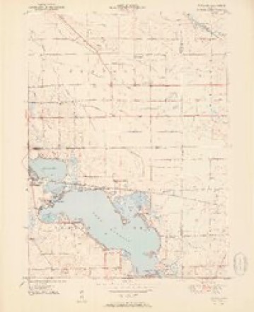
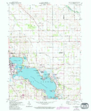
13 topographic sheets cover this place, the earliest surveyed in 1951 and the latest in 1994. It stands in Turkey Creek Township. It lies in ZIP code area 46567. It lies near Ogden Island. The Survey maps it on the Lake Wawasee quadrangle.
Topographic sheets covering this place
6 surveys from 13 printed sheetsMatched by testing this settlement's coordinate against the published boundary of every sheet in the United States Geological Survey's historical collection. Each opens the scanned sheet at the Survey.
- 1951 USGS Wawasee quadrangle1:24000, 2 printings
- 1953 USGS Fort Wayne quadrangle1:250000, 4 printings
- 1956 USGS Fort Wayne quadrangle1:250000, 2 printings
- 1961 USGS Lake Wawasee quadrangle1:24000, 3 printings
- 1984 USGS Fort Wayne quadrangle1:100000
- 1994 USGS Fort Wayne quadrangle1:100000




In the county-history sources
1,452 words on this townshipBiographical and Historical Reocrd of Kosciusko County, published 1887 has no passage naming this settlement, which was common for smaller places. Its township is covered in full.
The chapter on Turkey Creek Township covers the township.
Read the chapter on Turkey Creek Township - 1,452 words.
Storms near this place
10 since 2009Regional context, not property-specific evidence. The National Weather Service names Vawter Park in 10 storm reports between 2009 and 2024: 8 thunderstorm wind, 1 flash flood, 1 heavy rain. No death or injury is recorded in these reports. Each account below is quoted exactly as the forecast office filed it, from the NOAA Storm Events Database, and each date opens the federal record of that event.
| When | Event | Place named | Harm | What the report says |
|---|---|---|---|---|
| July 2024 | Thunderstorm Wind | Vawter Park | $10,000 | Several large trees uprooted on Ogden Point road. A few boat lifts damaged too. |
| July 2024 | Thunderstorm Wind | Vawter Park | $5,000 | Multiple trees down. |
| August 2021 | Thunderstorm Wind | Vawter Park | $2,000 | Boat lift cover damages and tree uprooted on the eastern bank of Lake Wawasee. |
| June 2016 | Thunderstorm Wind | Vawter Park | - | Local media reported several large trees were blown down on the south side of Lake Wawasee. Damage occurred to a boat canopy with pieces of a pier blown into the lake. |
| July 2015 | Flash Flood | Vawter Park | - | Water over State Road 13 has traffic restricted to one lane. |
| August 2015 | Thunderstorm Wind | Vawter Park | - | A survey of the area around Waco Drive on the southwest side of Lake Wawasee revealed several tree limbs were blown down as a result of a wet microburst from a stationary storm over the area. |
| August 2015 | Heavy Rain | Vawter Park | - | A thunderstorm remained over Lake Wawasee for nearly 90 minutes, dropping torrential rainfall. Rainfall totals peak out at just over 5 inches, on the northeast side of the lake. Flooding occurred on State Route 13, near the South Shore Golf Course, where high water signs had to be posted for several hours. Flooding was minimized across the area as a result of the majority of the rain likely falling into the lake. Rainfall amounts quickly diminished a few miles outside of this main area with the National Weather Service office picking up 1.86 inches of rain in the same amount of time. |
| June 2013 | Thunderstorm Wind | Vawter Park | - | An off duty NWS employee reported a two and one half foot (2.5 foot) diameter healthy tree snapped roughly five feet from the ground. A one and one half foot (1.5 foot) diameter healthy tree was snapped at the 15 foot level. A one foot tree limb was blown down with a six inch tree snapped at the base. |
| October 2010 | Thunderstorm Wind | Vawter Park | - | A trained spotter reported a one foot diameter tree limb down near Lake Wawasee. |
| June 2009 | Thunderstorm Wind | Vawter Park | - | NWS employees reported four trees uprooted on the south end of Lake Wawasee on Hatchery Road. Wind speeds, estimated at around 75 mph, appear to have locally increased as a result of flowing down the length of the lake. |
Nearest settlements
The eight closest, with where each one stands in the county. Distances are straight-line, computed from the Geographic Names Information System coordinates.
| Map | Place | Distance | Sheets |
|---|---|---|---|
| Marineland Gardens | 0.8 miles | 13 | |
| Sunrise Beach | 1.1 miles | 13 | |
| Cedar Point | 1.2 miles | 13 | |
| Buttermilk Point | 1.2 miles | 13 | |
| Black Point | 1.3 miles | 13 | |
| Kanata Manayunk | 1.6 miles | 13 | |
| Enchanted Hills | 1.7 miles | 13 | |
| South Park | 1.8 miles | 13 |
Elsewhere
Matched on this settlement's Geographic Names Information System number rather than its name, so it cannot be a different place of the same name in another state.
| Wikidata item Q122598444 | The structured record the population and elevation above come from. Public domain (CC0). |
Provenance
This settlement is recorded in the Geographic Names Information System as feature 445238. The sheet list is computed by point-in-boundary test against the United States Geological Survey's historical topographic inventory. Both are works of the United States government and carry no copyright under 17 U.S.C. 105.
Storms. NOAA National Centers for Environmental Information, Storm Events Database https://www.ncei.noaa.gov/stormevents/ A work of the United States government, no copyright under 17 U.S.C. 105. Narratives are quoted verbatim from the National Weather Service report and are not edited or summarised.