 Block
Wabash, Indiana
13 topographic sheets cover this place, the earliest surveyed in 1952 and the latest in 1986. It stands in Noble Township. It lies in ZIP code area 46992. It stands on Treaty Creek. The Survey maps it on the Wabash quadrangle. 10,440 people lived here at the 2020 count. It stands 712 feet above sea level.
Research this city
On record in Wabash
Buildings and businesses the archive holds for this place. Each opens its own page, with the source record it came from.
On the National Register 12 of 13 shown
 James M. Amoss Buildinglisted 1984
 Downtown Wabash Historic Districtlisted 1986
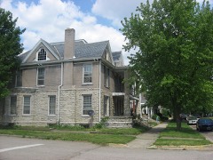 East Wabash Historic Districtlisted 2011
 First Christian Churchlisted 1983
 Honeywell Memorial Community Centerlisted 1983
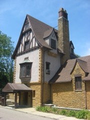 Honeywell Studiolisted 2005
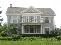 McNamee-Ford Houselisted 1995
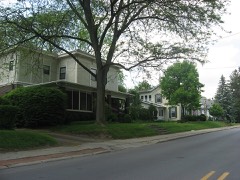 North Wabash Historic Districtlisted 1999
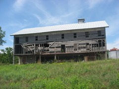 Teague Barn Wabash Importing Company Farm Stablelisted 2002
 West Wabash Historic Districtlisted 1988
 Solomon Wilson Buildinglisted 1984
- 13-24 Drive-In Movie Theaterlisted 2021
Population over time
2 figuresWabash fell from 10,666 to 10,440 between 2010 and 2020. These are the recorded population figures Wikidata holds for this place, reached through the Geographic Names Information System number this page is keyed on rather than by name, so they belong to this place and not to another of the same name. Most are census counts, but not all are: an early figure may be a founding or settlement estimate, and an estimate published within five years of a census is left out. The change column is computed, and is left blank where more than 20 years separate a figure from the one before it, because a gap that long is not a change between two counts.
| Year | People | Change |
|---|---|---|
| 2010 | 10,666 | |
| 2020 | 10,440 | -226 (-2%) |
Topographic sheets covering this place
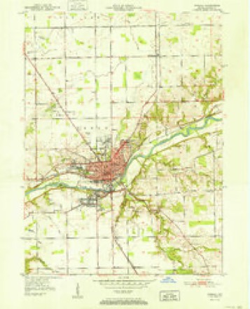
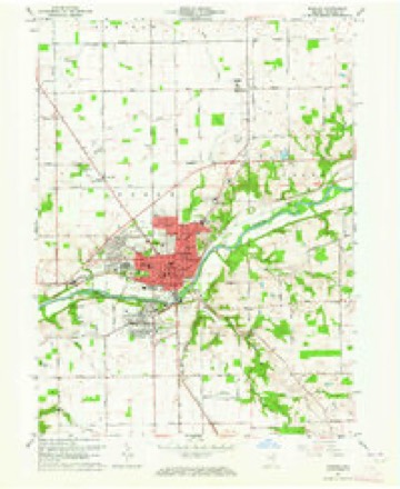
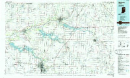
5 surveys from 13 printed sheetsMatched by testing this settlement's coordinate against the published boundary of every sheet in the United States Geological Survey's historical collection. Each opens the scanned sheet at the Survey.
- 1952 USGS Wabash quadrangle1:24000, 2 printings
- 1953 USGS Muncie quadrangle1:250000, 5 printings
- 1956 USGS Muncie quadrangle1:250000
- 1963 USGS Wabash quadrangle1:24000, 3 printings
- 1986 USGS Wabash quadrangle1:100000, 2 printings


In the county-history sources
42,492 words on this townshipHistory of Wabash County Indiana, published 1914 names this settlement in its chapter on Noble Township. These are the passages that mention it, exactly as the scans read.
The first meeting of the board of county commissioners was held at tlie house of David Burr, Town of Wabash, on the forenoon of j\Ionday, June 15, 1835. The board was organized, several county officers were sworn in and some other preliminary liusiness was disposed of before it adjourned for an afternoon session to the house of Commissioner Blaekman. At the afternoon meeting the county was divided into both commissioners' districts and townships.
Passage source: History of Wabash County Indiana, published 1914.
AVith the exception of the City of Wabash, there is virtually no center of population in the township. Rich Valley postoffice, about four miles to the west of the county seat, was at one time quite a promising village, but is now scarcely on the map, tlie rural route system having even abolished its distinctive pastoffice.
Passage source: History of Wabash County Indiana, published 1914.
The first settlements in what is now Noble Township were at and near the present City of AValmsh. The Lulians had tirst to be bought otif before the whites could come in, and the tii'st stej) was taken under the Treaty of 1818; for shortly alter it had been ratilied the General Government sent Benjamin Level to the point on a creek, four miles southwest of the present City of AVabash, which the Indians had selected as a site for their promised mill. There - on Mill Creek - Mr. Level erected it, and Lewis ^Miller came as its tirst miller. On the 4th of July, 1826, Gillis AIcBean moved to the Indian ]Mills as its superintendent. These two millers, with their fannlies, represented the white settlers of Noble Township antl Wabash County prior to the opening up of the Indian lands north of the AVabash in the fall of the year named (1826).
Passage source: History of Wabash County Indiana, published 1914.
Machine-read from a century-old scan, so expect the errors a machine makes: misspelled names, dropped words, stray characters.
Read the whole chapter on Noble Township - it names this place 154 more 154 times.
Mines and quarries near this place
3 within 5 milesRegional context, not property-specific evidence. The federal mineral resources record lists 3 workings within 5 miles of Wabash: 3 producers. All of them still produce. What was taken out: Stone, Crushed/Broken, Sand and Gravel, Construction, Stone. Distance is straight-line from the map coordinates, so a quarry counted here may appear on a neighbouring settlement's page as well.
| Where | Site | Commodity | Status | Recorded |
|---|---|---|---|---|
| Higley Curve Gravel Pit | Sand and Gravel, Construction | Producer | ||
| Mill Creek Quarry | Stone, Crushed/Broken | Producer | ||
| Wabash Co. Hwy. Dept. | Stone | Producer |
Storms near this place
55 since 1994Regional context, not property-specific evidence. The National Weather Service names Wabash in 55 storm reports between 1994 and 2026: 26 thunderstorm wind, 22 hail, 3 flash flood, 2 tornado. No death or injury is recorded in these reports. Each account below is quoted exactly as the forecast office filed it, from the NOAA Storm Events Database, and each date opens the federal record of that event.
| When | Event | Place named | Harm | What the report says |
|---|---|---|---|---|
| July 1998 | Flash Flood | Wabash | $6,000,000 | 6 TO 8 INCHES OF RAIN FELL ACROSS THE SOUTHERN HALF OF WABASH COUNTY SENDING THE NORMALLY DOCILE CHARLEY CREEK INTO A RAGING ONE-HALF MILE WIDE TORRENT THROUGH TOWN. MANY PEOPLE WHO WERE NOT STRANDED BY THE FLOOD WATERS WERE EVACUATED TO HIGHER GROUND. TWO BRIDGES AND 15 COUNTY ROADS WERE COMPLETELY WASHED OUT. MANY HOMES ALONG THE EEL AND SALAMONIE RIVERS WERE EVACUATED AS WELL AS THOSE RIVERS APPROACHED RECORD FLOOD LEVELS. DAMAGE ESTIMATES WERE IN THE MILLIONS DUE TO COUNTLESS FLOODED HOMES... BASEMENTS AND VEHICLES. |
| August 2001 | Lightning | Wabash | $500,000 | A lightning strike caused a fire at the administration building of North Central Co-op in Wabash. The building is located at the southwest corner of Cass and Fulton Streets. Damage was estimated to be as high as a half million dollars. |
| May 2008 | Lightning | Wabash | $30,000 | Lightning struck a tree near the residence, causing a limb to fall onto power lines. The line caused a fire in the exterior wall, but the fire was dealt with quickly and extinguished. Damage estimates include $10,000 for the structure and $20,000 for contents for a total of $30,000. |
| August 2001 | Thunderstorm Wind | Wabash | $25,000 | A tree was blown down in the 200 block of Elm Street, damaging several automobiles. A downed tree blocked the road and downed a power line at 62 W. Harrison Street. Another downed tree blocked the intersection of Hawthorne and Lafayette Streets. |
| August 2022 | Thunderstorm Wind | Wabash | $20,000 | A large tree is down on a car. |
| December 1998 | Thunderstorm Wind | Wabash | $20,000 | SEVERAL TREES...POWER POLES AND LINES WERE BLOWN DOWN IN TOWN. |
| July 2005 | Thunderstorm Wind | Wabash | $15,000 | Several utility poles, trees and tree limbs were blown down in and around Wabash. A tree was blown down onto a car north of Wabash, with another tree being blown down onto a power line 10 miles southeast of Wabash. |
| July 2024 | Thunderstorm Wind | Wabash | $10,000 | Large tree down onto powerlines. Nearly landed on a house. |
| June 2005 | Thunderstorm Wind | Wabash | $10,000 | Scattered reports of trees, tree limbs and power lines were received around the county. Much of the damage was confined to Wabash, as well as Lagro. |
| July 2008 | Thunderstorm Wind | Wabash | $5,000 | Emergency management officals reported a few trees and power lines down in Wabash. |
| May 2001 | Tornado (F0) | Wabash | $2,500 | F0 tornado damaged ne corner of garage and nearby shed. |
| July 2005 | Thunderstorm Wind | Wabash | $2,000 | Power poles were blown down. |
| May 2001 | Thunderstorm Wind | Wabash | $100 | Twelve inch diameter trees snapped off 12 feet above ground. Shed damaged and moved. |
| February 2026 | Hail | Wabash | - | Emergency management officials report hail completely covering the ground with stones ranging from one half to one and a half inch in diameter. |
| August 2025 | Hail | Wabash | - | Public report. |
| July 2020 | Thunderstorm Wind | Wabash | - | Tree on house and multiple trees and limbs down across Wabash. |
| May 2019 | Thunderstorm Wind | Wabash | - | Emergency management officials reported a 12 inch diameter tree was blown down across Market Street. |
| June 2013 | Thunderstorm Wind | Wabash | - | A National Weather Service survey of damage northwest of Wabash indicated the damage patterns were consistent with a downburst. The path noted here is the center point of the swath with a maximum width of around 3 miles at the start, to roughly 2/3rds of a mile wide at the end. In addition to extensive tree damage, a grain silo and two pole barns were completely destroyed, with the debris being blown to the southeast. Winds were estimated between 90 and 100 mph. |
| November 2013 | Thunderstorm Wind | Wabash | - | A mesonet site recorded at 69 mph wind gust. |
| November 2013 | Thunderstorm Wind | Wabash | - | Damage was observed to cars and homes in the city. A home suffered partial roof damage with windows being blown out of a second story floor. |
| March 2012 | Hail | Wabash | - | The public reported hail from one half inch to the size of pennies for two to three minutes. |
| June 2012 | Thunderstorm Wind | Wabash | - | A 60 mph wind gust was recorded by a mesonet site at the Wabash county central dispatch. |
| July 2010 | Flash Flood | Wabash | - | Emergency management officials reported several county and city roads closed due to flowing high water. |
| October 2010 | Tornado (EF0) | Wabash | - | A survey of damage indicated that a circulation, embedded within a larger area of straight-line winds, touched down at the intersection of US 24 and State Highway 15, on the north side of Wabash. Winds from the tornado blew in a door and pushed out a few sky lights as well as shifted a HVAC unit on top of the building. The tornado continued northeast, removing much of the roof of a vocational center building, and then some metal roofing from an older grain storage barn. A few utility poles were bent or snapped towards the end of the tornado track. The tornado dissipated near the intersection of County Roads 300 North and 100 East. Maximum wind speeds are estimated at between 80 and 85 mph, with a maximum width of 100 yards. |
| October 2010 | Thunderstorm Wind | Wabash | - | Emergency management officials reported several trees and power lines down in and around Wabash. |
| August 2009 | Thunderstorm Wind | Wabash | - | Emergency management officials reported winds of at least 60 mph. |
| August 2008 | Thunderstorm Wind | Wabash | - | Emergency management officials reported trees and power lines down. |
| June 2006 | Thunderstorm Wind | Wabash | - | Tree blown down. |
| May 2004 | Thunderstorm Wind | Wabash | - | Emergency management reported trees down near the city of Wabash. |
| July 2003 | Flash Flood | Wabash | - | Law enforcement reported water over a foot deep on US 24 near Wabash with cars abandoned due to flash flooding. |
| July 2003 | Thunderstorm Wind | Wabash | - | Law enforcement reported trees down southwest of Wabash. |
| July 2003 | Thunderstorm Wind | Wabash | - | Law enforcement reported trees and power lines down in Wabash. |
| August 2003 | Thunderstorm Wind | Wabash | - | Numerous trees and power lines were reported down across much of the city of Wabash with several roads being blocked by debris. Trees were also reported down in the surrounding areas of the county, along State Routes 15 and 13. |
| September 2000 | Thunderstorm Wind | Wabash | - | Numerous trees blown down. |
| August 1994 | Thunderstorm Wind | Wabash | - | Sheriff reported trees downed by thunderstorm winds. |
| June 2006 | Hail | Wabash | - | no account filed |
| June 2006 | Hail | Wabash | - | no account filed |
| June 2006 | Hail | Wabash | - | no account filed |
| June 2006 | Hail | Wabash | - | no account filed |
| September 2006 | Hail | Wabash | - | no account filed |
| September 2006 | Hail | Wabash | - | no account filed |
| August 2005 | Hail | Wabash | - | no account filed |
| April 2002 | Hail | Wabash | - | no account filed |
| May 2002 | Hail | Wabash | - | no account filed |
| June 2002 | Hail | Wabash | - | no account filed |
| June 2002 | Hail | Wabash | - | no account filed |
| April 2001 | Hail | Wabash | - | no account filed |
| April 2001 | Hail | Wabash | - | no account filed |
| April 2001 | Hail | Wabash | - | no account filed |
| August 2001 | Hail | Wabash | - | no account filed |
| May 2000 | Hail | Wabash | - | no account filed |
| May 2000 | Hail | Wabash | - | no account filed |
| May 1999 | Hail | Wabash | - | no account filed |
| May 1998 | Thunderstorm Wind | Wabash | - | no account filed |
| May 1996 | Hail | Wabash | - | no account filed |
Nearest settlements
The eight closest, with where each one stands in the county. Distances are straight-line, computed from the Geographic Names Information System coordinates.
| Map | Place | Distance | Sheets |
|---|---|---|---|
| South Haven | 1.1 miles | 13 | |
| Sunnymede | 1.3 miles | 13 | |
| Valley Brook | 1.4 miles | 13 | |
| Speicherville | 4.2 miles | 13 | |
| Richvalley | 5.4 miles | 13 | |
| Treaty | 5.4 miles | 13 | |
| Lagro | 5.5 miles | 14 | |
| Pioneer | 5.7 miles | 14 |
Elsewhere
Matched on this settlement's Geographic Names Information System number rather than its name, so it cannot be a different place of the same name in another state.
| Wikipedia article on Wabash | An encyclopaedic summary. Its text is share-alike, so it is linked here rather than copied. |
| Wikidata item Q989967 | The structured record the population and elevation above come from. Public domain (CC0). |
Provenance
This settlement is recorded in the Geographic Names Information System as feature 445327. The sheet list is computed by point-in-boundary test against the United States Geological Survey's historical topographic inventory. Both are works of the United States government and carry no copyright under 17 U.S.C. 105.
Mines and quarries. USGS Mineral Resources Data System (MRDS) https://mrdata.usgs.gov/mrds/ A work of the United States government, no copyright under 17 U.S.C. 105.
Storms. NOAA National Centers for Environmental Information, Storm Events Database https://www.ncei.noaa.gov/stormevents/ A work of the United States government, no copyright under 17 U.S.C. 105. Narratives are quoted verbatim from the National Weather Service report and are not edited or summarised.