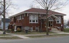
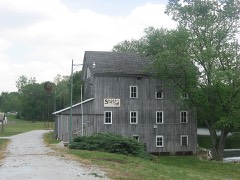
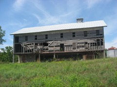
Block
From the record
33 National Register listings published here.
Sources: the county history on the Internet Archive · the National Register database, National Park Service
62 topographic sheets cover 26 settlements here, and 33 properties are on the National Register of Historic Places.
33 National Register listings published here.
Sources: the county history on the Internet Archive · the National Register database, National Park Service
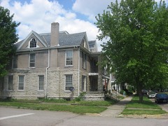
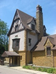
Every property in this county listed on the National Register of Historic Places, with the year it was listed and the federal nomination document.
Wabash County has 2 covered bridges on the National Register. Each is a listed structure with a federal nomination on file.
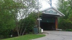 | North Manchester Covered Bridge | Listed 1982 |
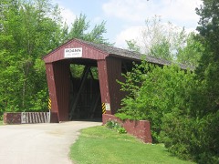 | Roann Covered Bridge, 4th | Listed 1981 |
Every wildfire the federal occurrence database records inside this county: 1 of them, burning about 1 acre. None started naturally and none was recorded as arson. Each settlement page carries the fires within five miles of it.
| Reported cause | Fires |
|---|---|
| Debris and open burning | 1 |
The five largest, by the area the report gives. None of them was recorded as arson.
| Date | Cause | Size | Reported by | Name on the report |
|---|---|---|---|---|
| 15 March 2001 | Debris and open burning | 1.0 acres | Indiana State Fire Marshal's Office | not named |
Every settlement page carries the fires within five miles of it - see the settlement index below.
The NOAA Storm Events Database holds 255 reports for this county, causing 2 deaths, 15 injuries and about $9,990,002 in recorded property damage. Each settlement page carries the reports that name it.
| Kind of event | Reports |
|---|---|
| Thunderstorm Wind | 123 |
| Hail | 87 |
| Tornado | 21 |
| Flash Flood | 10 |
| Flood | 9 |
| Lightning | 4 |
| Heavy Rain | 1 |
The most serious of them, by death, then injury, then recorded damage. The accounts are quoted exactly as the forecast office filed them.
| When | Event | Place named | Harm | What the report says |
|---|---|---|---|---|
| May 1968 | Tornado (F3) | not stated | 1 killed, 12 hurt, $250,000 | no account filed |
| May 2019 | Flood | Mt Vernon | 1 killed | State police say 22-year-old Anthonitte Carter of Indianapolis was driving east on CR 925 South east of SR 13 in Wabash County when she passed a high water sign and drove into floodwaters. After the vehicle entered the water, it was carried to the north side of the road and became completely submerged, police said.||The driver was able to get out of her Chevrolet Impala and attempted to rescue her son, 2-year-old Eric Long, but was not successful in freeing him. |
| June 2000 | Tornado (F2) | North Manchester | 3 hurt, $700,000 | The tornado touched down again, hitting a farm at 1300 N and 100 W. A man suffered a broken leg here. Two hog sheds and a large grain bin were destroyed. A 200-yard swath of trees were uprooted to the northeast along the railroad tracks. Another man suffered back and chest injuries as the tornado continued to the intersection of 1300 N and Meridian Road and demolished the barn in which he stood. A 5th wheel camper was rolled 50 yards from its original position destroying it. The tornado continued to the next farm just south of 1400 N and 100 E. The barn was destroyed and the house suffered moderate damage, primarily from flying tree debris. The tornado snapped a utility pole, which fell on an 18-year-old boy, breaking his leg. Many trees and power lines were downed along the way. From here, the tornado continued until the Wabash/Kosciusko county line. |
| July 1998 | Flash Flood | Wabash | $6,000,000 | 6 TO 8 INCHES OF RAIN FELL ACROSS THE SOUTHERN HALF OF WABASH COUNTY SENDING THE NORMALLY DOCILE CHARLEY CREEK INTO A RAGING ONE-HALF MILE WIDE TORRENT THROUGH TOWN. MANY PEOPLE WHO WERE NOT STRANDED BY THE FLOOD WATERS WERE EVACUATED TO HIGHER GROUND. TWO BRIDGES AND 15 COUNTY ROADS WERE COMPLETELY WASHED OUT. MANY HOMES ALONG THE EEL AND SALAMONIE RIVERS WERE EVACUATED AS WELL AS THOSE RIVERS APPROACHED RECORD FLOOD LEVELS. DAMAGE ESTIMATES WERE IN THE MILLIONS DUE TO COUNTLESS FLOODED HOMES... BASEMENTS AND VEHICLES. |
| August 2001 | Lightning | Wabash | $500,000 | A lightning strike caused a fire at the administration building of North Central Co-op in Wabash. The building is located at the southwest corner of Cass and Fulton Streets. Damage was estimated to be as high as a half million dollars. |
| July 2003 | Flash Flood | Countywide | $350,000 | Law enforcement reported roads closed due to flash flooding across the county. 27 residences had some minor damage. |
| May 2011 | Flood | Servia | $250,000 | Numerous thunderstorms trained over northeastern Wabash county, with radar and eventually spotter confirmation, of three to more than four inches of rain falling. Flooding on roads slowly subsided during the daylight hours of the 15th. |
| May 1964 | Tornado (F1) | not stated | $250,000 | no account filed |
| April 1963 | Tornado (F2) | not stated | $250,000 | no account filed |
| March 2009 | Flood | Liberty Mills | $150,000 | The Eel River went well out of its banks as a result of heavy rainfall over a several day period. The river crested just above 14 feet in North Manchester, with numerous roads under water in North Manchester and adjacent areas. No reports of injuries or rescues were noted. |
| May 2024 | Thunderstorm Wind | Bolivar | $125,000 | Report of 3 damaged residences. Roof off one home. Uprooted trees and power lines down as well. |
| May 2008 | Tornado (EF1) | Hartman | $100,000 | A brief touchdown was confirmed in an open field just west of a residence on South State Road 13 south of West 400 S. Several trees were damaged with a pole barn being partially destroyed. A second barn had the north wall blown towards the north and a partial roof collapse as a result. Approximately 12 power poles were snapped or pushed over along State Route 13. The damage in the area was consistent with a EF1 tornado with maximum winds estimated at around 90 mph. Two minor injuries as two people were in the barn at the time the tornado struck. |
| June 2000 | Tornado (F1) | North Manchester | $100,000 | The initial tornado touchdown occurred near the intersection of SR 15 and 114. Two barns were deroofed and a grain silo was partially blown down. Several trees and limbs were taken down. The tornado lifted briefly as it crossed SR 15. It then continued on the ground for one half mile before striking another farm just west of the intersection of SR 114 and 400 W. A barn roof was blown off, and several trees and power lines were taken down. Crop damage was noted in an adjacent field. The tornado then lifted until it touched down about 1 mile to the northeast. |
| July 1998 | Thunderstorm Wind | North Manchester | $100,000 | TREE FELL ON HOME AND DESTROYED PORCH. COAST TO COAST STORE LOST THEIR GREEN HOUSE AND SECURITY FENCE AS IT BECAME AIRBORNE IN THE HIGH WINDS. |
| January 2008 | Flood | North Manchester | $75,000 | County officials reported high water on some roadways both in the county and also in a few cities, including North Manchester and Roann. 2.7 inches of rain was observed near North Manchester. The Eastside Mobile Home Park next to the Eel river in North Manchester was evacuated as flood waters moved into the park and under trailers. Luckily, no water got into the trailers and residents were able to return home by Jan 11th. A rescue from a residence was needed in Roann to get 2 adults and a 5 month old child. No exact damage figures are available, but are estimated at $75,000, mainly for road repairs and some basement flooding. |
| April 2004 | Tornado (F1) | Lincolnville | $75,000 | NWS storm survey team found F1 damage near Lincolnville with two homes heavily damaged and a barn destroyed. The tornado was skipping as it moved along a 2 mile path length and was around 150 yards wide at the widest point. |
| March 2009 | Thunderstorm Wind | Laketon | $65,000 | A National Weather Service (NWS) survey team examined the damage at a farm west of North Manchester on State Route 114. Over half of a barn roof was removed from strong winds, likely around 70 mph, entering through a possible door opening. Adjacent buildings, including a house, suffered minor damage, including siding and some shingles. A wooden playground suffered damage from the winds as did some shingles on the residence. Damage is estimated at around $60,000 for the barn and around $5,000 for the swing set and roof damage. |
| March 2025 | Thunderstorm Wind | Wabash Arpt | $50,000 | Semi trailers blown over at SR 13 at 500 South. |
| June 2008 | Lightning | North Manchester | $50,000 | Lightning struck a house on State Route 13 in the city of North Manchester, causing extensive damage to the residence. No injuries were reported but damage is estimated at $50,000. |
| July 2001 | Lightning | La Fontaine | $50,000 | A two story wood frame house was destroyed by fire after being struck by lightning. No injuries. |
| June 2000 | Thunderstorm Wind | North Manchester | $50,000 | Barn destroyed and windows blown out of a brick house. |
| September 2000 | Thunderstorm Wind | Countywide | $50,000 | Numerous trees and power lines reported down. |
| May 2008 | Tornado (EF0) | Dora | $40,000 | Another brief tornado touched down near the intersection of 600 East and 250 S, just north of Lincolnville. After touching down in an open field, the circulation struck an older wood barn, causing the west-facing wall to fall in and some roof material to be blown off. Mud splatter was observed on the north-facing wall of the barn. A few trees were observed blown down facing west immediately north of the touchdown location. The tornado then quickly dissipated as it approached Salamonie Lake Reservoir. The damage was consistent with a EF0 with maximum winds of 80 mph. Maximum width was 25 yards and the tornado was on the ground for around one tenth of a mile. No injuries were reported. |
| May 2024 | Thunderstorm Wind | North Manchester | $35,000 | Video on Facebook shows power poles snapped on Sate Road 13. Also a report of a barn destroyed one-half mile away. |
| May 2008 | Lightning | Wabash | $30,000 | Lightning struck a tree near the residence, causing a limb to fall onto power lines. The line caused a fire in the exterior wall, but the fire was dealt with quickly and extinguished. Damage estimates include $10,000 for the structure and $20,000 for contents for a total of $30,000. |
| May 2002 | Thunderstorm Wind | Somerset | $30,000 | A Law enforcement reported several trees down as well as 2 barns and a silo destroyed. |
| August 2001 | Thunderstorm Wind | Wabash | $25,000 | A tree was blown down in the 200 block of Elm Street, damaging several automobiles. A downed tree blocked the road and downed a power line at 62 W. Harrison Street. Another downed tree blocked the intersection of Hawthorne and Lafayette Streets. |
| June 1999 | Thunderstorm Wind | Somerset | $25,000 | Numerous trees and power lines were downed across the southern part of the county. |
| June 1983 | Tornado (F1) | not stated | $25,000 | no account filed |
| August 2022 | Thunderstorm Wind | Disko | $20,000 | The public reported there is damage to houses from thunderstorm wind. |
| August 2022 | Thunderstorm Wind | Wabash | $20,000 | A large tree is down on a car. |
| November 2005 | Thunderstorm Wind | Countywide | $20,000 | Trees, tree limbs, power lines and poles were reported down across the county. A porch was blown off of a house in the city of Wabash. Surveys from local emergency and NWS officials found evidence of the formation of gustnadoes where concentrated areas of damage were observed. |
| August 2001 | Thunderstorm Wind | Urbana | $20,000 | Five utility poles fell across SR 13, blocking traffic for up to two hours as power companies worked to shut off power to live electrical wires. The poles had to be replaced before power could be restored. |
| December 1998 | Thunderstorm Wind | Wabash | $20,000 | SEVERAL TREES...POWER POLES AND LINES WERE BLOWN DOWN IN TOWN. |
| October 2008 | Thunderstorm Wind | North Manchester | $15,000 | Emergency management officials reported trees down in North Manchester, with some onto vehicles. |
| July 2005 | Thunderstorm Wind | Wabash | $15,000 | Several utility poles, trees and tree limbs were blown down in and around Wabash. A tree was blown down onto a car north of Wabash, with another tree being blown down onto a power line 10 miles southeast of Wabash. |
| July 2024 | Thunderstorm Wind | Wabash | $10,000 | Large tree down onto powerlines. Nearly landed on a house. |
| June 2005 | Thunderstorm Wind | Wabash | $10,000 | Scattered reports of trees, tree limbs and power lines were received around the county. Much of the damage was confined to Wabash, as well as Lagro. |
| May 2000 | Thunderstorm Wind | Countywide | $10,000 | 24 inch diameter tree was uprooted. Several vehicles and two or three houses were damaged by fallen trees. |
| June 1995 | Thunderstorm Wind | not stated | $8,000 | Trees and lines were blown down in Roann and Laketon. A building in Laketon received damage to its roof when a tree was blown over on it. |
| July 2008 | Thunderstorm Wind | Wabash | $5,000 | Emergency management officals reported a few trees and power lines down in Wabash. |
| May 2001 | Tornado (F0) | Wabash | $2,500 | F0 tornado damaged ne corner of garage and nearby shed. |
| June 1957 | Tornado (F1) | not stated | $2,500 | no account filed |
| July 2005 | Thunderstorm Wind | Wabash | $2,000 | Power poles were blown down. |
| June 1999 | Thunderstorm Wind | North Manchester | $2,000 | Trees reported down in North Manchester. |
| May 2025 | Thunderstorm Wind | North Manchester | $1,000 | Mature oak tree lost part of its top. |
| June 1995 | Thunderstorm Wind | not stated | $1,000 | Several large trees were blown down south of Wabash. |
| May 2024 | Hail | North Manchester | $1,000 | no account filed |
| June 2023 | Hail | North Manchester | $1,000 | no account filed |
| June 2023 | Hail | North Manchester | $1,000 | no account filed |
| June 2023 | Hail | North Manchester | $1,000 | no account filed |
| May 2024 | Thunderstorm Wind | North Manchester | $500 | Large tree branches snapped in North Manchester. |
| July 2024 | Thunderstorm Wind | Roann | $500 | Large tree limbs down, including a 10-inch diameter branch near Adams and Church roads. |
| August 2023 | Hail | La Fontaine | $500 | A member of the public estimated 1.25 inch hail was falling in La Fontaine. |
| June 1997 | Thunderstorm Wind | Near Highway 114/13 | $400 | no account filed |
| May 2001 | Thunderstorm Wind | Wabash | $100 | Twelve inch diameter trees snapped off 12 feet above ground. Shed damaged and moved. |
| June 1995 | Thunderstorm Wind | North Manchester | $2 | A barn was blown down just south of North Manchester. A 20-foot length of roof was blown off the water plant and and a farm wagon was blown over and destroyed in North Manchester. Trees and lines were reported down across the Northern part of the county. |
| February 2026 | Hail | Wabash | - | Emergency management officials report hail completely covering the ground with stones ranging from one half to one and a half inch in diameter. |
| August 2025 | Hail | Wabash | - | Public report. |
| March 2022 | Thunderstorm Wind | North Manchester | - | The public reported a lean-to style airplane hangar and anchoring posts destroyed. |
The Survey's mineral resources record lists 5 workings inside this county. 4 still produce and 1 is closed or unrecorded. Each settlement page carries the workings within five miles of it.
| Commodity | Workings |
|---|---|
| Sand and Gravel, Construction | 3 |
| Stone, Crushed/Broken | 1 |
| Stone | 1 |
The least common of them first, because a county's hundredth gravel pit says nothing its first ten did not.
| Where | Site | Commodity | Status | Recorded |
|---|---|---|---|---|
| Mill Creek Quarry | Stone, Crushed/Broken | Producer | ||
| Wabash Co. Hwy. Dept. | Stone | Producer | ||
| Disko Sand and Gravel | Sand and Gravel, Construction | Producer | ||
| Higley Curve Gravel Pit | Sand and Gravel, Construction | Producer | ||
| Mcginnis Sand and Gravel Pit | Sand and Gravel, Construction | Past Producer |
History of Wabash County Indiana devotes a chapter to each township: its boundaries and streams, who settled it and when, the mills, the schools and the churches. All 4 are reproduced here in full. Each row shows the township's own shape and where it lies in the county, drawn from the Census Bureau's boundary. Which settlements belong to which township is computed from that same boundary, not taken from the book.
| Shape and position in the county | Township | Settlements in it | Length | Sections |
|---|---|---|---|---|
| Lagro Township | Lagro, Lincolnville, Speicherville | 412 words | 2 | |
| Liberty Township | America, La Fontaine, Treaty | 6,695 words | 0 | |
| Noble Township | Pioneer, Richvalley, South Haven, Sunnymede, Valley Brook, Wabash | 42,492 words | 8 | |
| Pleasant Township | Disko, Ijamsville, Laketon, Newton | 7,000 words | 1 |
2 books written about this county, cut here where the book itself is cut, at its printed chapters: 12 chapters in all. Every chapter is public domain, machine-read from the scan and reproduced complete. A chapter already given under one of the county's towns is not repeated in this list.
| Chapter | Length |
|---|---|
| ^ Piiy.sical and Descriptive ,," . | 4,214 words |
| Chapter with an unread heading (no. 2 of those read) | 4,229 words |
| Chapter 3 | 6,353 words |
| Chapter 4: The ^nssis>sixewa Expedition | 10,894 words |
| Fikst White Settlers and Settlements | 8,781 words |
| Chapter with an unread heading (no. 6 of those read) | 5,092 words |
| Pionekr Pictures | 27,702 words in 2 parts |
| Chapter 13 | 5,137 words |
| Chapter 14: ^ileans of Transportation | 7,532 words |
| Chapter 15: Piiysiclani^ Op the County | 3,856 words |
| Chapter 16 | 14,921 words |
| Chapter | Length |
|---|---|
| The whole text | 253,454 words in 16 parts |
Named settlements recorded in the Geographic Names Information System, each with the topographic sheets covering it. Villages, hamlets and abandoned places alike. Each is shown with the nearest named watercourse or landform and the survey quadrangle it falls on.
Pleasant township · 46962 · On Silver Creek · North Manchester South quadrangle
11 sheets, 1953 to 1986
Liberty township · 46940 · On Badger Creek · La Fontaine quadrangle
12 sheets, 1953 to 1986
Pleasant township · 46943 · On Otter Creek · North Manchester South quadrangle
11 sheets, 1953 to 1986
Chester township · 46962 · On Simonton Creek · South Whitley West quadrangle
10 sheets, 1953 to 1994
Pleasant township · 46962 · On Otter Creek · North Manchester South quadrangle
11 sheets, 1953 to 1986
Chester township · 46962 · On Pony Creek · North Manchester North quadrangle
10 sheets, 1953 to 1994
Noble township · 46992 · On Carlin Branch · Richvalley quadrangle
13 sheets, 1951 to 1986