 Block
Waldron, Indiana
12 topographic sheets cover this place, the earliest surveyed in 1942 and the latest in 1986. It stands in Liberty Township. It lies in ZIP code area 46182. It stands on Deer Creek. The Survey maps it on the Waldron quadrangle. 805 people lived here at the 2020 count. It stands 823 feet above sea level.
On record in Waldron
Buildings and businesses the archive holds for this place. Each opens its own page, with the source record it came from.
On the National Register 3 records
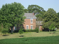 Cooper-Alley Houselisted 1982
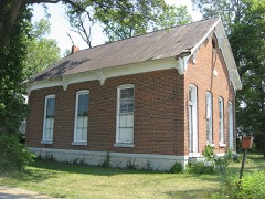 Liberty Township Schoolhouse No. 2listed 1992
 George Rudicel Polygonal Barnlisted 1993
Population over time
2 figuresWaldron grew from 804 to 805 between 2010 and 2020. These are the recorded population figures Wikidata holds for this place, reached through the Geographic Names Information System number this page is keyed on rather than by name, so they belong to this place and not to another of the same name. Most are census counts, but not all are: an early figure may be a founding or settlement estimate, and an estimate published within five years of a census is left out. The change column is computed, and is left blank where more than 20 years separate a figure from the one before it, because a gap that long is not a change between two counts.
| Year | People | Change |
|---|---|---|
| 2010 | 804 | |
| 2020 | 805 | +1 (+0%) |
Topographic sheets covering this place
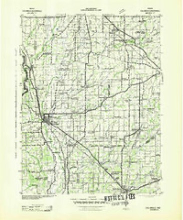
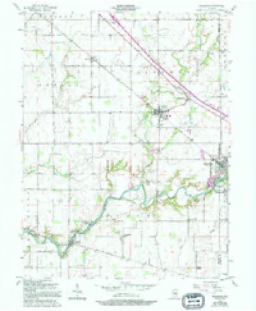
5 surveys from 12 printed sheetsMatched by testing this settlement's coordinate against the published boundary of every sheet in the United States Geological Survey's historical collection. Each opens the scanned sheet at the Survey.
- 1942 USGS Columbus quadrangle1:125000
- 1953 USGS Cincinnati quadrangle1:250000, 3 printings
- 1956 USGS Waldron quadrangle1:24000, 5 printings
- 1957 USGS Cincinnati quadrangle1:250000
- 1986 USGS Greensburg quadrangle1:100000, 2 printings



Mines and quarries near this place
2 within 5 milesRegional context, not property-specific evidence. The federal mineral resources record lists 2 workings within 5 miles of Waldron: 1 producer, 1 unknown. 1 still produces. What was taken out: Stone, Crushed/Broken, Sand and Gravel, Construction. Distance is straight-line from the map coordinates, so a quarry counted here may appear on a neighbouring settlement's page as well.
| Where | Site | Commodity | Status | Recorded |
|---|---|---|---|---|
| St Omer Gravel Pit | Sand and Gravel, Construction | Unknown | ||
| St. Paul Quarry | Stone, Crushed/Broken | Producer |
Storms near this place
13 since 1994Regional context, not property-specific evidence. The National Weather Service names Waldron in 13 storm reports between 1994 and 2021: 6 thunderstorm wind, 2 tornado, 2 flash flood, 1 hail. The reports record 1 injury. Each account below is quoted exactly as the forecast office filed it, from the NOAA Storm Events Database, and each date opens the federal record of that event.
| When | Event | Place named | Harm | What the report says |
|---|---|---|---|---|
| July 2021 | Thunderstorm Wind | Waldron | 1 hurt, $18,000 | Minor tree and roof damage at 5364 South County Road 425 East. One minor injury when homeowner walked outside during storm and was hit by flying debris 3 times leading to minor chest injury and minor lacerations. |
| June 2008 | Tornado (EF0) | Waldron | $200,000 | The tornado touched down in Shelby County at 2004 EST 200 meters north of the County Road South 500 East and County Road East 500 South intersection. The tornado tracked to the east northeast for 2.93 miles before entering Rush County at 2012 EST near County Road South 1000 West just south of County Road East 450 South. The tornado continued to the northeast for 6.75 miles until lifting at 2030 EST. The tornado lifted 200 meters east of County Road South 400 West and 400 meters north of West State Road 244. The tornado was on the ground for a total of 9.68 miles and 26 minutes. The tornado was an EF-0 with wind speeds around 75 miles per hour while in Shelby County, however intensified to an EF-3 tornado while in Rush County with wind speeds around 150 miles per hour. The tornado had a width of 150 yards. The tornado formed from a supercell storm. While in Shelby County the tornado damaged 34 structures with the hardest hit areas being Middletown and Waldron. 27 of the damaged structures were in Middletown with 4 of these being completely destroyed. Trees and powerlines were also blown down and a semi-trailer was blown off Interstate 74. In Rush County 8 people were injured including a man and a woman who were pinned beneath a wall in Moscow. A 67 year old woman in Moscow was injured from a large tree limb that impaled her in the chest and later passed away due to those injuries on August 17th. The historic Moscow Covered Bridge was destroyed in addition to extensive damage to the Moscow school. Dozens of houses were severely damaged or destroyed including some houses that were swept completely off the foundation. Approximately 200,000 dollars in damage occurred in Shelby County and approximately one million dollars in damage occurred in Rush County. |
| June 2008 | Flash Flood | Waldron | $150,000 | Damage occurred to numerous homes and other structures, as well as bridges, culverts, and county roads due to heavy rain that caused flash flooding. Two hundred to three hundred homes were affected. |
| April 1994 | Thunderstorm Wind | Waldron | $50,000 | Part of a high school roof was blown off in Waldron. Two grain bins were also destroyed in Waldron. Numerous trees blown down throughout the county. |
| July 2021 | Tornado (EF1) | Waldron | $15,000 | The second tornado of the day was short lived. The tornado initially began near a river cabin and caused a narrow but intense swath of tree damage along County Road 500 East. The tornado then crossed the Flatrock River where it impacted the Van Pelt cemetery. Several grave stones were knocked over by the tornado with additional tree damage on the property. The tornado may have briefly lifted before occurring again in a field to the south then dissipating. |
| March 2008 | Flood | Waldron | $10,000 | Flooding occurred along the Flatrock River in southeastern Shelby County due to heavy rain. |
| August 2019 | Thunderstorm Wind | Waldron | $5,000 | Multiple trees and power lines were downed due to thunderstorm wind gusts. |
| June 2008 | Flash Flood | Waldron | $5,000 | Roadways were covered and previous flooding conditions were exacerbated due to heavy rainfall that caused renewed flash flooding. |
| May 2019 | Thunderstorm Wind | Waldron | $3,000 | Power lines were reported down due to damaging thunderstorm wind gusts. |
| May 2014 | Thunderstorm Wind | Waldron | - | Emergency management relayed a report of a measured 60 mph thunderstorm wind gust in this location. |
| July 2008 | Thunderstorm Wind | Waldron | - | Thunderstorm winds blew trees down onto roads in several locations in and near Waldron, Indiana. In Waldron, a tree fell onto Mulberry Street. Outside of Waldron, trees fell onto: Country Road (CR) 900 South and CR 600 West, CR 1000 South, and State Road 252 and CR 700 West. |
| August 2005 | Lightning | Waldron | - | Lightning set a home on fire. Heavy damage was sustained. No damage estimates were available. |
| June 2005 | Hail | Waldron | - | no account filed |
Nearest settlements
The eight closest, with where each one stands in the county. Distances are straight-line, computed from the Geographic Names Information System coordinates.
| Map | Place | Distance | Sheets |
|---|---|---|---|
| Middletown | 1.1 miles | 12 | |
| Morven | 2.1 miles | 12 | |
| Prescott | 2.8 miles | 12 | |
| Pleasure Valley | 4.3 miles | 12 | |
| Meltzer | 4.5 miles | 11 | |
| Sleepy Hollow | 4.8 miles | 12 | |
| Wilson Corner | 4.8 miles | 14 | |
| Blue Ridge | 4.8 miles | 11 |
Elsewhere
Matched on this settlement's Geographic Names Information System number rather than its name, so it cannot be a different place of the same name in another state.
| Wikipedia article on Waldron | An encyclopaedic summary. Its text is share-alike, so it is linked here rather than copied. |
| Wikidata item Q7961630 | The structured record the population and elevation above come from. Public domain (CC0). |
Provenance
This settlement is recorded in the Geographic Names Information System as feature 445366. The sheet list is computed by point-in-boundary test against the United States Geological Survey's historical topographic inventory. Both are works of the United States government and carry no copyright under 17 U.S.C. 105.
Mines and quarries. USGS Mineral Resources Data System (MRDS) https://mrdata.usgs.gov/mrds/ A work of the United States government, no copyright under 17 U.S.C. 105.
Storms. NOAA National Centers for Environmental Information, Storm Events Database https://www.ncei.noaa.gov/stormevents/ A work of the United States government, no copyright under 17 U.S.C. 105. Narratives are quoted verbatim from the National Weather Service report and are not edited or summarised.