 Block
Waynetown, Indiana
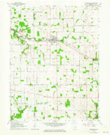
9 topographic sheets cover this place, the earliest surveyed in 1953 and the latest in 1987. It stands in Wayne Township. It lies in ZIP code area 47990. The Survey maps it on the Waynetown quadrangle.
Topographic sheets covering this place
6 surveys from 9 printed sheetsMatched by testing this settlement's coordinate against the published boundary of every sheet in the United States Geological Survey's historical collection. Each opens the scanned sheet at the Survey.
- 1953 USGS Danville quadrangle1:250000, 3 printings
- 1955 USGS Danville quadrangle1:250000
- 1956 USGS Danville quadrangle1:250000
- 1962 USGS Waynetown quadrangle1:24000, 2 printings
- 1984 USGS Danville quadrangle1:100000
- 1987 USGS Danville quadrangle1:100000



Storms near this place
10 since 1993Regional context, not property-specific evidence. The National Weather Service names Waynetown in 10 storm reports between 1993 and 2025: 4 thunderstorm wind, 3 hail, 2 flash flood, 1 tornado. The reports record 3 injuries. Each account below is quoted exactly as the forecast office filed it, from the NOAA Storm Events Database, and each date opens the federal record of that event.
| When | Event | Place named | Harm | What the report says |
|---|---|---|---|---|
| May 2000 | Thunderstorm Wind | Waynetown | 3 hurt | no account filed |
| May 2019 | Thunderstorm Wind | Waynetown | $25,000 | Several large trees were uprooted in and around the Waynetown area due to damaging thunderstorm wind gusts. Power was also out across portions of the town. There were also sporadic trees down across the rest of the county. |
| May 2008 | Flash Flood | Waynetown | $5,000 | A trained spotter observed flash flooding 3 miles south of Waynestown in Montgomery County. |
| June 2019 | Thunderstorm Wind | Waynetown | $1,000 | A report from social media showed several healthy 3 to 5 inch tree limbs snapped southeast of Waynetown due to damaging thunderstorm wind gusts. |
| May 2022 | Tornado (EFU) | Waynetown | - | Thunderstorm spawned a brief tornado approximately one mile to the north-northeast of the Interstate 74 and Indiana State Route 25 interchange. Tornado was reportedly seen on the ground, but no damage was noted. |
| August 1993 | Thunderstorm Wind | Waynetown | - | Trees were downed by thunderstorm winds. |
| May 2025 | Hail | Waynetown | - | no account filed |
| March 2011 | Hail | Waynetown | - | no account filed |
| November 2002 | Hail | Waynetown | - | no account filed |
| May 1996 | Flash Flood | Waynetown | - | no account filed |
Nearest settlements
The eight closest, with where each one stands in the county. Distances are straight-line, computed from the Geographic Names Information System coordinates.
| Map | Place | Distance | Sheets |
|---|---|---|---|
| Wesley | 3.1 miles | 9 | |
| Elmdale | 4.1 miles | 9 | |
| Taylor Corner | 4.9 miles | 9 | |
| Wingate | 5.9 miles | 9 | |
| Yountsville | 6.1 miles | 11 | |
| Hibernia | 6.5 miles | 9 | |
| Alamo | 7.3 miles | 14 | |
| Manchester | 8.3 miles | 11 |
Provenance
This settlement is recorded in the Geographic Names Information System as feature 445584. The sheet list is computed by point-in-boundary test against the United States Geological Survey's historical topographic inventory. Both are works of the United States government and carry no copyright under 17 U.S.C. 105.
Storms. NOAA National Centers for Environmental Information, Storm Events Database https://www.ncei.noaa.gov/stormevents/ A work of the United States government, no copyright under 17 U.S.C. 105. Narratives are quoted verbatim from the National Weather Service report and are not edited or summarised.