 Block
West Lafayette, Indiana
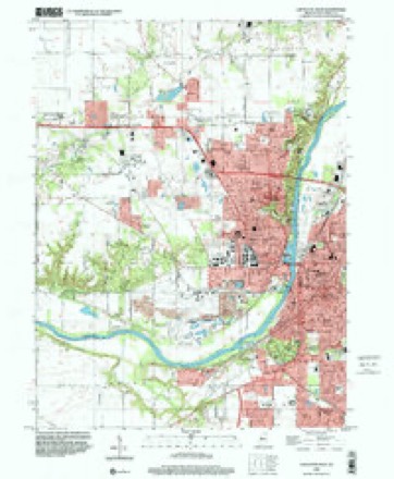
18 topographic sheets cover this place, the earliest surveyed in 1941 and the latest in 1998. It stands in Wabash Township. It lies in ZIP code area 47906. It lies near Happy Hollow. The Survey maps it on the Lafayette West quadrangle. 44,595 people lived here at the 2020 count. It stands 614 feet above sea level.
On record in West Lafayette
Buildings and businesses the archive holds for this place. Each opens its own page, with the source record it came from.
On the National Register 11 records
 John E. and Catherine E. Christian HouseNational Historic Landmark · listed 1992
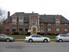 Alpha Tau Omega Fraternity Houselisted 2002
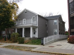 Jesse Andrew Houselisted 1983
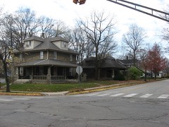 Chauncey-Stadium Avenues Historic Districtlisted 2002
 Curtis-Grace Houselisted 2012
 Happy Hollow Heights Historic Districtlisted 2015
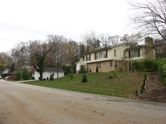 Hills and Dales Historic Districtlisted 2002
 Morton Schoollisted 1999
 James Pierce Jr. Houselisted 1982
 Varsity, Thelisted 2001
- Levi and Lucy Morehouse Farmlisted 2012
Population over time
2 figuresWest Lafayette grew from 29,596 to 44,595 between 2010 and 2020. These are the recorded population figures Wikidata holds for this place, reached through the Geographic Names Information System number this page is keyed on rather than by name, so they belong to this place and not to another of the same name. Most are census counts, but not all are: an early figure may be a founding or settlement estimate, and an estimate published within five years of a census is left out. The change column is computed, and is left blank where more than 20 years separate a figure from the one before it, because a gap that long is not a change between two counts.
| Year | People | Change |
|---|---|---|
| 2010 | 29,596 | |
| 2020 | 44,595 | +14,999 (+51%) |
Topographic sheets covering this place
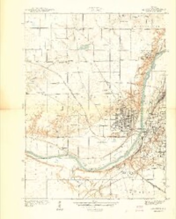
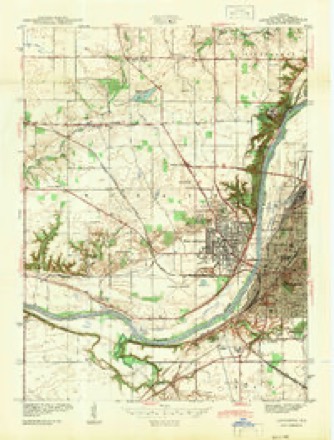
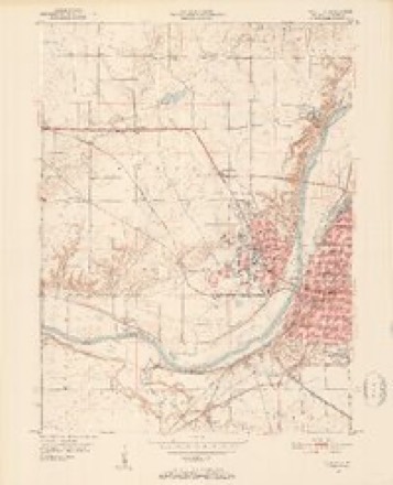
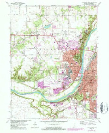
9 surveys from 18 printed sheetsMatched by testing this settlement's coordinate against the published boundary of every sheet in the United States Geological Survey's historical collection. Each opens the scanned sheet at the Survey.
- 1941 USGS Lafayette quadrangle1:24000
- 1942 USGS Lafayette quadrangle1:24000
- 1950 USGS Lafayette quadrangle1:24000, 2 printings
- 1953 USGS Danville quadrangle1:250000, 3 printings
- 1955 USGS Danville quadrangle1:250000
- 1956 USGS Danville quadrangle1:250000
- 1961 USGS Lafayette West quadrangle1:24000, 6 printings
- 1984 USGS Lafayette quadrangle1:100000, 2 printings
- 1998 USGS Lafayette West quadrangle1:24000




Mines and quarries near this place
9 within 5 milesRegional context, not property-specific evidence. The federal mineral resources record lists 9 workings within 5 miles of West Lafayette: 6 producers, 1 occurrence, 1 plant, 1 past producer. 7 still produce. What was taken out: Sand and Gravel, Construction, Aluminum. Distance is straight-line from the map coordinates, so a quarry counted here may appear on a neighbouring settlement's page as well.
| Where | Site | Commodity | Status | Recorded |
|---|---|---|---|---|
| Rostone Crp/ Lafayette Oprtns. | Aluminum | Occurrence | ||
| Rostone Crp/ Lafayette Oprtns. | Aluminum | Plant | ||
| Bratz Pit | Sand and Gravel, Construction | Producer | ||
| Casi Pit | Sand and Gravel, Construction | Producer | ||
| Elwood Sales | Sand and Gravel, Construction | Producer | ||
| Lafayette Gravel Pit | Sand and Gravel, Construction | Past Producer | ||
| Lafayette Portable Gravel | Sand and Gravel, Construction | Producer | ||
| Macy's Pit | Sand and Gravel, Construction | Producer | ||
| Taylor Station | Sand and Gravel, Construction | Producer |
Storms near this place
39 since 1998Regional context, not property-specific evidence. The National Weather Service names West Lafayette in 39 storm reports between 1998 and 2021: 14 thunderstorm wind, 12 hail, 9 flood, 2 tornado. No death or injury is recorded in these reports. Each account below is quoted exactly as the forecast office filed it, from the NOAA Storm Events Database, and each date opens the federal record of that event.
| When | Event | Place named | Harm | What the report says |
|---|---|---|---|---|
| January 2008 | Flood | West Lafayette | $500,000 | Flooding occurred along the Wabash River in Tippecanoe County, including near Lafayette, due to heavy rain and snow melt. 30 to 40 homes were damaged by flood waters. |
| February 2008 | Flood | West Lafayette | $400,000 | Flooding occurred along the Wabash River in Tippecanoe County, including near Lafayette, due to heavy rain and snow melt. Numerous homes were affected by flood waters. |
| July 1998 | Tornado (F1) | West Lafayette | $200,000 | Tornado damaged several houses and blew down numerous trees and power lines near North River Road and Happy Hollow Road. |
| July 2015 | Thunderstorm Wind | West Lafayette | $50,000 | A concrete plant had it's roof blown off due to damaging thunderstorm wind gusts. The building's bay doors were open at the time. |
| May 2006 | Thunderstorm Wind | West Lafayette | $30,000 | A tree fell on a home in West Lafayette. No one was injured. |
| March 2008 | Flood | West Lafayette | $15,000 | Flooding occurred along the Wabash River in Tippecanoe County, including near Lafayette, due to heavy rain and snow melt. |
| March 2008 | Flood | West Lafayette | $12,000 | Flooding occurred along the Wabash River in Tippecanoe County, including near Lafayette, due to heavy rain. Flooding continued until April 5th at 17:12. |
| June 2011 | Thunderstorm Wind | West Lafayette | $5,000 | An estimated 60 mph thunderstorm wind gust was observed in this location with the passage of the gust front. Also, shingles were blown off of the State Farm building. |
| May 2008 | Flood | West Lafayette | $5,000 | Flooding occurred along the Wabash River in Tippecanoe County, including near Lafayette, due to heavy rain. Flooding continued until June 3rd at 0049. |
| August 2008 | Flash Flood | West Lafayette | $5,000 | The rain and flash flooding created high water on numerous streets around Greater Lafayette Tuesday morning. It also forced the Lafayette Parks Department to close Munger Park and the city's aquatic facilities for the day. Power companies reported power outages scattered across the area that continued into the afternoon. |
| March 2006 | Hail | West Lafayette | $5,000 | Golfball sized hail damaged a Sheriff deputy's car. |
| August 2011 | Thunderstorm Wind | West Lafayette | $4,000 | Multiple trees, three to four inches in diameter, were downed in this location due to damaging thunderstorm wind gusts. |
| June 2008 | Flood | West Lafayette | $2,000 | This flooding is a continuation from flooding that began on May 31st at 1636 EST. The flooding occurred along the Wabash River in Tippecanoe County, including near Lafayette, due to heavy rain. Flood damage from May included five-thousand dollars in both crop and property damage. An addition two-thousand dollars in both crop and property damage occurred in June for a total of seven-thousand dollars in both crop and property damage. |
| June 2021 | Thunderstorm Wind | West Lafayette | $1,000 | Tree downed near intersection of North River Road and US Highway 52. Time estimated from radar. |
| August 2009 | Thunderstorm Wind | West Lafayette | $1,000 | Thunderstorm wind gusts downed a tree across State Route 43 between US Route 52 and State Route 443 near the Purdue University campus. |
| July 2004 | Thunderstorm Wind | West Lafayette | $1,000 | no account filed |
| December 2007 | Flood | West Lafayette | $500 | Heavy rain caused flooding of the Wabash River in Tippecanoe County near Lafayette. |
| August 2014 | Flood | West Lafayette | $250 | Four to five inches of standing water was observed in a parking lot due to heavy thunderstorm rainfall. |
| September 2015 | Hail | West Lafayette | - | This event occurred at Highway 52 and Piermont Drive. |
| September 2015 | Thunderstorm Wind | West Lafayette | - | An estimated 60 mph thunderstorm wind gust was observed at Highway 52 and Piermont Drive. |
| November 2011 | Thunderstorm Wind | West Lafayette | - | A 55 to 60 mph thunderstorm wind gust was observed in this location. Penny sized hail was also noted. |
| March 2009 | Flood | West Lafayette | - | Very minor flooding occurred along the Wabash River in Tippecanoe County, including in and near Lafayette, due to heavy rain. The river crest was less than one foot above flood stage. This event is a continuation from February. |
| June 2009 | Thunderstorm Wind | West Lafayette | - | A trained spotter observed an estimated 58 mph wind gust with pea sized hail in West Lafayette. |
| August 2007 | Thunderstorm Wind | West Lafayette | - | Trees were reported down on South River Road, south of the airport, due to damaging thunderstorm winds. |
| April 2017 | Hail | West Lafayette | - | no account filed |
| May 2014 | Hail | West Lafayette | - | no account filed |
| May 2014 | Hail | West Lafayette | - | no account filed |
| March 2012 | Hail | West Lafayette | - | no account filed |
| May 2011 | Hail | West Lafayette | - | no account filed |
| August 2011 | Hail | West Lafayette | - | no account filed |
| August 2011 | Hail | West Lafayette | - | no account filed |
| August 2011 | Hail | West Lafayette | - | no account filed |
| June 2010 | Thunderstorm Wind | West Lafayette | - | no account filed |
| June 2010 | Hail | West Lafayette | - | no account filed |
| March 2006 | Hail | West Lafayette | - | no account filed |
| June 2003 | Tornado (F0) | West Lafayette | - | no account filed |
| June 2003 | Flash Flood | West Lafayette | - | no account filed |
| July 2003 | Thunderstorm Wind | West Lafayette | - | no account filed |
| June 2002 | Thunderstorm Wind | West Lafayette | - | no account filed |
Nearest settlements
The eight closest, with where each one stands in the county. Distances are straight-line, computed from the Geographic Names Information System coordinates.
| Map | Place | Distance | Sheets |
|---|---|---|---|
| Happy Hollow Heights | 1.2 miles | 18 | |
| Summit | 1.3 miles | 18 | |
| Wabash Shores | 1.6 miles | 18 | |
| Lafayette | 1.8 miles | 18 | |
| Bar-Barry Heights | 2.1 miles | 18 | |
| Crumb Corner | 2.2 miles | 18 | |
| Elston | 2.3 miles | 18 | |
| Ravinamy | 2.6 miles | 18 |
Elsewhere
Matched on this settlement's Geographic Names Information System number rather than its name, so it cannot be a different place of the same name in another state.
| Wikipedia article on West Lafayette | An encyclopaedic summary. Its text is share-alike, so it is linked here rather than copied. |
| Wikidata item Q166481 | The structured record the population and elevation above come from. Public domain (CC0). |
Provenance
This settlement is recorded in the Geographic Names Information System as feature 445775. The sheet list is computed by point-in-boundary test against the United States Geological Survey's historical topographic inventory. Both are works of the United States government and carry no copyright under 17 U.S.C. 105.
Mines and quarries. USGS Mineral Resources Data System (MRDS) https://mrdata.usgs.gov/mrds/ A work of the United States government, no copyright under 17 U.S.C. 105.
Storms. NOAA National Centers for Environmental Information, Storm Events Database https://www.ncei.noaa.gov/stormevents/ A work of the United States government, no copyright under 17 U.S.C. 105. Narratives are quoted verbatim from the National Weather Service report and are not edited or summarised.