Block
From the record
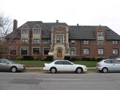
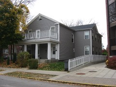
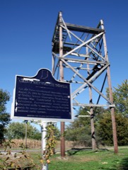
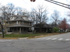
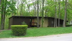
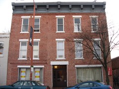
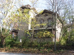
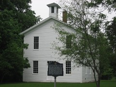
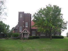
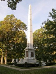
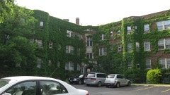
48 National Register listings published here, 2 of them National Historic Landmarks.
Sources: the National Register database, National Park Service
54 topographic sheets cover 48 settlements here, and 48 properties are on the National Register of Historic Places.
48 National Register listings published here, 2 of them National Historic Landmarks.
Sources: the National Register database, National Park Service
Every property in this county listed on the National Register of Historic Places, with the year it was listed and the federal nomination document.
Every wildfire the federal occurrence database records inside this county: 22 of them, burning about 30 acres. 1 started naturally and 3 were recorded as arson. Each settlement page carries the fires within five miles of it.
| Reported cause | Fires |
|---|---|
| Missing data/not specified/undetermined | 7 |
| Recreation and ceremony | 6 |
| Arson/incendiarism | 3 |
| Debris and open burning | 2 |
| Equipment and vehicle use | 2 |
| Natural | 1 |
| Smoking | 1 |
The five largest, by the area the report gives. Three of them were set deliberately.
| Date | Cause | Size | Reported by | Name on the report |
|---|---|---|---|---|
| 10 April 2004 | Arson/incendiarism | 15 acres | Indiana State Fire Marshal's Office | not named |
| 15 October 2005 | Recreation and ceremony | 2.5 acres | Indiana State Fire Marshal's Office | not named |
| 6 April 2004 | Debris and open burning | 2.0 acres | Indiana State Fire Marshal's Office | not named |
| 29 February 2004 | Arson/incendiarism | 2.0 acres | Indiana State Fire Marshal's Office | not named |
| 28 March 2005 | Equipment and vehicle use | 1.0 acres | Indiana State Fire Marshal's Office | not named |
| 20 September 2004 | Natural | 1.0 acres | Indiana State Fire Marshal's Office | not named |
| 5 April 2005 | Recreation and ceremony | 1.0 acres | Indiana State Fire Marshal's Office | not named |
| 12 March 2004 | Arson/incendiarism | 1.0 acres | Indiana State Fire Marshal's Office | not named |
Every settlement page carries the fires within five miles of it - see the settlement index below.
The NOAA Storm Events Database holds 556 reports for this county, causing 4 deaths, 94 injuries and about $20,859,760 in recorded property damage. Each settlement page carries the reports that name it.
| Kind of event | Reports |
|---|---|
| Thunderstorm Wind | 296 |
| Hail | 130 |
| Tornado | 55 |
| Flood | 46 |
| Flash Flood | 23 |
| Lightning | 4 |
| Heavy Rain | 1 |
| Funnel Cloud | 1 |
The most serious of them, by death, then injury, then recorded damage. The accounts are quoted exactly as the forecast office filed them.
| When | Event | Place named | Harm | What the report says |
|---|---|---|---|---|
| April 1994 | Tornado (F4) | Lafayette | 3 killed, 70 hurt, $5,000,000 | The path of the tornado was intermittent. The tornado touched down northwest of Lafayette just before midnight, and then moved northeast at a forward speed of about 60 mph. The tornado crossed into Carroll County at 1212 EST and then lifted. Eleven single family homes were destroyed, and 17 homes sustained major damage. Seven single family homes sustained minor damage. Thirteen multi-family dwellings were heavily damaged. At the Sagamore Village Estates mobile home park, 64 mobile homes were destroyed or heavily damaged, and 21 mobile homes sustained minor damage. Three additional mobile homes outside the park were also damaged. Two gas stations and a venetian blind factory were heavily damaged. Total property damage was estimated at 3.5 million dollars. An eleven year old girl was killed when the tornado destroyed her house in Pine View Farms, which is adjacent to Sagamore Village Estates. Her 37 year old stepfather was critically injured at their home, and died the next day. A 24-year old male who was working at the Lafayette Venetian Blind factory was killed when the roof collapsed on him. F11P, M37P, M24O. |
| June 2011 | Thunderstorm Wind | Welborn Arpt | 1 killed, 1 hurt, $10,000 | Thunderstorm wind gusts downed a 12 to 18 diameter tree fell on a vehicle traveling southbound on State Route 43, just north of West Lafayette. Two individuals were in the vehicle, with one fatality and one injury. Winds were estimated at 45 to 50 mph. |
| April 1965 | Tornado (F4) | not stated | 10 hurt | no account filed |
| March 1976 | Tornado (F4) | not stated | 6 hurt, $2,500,000 | no account filed |
| May 1989 | Thunderstorm Wind | not stated | 3 hurt | no account filed |
| September 1999 | Tornado (F1) | Battle Ground | 1 hurt, $300,000 | no account filed |
| July 2001 | Thunderstorm Wind | Lafayette | 1 hurt, $20,000 | no account filed |
| March 2009 | Thunderstorm Wind | Dayton | 1 hurt, $12,000 | A semi-trailer was blown off Interstate 65 by thunderstorm winds. The driver was traveling north on I-65 about 10 miles north of Frankfort when the wind forced his empty vehicle off the road, tearing the roof open. The driver sustained minor injuries. |
| October 2006 | Thunderstorm Wind | Lafayette | 1 hurt, $10,000 | Thunderstorm winds blew a tree down on top of a mobile home, destroying the dwelling and injuring the occupant. Power outages were caused by wind in the area as well. |
| May 2000 | Hail | Romney | $5,000,000 | no account filed |
| May 2004 | Tornado (F2) | Dayton | $1,000,000 | A tornado touched down near Dayton. The tornado caused significant tree damage and blew parts of roofs off two buildings in Dayton. The tornado continued moving northeast with sporadic damage until reaching large homes approximately 1.5 miles northeast of Dayton. Two homes were nearly destroyed on Halifax Lane. Wind speeds were estimated around 150 mph. |
| November 2013 | Tornado (EF3) | North Crane | $750,000 | At 1454EST, this EF-3 tornado touched down 5 miles south-southeast of Lafayette. This EF-3 tornado impacted the Subaru and Voest Alpine plants southeast of Lafayette. Both sustained significant damage consistent with a low end EF-3 rating. Property and tree damage then continued northeast to the north of Dayton. The tornado crossed through the far northwest corner of Clinton County causing mainly tree damage. Then, the tornado moved into southwest Carroll county. A hog farm sustained damage to several outbuildings in extreme southwest Carroll County. Additional damage was found in Cutler. Much of the damage across Carroll County ranged between EF-0 and EF-1. This tornado crossed into Cass County near State Route 18 at 1517EST, continuing for nearly an additional 10 miles. The total path length including Cass County is 39 miles. The tornado lifted 4 miles southwest of Grissom Air Reserve Base at 1527EST. |
| March 2023 | Thunderstorm Wind | Octagon | $700,000 | Thunderstorm winds flattened two structures to their basements. Roofs were blown off of several other structures near the junction of Benton, Tippecanoe and White Counties. |
| January 2008 | Flood | West Lafayette | $500,000 | Flooding occurred along the Wabash River in Tippecanoe County, including near Lafayette, due to heavy rain and snow melt. 30 to 40 homes were damaged by flood waters. |
| February 2014 | Flood | Welborn Arpt | $450,000 | On Saturday, February 22nd at 2:36 PM EST, an ice jam broke, began to move downstream, and continued to flow for 20 minutes. Then it stopped. This movement caused some of the ice to flow into the Barton Beach Road area. The ice that moved into this area created damage to homes along Wildcat Creek. After the ice stopped, water began to flood the Conservation Club Road area and covered the roadway trapping 100+ people and 50+ vehicles in the Legacy Sports complex. People and vehicles had to be evacuated out of the back side of Conservation Club Road through the old gravel pit to safety.||The ice jam broke a second time Saturday night and moved downstream to the bend just past all the housing on Barton Beach Road. As this ice moved, a large quantity flowed into the Barton Beach Road area causing a great deal of damage to the property along the Wildcat. Some of the damage is significant to homes and roadways. This includes 2 homes having partial collapse of the foundations and washing away of the ground leaving a washout about 10 feet deep and part of the homes were hanging in mid-air. Portions of blacktop roads were washed out as well. Most homes were reported to be not structurally stable. |
| June 2004 | Flash Flood | Countywide | $450,000 | no account filed |
| February 2008 | Flood | West Lafayette | $400,000 | Flooding occurred along the Wabash River in Tippecanoe County, including near Lafayette, due to heavy rain and snow melt. Numerous homes were affected by flood waters. |
| June 1981 | Tornado (F1) | not stated | $250,000 | no account filed |
| April 1978 | Tornado (F1) | not stated | $250,000 | no account filed |
| September 1965 | Tornado (F2) | not stated | $250,000 | no account filed |
| July 1998 | Tornado (F1) | West Lafayette | $200,000 | Tornado damaged several houses and blew down numerous trees and power lines near North River Road and Happy Hollow Road. |
| June 2002 | Thunderstorm Wind | Lafayette | $200,000 | no account filed |
| December 1998 | Thunderstorm Wind | Countywide | $200,000 | no account filed |
| April 2001 | Thunderstorm Wind | Dayton | $150,000 | no account filed |
| November 2013 | Tornado (EF2) | South Raub | $125,000 | At 1452EST, this EF-2 tornado touched down 3 miles northwest of Romney. The Southwestern Elementary and Middle School to the northwest of Romney both sustained significant damage to their structures. The gymnasium at the middle school had a wall blown out, with roof damage to both schools. Some other homes sustained roof and structural damage as well. Trees were downed too. This tornado lifted 7 miles south of Lafayette at 1455EST. |
| June 2019 | Flash Flood | Meadowbrook | $100,000 | Water was as deep as 3 feet deep in portions of the Tippecanoe Mall with rapidly flowing water reported over the road in the subdivision behind the mall due to heavy thunderstorm rainfall. This report was relayed via social media. |
| March 2006 | Flood | Lafayette | $100,000 | no account filed |
| September 1999 | Hail | Lafayette | $100,000 | no account filed |
| April 2011 | Tornado (EF1) | Taylors | $80,000 | An EF-1 tornado touched down on the south side of Lafayette in Tippecanoe county. Numerous trees were downed and one was downed on a house, completely destroying the garage. |
| June 2008 | Thunderstorm Wind | Lafayette | $60,000 | A tree fell on a house and a car due to damaging thunderstorm winds. A garage also sustained damage. The winds also tore off part of a roof of a church and a trailer. The metal roof of another building was also damaged. |
| August 2020 | Thunderstorm Wind | Battle Ground | $50,000 | Numerous trees and limbs downed due to thunderstorm wind gusts around Battle Ground Indiana. Video and lots of pics of tree damage were received. Also, widespread power outages from Battle Ground to Burrows reported with much of Delphi without power. |
| May 2019 | Thunderstorm Wind | Lafayette | $50,000 | A roof was torn and raised off of the Wabash National Corporation due to damaging thunderstorm wind gusts. Trailers were also overturned. |
| March 2016 | Tornado (EF1) | Meadowbrook | $50,000 | The National Weather Service in Indianapolis has confirmed an EF-1 tornado near Lafayette in Tippecanoe County on March 31, 2016. The EF-1, 30-yard wide tornado was captured on video as it moved across the lot at the Wabash National Trailer site. With wind speeds estimated at approximately 100 mph, a guard shack was destroyed, a car was rolled over, a few tractor trailers were blown over, and a construction trailer was damaged and nearly rolled over. |
| July 2015 | Thunderstorm Wind | West Lafayette | $50,000 | A concrete plant had it's roof blown off due to damaging thunderstorm wind gusts. The building's bay doors were open at the time. |
| April 2006 | Tornado (F1) | Romney | $50,000 | A small tornado touched down near the small town of Romney on 2 April 2006. The damage was confined mostly to outbuildings. |
| April 2001 | Thunderstorm Wind | Lafayette | $50,000 | no account filed |
| April 2001 | Thunderstorm Wind | Cairo | $50,000 | no account filed |
| July 2010 | Thunderstorm Wind | Purdue University | $45,000 | A television meteorologist measured thunderstorm wind gusts of 73 mph in this location. He also reported 22 homes with shingles, siding, and/or gutters removed. Heavy tree damage was also noted. |
| July 2015 | Tornado (EF1) | Stockwell | $35,000 | NWS survey revealed EF1 damage with approximately 100 mph winds affecting a residence south of Newcastle Road, between County Road 775 East and County Road 900 East in southeast Tippecanoe County. Numerous trees, west of the affected residence, had tops sheared off or were downed completely and a garage at the residence was destroyed. |
| April 2026 | Thunderstorm Wind | (Laf)Purdue Univ Laf | $30,000 | Thunderstorm wind gusts snapped and uprooted multiple trees. Multiple power lines were also downed. |
| July 2015 | Tornado (EF1) | Monroe | $30,000 | NWS survey revealed EF1 damage with approximately 97 mph winds in the southeast portion of Tippecanoe County, south of the intersection of Highway 52 and County Road 900 South. Observed damage included a collapsed garage, downed trees, and at least one home with vinyl siding removed. |
| April 2006 | Tornado (F1) | Americus | $30,000 | A weak tornado touched down near Americus and moved eastward, lifting shortly after entering Carroll County. Damage was confined to farm outbuildings. |
| May 2006 | Thunderstorm Wind | West Lafayette | $30,000 | A tree fell on a home in West Lafayette. No one was injured. |
| June 2025 | Tornado (EF0) | Klondyke | $25,000 | The second tornado caused tree damage and minor roof damage to a home on 500N. Drone footage showed clear convergence in a grass field and a touchdown in a field of corn north of 500N. The tornado then downed a few additional trees before dissipating in a field to the northeast. The tornado had a peak wind of 75 mph. |
| June 2023 | Thunderstorm Wind | Elston | $25,000 | Multiple trees downed by thunderstorm wind gusts across Lafayette. |
| July 2020 | Thunderstorm Wind | Halsmer Arpt | $25,000 | Large metal doors were blown off of the Toyota Tsusho America Inc plant at the 5400 block of Haggerty Lane. A plant employee told local broadcast media that if not for the tornado warning and their resulting shelter in place employees would have been struck. |
| April 2018 | Tornado (EF0) | Lafayette Aretz Arpt | $25,000 | This EF-0 tornado, with a max wind speed of 85 mph, affected one homestead and a thin band of trees. Damage at the homestead included barn skylights being blown out from wind entering an east-facing opening, debris from half an outbuilding`s roof and collapsed wall sent into an adjacent field to the northeast, downed tree branches with one breaking the garage window, and the top horizontal portion of a power pole being broken off. Also, straight-line wind damage was noted south and east of Buck Creek including downed trees and an outbuilding shifted off its foundation. |
| July 1978 | Tornado (F1) | not stated | $25,000 | no account filed |
| April 1978 | Tornado (F2) | not stated | $25,000 | no account filed |
| April 1974 | Tornado (F2) | not stated | $25,000 | no account filed |
| June 1973 | Tornado (F1) | not stated | $25,000 | no account filed |
| March 1971 | Tornado (F2) | not stated | $25,000 | no account filed |
| April 1956 | Tornado (F2) | not stated | $25,000 | no account filed |
| June 2015 | Thunderstorm Wind | Lafayette | $21,000 | A tree was reported down on a house due to damaging thunderstorm wind gusts. |
| November 2013 | Tornado (EF0) | South Raub | $21,000 | At 1451EST, this EF-0 tornado touched down in South Raub and damaged a shed and a grain bin during the short duration and path length it was on the ground. The tornado lifted at 1452EST. |
| June 2025 | Tornado (EF0) | West Pt | $20,000 | The first tornado of the event impacted mostly trees in a valley before moving up a hill and crossing 850W. A home in the path suffered very minor damage with the tornado dissipating in a field just south of 200S. Tornado had a peak wind of 80 mph. |
| July 2011 | Flash Flood | Americus | $20,000 | Several culverts along County Road 800 North were washed out by 5.5 inches of rainfall. |
| June 2002 | Thunderstorm Wind | Lafayette | $20,000 | no account filed |
| May 2000 | Thunderstorm Wind | Clarks Hill | $20,000 | no account filed |
| June 2021 | Tornado (EF1) | Pettit | $18,000 | A National Weather Service damage survey found the first tornado of the episode was an EF1 with maximum winds of 95 mph and a path length of 2.17 miles, which included both Tippecanoe and Carroll Counties. It began near the intersection of 1025 E and 100 N in far Eastern Tippecanoe county. The roof on the east side of a barn was lifted and thrown about 20 yards to the southeast. Several large branches were broken off trees and thrown to the west and northwest, several being drug along the ground. A small wind mill was knocked down and pointed into the path of the tornado. Several small farm vehicles were moved or overturned. The tornado then appeared to lift briefly but may have occurred again in a field of corn before hitting a barn and house along county|line road, northeast of where it originally began. Here another roof segment was torn off a small barn and tree branches were thrown into the side of a house and a few went through windows. A car was also pulled about 5 feet. Damage at all of the locations impacted was consistent with an EF1 and winds up to 95 mph. The tornado then crossed into Carroll County. |
The Survey's mineral resources record lists 11 workings inside this county. 9 still produce and 2 are closed or unrecorded. Each settlement page carries the workings within five miles of it.
| Commodity | Workings |
|---|---|
| Sand and Gravel, Construction | 9 |
| Aluminum | 2 |
The least common of them first, because a county's hundredth gravel pit says nothing its first ten did not.
| Where | Site | Commodity | Status | Recorded |
|---|---|---|---|---|
| Rostone Crp/ Lafayette Oprtns. | Aluminum | Occurrence | ||
| Rostone Crp/ Lafayette Oprtns. | Aluminum | Plant | ||
| Bratz Pit | Sand and Gravel, Construction | Producer | ||
| Casi Pit | Sand and Gravel, Construction | Producer | ||
| Elwood Sales | Sand and Gravel, Construction | Producer | ||
| Fairfield Pit | Sand and Gravel, Construction | Producer | ||
| Lafayette Gravel Pit | Sand and Gravel, Construction | Producer | ||
| Lafayette Gravel Pit | Sand and Gravel, Construction | Past Producer | ||
| Lafayette Portable Gravel | Sand and Gravel, Construction | Producer | ||
| Macy's Pit | Sand and Gravel, Construction | Producer | ||
| Taylor Station | Sand and Gravel, Construction | Producer |
Named settlements recorded in the Geographic Names Information System, each with the topographic sheets covering it. Villages, hamlets and abandoned places alike. Each is shown with the nearest named watercourse or landform and the survey quadrangle it falls on.
Wabash township · 47906 · Near Cedar Hollow · Lafayette West quadrangle
18 sheets, 1941 to 1998
Tippecanoe township · 47920 · On Buck Creek · Brookston quadrangle
9 sheets, 1953 to 1985
Fairfield township · 47905 · On Wildcat Creek · Lafayette East quadrangle
13 sheets, 1953 to 1998
Washington township · 47905 · On Little Sugar Creek · Delphi quadrangle
9 sheets, 1953 to 1985
Lauramie township · 47909 · On East Branch Wea Creek · Stockwell quadrangle
9 sheets, 1953 to 1984
Washington township · 47905 · On Buck Creek · Lafayette East quadrangle
13 sheets, 1953 to 1998
Wabash township · 47906 · Near Happy Hollow · Lafayette West quadrangle
18 sheets, 1941 to 1998
Wabash township · 47906 · Near Cedar Hollow · Lafayette West quadrangle
18 sheets, 1941 to 1998
Perry township · 47905 · On South Fork Wildcat Creek · Lafayette East quadrangle
13 sheets, 1953 to 1998
Perry township · 47905 · On Middle Fork Wildcat Creek · Lafayette East quadrangle
13 sheets, 1953 to 1998
Wabash township · 47906 · Near Cedar Hollow · Lafayette West quadrangle
18 sheets, 1941 to 1998
Wabash township · 47906 · Near Happy Hollow · Lafayette West quadrangle
18 sheets, 1941 to 1998
Wabash township · 47906 · Near Happy Hollow · Lafayette West quadrangle
18 sheets, 1941 to 1998