 Block
Whitestown, Indiana
18 topographic sheets cover this place, the earliest surveyed in 1953 and the latest in 1998. It stands in Worth Township. It lies in ZIP code area 46075. The Survey maps it on the Zionsville quadrangle. 10,178 people lived here at the 2020 count. It stands 938 feet above sea level.
Population over time
2 figuresWhitestown grew from 2,867 to 10,178 between 2010 and 2020. These are the recorded population figures Wikidata holds for this place, reached through the Geographic Names Information System number this page is keyed on rather than by name, so they belong to this place and not to another of the same name. Most are census counts, but not all are: an early figure may be a founding or settlement estimate, and an estimate published within five years of a census is left out. The change column is computed, and is left blank where more than 20 years separate a figure from the one before it, because a gap that long is not a change between two counts.
| Year | People | Change |
|---|---|---|
| 2010 | 2,867 | |
| 2020 | 10,178 | +7,311 (+255%) |
Topographic sheets covering this place
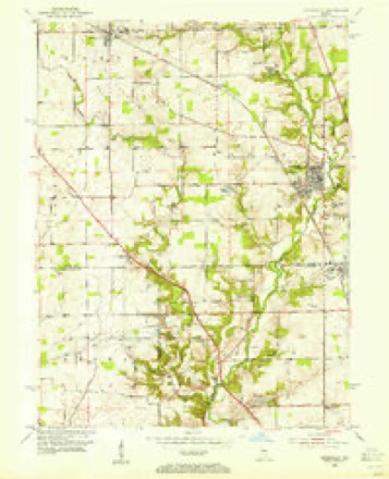
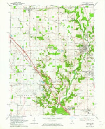
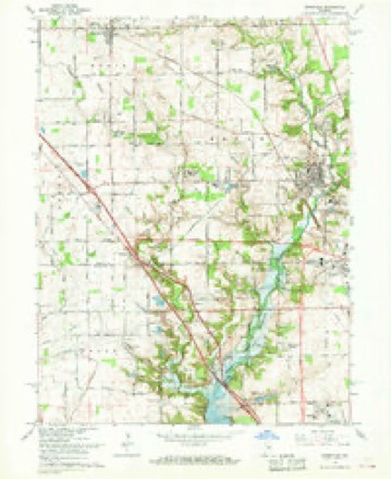
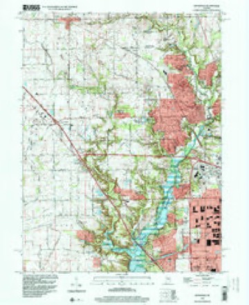
9 surveys from 18 printed sheetsMatched by testing this settlement's coordinate against the published boundary of every sheet in the United States Geological Survey's historical collection. Each opens the scanned sheet at the Survey.
- 1953 USGS Indianapolis quadrangle1:250000, 4 printings
- 1953 USGS Zionsville quadrangle1:24000
- 1956 USGS Indianapolis quadrangle1:250000
- 1957 USGS Indianapolis quadrangle1:250000, 2 printings
- 1962 USGS Indianapolis quadrangle1:250000
- 1962 USGS Zionsville quadrangle1:24000
- 1966 USGS Zionsville quadrangle1:24000, 5 printings
- 1986 USGS Indianapolis quadrangle1:100000, 2 printings
- 1998 USGS Zionsville quadrangle1:24000





In the county-history sources
7,549 words on this townshipEarly Life and Times in Boone County Indiana, published 1861 names this settlement in its chapter on Worth Township. These are the passages that mention it, exactly as the scans read.
The above township contains twenty-one sections. It was created in 1851, out of territory taken from adjoining townships. There are no water courses here. The extreme headwaters of Fishback have their source in the south part of Worth. The Indianapolis, Cincinnati & Lafayette Railroad passes through from the southeast to th> northwest, dividing the townships into equal parts. Whitestown, on the railroad and near the center, is the voting place and the headquarters for the business transactions of the township. Holmes Station, founded by John Holmes, was in earlier days quite a business place. Mr. Holmes built a warehouse about the year 1860. At one time a large amount of grain was taken in here, but. of late years the business has been discontinued. A separate account of Whitestown will be found under the head of "Sketch of Whitestown." Worth is without doubt the levelest township in the county and contains as fine land as can be found in Indiana. The farmers have tested to perfection the benefit of drainage, thousands upon thousands of dollars having been expended. Could the tile that is buried under the ground be exposed on the surface the ground would be red.
Passage source: Early Life and Times in Boone County Indiana, published 1861.
Machine-read from a century-old scan, so expect the errors a machine makes: misspelled names, dropped words, stray characters.
Mines and quarries near this place
1 within 5 milesRegional context, not property-specific evidence. The federal mineral resources record lists 1 working within 5 miles of Whitestown: 1 past producer. None of them still produces. What was taken out: Sand and Gravel, Construction. Distance is straight-line from the map coordinates, so a quarry counted here may appear on a neighbouring settlement's page as well.
| Where | Site | Commodity | Status | Recorded |
|---|---|---|---|---|
| Routh Sand and Gravel Pit | Sand and Gravel, Construction | Past Producer |
Storms near this place
24 since 1997Regional context, not property-specific evidence. The National Weather Service names Whitestown in 24 storm reports between 1997 and 2024: 14 thunderstorm wind, 8 hail, 1 funnel cloud, 1 tornado. No death or injury is recorded in these reports. Each account below is quoted exactly as the forecast office filed it, from the NOAA Storm Events Database, and each date opens the federal record of that event.
| When | Event | Place named | Harm | What the report says |
|---|---|---|---|---|
| April 2016 | Tornado (EF1) | Whitestown | $35,000 | This EF-1 tornado, with winds estimated at 100 mph, moved from 2.5 miles ESE of Whitestown to 2.6 miles ESE of Whitestown. The tornado demolished a small barn and did some minor damage to a home. |
| July 2016 | Thunderstorm Wind | Whitestown | $25,000 | Trees were snapped, large limbs and fences were downed, roof shingles were blown off, air conditioning units were moved and twisted, and a patio set was moved over a city block due to damaging thunderstorm wind gusts. Event occurred at Green Willow Road and Limelight Lane. |
| July 2003 | Thunderstorm Wind | Whitestown | $25,000 | no account filed |
| May 2013 | Thunderstorm Wind | Whitestown | $5,000 | Trees were reported down in this location due to damaging thunderstorm wind gusts. |
| June 2020 | Thunderstorm Wind | Whitestown | $2,000 | Tree downed due to thunderstorm wind gusts at the 4600 block of South 700 East. Another tree was downed nearby. |
| June 2009 | Thunderstorm Wind | Whitestown | $1,500 | Power lines were reported down in Whitestown. |
| August 2018 | Thunderstorm Wind | Whitestown | $1,000 | Shingles were ripped off of roofs and large trash cans were blown away due to damaging thunderstorm wind gusts. |
| July 2015 | Thunderstorm Wind | Whitestown | $1,000 | A large tree was downed along County Road 300 South due to damaging thunderstorm wind gusts. |
| March 2020 | Hail | Whitestown | - | Report was relayed through broadcast media. |
| May 2019 | Thunderstorm Wind | Whitestown | - | An estimated thunderstorm wind gust of 60 mph was observed in this location. A gust of 53 mph was measured in this location as well. |
| July 2015 | Hail | Whitestown | - | Penny size hail fell for five minutes accompanied by lightning strikes every one to two seconds. |
| March 2012 | Funnel Cloud | Whitestown | - | A lowering of the thunderstorm cloud base was reported with rotation in this location. |
| April 2011 | Thunderstorm Wind | Whitestown | - | A thunderstorm wind gust, estimated at 70 mph, was reported in Whitestown. |
| June 2008 | Thunderstorm Wind | Whitestown | - | Trees and large limbs were knocked down due to damaging thunderstorm winds. |
| January 2008 | Thunderstorm Wind | Whitestown | - | Damaging winds were reported in Whitestown. |
| March 2024 | Hail | Whitestown | - | no account filed |
| March 2017 | Hail | Whitestown | - | no account filed |
| May 2015 | Hail | Whitestown | - | no account filed |
| May 2011 | Hail | Whitestown | - | no account filed |
| February 2006 | Thunderstorm Wind | Whitestown | - | no account filed |
| June 2006 | Hail | Whitestown | - | no account filed |
| September 2006 | Hail | Whitestown | - | no account filed |
| December 1998 | Thunderstorm Wind | Whitestown | - | no account filed |
| April 1997 | Thunderstorm Wind | Whitestown | - | no account filed |
Nearest settlements
The eight closest, with where each one stands in the county. Distances are straight-line, computed from the Geographic Names Information System coordinates.
| Map | Place | Distance | Sheets |
|---|---|---|---|
| Allens Acres | 2.3 miles | 18 | |
| Dale | 3.2 miles | 11 | |
| Stonegate | 3.4 miles | 18 | |
| Gadsden | 3.5 miles | 11 | |
| Eaglewood Estates | 3.6 miles | 18 | |
| Russell Lake | 4.1 miles | 18 | |
| Northfield | 4.2 miles | 11 | |
| Rosston | 4.6 miles | 11 |
Elsewhere
Matched on this settlement's Geographic Names Information System number rather than its name, so it cannot be a different place of the same name in another state.
| Wikipedia article on Whitestown | An encyclopaedic summary. Its text is share-alike, so it is linked here rather than copied. |
| Wikidata item Q2223910 | The structured record the population and elevation above come from. Public domain (CC0). |
Provenance
This settlement is recorded in the Geographic Names Information System as feature 445978. The sheet list is computed by point-in-boundary test against the United States Geological Survey's historical topographic inventory. Both are works of the United States government and carry no copyright under 17 U.S.C. 105.
Mines and quarries. USGS Mineral Resources Data System (MRDS) https://mrdata.usgs.gov/mrds/ A work of the United States government, no copyright under 17 U.S.C. 105.
Storms. NOAA National Centers for Environmental Information, Storm Events Database https://www.ncei.noaa.gov/stormevents/ A work of the United States government, no copyright under 17 U.S.C. 105. Narratives are quoted verbatim from the National Weather Service report and are not edited or summarised.