 Block
Wolcott, Indiana
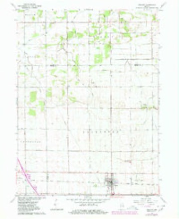
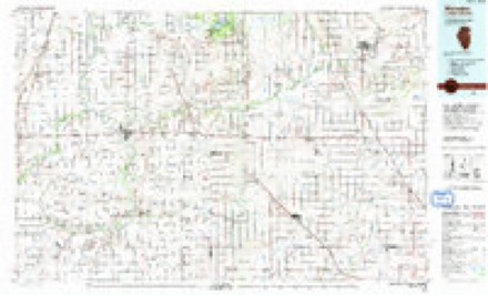
10 topographic sheets cover this place, the earliest surveyed in 1953 and the latest in 1990. It stands in Princeton Township. It lies in ZIP code area 47995. The Survey maps it on the Wolcott quadrangle. 950 people lived here at the 2020 count. It stands 715 feet above sea level.
Research this city
Population over time
2 figuresWolcott fell from 1,001 to 950 between 2010 and 2020. These are the recorded population figures Wikidata holds for this place, reached through the Geographic Names Information System number this page is keyed on rather than by name, so they belong to this place and not to another of the same name. Most are census counts, but not all are: an early figure may be a founding or settlement estimate, and an estimate published within five years of a census is left out. The change column is computed, and is left blank where more than 20 years separate a figure from the one before it, because a gap that long is not a change between two counts.
| Year | People | Change |
|---|---|---|
| 2010 | 1,001 | |
| 2020 | 950 | -51 (-5%) |
Topographic sheets covering this place
6 surveys from 10 printed sheetsMatched by testing this settlement's coordinate against the published boundary of every sheet in the United States Geological Survey's historical collection. Each opens the scanned sheet at the Survey.
- 1953 USGS Danville quadrangle1:250000, 3 printings
- 1955 USGS Danville quadrangle1:250000
- 1956 USGS Danville quadrangle1:250000
- 1962 USGS Wolcott quadrangle1:24000, 3 printings
- 1984 USGS Watseka quadrangle1:100000
- 1990 USGS Watseka quadrangle1:100000




Storms near this place
36 since 1999Regional context, not property-specific evidence. The National Weather Service names Wolcott in 36 storm reports between 1999 and 2022: 24 thunderstorm wind, 7 hail, 2 tornado, 2 flash flood. No death or injury is recorded in these reports. Each account below is quoted exactly as the forecast office filed it, from the NOAA Storm Events Database, and each date opens the federal record of that event.
| When | Event | Place named | Harm | What the report says |
|---|---|---|---|---|
| January 2008 | Flood | Wolcott | $250,000 | Widespread flooding of many creeks, streams, low areas and small towns occurred as a result of anywhere from 5 to locally as much as 7 inches of rain across much of northern White county. Several inches of snow also rapidly melted, contributing to flooding. Portions of several towns, including Monon, Wolcott, Buffalo and Reynolds were under water, in some places over a foot deep. While the significant flooding subsided during the day of January 9th, numerous areas of standing water persisted well into the 10th. Exact damage figures are not available at this time, but are estimated around $250,000. |
| May 2006 | Thunderstorm Wind | Wolcott | $25,000 | Eyewitness reported several weak circulations in contact with the ground across western White county, starting south of Wolcott and heading east into Monticello. These circulations were associated with gust fronts from several rapidly developing thunderstorms across the area. Video footage of some of these circulations supported the conclusion that a combination of straight line winds and brief gustnadoes, were responsible for sporadic damage in and west of Monticello. This included trees and tree limbs down as well as minor structure damage to homes and barns. The storm that moved east into Monticello merged with a storm moving in from the south west. This resulted in a rapid intensification of the storm and a resultant tornado east of Monticello. This is covered in a seperate entry. |
| May 2005 | Thunderstorm Wind | Wolcott | $25,000 | 12 large trees uprooted. Large branches fell onto house, causing damage. New 2 car garage, with garage doors open, was destroyed. A machine shed with its doors open and a storage shed were both destroyed. |
| July 2006 | Thunderstorm Wind | Wolcott | $10,000 | A tree was blown down onto power lines in Wolcott, causing the partial closure of US 24. Other reports of trees, power lines and poles were received between Wolcott and Monticello. |
| June 2000 | Thunderstorm Wind | Wolcott | $10,000 | Roof blown off of a restaurant. |
| June 1999 | Thunderstorm Wind | Wolcott | $10,000 | Numerous trees and power lines blown down. |
| March 2022 | Thunderstorm Wind | Wolcott | - | Local media reported nine large trees were uprooted. |
| October 2021 | Thunderstorm Wind | Wolcott | - | Local media reported a semi was blown over just east of Wolcott on US-24. No reports of injuries were received. |
| July 2020 | Thunderstorm Wind | Wolcott | - | Large limb broke off healthy tree and entangled in power line. Limb was 10 to 12 inches in diamater. Time estimated from radar. |
| May 2017 | Tornado (EF0) | Wolcott | - | Spotter reports as well as video footage confirm a tornado touched down near the Benton/White county line and tracked slowly east into White County. The tornado remained over open fields in Benton County and caused damage at a property on the eastern side of the White county line along North County Road 1200 East. A trailer was shoved 15 to 20 feet, along with a fishing boat being flipped roughly 30 feet from its starting location. A wooden outbuilding was destroyed along with a steel patio chair being thrown about a third of a mile. The tornado made a turn to the left near the end of its life, missing a wind turbine and eventually roping out. The tornado was on the ground for roughly 5 minutes with a maximum width of 50 yards and estimated wind speeds of around 75 mph. The tornado was on the ground for roughly three quarters of a mile from start to finish, with a tenth of a mile taking place in Benton county. |
| June 2017 | Thunderstorm Wind | Wolcott | - | Trained spotters reported a tree was blown down as was some tree limbs. |
| June 2016 | Thunderstorm Wind | Wolcott | - | A swath of damage was surveyed by emergency management officials in portions of White county. Damage was first reported west of Wolcott, where numerous trees were uprooted, a semi was blown over on I-65, and a empty grain bin was flattened. Moving southeast, the damage path began to expand in coverage and intensity, passing west of Chalmers. A NWS Cooperative Observer reported damage at his residence with several tree limbs down, 1 tree snapped and outbuilding suffering damage. The progressive wind signature expanded and accelerated even further as it moved near and west of Brookston. Numerous tree limbs, as well as several uprooted or snapped trees were found in town. West and southwest of town a larger pole barn was knocked down with additional swaths of tree damage found heading towards the Tippecanoe county line. Damage did continue into Tippecanoe county, towards Battleground where winds were measured at over 100 mph. See Central Indiana Storm Data entries for more details in this area. Winds in White county are estimated to have peaked between 90 and 100 mph. The line noted in StormData is meant to act as a central point to the swath that likely exceeded 5 miles in width. |
| June 2013 | Thunderstorm Wind | Wolcott | - | A trained spotter measured sustained winds of 45 mph for 15 minutes, with a peak gust of 65 mph. |
| August 2011 | Thunderstorm Wind | Wolcott | - | Law enforcement officials reported a tree blown down, which became tangled in power lines. |
| July 2011 | Flash Flood | Wolcott | - | Local law enforcement officials reported numerous roads covered in water, some with several inches of flowing water. Radar estimated that two to four inches of rain fell, mainly in a few hour period. High water lingered through much of the night, causing some travel issues. |
| August 2011 | Thunderstorm Wind | Wolcott | - | Local media reported several tree limbs down. |
| June 2010 | Tornado (EF0) | Wolcott | - | Local media relayed a report of a tornado being observed northeast of Wolcott by a trained spotter. The spotter subsequently sent a photograph and video of the tornado. The spotter stated that it touched down in an open field and was on the ground for less than a minute, causing no appreciable damage. The width of the circulation has been estimated from a photograph of the debris cloud. As no damage was reported, a intensity of EF0 with winds of 65 mph will be assigned. |
| June 2010 | Flash Flood | Wolcott | - | Law enforcement officials reported water flowing over several roads in the southern portion of the county, forcing some closures. Even after the rain ended, the threat of flooding continued into the afternoon. |
| April 2006 | Hail | Wolcott | - | Hail ranging from the size of quarters to golf balls were reported in and to the west of Wolcott. |
| April 2006 | Hail | Wolcott | - | Hail ranging from penny to golf ball size was reported around Wolcott with another severe thunderstorm. |
| May 2004 | Thunderstorm Wind | Wolcott | - | Trained spotter estimated winds of 75 MPH 3 miles south of Wolcott. |
| July 2003 | Thunderstorm Wind | Wolcott | - | Law enforcement reported trees down in Wolcott. |
| July 2003 | Thunderstorm Wind | Wolcott | - | The Wolcott COOP observer reported a wind gust to 70 MPH. |
| July 2001 | Thunderstorm Wind | Wolcott | - | Several trees down in Wolcott. |
| May 2000 | Thunderstorm Wind | Wolcott | - | Minor wind damage. |
| June 2000 | Thunderstorm Wind | Wolcott | - | Trees down. |
| June 1999 | Thunderstorm Wind | Wolcott | - | Numerous trees and power lines were downed. |
| August 2017 | Hail | Wolcott | - | no account filed |
| June 2015 | Thunderstorm Wind | Wolcott | - | no account filed |
| September 2014 | Hail | Wolcott | - | no account filed |
| August 2012 | Hail | Wolcott | - | no account filed |
| April 2006 | Thunderstorm Wind | Wolcott | - | no account filed |
| July 2003 | Hail | Wolcott | - | no account filed |
| July 2001 | Thunderstorm Wind | Wolcott | - | no account filed |
| May 2000 | Hail | Wolcott | - | no account filed |
| May 2000 | Thunderstorm Wind | Wolcott | - | no account filed |
Nearest settlements
The eight closest, with where each one stands in the county. Distances are straight-line, computed from the Geographic Names Information System coordinates.
Elsewhere
Matched on this settlement's Geographic Names Information System number rather than its name, so it cannot be a different place of the same name in another state.
| Wikipedia article on Wolcott | An encyclopaedic summary. Its text is share-alike, so it is linked here rather than copied. |
| Wikidata item Q2349059 | The structured record the population and elevation above come from. Public domain (CC0). |
Provenance
This settlement is recorded in the Geographic Names Information System as feature 446230. The sheet list is computed by point-in-boundary test against the United States Geological Survey's historical topographic inventory. Both are works of the United States government and carry no copyright under 17 U.S.C. 105.
Storms. NOAA National Centers for Environmental Information, Storm Events Database https://www.ncei.noaa.gov/stormevents/ A work of the United States government, no copyright under 17 U.S.C. 105. Narratives are quoted verbatim from the National Weather Service report and are not edited or summarised.