 Block
Worthington, Indiana
17 topographic sheets cover this place, the earliest surveyed in 1908 and the latest in 1986. It stands in Jefferson Township. It lies in ZIP code area 47471. It stands on Lemon Creek. The Survey maps it on the Arney quadrangle. 1,393 people lived here at the 2020 count. It stands 515 feet above sea level.
Population over time
2 figuresWorthington fell from 1,463 to 1,393 between 2010 and 2020. These are the recorded population figures Wikidata holds for this place, reached through the Geographic Names Information System number this page is keyed on rather than by name, so they belong to this place and not to another of the same name. Most are census counts, but not all are: an early figure may be a founding or settlement estimate, and an estimate published within five years of a census is left out. The change column is computed, and is left blank where more than 20 years separate a figure from the one before it, because a gap that long is not a change between two counts.
| Year | People | Change |
|---|---|---|
| 2010 | 1,463 | |
| 2020 | 1,393 | -70 (-5%) |
Topographic sheets covering this place
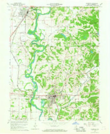
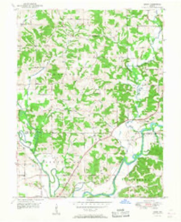
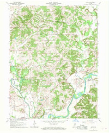
8 surveys from 17 printed sheetsMatched by testing this settlement's coordinate against the published boundary of every sheet in the United States Geological Survey's historical collection. Each opens the scanned sheet at the Survey.
- 1908 USGS Bloomfield quadrangle1:62500
- 1950 USGS Arney quadrangle1:24000, 2 printings
- 1953 USGS Indianapolis quadrangle1:250000, 4 printings
- 1956 USGS Indianapolis quadrangle1:250000
- 1957 USGS Indianapolis quadrangle1:250000, 2 printings
- 1962 USGS Indianapolis quadrangle1:250000
- 1966 USGS Arney quadrangle1:24000, 3 printings
- 1986 USGS Bloomington quadrangle1:100000, 3 printings





In the county-history sources
1,278 words on this townshipEarly History of Greene County, Indiana : As Taken from the Official Records, and Compiled from Authentic Recollection, by Pioneer Settlers ... Including Brief Sketches of Pioneer Families ..., published 1875 names this settlement in its chapter on Jefferson Township. These are the passages that mention it, exactly as the scans read.
Benjamin Shumaker made the first land entry, after -which he b-uilt the first house, which -was located upon the ground where Uncle Jonny Myers' dwelling now stands^ in Worth-' ington. Old Thomas Smith settled on the hill-side, about; t-wo hundred yards cast of -where Verlin. Jessup g dwelling house no-w stands ) and Mr.- Smith set out that old apple otchard^ built the first ferry-'boat, and kept the old Smith's ferry, en White river,- for nearly forty years. James Stal-* cup built a lo:g house snd set outthose apple trees in George R. Taylor's field, on the hill just east of Worthington. Tliomas Stalcup built his hotisc and lived an the north side of the old State road, opposite where 'Squire Spainhower now lives. Uncle Eli Dixon entered the most land, made the biggest farm, built the best dwelling house, and set out the old apple orchard on tbef farm now own^ ed by Willis Watson^ just south of Worthington.
Passage source: Early History of Greene County, Indiana : As Taken from the Official Records, and Compiled from Authentic Recollection, by Pioneer Settlers ... Including Brief Sketches of Pioneer Families ..., published 1875.
Thomas J. Fires' great-grandfather, old John Craig, entered the land, built the house, and set out the apple orchard at the. old Anderson Harvey place, just northwest of Worthington. W illiam Lemons built his house and settled in the grove.
Passage source: Early History of Greene County, Indiana : As Taken from the Official Records, and Compiled from Authentic Recollection, by Pioneer Settlers ... Including Brief Sketches of Pioneer Families ..., published 1875.
John Craig built the first distillhouse, in the bi..nch east of where John B. Poe's chair factory now stands ; and then Benjamin Huey built another distill'house, at the Fuller spring, on the Terre Haute road, three miles from Worthington, Avherelie made whisky.
Passage source: Early History of Greene County, Indiana : As Taken from the Official Records, and Compiled from Authentic Recollection, by Pioneer Settlers ... Including Brief Sketches of Pioneer Families ..., published 1875.
Machine-read from a century-old scan, so expect the errors a machine makes: misspelled names, dropped words, stray characters.
Read the whole chapter on Jefferson Township - it names this place 6 more 6 times.
Fires near this place
1 since 2006Regional context, not property-specific evidence. The federal wildfire occurrence database lists 1 fire within 5 miles of Worthington in 2006, burning about 5 acres in total. None started naturally. None was recorded as arson. Distance is straight-line from the map coordinates, so a fire counted here may appear on a neighbouring settlement's page as well.
| Reported cause | Fires |
|---|---|
| Debris and open burning | 1 |
The most recent of them, most recent first, with the day each was reported and the service that recorded it.
| Date | Cause | Size | Reported by | Name on the report |
|---|---|---|---|---|
| 29 April 2006 | Debris and open burning | 5.0 acres | Indiana State Fire Marshal's Office | not named |
Settlements close enough to share some of these fires:
Mines and quarries near this place
1 within 5 milesRegional context, not property-specific evidence. The federal mineral resources record lists 1 working within 5 miles of Worthington: 1 producer. All of them still produce. What was taken out: Sand and Gravel, Construction. Distance is straight-line from the map coordinates, so a quarry counted here may appear on a neighbouring settlement's page as well.
| Where | Site | Commodity | Status | Recorded |
|---|---|---|---|---|
| Greene County Plant | Sand and Gravel, Construction | Producer |
Storms near this place
23 since 1997Regional context, not property-specific evidence. The National Weather Service names Worthington in 23 storm reports between 1997 and 2026: 13 thunderstorm wind, 6 hail, 3 flood, 1 flash flood. The reports record 1 death. Each account below is quoted exactly as the forecast office filed it, from the NOAA Storm Events Database, and each date opens the federal record of that event.
| When | Event | Place named | Harm | What the report says |
|---|---|---|---|---|
| January 2007 | Flood | Worthington | 1 killed, $10,000 | The White River in Greene County flooded for much of January. Crests were as high as 8.9 feet above flood stage. A man was killed near Worthington when he lost control of his car in high water and attempted to wade through the frigid water to safety. |
| June 2009 | Thunderstorm Wind | Worthington | $200,000 | Twelve railroad cars were overturned south of Worthington and there were numerous reports of trees downed throughout Greene County due to thunderstorm wind gusts. |
| July 2001 | Thunderstorm Wind | Worthington | $20,000 | no account filed |
| April 2006 | Thunderstorm Wind | Worthington | $10,000 | Trees and power lines were downed, and minor structural damage was reported. |
| June 2006 | Thunderstorm Wind | Worthington | $10,000 | Small outbuildings were blown into a roadway, and power lines were downed. |
| February 2026 | Thunderstorm Wind | Worthington | $5,000 | Several power poles were pushed over, but not completely toppled by thunderstorm wind gusts. |
| July 2019 | Thunderstorm Wind | Worthington | $1,000 | A large tree was downed across a road due to damaging thunderstorm wind gusts. |
| August 2012 | Thunderstorm Wind | Worthington | $1,000 | A three foot diameter tree was downed due to damaging thunderstorm wind gusts. |
| April 1997 | Thunderstorm Wind | Worthington | $500 | no account filed |
| December 2008 | Flood | Worthington | - | Rainfall and warm temperatures that occurred on and off during the second half of December led to flooding of low lying agricultural land on the White River during late December, affecting Greene County at and near Elliston. |
| December 2008 | Flood | Worthington | - | Rainfall and warm temperatures that occurred on and off during the second half of December led to flooding of low lying agricultural land on the White River during late December, affecting Greene County at and near Elliston. |
| April 2006 | Hail | Worthington | - | No property damage estimates were available. |
| June 2006 | Flash Flood | Worthington | - | Water closed the intersection of State Roads 157 and 48. No damage was reported. |
| May 2005 | Thunderstorm Wind | Worthington | - | A downed tree blocked a highway near Worthington. |
| June 2005 | Thunderstorm Wind | Worthington | - | Large limbs were blown down. |
| September 2002 | Thunderstorm Wind | Worthington | - | Trees down |
| February 2026 | Hail | Worthington | - | no account filed |
| June 2023 | Hail | Worthington | - | no account filed |
| April 2006 | Hail | Worthington | - | no account filed |
| November 2005 | Thunderstorm Wind | Worthington | - | no account filed |
| July 2004 | Thunderstorm Wind | Worthington | - | no account filed |
| April 2002 | Hail | Worthington | - | no account filed |
| November 2002 | Hail | Worthington | - | no account filed |
Nearest settlements
The eight closest, with where each one stands in the county. Distances are straight-line, computed from the Geographic Names Information System coordinates.
| Map | Place | Distance | Sheets |
|---|---|---|---|
| Point Commerce | 0.8 miles | 17 | |
| Rincon | 1.7 miles | 15 | |
| Johnstown | 3.3 miles | 18 | |
| Calvertville | 4.0 miles | 15 | |
| Dixon | 4.7 miles | 17 | |
| Tulip | 5.7 miles | 15 | |
| Elliston | 6.7 miles | 15 | |
| Bloomfield | 7.1 miles | 15 |
Elsewhere
Matched on this settlement's Geographic Names Information System number rather than its name, so it cannot be a different place of the same name in another state.
| Wikipedia article on Worthington | An encyclopaedic summary. Its text is share-alike, so it is linked here rather than copied. |
| Wikidata item Q1967748 | The structured record the population and elevation above come from. Public domain (CC0). |
Provenance
This settlement is recorded in the Geographic Names Information System as feature 446331. The sheet list is computed by point-in-boundary test against the United States Geological Survey's historical topographic inventory. Both are works of the United States government and carry no copyright under 17 U.S.C. 105.
Wildfire. Short, Karen C. 2022. Spatial wildfire occurrence data for the United States, 1992-2020 [FPA_FOD_20221014]. 6th Edition. Fort Collins, CO: Forest Service Research Data Archive. https://doi.org/10.2737/RDS-2013-0009.6 Collected with United States Government funding and usable without additional permissions or fees.
Mines and quarries. USGS Mineral Resources Data System (MRDS) https://mrdata.usgs.gov/mrds/ A work of the United States government, no copyright under 17 U.S.C. 105.
Storms. NOAA National Centers for Environmental Information, Storm Events Database https://www.ncei.noaa.gov/stormevents/ A work of the United States government, no copyright under 17 U.S.C. 105. Narratives are quoted verbatim from the National Weather Service report and are not edited or summarised.