 Block
From the record
One of 14 National Register listings published here for Posey County · listed in 2000 · category: District.
Sources: the case file at the National Archives · the National Register database, National Park Service
Listed on the National Register of Historic Places in 2000.
One of 14 National Register listings published here for Posey County · listed in 2000 · category: District.
Sources: the case file at the National Archives · the National Register database, National Park Service
The chapter on Harmony Township in History and Directory of Posey County [Indiana] : Containing an Account of the Early Settlement and Organization of the County ... : Also a Complete List of the Tax-payers, Their Post-office Addresses and Places of Residence, Together with a Business Directory of Mt. Vernon and New Harmony ... Also Biographical Sketches of Prominent Citizens of the County, published 1882; History of Posey County, Indiana : from the Earliest Times to the Present, with Biographical Sketches, Reminiscences, Notes, Etc. : Together with an Extended History of the Northwest, the Indiana Territory, and the State of Indiana, published 1886 names New Harmony. This is what it says, exactly as the scans read.
Was organized August 14, 182 1, and derives its name from the peculiar class of people who settled it in 1814 - 15, and who styled themselves the "Harmonie Society," an account of which will be found under the sketch of New Harmony. In population and wealth it is second only to Black. Its inhabitants are intelligent, industrious and public spirited. There were 8,573 acres of land under cultivation in the township in 1880, and the yield of wheat and corn for that year aggregated 265,402 bushels, the average production being respectively, fifteen and thirty-five bushels per acre.
JACOB BEEITH, dealer in drugs and family groceries, was born in Bavaria, Germany, April 15, 1828, and is a son of Frank and l^argaret (Heldebrand) Breith, who were the parents of twelve children. His father was also a native of Germany, a shoe-maker by trade, and served four years in the Bavarian Army. His mother was also of German nativity, both lived and died in their native land. The only education received by our subject was when he was very young. When he was nine years old his father began teaching him the trade of a shoe-maker, at which he worked until arrivii}g at his majority, when according to the law of his country he began serving the regular term of five years in the Bavarian Army. He immigrated to America in 1854, landing at New Orleans, coming up the Mississippi and Ohio Elvers to Evansville, thence to Posey Coiinty, and settling at Stewartsville. For about [two years he worked by the day on the farm at 50 cents per day, and then began the shoe-maker's trade at Stewartsville, where he continued working at his trade until 1870, since which time he has been a resident of New Harmony. For a short time he continued working at his trade in this place. In 1873 he engaged in the grocery business; in 1876 moved to his present place of business, and the same year added a stock of drugs. He was married, March 1, 1854, to Miss Saloma Shifar, also a native of Germany. Of fourteen children born to Mr. and Mrs. Breith, only three survive: Elizabeth, Caroline and Eleanora. At the time of their marriage they were too poor to buy a bedstead and for six weeks had to sleep on the floor, but by energy, economy and hard labor they have made a comfortable living. In politics Mr. Breith is a Democrat, and withal an estimable and worthy citizen.
Passage source: History of Posey County, Indiana : from the Earliest Times to the Present, with Biographical Sketches, Reminiscences, Notes, Etc. : Together with an Extended History of the Northwest, the Indiana Territory, and the State of Indiana, published 1886.
Machine-read from a century-old scan, so expect the errors a machine makes: misspelled names, dropped words, stray characters.
Read the whole chapter on Harmony Township - 13,814 words on its settlement, mills, schools and churches.
Regional context, not property-specific evidence. The federal wildfire occurrence database lists 2 fires within 5 miles of New Harmony Historic District between 2003 and 2004, burning about 1 acre in total. None started naturally. None was recorded as arson. Distance is straight-line from the map coordinates, so a fire counted here may appear on a neighbouring settlement's page as well.
| Reported cause | Fires |
|---|---|
| Recreation and ceremony | 1 |
| Debris and open burning | 1 |
The most recent of them, most recent first, with the day each was reported and the service that recorded it.
| Date | Cause | Size | Reported by | Name on the report |
|---|---|---|---|---|
| 29 February 2004 | Debris and open burning | 1.0 acres | Indiana State Fire Marshal's Office | not named |
| 13 December 2003 | Recreation and ceremony | under an acre | Indiana State Fire Marshal's Office | not named |
Regional context, not property-specific evidence. The federal mineral resources record lists 3 workings within 5 miles of New Harmony Historic District: 2 producers, 1 past producer. 2 still produce. What was taken out: Sand and Gravel, Construction. Distance is straight-line from the map coordinates, so a quarry counted here may appear on a neighbouring settlement's page as well.
| Where | Site | Commodity | Status | Recorded |
|---|---|---|---|---|
| Compton Pit & Dredge | Sand and Gravel, Construction | Producer | ||
| Diamond Dredge and Mill | Sand and Gravel, Construction | Past Producer | ||
| Maunie Plant/Dredge & Mill | Sand and Gravel, Construction | Producer |
Regional context, not property-specific evidence. The National Weather Service names New Harmony, the town this property stands in, in 91 storm reports between 1998 and 2024: 72 flood, 12 thunderstorm wind, 3 hail, 2 flash flood. No death or injury is recorded in these reports. Each account below is quoted exactly as the forecast office filed it, from the NOAA Storm Events Database, and each date opens the federal record of that event.
| When | Event | Place named | Harm | What the report says |
|---|---|---|---|---|
| April 2024 | Tornado (EF2) | New Harmony | $250,000 | An EF-2 occurred in Central Posey County, IN, early morning on April 2nd. The path started just east of IN-69, resulting in tree and powerline damage as it moved southeastward towards Harmony Township Rd. Large portions of a roof were blown off a home on Harmony Township Rd, while a roof and several walls were blown off of a barn on Williams Rd. The tornado continued to track southeastward, eventually merging with another tornado west-southwest of Blairsville. North of Parkers Settlement, the tornado destroyed a barn on IN-66 and threw a garage roof south and east at Rexing Rd. The tornado lifted just north of Parkers Settlement, after which straight-line wind damage continued into Vanderburgh County on the north side of Evansville. In total, hundreds of trees were snapped or uprooted, dozens of outbuildings were damaged or destroyed, and minor to moderate damage occurred to several homes. Estimated peak winds with this tornado were 115 mph. |
| May 2011 | Flood | New Harmony | $200,000 | Major flooding continued on the Wabash River from April. At the New Harmony river gage, the river crested at 23.67 feet on May 4. This level was the fourth highest crest on record, exceeding the 2005 flood by about six inches. This was the highest level since 1943. The National Guard assisted with sandbagging efforts along the Wabash River in the New Harmony area. Miles of farmland were flooded near the confluence of the Wabash and Ohio Rivers, both of which were well above flood stage. A number of lowland residents were evacuated. Many roads were closed. Some communities were accessible by boat only. |
| January 2008 | Thunderstorm Wind | New Harmony | $50,000 | Winds were estimated around 60 mph by an amateur radio operator in Poseyville. Around the county, at least 22 homes received some type of damage. Most of the damage was to roofs. Just south of New Harmony, a semi was blown over. |
| October 2014 | Tornado (EF1) | New Harmony | $30,000 | The damage path was through farmland with patches of woods. The damage path started at a farmhouse about two miles southeast of New Harmony, where a large tree was snapped and another large tree was uprooted. A tin roof was blown off a barn. The path was mostly through corn and soybean fields for the first couple miles. The strongest winds occurred near the end of the damage path, in a heavily wooded area about one-half mile southeast of the intersection of Highways 68 and 69. Numerous large trees were snapped in this area. Peak winds were estimated near 100 mph. The tornado path apparently ended on Highway 68 about 2.5 miles northeast of New Harmony, where a tree and some limbs were blown onto the road. |
| May 2011 | Flood | New Harmony | $30,000 | no account filed |
| May 2004 | Flash Flood | New Harmony | $25,000 | no account filed |
| August 2022 | Flash Flood | New Harmony | $15,000 | Half a foot of water was over the road near Springfield Road and Williams Road, six miles southeast of New Harmony. Half a foot of water was over Highway 66 and Goodman Road, five miles east of New Harmony. Seven miles northeast of Mt. Vernon, a water rescue was conducted on Caborn Road. |
| April 2017 | Flood | New Harmony | $15,000 | Following the flash flooding that occurred during the early morning hours, flooding of some roads lingered into the early afternoon hours. A water rescue was conducted near the intersection of Highways 66 and 69 near New Harmony, where the road was closed. A house basement wall collapsed a couple miles east of New Harmony. |
| September 2000 | Thunderstorm Wind | New Harmony | $15,000 | Numerous trees were blown down in New Harmony. Trees and power lines were down in Wadesville. |
| February 2019 | Flood | New Harmony | $10,000 | Moderate flooding occurred on the Wabash River. At the New Harmony, IN river gage, the river crested at 20.41 feet on the 16th. Flood stage is 15 feet. Considerable flooding of low ground occurred, but most of the low ground was dormant agricultural fields. Some county roads were flooded. Water encroached on parts of northern New Harmony, and Harmonie State Park was closed. Some stripper oil wells were flooded along the river from New Harmony to Mt. Vernon Indiana. |
| June 2019 | Thunderstorm Wind | New Harmony | $10,000 | A barn was damaged and power lines were down. |
| May 2017 | Flood | New Harmony | $10,000 | Moderate flooding occurred along the Wabash River. At the New Harmony river gage, the river crested at 21.68 feet on the 12th. Flood stage is 15 feet. Floodwaters encroached on the northern and western edges of New Harmony. A few dead-end city streets that access the river bottomlands were flooded and closed. Harmonie State Park was closed. Some stripper oil wells were flooded along the river. Floodwaters extended nearly to Indiana Route 69 north of Route 68. |
| December 2013 | Flood | New Harmony | $10,000 | Minor flooding occurred along the Wabash River. Low-lying woods and fields near the river were underwater. Some stripper oil wells near the river were flooded. |
| April 2013 | Flood | New Harmony | $10,000 | Moderate flooding occurred along the Wabash River. Low-lying fields and woodlands were underwater. Parts of northern New Harmony began to flood, and sandbagging became necessary in town. Harmonie State Park was closed. The river continued above flood stage into early May. |
| March 2012 | Hail | New Harmony | $10,000 | Golf ball size hail was reported in New Harmony. |
| September 2012 | Thunderstorm Wind | New Harmony | $10,000 | Large tree limbs were down on power lines, causing power outages. |
| April 2011 | Flood | New Harmony | $10,000 | The National Guard assisted with sandbagging efforts along the Wabash River in the New Harmony area. Miles of farmland were flooded near the confluence of the Wabash and Ohio Rivers, both of which were well above flood stage. |
| April 2016 | Thunderstorm Wind | New Harmony | $8,000 | Trees and power lines were blown down. |
| June 2013 | Flood | New Harmony | $5,000 | Minor flooding occurred along the Wabash River in and near New Harmony. A few river access roads along the river were flooded. Some cropland was flooded. The flooding continued into early July. |
| June 2007 | Thunderstorm Wind | New Harmony | $5,000 | Large trees were blown down along a street. |
| May 2007 | Thunderstorm Wind | New Harmony | $5,000 | Trees were blown down. |
| May 1999 | Thunderstorm Wind | New Harmony | $5,000 | Thunderstorm gusts to 60 MPH were reported from Mt. Vernon to New Harmony. In Wadesville, 25-foot tall trees were broken in half at Parkers Settlement. |
| May 1998 | Thunderstorm Wind | New Harmony | $5,000 | Trees were down along Route 66 from the New Harmony area to Wadesville. |
| April 2014 | Flood | New Harmony | $4,000 | Minor flooding occurred along the Wabash River. Low-lying fields and woodlands near the river were inundated. Harmonie State Park was closed. |
| June 2015 | Flood | New Harmony | $3,000 | Minor flooding occurred along the Wabash River. Low-lying fields, woodlands, and some oil wells were flooded in the flood plain. The flooding continued into July. |
| July 2021 | Thunderstorm Wind | New Harmony | $2,000 | A tree and power lines were down. |
| January 2017 | Flood | New Harmony | $2,000 | Minor flooding occurred along the Wabash River. Low-lying agricultural land was inundated. The land was dormant for the winter season. Some stripper oil wells began to flood along the river from New Harmony south. |
| April 2016 | Thunderstorm Wind | New Harmony | $2,000 | Large tree limbs were blown down. |
| January 2012 | Flood | New Harmony | $2,000 | Minor flooding of low-lying fields and woodlands occurred along the Wabash River. Oil field production was restricted. A few local river roads were flooded. |
| July 2021 | Thunderstorm Wind | New Harmony | $1,000 | A tree was on the roadway. |
| February 2012 | Flood | New Harmony | $1,000 | Minor flooding of low-lying fields and woodlands occurred along the Wabash River. Oil field production was restricted. A few local river roads were flooded. |
| December 2011 | Flood | New Harmony | $1,000 | Minor flooding occurred along the Wabash River in the New Harmony area. Several local river roads were flooded. Low-lying fields near the river were flooded. |
| March 2023 | Flood | New Harmony | - | The Wabash River rose above flood stage on the night of the 25th and continued rising into early April. |
| February 2022 | Flood | New Harmony | - | The river rose above flood stage and remained there into March. The crest occurred in March. |
| April 2022 | Flood | New Harmony | - | Minor flooding ended on the Wabash River very early in the month. Some low-lying cropland was underwater. |
| January 2020 | Flood | New Harmony | - | Moderate flooding occurred on the Wabash River. The river crested at 20.17 feet on the 21st at the New Harmony, IN river gage. Moderate flooding begins at 20.0 feet. Considerable flooding of low ground occurred, but most of the low ground was dormant agricultural fields. Some county roads were flooded. Water encroached on parts of northern New Harmony, and Harmonie State Park was closed. Some stripper oil wells were flooded along the river from New Harmony to Mt. Vernon Indiana. |
| June 2019 | Flood | New Harmony | - | Minor flooding affected low-lying woods and fields near the river, including portions of New Harmonie State Park. |
| March 2018 | Flood | New Harmony | - | The Wabash River rose above flood stage on the 29th and continued rising through the end of the month. The flooding during late March was minor, consisting of bottomland woods and fields. |
| February 2017 | Flood | New Harmony | - | Minor flooding on the Wabash River ended shortly after midnight. The flooding began in January. Some low-lying fields and woods near the river were underwater. |
| April 2016 | Flood | New Harmony | - | Minor flooding occurred along the Wabash River. Low-lying fields and woodlands near the river were inundated. |
| April 2015 | Flood | New Harmony | - | Minor flooding occurred along the Wabash River. Low-lying fields and woodlands near the river were inundated. Some stripper oil wells began to flood. |
| March 2015 | Flood | New Harmony | - | Minor flooding occurred on the Wabash River. At the New Harmony river gage, the river crested at 18.34 feet on the 20th. Flood stage is 15 feet. There was minor flooding of low-lying fields and bottomlands. |
| February 2014 | Flood | New Harmony | - | Minor flooding occurred along the Wabash River. Low-lying fields and woodlands near the river were flooded. The flooding continued into March. |
| March 2014 | Flood | New Harmony | - | Minor flooding occurred along the Wabash River. Low-lying fields and woodlands near the river were flooded. The flooding continued from late February. |
| July 2013 | Flood | New Harmony | - | Minor flooding continued from late June along the Wabash River near New Harmony. A few river access roads along the river were flooded. Some cropland was flooded. |
| January 2013 | Flood | New Harmony | - | Minor flooding occurred along the Wabash River near New Harmony. Some low-lying fields and woodlands near the river were underwater. |
| May 2013 | Flood | New Harmony | - | The flooded Wabash River continued to recede after cresting in late April. Moderate flooding occurred along the Wabash River. Low-lying fields and woodlands were underwater. Parts of northern New Harmony began to flood, and sandbagging became necessary in town. Harmonie State Park was closed. |
| January 2012 | Flood | New Harmony | - | Minor flooding continued from December into the first day of January along the Wabash River. The river crested in December and continued falling into early January. Several local river roads were flooded. Low-lying fields near the river were flooded. |
| June 2011 | Flood | New Harmony | - | Minor flooding along the Wabash River flooded some low-lying fields. |
| June 2011 | Flood | New Harmony | - | Minor flooding continued along the Wabash River from late May. Some low-lying fields along the river were flooded. |
| July 2011 | Flood | New Harmony | - | Minor flooding that began on the Wabash River in late June ended very early in July. There was some inundation of low-lying fields near the river. |
| June 2010 | Flood | New Harmony | - | Minor flooding occurred on the Wabash River near New Harmony. Some oil well production ceased. Low-lying fields were flooded, including some cropland. |
| July 2010 | Flood | New Harmony | - | Minor flooding continued on the Wabash River from late June into early July. Some oil well production ceased. Low-lying fields were flooded, including some cropland. Crop damage estimates were posted in the June report. |
| May 2009 | Flood | New Harmony | - | Minor flooding of the Wabash River occurred for most of the month. At the New Harmony gage, where flood stage is 15 feet, the river crested at 18.65 feet on the 24th. Low ground was flooded along the river, including agricultural fields. |
| February 2009 | Flood | New Harmony | - | Minor flooding of the Wabash River occurred. At the New Harmony gage, the river crested at 17.56 feet on the 21st. Flood stage there is 15 feet. Low-lying bottomlands along the river were flooded. |
| April 2009 | Flood | New Harmony | - | Minor flooding of low-lying fields and bottomland occurred along the Wabash River. At the New Harmony gage, where flood stage is 15 feet, the river crested at 17.32 feet on the 16th. |
| January 2008 | Flood | New Harmony | - | Minor flooding of the Wabash River occurred. At New Harmony, where flood stage is 15 feet, the river crested at 15.96 feet on the 19th. This resulted in minor flooding of bottomland fields. |
| February 2008 | Flood | New Harmony | - | Minor flooding occurred on the Wabash River. At New Harmony, the river crested at 19.46 feet on the 16th. Flood stage is 15 feet. Surrounding bottomland was flooded. Harmonie State Park was closed. The Wabash River was more than 2 miles wide at I-64. |
| March 2008 | Flood | New Harmony | - | Moderate flooding of the Wabash River occurred. At the New Harmony gage, the river crested at 20.87 feet on March 28. Flood stage there is 15 feet, and moderate flooding begins at 20 feet. Parts of northern New Harmony began to flood, and sandbagging became necessary in town. Surrounding bottomland was flooded. Harmonie State Park was closed. |
| April 2008 | Flood | New Harmony | - | Flooding of the Wabash River that began in early March continued through much of April. The April crest occurred on the 4th, when the crest on the New Harmony gage was 19.81 feet. This resulted in minor flooding of low-lying fields and bottomlands. Harmonie State Park was closed. Flood stage at New Harmony is 15 feet. |
No historic map-sheet match is published for this property yet. That does not mean no map exists. This record needs a coordinate-quality review before it can be joined to a sheet boundary. Browse the county's mapped places while that work is pending.
Other National Register properties close enough to walk or drive between, ordered by distance from this one. Both positions come from the same geocoding pass that matched these properties to their map sheets.
| Photograph | Property | Distance | Listed |
|---|---|---|---|
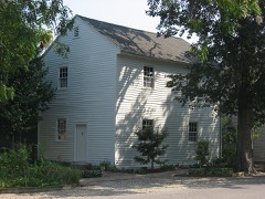 | Ludwig Epple House | under 500 feet | 1984 |
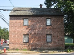 | Mattias Scholle House | under 500 feet | 1981 |
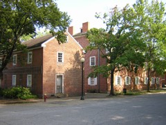 | New Harmony Historic District | under 500 feet | 1966 |
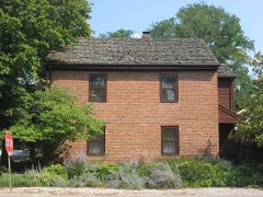 | George Bentel House | 0.1 miles | 1984 |
 | Amon Clarence Thomas House | 0.2 miles | 1995 |
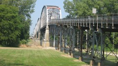 | Harmony Way Bridge | 0.6 miles | 2007 |
| National Archives record | The nomination case file for reference 00000669 in Record Group 79. |
| Posey County | All 14 listed properties in this county. |