 Block
From the record
14 National Register listings published here, 1 of them a National Historic Landmark.
Sources: the county history on the Internet Archive · the National Register database, National Park Service
107 topographic sheets cover 34 settlements here, and 14 properties are on the National Register of Historic Places.
14 National Register listings published here, 1 of them a National Historic Landmark.
Sources: the county history on the Internet Archive · the National Register database, National Park Service
Every property in this county listed on the National Register of Historic Places, with the year it was listed and the federal nomination document.
| Photograph | Property | Type | Listed | Reference |
|---|---|---|---|---|
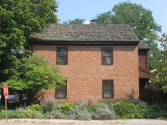 | George Bentel House | building | 1984 | 84001224 |
 | Bozeman-Waters National Bank | building | 1987 | 87001768 |
 | James Elliott Farm | building | 2003 | 03001312 |
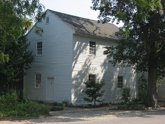 | Ludwig Epple House | building | 1984 | 84001227 |
 | William Gonnerman House | building | 1985 | 85003192 |
 | Frederick and Augusta Hagemann Farm | building | 1993 | 93000180 |
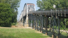 | Harmony Way Bridge | structure | 2007 | 07001030 |
| Mount Vernon Downtown Historic District | district | 2003 | 03000545 | |
| New Harmony Historic District | district | 2000 | 00000669 | |
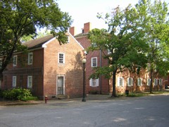 | New Harmony Historic District | district | 1966 | 66000006 |
 | Posey County Courthouse Square | building | 1989 | 88003042 |
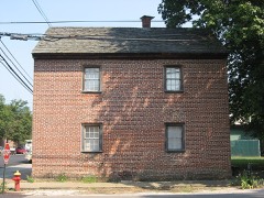 | Mattias Scholle House | building | 1981 | 81000007 |
 | Amon Clarence Thomas House | district | 1995 | 95001111 |
 | Welborn Historic District | district | 1992 | 92000188 |
Every wildfire the federal occurrence database records inside this county: 3 of them, burning about 11 acres. None started naturally and none was recorded as arson. Each settlement page carries the fires within five miles of it.
| Reported cause | Fires |
|---|---|
| Debris and open burning | 2 |
| Recreation and ceremony | 1 |
The five largest, by the area the report gives. None of them was recorded as arson.
| Date | Cause | Size | Reported by | Name on the report |
|---|---|---|---|---|
| 27 February 2004 | Debris and open burning | 10 acres | Indiana State Fire Marshal's Office | not named |
| 29 February 2004 | Debris and open burning | 1.0 acres | Indiana State Fire Marshal's Office | not named |
| 13 December 2003 | Recreation and ceremony | under an acre | Indiana State Fire Marshal's Office | not named |
Every settlement page carries the fires within five miles of it - see the settlement index below.
The NOAA Storm Events Database holds 441 reports for this county, causing 2 deaths, 4 injuries and about $9,855,000 in recorded property damage. Each settlement page carries the reports that name it.
| Kind of event | Reports |
|---|---|
| Flood | 169 |
| Thunderstorm Wind | 119 |
| Hail | 80 |
| Flash Flood | 32 |
| Tornado | 23 |
| Heavy Rain | 10 |
| Funnel Cloud | 8 |
The most serious of them, by death, then injury, then recorded damage. The accounts are quoted exactly as the forecast office filed them.
| When | Event | Place named | Harm | What the report says |
|---|---|---|---|---|
| January 2008 | Tornado (EF2) | Stewartsville | 2 killed, $200,000 | A mobile home was destroyed. Two occupants of the mobile home were killed. Numerous trees were uprooted. One barn was destroyed, along with some small sheds. Four barns, three houses, and one church were damaged. The damage was mostly to roofs. Peak winds were estimated near 120 mph. The average path width was estimated to be 80 yards. The tornado continued into extreme southern Gibson County. |
| August 2000 | Thunderstorm Wind | Poseyville | 2 hurt, $80,000 | A mobile home was rolled over several times by thunderstorm winds. The occupants received minor injuries. Numerous trees were down across the northern half of Posey County. An unofficial wind gust to 94 MPH was recorded at the North Posey High School, where the roof of the gymnasium and ag room were damaged. Light poles were snapped off around the school's baseball fields. Two grain bins just east of the school were destroyed, and a tool shed was blown over. Wind toppled a tree that landed on a house. |
| April 2011 | Thunderstorm Wind | Griffin | 1 hurt, $750,000 | A machine shed was unroofed at exit 12 along Interstate 64. A tractor-trailer rig was blown off Interstate 64. The driver was slightly injured. At least a half dozen grain bins were destroyed, and at least a half dozen house roofs sustained moderate to major damage. Dozens of houses received minor roof damage. Several farms in the Griffin area sustained damage. Trees, barns, and sheds were blown down. Three mobile homes were destroyed in the Wadesville area. A few farm buildings were destroyed in the New Harmony area. |
| September 2002 | Tornado (F2) | Wadesville | 1 hurt, $500,000 | The tornado destroyed 10 mobile homes and four buildings. The greatest concentration of damage was on Highway 165 about 2 miles south of Poseyville. Peak winds were estimated around 130 MPH. Among the destroyed structures was a county highway garage. Eight vehicles were tossed, including a small van that was thrown onto a debris pile. One person was treated for a cut. |
| April 2002 | Hail | Bufkin | $2,000,000 | A hailstorm with stones up to golf ball size passed directly over Mount Vernon. At least 200 homes were damaged by the hail, and several hundred vehicles were damaged. |
| July 2024 | Tornado (EF3) | Mt Vernon Arpt | $1,100,000 | The long track cell entering from Northwest Kentucky produced its first Southwest Indiana tornado on the afternoon of July 9th with an EF-3 tornado. Tree debris and crops flattened in a convergent pattern occurred north of Port Rd, just south of the Kenco facility. The tornado intensified quickly with the Kenco facility the EF-3 damage point, undergoing removal of roughly half the roof and the collapse of several large segments of outer walls. The tornado continued northward, overturning semi trailers and train cars near Old Hwy 62. A manufactured home had its roof blown off and walls collapse near Seibert Ln. Damage to roofs of homes and farm buildings occurred on Nation Rd just west of Breeze Rd. Primarily tree damage occurred for the remainder of the path, while a shed door was pushed in on Copperline Rd. The tornado lifted north of Johnson Rd. Peak estimated winds for this tornado were 140 mph. |
| February 2017 | Tornado (EF2) | Griffin | $500,000 | This long-track tornado continued from White County, Illinois across the Wabash River into Posey County. The tornado was rated EF-2 throughout its path in Posey County. The tornado was about 220 yards wide when it crossed the Wabash River to Indiana Highway 69. Several small barns were destroyed, and most trees were snapped along the path. Power poles were snapped, and roads were blocked by debris. The Posey County portion of the path was almost entirely through agricultural land, resulting in damage to very few residences. The tornado crossed Interstate 64 west of Poseyville, leaving a path of flattened trees across the interstate. Just before the tornado crossed into Gibson County, an old house was shifted off its foundation. The tornado again strengthened to EF-3 intensity after crossing into Gibson County. |
| March 2012 | Tornado (EF2) | Springfield | $500,000 | The tornado began 4.5 miles west southwest of Wadesville and ended 0.6 miles east northeast of Blairsville. The tornado destroyed 1 wood frame house and moderately damaged several others. Several equipment sheds or garages were damaged or destroyed. Several grain bins were destroyed. Over 100 trees were snapped or uprooted. The tornado, which was observed by numerous individuals including storm spotters, had peak winds near 125 mph. |
| May 1996 | Flash Flood | Poseyville | $500,000 | no account filed |
| May 2011 | Flood | Mt Vernon | $300,000 | Moderate flooding continued on the Ohio River from April. At the Mount Vernon river gage, the river crested at 51.80 feet on May 5. This was the 3rd highest crest on record, and almost two feet above the 1997 flood. Miles of farmland were submerged by the Ohio River, especially near the confluence of the flooded Wabash River. |
| April 1996 | Flash Flood | Poseyville | $300,000 | no account filed |
| June 2018 | Thunderstorm Wind | Griffin | $275,000 | A microburst produced a long swath of damaging winds across far northern Posey County. The swath was as much as two miles wide in places. Several corn fields were blown down, with the stalks broken in some areas. Hundreds of trees were broken or uprooted, and several power lines were down. Widespread tree damage occurred along Interstate 64 near the Black River rest area. Some small sheds and signs were damaged. The 25-mile long microburst continued across southern Gibson County, where it became more intense and damaging. |
| April 2024 | Tornado (EF2) | New Harmony | $250,000 | An EF-2 occurred in Central Posey County, IN, early morning on April 2nd. The path started just east of IN-69, resulting in tree and powerline damage as it moved southeastward towards Harmony Township Rd. Large portions of a roof were blown off a home on Harmony Township Rd, while a roof and several walls were blown off of a barn on Williams Rd. The tornado continued to track southeastward, eventually merging with another tornado west-southwest of Blairsville. North of Parkers Settlement, the tornado destroyed a barn on IN-66 and threw a garage roof south and east at Rexing Rd. The tornado lifted just north of Parkers Settlement, after which straight-line wind damage continued into Vanderburgh County on the north side of Evansville. In total, hundreds of trees were snapped or uprooted, dozens of outbuildings were damaged or destroyed, and minor to moderate damage occurred to several homes. Estimated peak winds with this tornado were 115 mph. |
| March 2008 | Flood | Griffin | $250,000 | A number of structures throughout the county were damaged by flooding. A subdivision off Indiana Highway 62 was flooded. Flooding of Big Creek raised water to the eaves of structures of an historic village off Indiana 69. The village is an attraction that consists of recreated historic buildings. Numerous roads were closed. Five motorists were rescued from flooded roads. Schools were closed. The county declared a State of Emergency. |
| May 2011 | Flood | New Harmony | $200,000 | Major flooding continued on the Wabash River from April. At the New Harmony river gage, the river crested at 23.67 feet on May 4. This level was the fourth highest crest on record, exceeding the 2005 flood by about six inches. This was the highest level since 1943. The National Guard assisted with sandbagging efforts along the Wabash River in the New Harmony area. Miles of farmland were flooded near the confluence of the Wabash and Ohio Rivers, both of which were well above flood stage. A number of lowland residents were evacuated. Many roads were closed. Some communities were accessible by boat only. |
| April 2024 | Tornado (EF2) | Wadesville | $150,000 | An EF-2 tornado struck far eastern portions of Posey County, IN, in the St. Wendel area. This tornado began by damaging an outbuilding on Spahn Rd. Significant roof damage occurred to a home on Will Rd, with several homes losing their entire roof on Saint Wendel Cynthiana Rd. The tornado crossed over to Vanderburgh County north of St. Wendel continuing all the way through Vanderburgh into Warrick County. Peak estimated wind gusts with this tornado as a whole and in Posey County were 120 mph. |
| April 2011 | Thunderstorm Wind | Mt Vernon | $150,000 | In the Mount Vernon area, several houses received moderate to major roof damage. At least a dozen others received minor roof damage. A mobile home was moved off its foundation, and another mobile home lost its entire roof. Several large trees were blown down in the city limits. |
| April 2024 | Tornado (EF2) | Savah | $130,000 | An EF-2 tornado struck western Posey County, IN, during the early morning hours of April 2nd. This tornado began in far eastern White County, IL, before proceeding to cross the Wabash River into Posey County. The tornado crossed through Harmonie State Park causing significant tree damage. The tornado tracked to the south-southeast, crossing IN-69 near Lynn with several pine trees snapped at the base. Additional tree damage occurred on Harmony Springfield Rd and Springfield Rd, the latter of which also had an outbuilding collapse. The tornado crossed Oliver Rd and Wade Rd, destroying multiple outbuildings and a grain bin while damaging a roof on Oliver Rd. The tornado track shifts northeastward, eventually merging with another tornado west-southwest of the town of Blairsville. In total, hundreds of trees were uprooted or snapped, several outbuildings/sheds were damaged or destroyed, and minor to moderate roof damage occurred to several homes. Estimated peak wind speeds for the tornado as a whole, and in the Posey County segment, are 115 mph. |
| April 2024 | Thunderstorm Wind | Grafton | $110,000 | A microburst with winds of 70-90 mph produced widespread tree damage and some minor damage to a few homes and outbuildings across Posey County, Indiana, north of Mount Vernon, on the morning of April 2, 2024. The damage was mainly east of Lower New Harmony Road and west of the town of Caborn. The damage was primarily south of Copperline Road and north of Nation Road. The microburst path length was approximately 8 miles and path width was approximately 2 miles. |
| July 2020 | Tornado (EF1) | Lippe | $80,000 | The tornado damage was mainly to trees and power lines. A couple houses lost some shingles and fascia. At least one vehicle was damaged by a fallen tree. Corn was blown down in a strongly convergent pattern. There was a strong cross-wind component to the snapped and uprooted trees. Estimated maximum wind speeds were near 95 mph. Survey findings were compiled from drone footage and data provided by the Evansville-Vanderburgh and Posey County emergency management agencies in conjunction with NWS data. The tornado path continued into Vanderburgh County. |
| April 2024 | Thunderstorm Wind | Parkers Settlement | $75,000 | A macroburst began in eastern portions of Central Posey county at Parkers Settlement, progressing eastward into Vanderburgh County. In Parkers Settlement, a roof collapsed on an outbuilding, roofing damage occurred at a home, and many trees were uprooted or snapped. This macroburst began downstream of a tornado track that ended just north of Parkers Settlement. The Posey County portion of the macroburst had a length of three-quarters of a mile and a path width of almost one mile. The survey was completed in partnership with Vanderburgh County Emergency Management Agency. |
| April 2024 | Thunderstorm Wind | Savah | $75,000 | Downburst winds destroyed barns and sheds near Savah. |
| August 2016 | Flash Flood | Mt Vernon | $75,000 | Flash flooding of several streets was reported in town. One water rescue was conducted on a flooded county road. The Mount Vernon community center sustained water damage from flooding. At Mount Vernon High School, major flooding submerged vehicles in the parking lot up to the steering wheel. Water was pumped out of at least one flooded building at the high school. Two trained spotters located on the north and northeast sides of town measured 4.18 and 4.23 inches, respectively, in just over an hour. |
| March 2011 | Flood | Mt Vernon | $70,000 | no account filed |
| June 2009 | Thunderstorm Wind | Mt Vernon | $60,000 | A wind gust to 61 mph was measured. A pole barn was destroyed. Trees were blown down. Some of the downed trees landed on power lines, knocking out power for several hours. |
| March 2018 | Flood | Mt Vernon | $50,000 | Moderate flooding continued on the Ohio River from late February. At the Mt. Vernon river gage, the river crested at 49 feet on the 4th. Flood stage is 35 feet. This crest was exactly one foot below the flood of March, 1997. There was considerable flooding of low-lying farmland. County roads were underwater. The riverfront park at Mount Vernon was inundated. |
| March 2012 | Hail | Wilson | $50,000 | Tennis ball size hail was reported just north of Wadesville. |
| March 2012 | Thunderstorm Wind | Blairsville | $50,000 | The roof was blown off a 2 story home. |
| April 2010 | Thunderstorm Wind | Farmersville | $50,000 | The roof was blown off the gym at the Farmersville elementary school. The roof was blown about 100 yards away. Water damage occurred due to heavy rain that poured into the building. An electronic weather station at the school measured a wind gust to 71 mph. |
| January 2008 | Thunderstorm Wind | New Harmony | $50,000 | Winds were estimated around 60 mph by an amateur radio operator in Poseyville. Around the county, at least 22 homes received some type of damage. Most of the damage was to roofs. Just south of New Harmony, a semi was blown over. |
| March 2006 | Flash Flood | Countywide | $50,000 | Major flooding was reported. Some roads were damaged. |
| February 1999 | Thunderstorm Wind | Poseyville | $50,000 | A trailer was blown over, and a barn was blown down. |
| May 2011 | Tornado (EF2) | Cynthiana | $40,000 | The tornado started north of St. Wendell, where trees were damaged along with a machine shed. As it moved across Highway 65, high-tension power lines were taken down. Peak winds were estimated near 125 mph. The tornado continued moving northeast into Vanderburgh County. |
| October 2014 | Tornado (EF1) | New Harmony | $30,000 | The damage path was through farmland with patches of woods. The damage path started at a farmhouse about two miles southeast of New Harmony, where a large tree was snapped and another large tree was uprooted. A tin roof was blown off a barn. The path was mostly through corn and soybean fields for the first couple miles. The strongest winds occurred near the end of the damage path, in a heavily wooded area about one-half mile southeast of the intersection of Highways 68 and 69. Numerous large trees were snapped in this area. Peak winds were estimated near 100 mph. The tornado path apparently ended on Highway 68 about 2.5 miles northeast of New Harmony, where a tree and some limbs were blown onto the road. |
| June 2009 | Thunderstorm Wind | Griffin | $30,000 | A couple of homes were damaged by falling trees, along with a couple of pickup trucks. |
| May 2004 | Thunderstorm Wind | Cynthiana | $30,000 | A 50-by-75 foot pole barn was destroyed. |
| July 2004 | Thunderstorm Wind | Stewartsville | $30,000 | Wind gusts were estimated to at least 70 MPH by a spotter and an emergency manager. Numerous trees were blown down in Griffin and Stewartsville, some of which landed on houses, cars, and roadways. |
| July 2000 | Thunderstorm Wind | Countywide | $30,000 | Numerous trees were blown down, including some on houses. The storms that produced this damage moved southeast from White County, Illinois. |
| May 2011 | Flood | New Harmony | $30,000 | no account filed |
| August 2019 | Thunderstorm Wind | Mt Vernon | $25,000 | Multiple large tree limbs were down, shingles were torn from roofs, and a 16-foot utility trailer was moved two feet. |
| March 2006 | Thunderstorm Wind | Mt Vernon | $25,000 | A roof was blown off a home. Numerous trees and power lines were down. Pillars were blown off a home. Power poles were down in Mount Vernon. |
| May 2004 | Flash Flood | New Harmony | $25,000 | no account filed |
| May 1989 | Tornado (F1) | not stated | $25,000 | no account filed |
| April 1971 | Tornado (F1) | not stated | $25,000 | no account filed |
| March 2018 | Flood | Savah | $20,000 | Moderate flooding continued on the Wabash River from late February. At the New Harmony river gage, the river crested at 21.21 feet on March 4th. Flood stage there is 15 feet. Floodwaters encroached on parts of northern New Harmony, requiring sandbagging in town. Harmonie State Park was partially inundated and closed. Some stripper oil wells were flooded along the river from New Harmony south. The river was three miles wide at Interstate 64. Considerable flooding of bottomland agricultural land occurred. Some rural county roads were impacted. |
| April 2018 | Flood | Griffin | $20,000 | Moderate flooding continued on the Wabash River from late March. At the New Harmony river gage, the river crested at 20.68 feet on April 11th. Flood stage there is 15 feet. Flooding of farmland was extensive, and farmers were forced to delay the planting of crops. Corn is normally planted by mid May. Floodwaters encroached on parts of northern New Harmony, requiring sandbagging in town. Harmonie State Park was partially inundated and closed. Some stripper oil wells were flooded along the river from New Harmony south. The river was three miles wide at Interstate 64. Considerable flooding of bottomland agricultural land occurred. Some rural county roads were impacted. |
| June 2018 | Thunderstorm Wind | Mt Vernon | $20,000 | Numerous trees and power lines were down. Isolated power outages were reported. |
| May 2014 | Thunderstorm Wind | Bufkin | $20,000 | A house roof was damaged. There was considerable loss of shingles and minor damage to the decking. A patio roof was blown away. Tree limbs were blown down. |
| May 2011 | Thunderstorm Wind | Mt Vernon | $20,000 | Trees were blown down. Wind gusts were measured to 91 mph. |
| July 2006 | Thunderstorm Wind | Countywide | $20,000 | Trees and power lines were blown down countywide. At an elementary school in Farmersville, half the roof of a temporary classroom was torn off. Debris hit the school's main building, cutting several holes in the roof. Several classrooms and hallways were flooded. |
| July 2004 | Thunderstorm Wind | Countywide | $20,000 | A trained spotter measured a wind gust to 58 MPH in Wadesville, where utility poles were snapped. There was minor structural damage to several homes in Marrs Township, which is in the southeast corner of the county. Two roofs were damaged in Marrs Township, and several utility poles were snapped. A large tree fell across Indiana Highway 68 west of Poseyville, blocking the roadway. Trees and power lines were down in Poseyville. |
| August 2022 | Flash Flood | New Harmony | $15,000 | Half a foot of water was over the road near Springfield Road and Williams Road, six miles southeast of New Harmony. Half a foot of water was over Highway 66 and Goodman Road, five miles east of New Harmony. Seven miles northeast of Mt. Vernon, a water rescue was conducted on Caborn Road. |
| April 2017 | Flood | New Harmony | $15,000 | Following the flash flooding that occurred during the early morning hours, flooding of some roads lingered into the early afternoon hours. A water rescue was conducted near the intersection of Highways 66 and 69 near New Harmony, where the road was closed. A house basement wall collapsed a couple miles east of New Harmony. |
| September 2012 | Thunderstorm Wind | Poseyville | $15,000 | Minor roof damage occurred to three homes. Several trees were down on power lines, and power lines were down. |
| September 2000 | Thunderstorm Wind | New Harmony | $15,000 | Numerous trees were blown down in New Harmony. Trees and power lines were down in Wadesville. |
| February 2019 | Flood | New Harmony | $10,000 | Moderate flooding occurred on the Wabash River. At the New Harmony, IN river gage, the river crested at 20.41 feet on the 16th. Flood stage is 15 feet. Considerable flooding of low ground occurred, but most of the low ground was dormant agricultural fields. Some county roads were flooded. Water encroached on parts of northern New Harmony, and Harmonie State Park was closed. Some stripper oil wells were flooded along the river from New Harmony to Mt. Vernon Indiana. |
| June 2019 | Thunderstorm Wind | New Harmony | $10,000 | A barn was damaged and power lines were down. |
| May 2017 | Flood | New Harmony | $10,000 | Moderate flooding occurred along the Wabash River. At the New Harmony river gage, the river crested at 21.68 feet on the 12th. Flood stage is 15 feet. Floodwaters encroached on the northern and western edges of New Harmony. A few dead-end city streets that access the river bottomlands were flooded and closed. Harmonie State Park was closed. Some stripper oil wells were flooded along the river. Floodwaters extended nearly to Indiana Route 69 north of Route 68. |
| January 2016 | Flood | Griffin | $10,000 | Moderate flooding of the Wabash River continued into January. At the New Harmony river gage, the river crested at 20.69 feet on the 7th. Flood stage there is 15 feet. There was considerable flooding of low-lying woods and fields near the river. A few secondary roads were flooded. Parts of northern New Harmony began to flood, and sandbagging became necessary in town. Harmonie State Park was closed. |
| December 2013 | Flood | New Harmony | $10,000 | Minor flooding occurred along the Wabash River. Low-lying woods and fields near the river were underwater. Some stripper oil wells near the river were flooded. |
The Survey's mineral resources record lists 3 workings inside this county. 2 still produce and 1 is closed or unrecorded. Each settlement page carries the workings within five miles of it.
| Commodity | Workings |
|---|---|
| Sand and Gravel, Construction | 2 |
| Stone | 1 |
The least common of them first, because a county's hundredth gravel pit says nothing its first ten did not.
| Where | Site | Commodity | Status | Recorded |
|---|---|---|---|---|
| Posey Co. Hwy. Dept. | Stone | Producer | ||
| Compton Pit & Dredge | Sand and Gravel, Construction | Producer | ||
| Mcdonald Sand & Gravel | Sand and Gravel, Construction | Past Producer |
History of Posey County, Indiana devotes a chapter to each township: its boundaries and streams, who settled it and when, the mills, the schools and the churches. All 9 are reproduced here in full. Each row shows the township's own shape and where it lies in the county, drawn from the Census Bureau's boundary. Which settlements belong to which township is computed from that same boundary, not taken from the book.
| Shape and position in the county | Township | Settlements in it | Length | Sections |
|---|---|---|---|---|
| Bethel Township | Griffin, New Baltimore | 3,149 words | 4 | |
| Black Township | Bufkin, Dead Mans Crossing, Erwin, Farmersville, Grafton, Hovey, Mount Vernon, Prairie, Upton, Welborn Switch | 35,592 words | 10 | |
| Center Township | Hepburn, Oliver, Wadesville | 124 words | 0 | |
| Harmony Township | New Harmony, Rapture | 13,814 words | 2 | |
| Lynn Township | Savah, Solitude, Springfield | 19,483 words | 12 | |
| Point Township | Oak Grove | 1,878 words | 3 | |
| Robb Township | Barrett, Poseyville, Stewartsville | 14,233 words | 3 | |
| Robinson Township | Blairsville, Lippe, Parkers Settlement | 1,541 words | 0 | |
| Smith Township | Cynthiana | 465 words | 0 |
3 books written about this county, cut here where the book itself is cut, at its printed chapters: 21 chapters in all. Every chapter is public domain, machine-read from the scan and reproduced complete. A chapter already given under one of the county's towns is not repeated in this list.
| Chapter | Length |
|---|---|
| Chapter 1: Aborigines | 11,611 words |
| Chapter 2: Geology and Topography | 2,377 words |
| Chapter 3: Early Settlements | 8,763 words |
| Chapter 4: Organization of County | 3,568 words |
| Chapter 6: Founding of Cities and Towns | 15,469 words |
| Chapter 7: Public Schools | 4,231 words |
| Chapter 8: Churches | 6,480 words |
| Chapter 9: The Bench and Bar | 5,577 words |
| Chapter 10: The Medical Profession | 10,987 words |
| Chapter 11: Agriculture and Horticulture | 2,345 words |
| Chapter 12: Transportation Facilities - Navigation and | 775 words |
| Chapter 13: Manufacturing and Commercial Enterprises | 2,760 words |
| Chapter 14: Banks and Banking | 1,742 words |
| Chapter 15: Newspapers | 1,542 words |
| Chapter 16: Military History | 5,059 words |
| Biographical sketches | 94,497 words in 7 parts |
| Chapter | Length |
|---|---|
| The whole text | 25,365 words in 2 parts |
Named settlements recorded in the Geographic Names Information System, each with the topographic sheets covering it. Villages, hamlets and abandoned places alike. Each is shown with the nearest named watercourse or landform and the survey quadrangle it falls on.
Black township · 47620 · On McFadden Creek · Mount Vernon quadrangle
19 sheets, 1917 to 1991
Bethel township · 47616 · On Black River · New Harmony quadrangle
21 sheets, 1903 to 1986
Harmony township · 47631 · On Harmony Creek · New Harmony quadrangle
21 sheets, 1903 to 1986
Point township · 47620 · On Levy Slough · Wabash Island quadrangle
23 sheets, 1905 to 1987