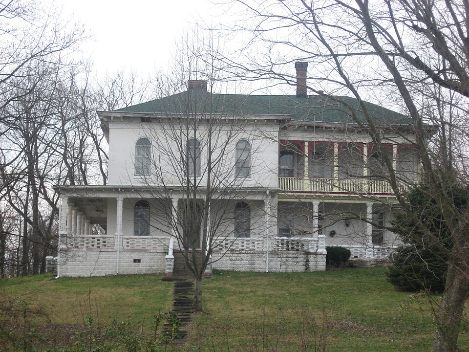
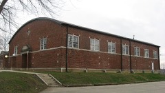
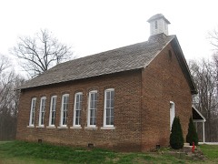
Listed on the National Register of Historic Places in 2000.
From the record
“Franklin Landers-Black and Adams Farm, also known as Mt. Aetna Stock Farm, is a historic home and dairy farm located in Brooklyn and Clay Township, Morgan County, Indiana.”
Wikipedia article Franklin Landers-Black and Adams Farm, CC BY-SA 4.0.
One of 27 National Register listings published here for Morgan County · listed in 2000 · category: Building.
National Register reference number.00001142- the number the National Park Service assigned this property when it was listed, and the key its nomination file is catalogued under at the National Archives.
So far as can be learned, the first improvement made by white men in the township of Clay was the corn-cracker erected on the creek at Brooklyn, in the summer of 1819, by Bfenjamin Cuthbert. The structure was built of logs, was about 18x18 feet, and was operating when Benjamin Barnes came to the township in December, 1819. The stones were "nigger-heads" which had been made from granite bowlders by Mr. Cuthbert, and the dam was built of brush, logs, stones, etc. Mr. Cuthbert lived northward in Brown Township, about two miles above the mill. He would go down to his liitle iqill -and remain there* nearty a week without going home, doing in tlje meantime the most of his own cooking in the fire-place in the mill. It is said-- that he could bake an excellent johnny-cake, and was an expert at roasting meat. He no doubt lived on the fat of the land. All the settlers throughout the northern part of the county went to his mill for their meal, and all complained of the '-grit" contained in the corn-bread baked therefrom. As this bread was the chief article of diet, the complaints from the women, especially, multiplied. Mrs. Barnes was probably the only exception to this statement. She had ato impediment in her speech which limited her conversation to the merest monosyllables. Mr. Barnes was envied as the luckiest man in his domestic relations in all the surrounding country.
In 1823, Jonathan Lyon, who had, in 1820, purchased quite a tract of land at what is now Brooklyn, came to the township, secured the old mill of Mr. Cuthbert, greatly improved it and the dam, built a saw mill on the opposite side, and soon afterward built a storehouse, in which he placed a stock of goods worth about $2,000. It is likely that the goods were not brought on until 1824. Mr. Lyon had several grown sons, who managed the mills and the store for him, while he remained the most of the time at his home in another portion of the State. In 1825, or possibly 1826, Mr. Lyon erected a distillery and a tannery, and paid James S. Kelley $600 to conduct them both for a few years, at the end of which time they were to be returned to the owner, Mr. Lyon. The profits as well as the expenses of the enterprises were to be borne by the owner. Mr. Lyon also started a battery soon afterward. The store, the distillery, the tannery, the battery, the grist mill and the saw mill were conducted successfully by Mr. Kelley, the Lyon boys and considerable hired help until about the year 1830, when Mr. Kelly's contract with Mr. Lyon expired, and the former went to Mooresville and engaged in the mercantile pursuit. The sons of Mr. Lyon continued the enterprises. Early in the thirties, in addition to the other pursuits, pork-packing was commenced, and was carried on for many years quite extensively. These industries served to make the place one of the most important industrial points in ithe county. Of course, no town had yet been started there. Late in the forties, the Lyons sold out their interests or abandoned them. Long before this, however, or about 1835, they had built a steam distillery, which took the place of the one first built, and had a much greater capacity. Probably as high as 100 barrels of whisky were manufactured annually, a considerable portion of which found a ready sale at home, the remainder being shipped to distant points. This distillery was destroyed by fire about the year 1843, and thereby hangs a tale which the old settlers may tell. Ask them.
Regional context, not property-specific
evidence. The federal mineral resources record lists
13 workings within 5 miles of Landers, Franklin-Black and Adams Farm: 7 producers, 5 past producers, 1 plant.
8 still produce. What was taken out: Sand and Gravel, Construction, Clay, Fire Clay (Refractory), Flagstone. Distance is straight-line from the
map coordinates, so a quarry counted here may appear on a neighbouring
settlement's page as well.
Regional context, not property-specific
evidence. The National Weather Service names
Brooklyn, the town this property stands in, in 3 storm reports between 1996 and 2003: 2 thunderstorm wind, 1 lightning.
No death or injury is recorded in these reports. Each account below is quoted exactly as the forecast office
filed it, from the NOAA Storm Events Database, and each date
opens the federal record of that event.
No historic map-sheet match is published
for this property yet. That does not mean no map exists. This record needs
a coordinate-quality review before it can be joined to a sheet boundary.
Browse the county's mapped places while that work is
pending.
Listed places nearby
6 within 8 miles
Other National Register properties close
enough to walk or drive between, ordered by distance from this one. Both
positions come from the same geocoding pass that matched these properties
to their map sheets.
Listing record. National Park Service National Register of Historic Places, listed-properties dataset, current to 2026-05-22.
Map join. Address geocoded through the United States Census geocoder, then tested against the published boundary of every sheet in the USGS Historical Topographic Map Collection.
How this page is made. Listing fields come from federal records; map-sheet coverage is a labelled coordinate-to-boundary calculation, not a source-field claim.
Mines and quarries. USGS Mineral Resources Data System (MRDS) https://mrdata.usgs.gov/mrds/ A work of the United States government, no copyright under 17 U.S.C. 105.
Storms. NOAA National Centers for Environmental Information, Storm Events Database https://www.ncei.noaa.gov/stormevents/ A work of the United States government, no copyright under 17 U.S.C. 105. Narratives are quoted verbatim from the National Weather Service report and are not edited or summarised.
 Block