BlockBefore
Photograph of Adams County Courthouse
Photograph by Derek Jensen ( Tysto ), Public domain. Via Wikimedia Commons.

Adams County Courthouse

Built in 1873 (Second Empire style). Listed on the National Register of Historic Places in 2008.

From the record

“Adams County Courthouse is located in the city of Decatur, the county seat of Adams County, Indiana. It was built in 1872-1873 at a cost of $78,979.”

Wikipedia article Adams County Courthouse (Indiana), CC BY-SA 4.0.

One of 10 National Register listings published here for Adams County · listed in 2008 · category: Building · built in 1873, Second Empire style.

Sources: the Wikipedia article · the case file at the National Archives · the National Register database, National Park Service

The listing

  • What is counted as historic. The nomination lists 3 objectss, 1 building as contributing to the listing.
  • Address. 112 S. Second St., Decatur, 46733
  • When was it listed? September 2008
  • Category. building
  • Township. Washington township
  • When was it built? 1873
  • Architectural style. Second Empire style
  • National Register reference number. 08000914 - the number the National Park Service assigned this property when it was listed, and the key its nomination file is catalogued under at the National Archives.

The ground it stands on

975 words

The chapter on Washington Township in Snow's History of Adams County, Indiana, published 1907 names Decatur. This is what it says, exactly as the scans read.

Washington township contains the county seat and much of its history is closely related with that of Decatur, which should be examined in this connection. This township was organized in 1838. Outside of the town of Decatur there were several churches, mills and schools that were of much importance to the country residents. The town of Decatur was under the control of the township authorities until its incorporation in 1854. This township had its settlements as: The Andrews settlement, the Coffee neighborhood, Eli Zimmerman's corner and so on. The old Winchester road ran a mile from the west side of the township and was the principal road traveled to the south part of the county. Some of the earliest residents were: James Niblick, Eli Zimmerman, Bazil Hendricks, Charles Scherriiyer, Daniel Coffee, Jacob Christ, Thomas W. Andrews, Andrew Luekey and Wesley Merryman. What is now known as the

Passage source: Snow's History of Adams County, Indiana, published 1907.

Washington church was among the first built in the township outside of Decatur. This church is located at the northwest corner of section 20 and was built by the Methodist congregation about 1855. It has been remodeled a number of times, but is still in use. In 1883 the Saint Paul's church was built at the corner of section 24, on the east stone road. This is a frame structure and is used by several church organizations. The only brick church in the township outside cf Decatur is what is known as the Beery church, situated at the southwest corner of section 6. This building was erected in 1 886 by the Brethren in Christ denomination. This church is on the west line of the township and a mile east of Peterson. Among the early school buildings were the Johnson school, southeast of Decatur, in section 14; the Coffee school house was later built on the mud pike road, just west of this. The Stultz school house was in the southeast corner of the township and was superseded by a small frame called the Brandyberry school house, in section 25. The Washington school house was among the first country school houses built in the township. It. was just a few rods from where the church of the same name was built. The first teacher in this log structure is said to have been Margaret A. Allen, who taught in 1S46. In 1880 there was a graded school building two stories in height built in this district, but the. graded work was discontinued after a few terms. This building was torn down in 1904 and a new and modern structure put up to take its place. The first brick house erected in this township was that of Samuel L. Rugg, in Decatur. The first country brick residence was the Studabaker homestead, which was built about 1873. The largest brick country residence in this township, and one of the most modern and tasty in the county, is that of Clark J. Lutz, in section II, southeast of Decatur. In his dreams the fortune hunter delights to think of buried treasure. The gold - that shining gold which men have toiled and slaved their lives away to save for some one else to spend. An old resident tells us that just after the sale of the Rivare Reservation by the Indian owners in 1826 that a band of Indians came down the Saint Mary's river and camped at an Indian village on what is now known as Numbers creek. The treasurer of the tribe, an old chief, was intrusted with the safe keeping of the money. He went up the creek a short distance and secreted it near a crooked oak tree. Some time in the night he took violently sick and died before he could reveal the treasure. He said, however, that it was near a crooked oak tree. Diligent search failed to locate the gold. That as late of 1865 a band of five Indians searched the creek for the money but could never locate it. The locations were in Root township and section 4, in Washington township. Air. John Schurger now owns these lands and says that he really does not know how rich he may some day be, as he may plow this gold up almost any day. Anyone can locate the creek. Mr. Schurger says that he chopped the crooked oak down long ago, but who can find the buried gold ?

Passage source: Snow's History of Adams County, Indiana, published 1907.

Machine-read from a century-old scan, so expect the errors a machine makes: misspelled names, dropped words, stray characters.

Read the whole chapter on Washington Township - 975 words on its settlement, mills, schools and churches.

Mines and quarries near this property

4 within 5 miles

Regional context, not property-specific evidence. The federal mineral resources record lists 4 workings within 5 miles of Adams County Courthouse: 3 producers, 1 past producer. 3 still produce. What was taken out: Sand and Gravel, Construction, Stone, Clay. Distance is straight-line from the map coordinates, so a quarry counted here may appear on a neighbouring settlement's page as well.

Where SiteCommodity StatusRecorded
Decatur City Engr.StoneProducer
Krick-Tyndall PitClayPast Producer
Adams County Sand & Gravel PitSand and Gravel, ConstructionProducer
Cly Gravel CompanySand and Gravel, ConstructionProducer

Every working recorded in Adams County

Storms near this property

60 of 70 shown

Regional context, not property-specific evidence. The National Weather Service names Decatur, the town this property stands in, in 70 storm reports between 1997 and 2025: 36 thunderstorm wind, 28 hail, 2 lightning, 2 tornado. The reports record 1 injury. Each account below is quoted exactly as the forecast office filed it, from the NOAA Storm Events Database, and each date opens the federal record of that event.

WhenEvent Place namedHarm What the report says
July 2005LightningDecatur1 hurtA firefighter was outside his home watching the storms approach when he was struck by lightning. He was taken to the hospital for evaluation but was released a few hours later with no major injuries. The same lightning strike also affected an adjacent house. The energy form the lightning entered a house and traveled through a set of video game controllers being held by two boys. Each received a shock from the strike, but did not require medical treatment.
August 2006Tornado (F1)Decatur$125,000The tornado briefly touched down 2 miles east of Decatur, in the Briarwood subdivision, at the intersection of US 224 and CR 200 E. Part of a roof was ripped off, with a garage door being pulled out. A leaf was found sucked up under a piece of siding. The tornado crossed 200 E, damaging some trees, blowing a barn door in and flattening a small area of soy beans before lifting. The funnel moved across US 224 and touched down about a quarter mile from where it lifted. A parked car was flipped, totallin
August 1998Flash FloodDecatur$100,000NUMEROUS COUNTY ROADS ESPECIALLY ACROSS THE SOUTHERN HALF OF THE COUNTY WERE INUNDATED ALONG WITH LOW LYING AGRICULTURAL FARMLANDS.
July 1998LightningDecatur$50,000A DOUBLE WIDE TRAILER AT THE CALVARY WORSHIP CENTER BURNED TO THE GROUND DUE TO A LIGHTNING STRIKE.
April 2006Tornado (F1)Decatur$45,000A tornado touched down roughly 3 miles northwest of Decatur and moved southeast across mainly open fields. Eyewitness reports of debris at the ground but no immediate condensation funnel. The tornado moved over a farm just east of the intersection of county roads West 750 North and North 200 W. While no significant damage occurred, several buildings suffered minor damage including damage to doors and a roof of a barn, trees being uprooted, and structure damage to a refinished garage. A corncob was also found inside a mini van on the property, apparently being thrown by the tornado through the back window. The circulation ended as it move into a grove of trees, roughly 2 miles northwest of Decatur. The damage was consistent with a low end F1 tornado with winds of around 80 mph. No injuries or fatalities were reported. Damage to all property is estimated at around $45,000.
December 1998Thunderstorm WindDecatur$30,000GARAGE DESTROYED. EIGHT AMERICAN ELECTRIC POWER POLES WERE KNOCKED DOWN.
August 2001Thunderstorm WindDecatur$25,000The Quality Glass store at 12th Street and Nuttman Avenue had the top section of its roof torn off by a thunderstorm wind gust. Damage to the roof was estimated to be between $10,000 and $15,000. Debris from the roof was blown across 12th Street and onto a parked car and into two yards. A power pole behind the building was also damaged and had to be replaced.
November 2005Thunderstorm WindDecatur$20,000Numerous trees, as well as a barn were blown over.
June 2008Thunderstorm WindDecatur$15,000Amateur radio operators reported numerous trees and power lines down in the city of Decatur.
May 2000Thunderstorm WindDecatur$15,000A travel trailer overturned and two barns destroyed.
June 2008Thunderstorm WindDecatur$10,000County officials reported a tree branch down onto a power line with other power outages in the area.
August 2005Thunderstorm WindDecatur$10,000A large tree was blown down northwest of Decatur and a roof was blown off a building near the town of Monmouth.
November 1998Thunderstorm WindDecatur$10,000MANY TREES AND POWER LINES WERE DOWN ACROSS THE TOWN.
April 2025HailDecatur$1,000Quarter size hail in Decatur.
March 2024HailDecatur$1,000no account filed
July 1999Thunderstorm WindDecatur$500Trees downed.
June 2022Thunderstorm WindDecatur-Amateur radio operators reported multiple trees blown down.
July 2021FloodDecatur-The Indiana State Police reports high water over the road at W 600 N around N 100 W.
May 2019Thunderstorm WindDecatur-The public reported a one foot diameter trees was uprooted.
July 2017Thunderstorm WindDecatur-Trees were blown down in the area.
July 2017Thunderstorm WindDecatur-A trained spotter estimated wind gusts to 60 mph.
July 2016Thunderstorm WindDecatur-A trained spotter reported several healthy four to six inch tree limbs being blown down.
July 2016Thunderstorm WindDecatur-A trained spotter reported a 45 foot tall, two foot diameter tree was blown down. Other smaller branches were also downed in the area.
July 2016Thunderstorm WindDecatur-Emergency management officials reported several tree limbs down, some up to eight inches in diameter. An evergreen tree was also uprooted with tree limbs suffering damage at Belmont High School.
June 2014Thunderstorm WindDecatur-A tree was reported blown down one mile northwest of Decatur by emergency management officials.
July 2014Thunderstorm WindDecatur-Trained spotters reported several small to medium size branches down across the town.
November 2013HailDecatur-A trained spotter reported quarter size hail.
November 2013Thunderstorm WindDecatur-A trained spotter reported wind gusts of at least 60 mph.
September 2012Thunderstorm WindDecatur-Law enforcement officials reported a tree was blown down onto Winchester Road.
June 2012Thunderstorm WindDecatur-Emergency management officials reported massive damage throughout the northern part of the county with intermittent damage across the remainder of the county. In Decatur, roofs were blown off, trucks blown over and several small fires reported, likely from downed power lines.
August 2011HailDecatur-A trained spotter reported hail to the size of dimes lasted for about 5 minutes in downtown Decatur.
May 2011HailDecatur-A trained spotter reported tennis ball size hail at U.S. 224 and County Road 300 West.
June 2007Thunderstorm WindDecatur-Two trees, one of which was 12 inches in diameter, were blown down along with several small branches.
July 2005Thunderstorm WindDecatur-A few trees were blown down just north of Decatur.
May 2004Thunderstorm WindDecatur-Trained spotter estimated wind gusts to 60 MPH.
July 2003Thunderstorm WindDecatur-Law enforcement reported trees and power lines down west of Decatur.
September 2002Thunderstorm WindDecatur-Emergency management reported a shed was blown over.
November 2002Thunderstorm WindDecatur-A trained spotter reported numerous trees down just north of Decatur.
August 2001Thunderstorm WindDecatur-Numerous power lines down.
August 2001Thunderstorm WindDecatur-Trees and power lines blown down.
May 2000Thunderstorm WindDecatur-Trees down.
May 2000Thunderstorm WindDecatur-Trees down on power lines.
July 1998Thunderstorm WindDecatur-ROOF DAMAGE JUST WEST OF DECATUR.
July 2016HailDecatur-no account filed
May 2011HailDecatur-no account filed
May 2005HailDecatur-no account filed
May 2004HailDecatur-no account filed
April 2003HailDecatur-no account filed
July 2003HailDecatur-no account filed
May 2002HailDecatur-no account filed
June 2002HailDecatur-no account filed
May 2001HailDecatur-no account filed

Every storm recorded in Adams County

Map coverage status

No historic map-sheet match is published for this property yet. That does not mean no map exists. This record needs a coordinate-quality review before it can be joined to a sheet boundary. Browse the county's mapped places while that work is pending.

Listed places nearby

6 within 8 miles

Other National Register properties close enough to walk or drive between, ordered by distance from this one. Both positions come from the same geocoding pass that matched these properties to their map sheets.

Photograph PropertyDistance Listed
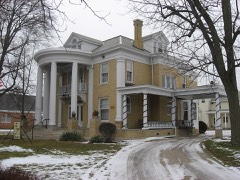
Charles Dugan House0.2 miles2009
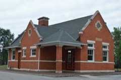
Grand Rapids and Indiana Railroad Depot0.3 miles2017
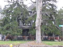
Bowers, John S. House0.3 miles1982
Decatur Homesteads1.1 miles2022
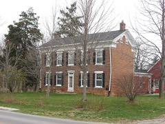
Lenhart Farmhouse1.2 miles2002
Ben Colter Polygonal Barn4.9 miles1993

Sources for this property

National Archives recordThe nomination case file for reference 08000914 in Record Group 79.
Wikipedia articleCommunity-written account of this property, licensed CC BY-SA.
Adams CountyAll 10 listed properties in this county.

Provenance

  • Listing record. National Park Service National Register of Historic Places, listed-properties dataset, current to 2026-05-22.
  • Map join. Address geocoded through the United States Census geocoder, then tested against the published boundary of every sheet in the USGS Historical Topographic Map Collection.
  • How this page is made. Listing fields come from federal records; map-sheet coverage is a labelled coordinate-to-boundary calculation, not a source-field claim.
  • Mines and quarries. USGS Mineral Resources Data System (MRDS) https://mrdata.usgs.gov/mrds/ A work of the United States government, no copyright under 17 U.S.C. 105.
  • Storms. NOAA National Centers for Environmental Information, Storm Events Database https://www.ncei.noaa.gov/stormevents/ A work of the United States government, no copyright under 17 U.S.C. 105. Narratives are quoted verbatim from the National Weather Service report and are not edited or summarised.