 Block
From the record
10 National Register listings published here.
Sources: the county history on the Internet Archive · the National Register database, National Park Service
37 topographic sheets cover 18 settlements here, and 10 properties are on the National Register of Historic Places.
10 National Register listings published here.
Sources: the county history on the Internet Archive · the National Register database, National Park Service
Every property in this county listed on the National Register of Historic Places, with the year it was listed and the federal nomination document.
| Photograph | Property | Type | Listed | Reference |
|---|---|---|---|---|
 | Adams County Courthouse | building | 2008 | 08000914 |
 | Bowers, John S. House | building | 1982 | 82000055 |
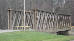 | Ceylon Covered Bridge | structure | 2007 | 06001289 |
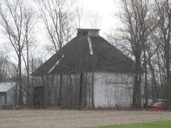 | Ben Colter Polygonal Barn | building | 1993 | 93000194 |
| Decatur Homesteads | district | 2022 | 100008407 | |
 | Charles Dugan House | building | 2009 | 09001124 |
 | Geneva Downtown Commercial Historic District | district | 2002 | 02000196 |
 | Grand Rapids and Indiana Railroad Depot | building | 2017 | 100000712 |
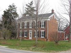 | Lenhart Farmhouse | building | 2002 | 02000688 |
 | Gene Stratton Porter Cabin | building | 1974 | 74000027 |
Adams County has 1 covered bridge on the National Register. Each is a listed structure with a federal nomination on file.
| Ceylon Covered Bridge | Listed 2007 |
Every wildfire the federal occurrence database records inside this county: 2 of them, burning about 4 acres. None started naturally and none was recorded as arson. Each settlement page carries the fires within five miles of it.
| Reported cause | Fires |
|---|---|
| Debris and open burning | 1 |
| Recreation and ceremony | 1 |
The five largest, by the area the report gives. None of them was recorded as arson.
| Date | Cause | Size | Reported by | Name on the report |
|---|---|---|---|---|
| 30 October 2004 | Debris and open burning | 2.0 acres | Indiana State Fire Marshal's Office | not named |
| 7 November 2004 | Recreation and ceremony | 2.0 acres | Indiana State Fire Marshal's Office | not named |
Every settlement page carries the fires within five miles of it - see the settlement index below.
The NOAA Storm Events Database holds 224 reports for this county, causing 4 deaths, 43 injuries and about $30,791,252 in recorded property damage. Each settlement page carries the reports that name it.
| Kind of event | Reports |
|---|---|
| Thunderstorm Wind | 104 |
| Hail | 78 |
| Tornado | 22 |
| Flash Flood | 8 |
| Lightning | 6 |
| Flood | 5 |
| Heavy Rain | 1 |
The most serious of them, by death, then injury, then recorded damage. The accounts are quoted exactly as the forecast office filed them.
| When | Event | Place named | Harm | What the report says |
|---|---|---|---|---|
| July 2018 | Thunderstorm Wind | Geneva | 2 killed | Local media and law enforcement reported a large rotten tree, roughly 20 years old, was blown over by non severe thunderstorm winds . The tree landed onto a moving truck that was occupied by a man and woman. Both occupants were pronounced deceased at the scene. The base of the tree was rotten in over half way and up 5 feet with the portion of the tree breaking off being the rotten portion. No other damage to structures, trees or any object were noted. |
| April 1965 | Tornado (F4) | not stated | 1 killed, 37 hurt, $25,000,000 | no account filed |
| March 2023 | Flood | Linn Grove | 1 killed | Indiana DNR officials reported a 55 year old male was driving north on County Road 300 West, north of County Road 850 South and disregarded road closed signs due to high water levels on the Wabash River. The driver's van entered the flood water at approximately 430 am EST and began to submerge. He left the van in an effort to exit the flood waters, but was subsequently found deceased roughly 50 yards southwest of the submerged van by first responders. |
| June 1980 | Tornado (F1) | not stated | 3 hurt, $250,000 | no account filed |
| August 1986 | Tornado (F2) | not stated | 2 hurt, $2,500,000 | no account filed |
| July 2005 | Lightning | Decatur | 1 hurt | A firefighter was outside his home watching the storms approach when he was struck by lightning. He was taken to the hospital for evaluation but was released a few hours later with no major injuries. The same lightning strike also affected an adjacent house. The energy form the lightning entered a house and traveled through a set of video game controllers being held by two boys. Each received a shock from the strike, but did not require medical treatment. |
| April 2006 | Lightning | Geneva | $250,000 | Lightning struck a barn north of Geneva shortly after 3 am EDT. The barn was a total loss from the resultant fire. In addition, four horses, two or three calves and several grown pigs were killed as well as several pieces of farm equipment being destroyed. Damage is estimated at around $250,000. |
| July 1992 | Tornado (F2) | not stated | $250,000 | no account filed |
| July 1992 | Tornado (F1) | not stated | $250,000 | no account filed |
| March 1982 | Tornado (F1) | not stated | $250,000 | no account filed |
| May 1970 | Tornado (F1) | not stated | $250,000 | no account filed |
| May 2008 | Thunderstorm Wind | Decatur Hi Way Arpt | $226,000 | Straight line wind damage was observed from near the intersection of State Route 101 and East 750 North southeast to just north of US 224 at North 600 East. At least five barns of varying size and age suffered damage with two destroyed. Two houses sustained minor roof and siding damage as well. Winds were estimated at around 70 mph. Damage is estimated by emergency management officials at around $226,000. |
| July 1998 | Flash Flood | Geneva | $150,000 | 35 MOBILE HOMES IN A TRAILER PARK SUSTAINED MINOR TO MODERATE FLOODING. 200 PEOPLE WERE EVACUATED ALONG THE UPPER WABASH RIVER. |
| August 2006 | Tornado (F1) | Decatur | $125,000 | The tornado briefly touched down 2 miles east of Decatur, in the Briarwood subdivision, at the intersection of US 224 and CR 200 E. Part of a roof was ripped off, with a garage door being pulled out. A leaf was found sucked up under a piece of siding. The tornado crossed 200 E, damaging some trees, blowing a barn door in and flattening a small area of soy beans before lifting. The funnel moved across US 224 and touched down about a quarter mile from where it lifted. A parked car was flipped, totallin |
| November 2002 | Tornado (F3) | Berne | $125,000 | This tornado touched down 2 miles northeast of Berne and moved just northeast of Salem before lifting.An NWS ground survey found F3 damage at times 200 yards wide northeast of Berne. Much of the damage was to extremely well built Amish barns and homes. A mobile home was also destroyed near Salem. |
| April 2025 | Tornado (EF1) | Salem | $100,000 | One of two likely simultaneous, parallel moving tornadoes impacted far eastern Adams County on the evening of April 2nd. Damage assessments from Adams County Emergency Management along with an NWS ground survey found evidence consistent with an EF-1 tornado with max estimated wind speeds of 100-105 mph that moved along E 300 near Monroe, IN. Reports from a local provided evidence of several properties that had sustained roof damage were already repaired early in the day. Otherwise, partial destruction and total destruction of well-built pole barns provided the maximum intensity of this particular tornado. The tornado dissipated before it reached the Mercer county line. |
| March 2009 | Lightning | Steele | $100,000 | Firefighters arrived at the residence on East County Road 100 South, east of Monroe to find the front of the house engulfed in flames. Several construction issues made it difficult to fight with the house being a total loss. The damage was estimated at around $100,000. |
| August 1998 | Flash Flood | Decatur | $100,000 | NUMEROUS COUNTY ROADS ESPECIALLY ACROSS THE SOUTHERN HALF OF THE COUNTY WERE INUNDATED ALONG WITH LOW LYING AGRICULTURAL FARMLANDS. |
| June 1998 | Thunderstorm Wind | Berne | $100,000 | MANY TREES AND POWER LINES WERE DOWN ACROSS THE COUNTY. ONE TREE FLATTENED TWO CARS IN DECATUR WITH THE LIBRARY IN BERNE LOSING PART OF ITS ROOF. |
| May 2006 | Lightning | Berne | $90,000 | The roof of a house just east of the Wells and Adams county line, was struck by lightning, resulting in a attic fire. No one was home at the time. Fire and water damage was estimated close to $90,000. |
| April 2025 | Tornado (EF1) | Steele | $75,000 | The second of two likely simultaneous, parallel moving tornadoes impacted far eastern Adams County on the evening of April 2nd. Damage assessments from Adams County Emergency Management along with an NWS ground survey found evidence consistent with an EF-1 tornado with max estimated wind speeds of 90-95 mph that moved along E 400 S near Monroe, IN. The tornado began by damaging pole-barns and poultry farms before removing the roof off of a mobile home at the corner of S 600 E and E 400 S. It then took a slightly northern turn and impacted another older pole barn, tossing a grain silo up to 1/2mi away. The tornado impacted another farm, collapsing the westward extend of the structure and reaching max intensity here. The tornado dissipated before it reached the Mercer county line. |
| June 2010 | Lightning | Coppess Corner | $50,000 | A local newspaper reported that lightning struck a two-car garage, causing a fire. The fire heavily damaged the building as well as two cars and other items inside it. Damage is estimated at $50,000. |
| July 1998 | Lightning | Decatur | $50,000 | A DOUBLE WIDE TRAILER AT THE CALVARY WORSHIP CENTER BURNED TO THE GROUND DUE TO A LIGHTNING STRIKE. |
| June 1994 | Thunderstorm Wind | not stated | $50,000 | Two barns had their roofs blown off in southern sections of the county. A car was damaged in the Geneva area when a tree fell on it. The motorist was briefly trapped but not injured. Numerous trees and power lines were also reported down across south sections of the county. |
| June 1994 | Thunderstorm Wind | not stated | $50,000 | A barn roof was blown off at 3223 N Piqua just northeast of Decatur. Trees and some power lines were blown down just north and east of Decatur. Kosciusko County Lake Wawasee,17,1605EST,,,0,0,?,?,Hail (1.75) |
| April 2006 | Tornado (F1) | Decatur | $45,000 | A tornado touched down roughly 3 miles northwest of Decatur and moved southeast across mainly open fields. Eyewitness reports of debris at the ground but no immediate condensation funnel. The tornado moved over a farm just east of the intersection of county roads West 750 North and North 200 W. While no significant damage occurred, several buildings suffered minor damage including damage to doors and a roof of a barn, trees being uprooted, and structure damage to a refinished garage. A corncob was also found inside a mini van on the property, apparently being thrown by the tornado through the back window. The circulation ended as it move into a grove of trees, roughly 2 miles northwest of Decatur. The damage was consistent with a low end F1 tornado with winds of around 80 mph. No injuries or fatalities were reported. Damage to all property is estimated at around $45,000. |
| December 1998 | Thunderstorm Wind | Decatur | $30,000 | GARAGE DESTROYED. EIGHT AMERICAN ELECTRIC POWER POLES WERE KNOCKED DOWN. |
| June 1998 | Thunderstorm Wind | Monroe | $30,000 | HIGH WINDS DESTROYED A BARN AND DESTROYED SEVERAL TREES |
| June 2005 | Thunderstorm Wind | Countywide | $25,000 | Trees and power lines were reported down around the county. A restaurant in Preble suffered some damage as well. |
| August 2001 | Thunderstorm Wind | Decatur | $25,000 | The Quality Glass store at 12th Street and Nuttman Avenue had the top section of its roof torn off by a thunderstorm wind gust. Damage to the roof was estimated to be between $10,000 and $15,000. Debris from the roof was blown across 12th Street and onto a parked car and into two yards. A power pole behind the building was also damaged and had to be replaced. |
| May 1989 | Tornado (F1) | not stated | $25,000 | no account filed |
| May 1965 | Tornado (F0) | not stated | $25,000 | no account filed |
| March 1953 | Tornado (F1) | not stated | $25,000 | no account filed |
| June 2006 | Thunderstorm Wind | Monroe | $20,000 | 100 to 200 yard wide path of concentrated damage with numerous trees down up to 20 inches in diameter. Several barn roofs blown off. |
| November 2005 | Thunderstorm Wind | Decatur | $20,000 | Numerous trees, as well as a barn were blown over. |
| June 2008 | Thunderstorm Wind | Decatur | $15,000 | Amateur radio operators reported numerous trees and power lines down in the city of Decatur. |
| May 2000 | Thunderstorm Wind | Decatur | $15,000 | A travel trailer overturned and two barns destroyed. |
| June 2023 | Thunderstorm Wind | Linn Grove | $10,000 | A 24 inch diameter healthy maple tree was uprooted. A grove of trees was heavily damaged, with varying sizes of trees uprooted or snapped. |
| June 2008 | Thunderstorm Wind | Decatur | $10,000 | County officials reported a tree branch down onto a power line with other power outages in the area. |
| June 2008 | Thunderstorm Wind | Berne | $10,000 | Emergency management officials reported significant tree damage east of Highway 27 from Berne south to Geneva. Some roads were temporarily closed as cleanup was being performed. |
| August 2005 | Thunderstorm Wind | Decatur | $10,000 | A large tree was blown down northwest of Decatur and a roof was blown off a building near the town of Monmouth. |
| December 1998 | Thunderstorm Wind | Williams | $10,000 | SEVERAL POWER POLES WERE SNAPPED. |
| November 1998 | Thunderstorm Wind | Decatur | $10,000 | MANY TREES AND POWER LINES WERE DOWN ACROSS THE TOWN. |
| June 2023 | Hail | Linn Grove | $5,000 | Quarter to half dollar size hail covered the road like snow about two inches deep. |
| May 1994 | Hail | Lenox | $5,000 | An upper level disturbance moved across northern Iowa during the afternoon. The upper level system was in part the result of convection that occurred the previous night across Nebraska. During the afternoon hours, the disturbance, in combination with an increasing low level jet and old outflow boundary from the previous evenings convection, set off a small cluster of thunderstorms. As the afternoon progressed, the outflow boundary from the new convection interacted with the low level jet and produced a line of storms. For the most part, the storms produced gusty winds of 35 to 50 mph and pea- to marble-size hail. Heavy rainfall also occurred. Even though one to two and one-half inches of rain fell in a short period of time, flooding was very minor due to the very dry soil conditions. The first report of severe weather came from Hamilton County, where a barn was blown over near Stratford. A short time later, a 64 mph wind gust was reported at the Waterloo Airport. The leading edge of the storms, actually the original cluster, moved into northeast Iowa and uprooted trees and downed several barns in Alamakee and Clayton Counties. As the storms moved through Clayton County, high winds tore through the town of Garnavillo. Several buildings received roof damage, a few were removed. The line later moved through Linn County and knocked over trees and several sheds. The roof was blown off of a house in Palo. By late afternoon the storm intensity had diminished. A couple small storms developed over southwest Iowa. Once the outflow boundary intersected with one of them, a cell merger occurred over Taylor County. The result was one inch diameter hail in Lenox. The storm dissipated a short time later however. As the thunderstorm passed over Warren County, a man was stuck by lightning on a golf course near Norwalk. He walked dazed into the clubhouse and had a cut on his forehead. He was taken to a local hospital and admitted in fair condition with a headache. In Madison County, lightning struck an historical church build in 1881. The bell tower was struck and toppled. Although not severe in nature, considerable crop damage was reported in Dallas County near Perry. Small hail accumulated to a depth of four inches in a 10 minute time span. Severe damage was reported on 200 acres of soybeans and 350 acres of corn. The screens were blown off of a farm house there by 50 mph winds, allowing the hail to accumulate inside the house. |
| April 1993 | Thunderstorm Wind | not stated | $5,000 | A well pump house was blown down northwest of Decatur. |
| April 1993 | Thunderstorm Wind | not stated | $5,000 | North of Decatur, the roof was peeled off a mobile home. |
| June 1995 | Thunderstorm Wind | not stated | $4,000 | Trees were blown down across Northern Adams County. Several homes in Decatur sustained minor damage when trees blew over into them. |
| April 2024 | Thunderstorm Wind | Monroe | $3,000 | A trained spotter reported one pole down and another damaged, as well as a couple large tree limbs down. |
| July 1986 | Tornado (F1) | not stated | $2,500 | no account filed |
| May 2006 | Thunderstorm Wind | Magley | $2,000 | Trees and powerlines down. Some roof damage to a home. |
| April 2023 | Thunderstorm Wind | Coppess Corner | $1,500 | A tree was uproot onto CR 100 N. |
| June 2025 | Thunderstorm Wind | Berne | $1,000 | Public reports that a large was tree uprooted. |
| April 2025 | Hail | Decatur | $1,000 | Quarter size hail in Decatur. |
| April 2025 | Thunderstorm Wind | Berne | $1,000 | Large tree down in Berne. |
| March 2024 | Hail | Berne | $1,000 | Photo on Twitter of quarter size hail. |
| March 2024 | Hail | Geneva | $1,000 | no account filed |
| March 2024 | Hail | Decatur | $1,000 | no account filed |
| May 2008 | Tornado (EF0) | Rivare | $500 | A resident in Van Wert county Ohio observed a funnel touch down in an open field. Several trees were found blown down near the Adams County (IN) and Van Wert County (OH) line. A local clearing of corn stubble and debris was found. A shed at a nearby residence suffered some shingle damage. Damage was estimated at $500 for the shingle damage. The tornado moved into Van Wert county Ohio. |
| July 1999 | Thunderstorm Wind | Decatur | $500 | Trees downed. |
The Survey's mineral resources record lists 9 workings inside this county. 8 still produce and 1 is closed or unrecorded. Each settlement page carries the workings within five miles of it.
| Commodity | Workings |
|---|---|
| Sand and Gravel, Construction | 3 |
| Stone, Crushed/Broken | 3 |
| Stone | 2 |
| Clay | 1 |
The least common of them first, because a county's hundredth gravel pit says nothing its first ten did not.
| Where | Site | Commodity | Status | Recorded |
|---|---|---|---|---|
| Krick-Tyndall Pit | Clay | Past Producer | ||
| Adams City Highway Dept. | Stone | Producer | ||
| Decatur City Engr. | Stone | Producer | ||
| Adams County Sand & Gravel Pit | Sand and Gravel, Construction | Producer | ||
| Cly Gravel Company | Sand and Gravel, Construction | Producer | ||
| Habig Trucking and Excavating | Sand and Gravel, Construction | Producer | ||
| Karch Stone Quarry | Stone, Crushed/Broken | Producer | ||
| Linn Grove Quarry | Stone, Crushed/Broken | Producer | ||
| Pleasant Mills Quarry | Stone, Crushed/Broken | Producer |
Snow's History of Adams County, Indiana devotes a chapter to each township: its boundaries and streams, who settled it and when, the mills, the schools and the churches. All 8 are reproduced here in full. Each row shows the township's own shape and where it lies in the county, drawn from the Census Bureau's boundary. Which settlements belong to which township is computed from that same boundary, not taken from the book.
| Shape and position in the county | Township | Settlements in it | Length | Sections |
|---|---|---|---|---|
| Blue Creek Township | Salem | 2,069 words | 0 | |
| Hartford Township | Linn Grove, Perryville | 1,165 words | 1 | |
| Kirkland Township | Honduras, Peterson | 735 words | 0 | |
| Monroe Township | Berne, Monroe | 5,546 words | 5 | |
| Preble Township | Magley, Preble | 849 words | 0 | |
| Root Township | Monmouth, Williams | 1,423 words | 0 | |
| St. Marys Township | Pleasant Mills, Rivare | 1,069 words | 0 | |
| Washington Township | Coppess Corner, Decatur, Elm Tree Crossroads | 975 words | 0 |
One book written about this county, cut here where the book itself is cut, at its printed chapters: 1 chapter in all. Every chapter is public domain, machine-read from the scan and reproduced complete. A chapter already given under one of the county's towns is not repeated in this list.
| Chapter | Length |
|---|---|
| The whole text | 250,226 words in 16 parts |
Named settlements recorded in the Geographic Names Information System, each with the topographic sheets covering it. Villages, hamlets and abandoned places alike. Each is shown with the nearest named watercourse or landform and the survey quadrangle it falls on.
St. Marys township · 46733 · On Martz Creek · Wren quadrangle
12 sheets, 1953 to 1986