 Block
From the record
One of 19 National Register listings published here for Clark County · listed in 2018 · category: District.
Sources: the National Register database, National Park Service
Listed on the National Register of Historic Places in 2018.
One of 19 National Register listings published here for Clark County · listed in 2018 · category: District.
Sources: the National Register database, National Park Service
The chapter on Charlestown Township in Baird's History of Clark County, Indiana, published 1909 names Charlestown. This is what it says, exactly as the scans read.
The town of Charlestown has a very prosperous and influential congregation of i\Iethodists. Of the later history of the Charlestown church but little can be learned, but its earlier history is that of the grant, as the earliest ser\'ices held in this locality were held near Charlestown. The church here is one of the three full stations in Clark county, Wall Street in Jeft'ersonville, and Port Fulton being the other two. The church building at Charlestown is a substantial brick structure. It was dedicated in 1854 by Bishop Ames. There is also a good parsonage, offering a comfortable and convenient home for the pastor. It is valued at three thousand dollars. The congregation numbers about three hundred souls.
Passage source: Baird's History of Clark County, Indiana, published 1909.
The New Washington Circuit at present consists of six chapels: New Washington, Mount Zion, New Hope, Bethlehem, Saiem and Shiloh. Salem Chapel is about three miles southeast of Charlestown and was originally Gazaways, one of the first three societies organized in the county by Benjamin Lakin. The congregation now numbers sixty. The New Washington church at New Washington is not very strong, having only thirty-seven members reported at the last conference. Mount Zion was reported as having ninety members; New Hope, twenty; Bethlehem, seventy, and Shiloh, fifty.
Passage source: Baird's History of Clark County, Indiana, published 1909.
Machine-read from a century-old scan, so expect the errors a machine makes: misspelled names, dropped words, stray characters.
Read the whole chapter on Charlestown Township - 3,790 words on its settlement, mills, schools and churches.
Regional context, not property-specific evidence. The federal mineral resources record lists 7 workings within 5 miles of Pleasant Ridge Historic District: 6 producers, 1 past producer. 6 still produce. What was taken out: Sand and Gravel, Construction, Stone, Crushed/Broken, Stone. Distance is straight-line from the map coordinates, so a quarry counted here may appear on a neighbouring settlement's page as well.
| Where | Site | Commodity | Status | Recorded |
|---|---|---|---|---|
| Charlestown Quarry | Stone | Producer | ||
| Speed Mill | Stone, Crushed/Broken | Producer | ||
| Speed Quarry | Stone, Crushed/Broken | Producer | ||
| Dredge No. 6 | Sand and Gravel, Construction | Producer | ||
| Harmony Landing | Sand and Gravel, Construction | Past Producer | ||
| Hel Del Dredge | Sand and Gravel, Construction | Producer | ||
| Hel Del Dredge | Sand and Gravel, Construction | Producer |
Regional context, not property-specific evidence. The National Weather Service names Charlestown, the town this property stands in, in 48 storm reports between 1996 and 2025: 20 hail, 18 thunderstorm wind, 7 flash flood, 2 flood. The reports record 1 death. Each account below is quoted exactly as the forecast office filed it, from the NOAA Storm Events Database, and each date opens the federal record of that event.
| When | Event | Place named | Harm | What the report says |
|---|---|---|---|---|
| July 2015 | Flood | Charlestown | 1 killed, $20,000 | The Clark County emergency manager along with several media outlets reported the drowning of a 67 year old male after he reportedly drove through a flooded roadway. Several inches of rain had fallen during the previous night, flooding a portion of Tunnel Mill Road. His vehicle was found several hours later and a search team discovered his body later that evening. |
| October 2007 | Thunderstorm Wind | Charlestown | $70,000 | Windows were blown out of a house. A carport was blown down. Thunderstorm winds picked up and moved a trailer. Two barns were destroyed. |
| April 2015 | Flash Flood | Charlestown | $40,000 | The public reported numerous flooded cars due to excessive heavy rainfall. Between 1 and 3 inches of rain fell across the county on top of very saturated ground. |
| May 2017 | Hail | Charlestown | $25,000 | Hail ranged in size from nickels to half dollar in diameter. |
| February 2008 | Thunderstorm Wind | Charlestown | $20,000 | Thunderstorm winds damaged a barn and downed trees along highway 160 near Jack Teeple Road. |
| March 2017 | Thunderstorm Wind | Charlestown | $15,000 | The public reported vinyl siding blown off a building due to severe thunderstorm winds. |
| February 2025 | Flood | Charlestown | - | Several flooded roads were reported in the Charlestown area. |
| July 2025 | Thunderstorm Wind | Charlestown | - | Multiple trees and power lines were downed in the area of 2nd, 3rd, 4th, and 5th Street and Market Street in Charlestown. |
| July 2025 | Flash Flood | Charlestown | - | Water was over the roadway at the intersection of State Road 62 and Market Street in Charlestown. Two vehicles became stuck in the water. |
| May 2024 | Thunderstorm Wind | Charlestown | - | There was roof damage, a power line down, and trees down in Clark County. |
| June 2024 | Thunderstorm Wind | Charlestown | - | A large tree fell on Main Street between Monroe and Jefferson. |
| July 2024 | Thunderstorm Wind | Charlestown | - | Trees down near Charlestown. |
| January 2023 | Hail | Charlestown | - | Quarter size hail reported north of Charlestown. Time estimated using a combination of observer's estimate and radar. |
| August 2023 | Thunderstorm Wind | Charlestown | - | A tree fell on a home. |
| June 2022 | Thunderstorm Wind | Charlestown | - | There was a downed power line hanging down over a street. |
| June 2022 | Thunderstorm Wind | Charlestown | - | Trees and large limbs were down on State Road 403. |
| May 2019 | Hail | Charlestown | - | Broadcast media reported 1 inch hail near Charlestown, Indiana. |
| March 2016 | Hail | Charlestown | - | A trained spotter reported that nickel sized hail fell for 3 minutes and covered the ground. |
| May 2016 | Hail | Charlestown | - | A trained spotter reported hail the size of quarters. |
| May 2016 | Hail | Charlestown | - | A trained spotter reported hail 1.75 inches in diameter. |
| May 2016 | Hail | Charlestown | - | A trained spotter reported quarter sized hail. |
| June 2015 | Hail | Charlestown | - | A report of 3/4 inch diameter hail was received by the public. |
| July 2015 | Flash Flood | Charlestown | - | A broadcast media meteorologist reported that Highway 3 flooded in Charlestown. Between 3 and 5 inches of rain from several rounds of thunderstorms were observed. |
| July 2015 | Flash Flood | Charlestown | - | A broadcast media meteorologist relayed a report of a flooded road in Charlestown. Between 2 and 4 inches of rain fell from several rounds of severe thunderstorms. |
| October 2014 | Thunderstorm Wind | Charlestown | - | A HAM operator relayed a report of an 18 inch diameter tree down in a yard as well as other trees down in the area. Multiple power outages were accompanied by pea sized hail. Local media also reported that at this same time, a roof was blown off of a laundromat on Park Street. A storm survey was conducted and one resident reported a small funnel cloud that didn't touch the ground. Several trees were snapped or blown down west of Charleston. The most concentrated surveyed damage lay along Locust Street and along Highway 403 near the O'Reilly auto parts store. A large Sycamore trees fell on a car parked on Water Street. The survey estimated straight line winds between 60 and 65 mph. |
| March 2012 | Thunderstorm Wind | Charlestown | - | A spotter measured a gust of 60 mph within a squall line that followed two earlier supercells that moved to the north of Charlestown. |
| September 2009 | Heavy Rain | Charlestown | - | Total rainfall between 6 am and 11 pm EST was 6.72 inches, with 5.2 inches falling after 7 pm EST. |
| September 2009 | Flash Flood | Charlestown | - | A water rescue was performed in Charlestown. |
| August 2009 | Hail | Charlestown | - | Quarter to golf ball size hail fell. |
| August 2009 | Flash Flood | Charlestown | - | High Street was closed due to flash flooding. |
| November 2005 | Flash Flood | Charlestown | - | High Jackson Road was covered by several feet of water. |
| May 2004 | Thunderstorm Wind | Charlestown | - | Numerous trees were downed. The spotter estimated a wind gust of 70 mph. |
| August 2003 | Thunderstorm Wind | Charlestown | - | Trees and power lines were downed. Pea size hail was also reported. |
| June 2001 | Thunderstorm Wind | Charlestown | - | Several trees were downed by thunderstorm winds. |
| May 1999 | Thunderstorm Wind | Charlestown | - | Trees down |
| August 2022 | Hail | Charlestown | - | no account filed |
| April 2011 | Hail | Charlestown | - | no account filed |
| April 2006 | Hail | Charlestown | - | no account filed |
| July 2005 | Thunderstorm Wind | Charlestown | - | no account filed |
| May 2004 | Hail | Charlestown | - | no account filed |
| May 2003 | Hail | Charlestown | - | no account filed |
| May 2003 | Hail | Charlestown | - | no account filed |
| May 2003 | Hail | Charlestown | - | no account filed |
| November 2002 | Hail | Charlestown | - | no account filed |
| June 2002 | Hail | Charlestown | - | no account filed |
| May 2001 | Hail | Charlestown | - | no account filed |
| April 2000 | Hail | Charlestown | - | no account filed |
| May 1996 | Thunderstorm Wind | Charlestown | - | no account filed |
No historic map-sheet match is published for this property yet. That does not mean no map exists. This record needs a coordinate-quality review before it can be joined to a sheet boundary. Browse the county's mapped places while that work is pending.
Other National Register properties close enough to walk or drive between, ordered by distance from this one. Both positions come from the same geocoding pass that matched these properties to their map sheets.
| Photograph | Property | Distance | Listed |
|---|---|---|---|
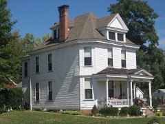 | Watson House | 0.7 miles | 1983 |
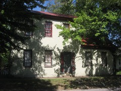 | Benjamin Ferguson House | 0.7 miles | 1983 |
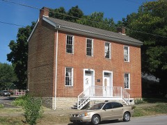 | Thomas Downs House | 0.8 miles | 1984 |
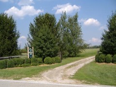 | Bottorff-McCulloch Farm | 2.4 miles | 1995 |
| National Archives record | The nomination case file for reference 100003178 in Record Group 79. |
| Clark County | All 19 listed properties in this county. |