 Block
From the record
19 National Register listings published here.
Sources: the county history on the Internet Archive · the National Register database, National Park Service
90 topographic sheets cover 48 settlements here, and 19 properties are on the National Register of Historic Places.
19 National Register listings published here.
Sources: the county history on the Internet Archive · the National Register database, National Park Service
Every property in this county listed on the National Register of Historic Places, with the year it was listed and the federal nomination document.
| Photograph | Property | Type | Listed | Reference |
|---|---|---|---|---|
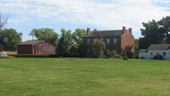 | Abbott-Holloway Farm | building | 1994 | 94001129 |
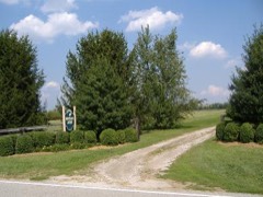 | Bottorff-McCulloch Farm | building | 1995 | 95000699 |
| Centralia Court Historic District | district | 2022 | 100007733 | |
| Clark-McKinley Historic District | district | 2023 | 100009012 | |
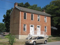 | Thomas Downs House | building | 1984 | 84000490 |
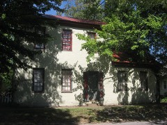 | Benjamin Ferguson House | building | 1983 | 83000118 |
| Francis Avenue Historic District | district | 2025 | 100011860 | |
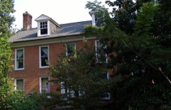 | Henry French House | building | 1989 | 89000772 |
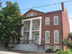 | Grisamore House | building | 1983 | 83000119 |
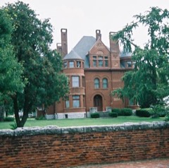 | Howard Home | building | 1973 | 73000031 |
| Indiana State Prison South-Indiana Reformatory- Colgate-Palmolive Historic District | district | 2019 | 100003501 | |
| Lincoln Heights Historic District | district | 2020 | 100005043 | |
| M. Fine & Sons Building | building | 2020 | 100005505 | |
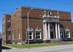 | Old Jeffersonville Historic District | district | 1987 | 87001461 |
| Patterson Place Historic District | district | 2023 | 100009013 | |
| Pleasant Ridge Historic District | district | 2018 | 100003178 | |
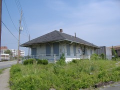 | Spring Street Freight House | building | 2007 | 07000209 |
| Victory Court Historic District | district | 2025 | 100011867 | |
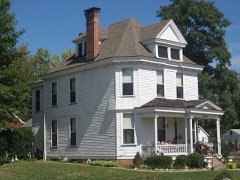 | Watson House | building | 1983 | 83000051 |
The NOAA Storm Events Database holds 470 reports for this county, causing 5 deaths, 45 injuries and about $312,455,000 in recorded property damage. Each settlement page carries the reports that name it.
| Kind of event | Reports |
|---|---|
| Thunderstorm Wind | 217 |
| Hail | 121 |
| Flash Flood | 76 |
| Tornado | 28 |
| Flood | 18 |
| Heavy Rain | 9 |
| Lightning | 1 |
The most serious of them, by death, then injury, then recorded damage. The accounts are quoted exactly as the forecast office filed them.
| When | Event | Place named | Harm | What the report says |
|---|---|---|---|---|
| April 1974 | Tornado (F5) | not stated | 1 killed, 23 hurt | no account filed |
| March 2012 | Tornado (EF4) | Blue Lick | 1 killed, $55,000,000 | This is a continuation of the violent long tracked tornado that began just south of Fredricksburg moved into Clark county as an EF-4 with a path width of one-third of a mile. ||On Dan Gray Road, many well-constructed homes were leveled. The tornado narrowed to a path width of one-quarter of a mile and decreased in intensity as it crossed Pixley Knob Road. Farther east, the twister destroyed two double-wide modular homes on Speith Road, killing one resident who had moments earlier been videotaping the tornado, and had taken shelter in the interior hallway of the home. Another family residence on the west side of the road was severely damaged, reflecting 150 mph winds. ||The tornado crossed Interstate 65, trapping several people within damaged cars and semis. This highway was closed for several hours. The tornado strengthened just east of exit 19 off the Interstate as it entered a heavily industrialized area. Buildings containing several businesses were destroyed. A home was destroyed with estimated EF-4 winds on the east side of North Fraucke Road. Several homes were seriously damaged on the north side of State Highway 160. The EF-4 tornado then moved through Henryville, severely damaging the south building of the Henryville Junior-Senior High School. The cafeteria was completely destroyed and six automobiles were piled up along the south side of the school. Two school buses in the south parking lot were ripped off their chassis, with one moved hundreds of feet east into a commercial business building across North Ferguson Street. ||Extensive structural damage was surveyed on the east side of Henryville on North Front and Pennsylvania Streets. A high tension tower and other homes were damaged just west of Pine Drive. On Brownstown Road, many homes sustained EF-3 damage along the north side of the road. Several homes were destroyed along Henryville-Otisco Road, with the damage to one reflecting EF-4 winds. The tornado cycled near the intersect of Blackberry Trail and State Highway 3, with the original vortex narrowing rapidly into a rope-like funnel and ending as an EF-1 just as a new vortex immediately touched down just to the southwest of the original near Highway 3 and Mahan Road. This new twister damaged a church as an EF-1 and quickly intensified to an EF-3 as it severely damaged several homes on the south side of Marysville. A Civil Air Patrol Flight revealed extensive ground scouring across several fields east of Marysville all the way to the Scott Jefferson County Line. The scouring indicated a multiple vortex tornado and was confirmed by witnesses and photos. Several homes were severely damaged near and south of the intersection of Nabb-New Washington and Marysville-Nabb Roads. The tornado had 150 mph winds and a width of one third of a mile at this point. ||The tornado intensified over open country east of the intersection of Kettle Bottom and State Highway 362 before crossing into Scott County as it moved north of Route 362. |
| January 2008 | Tornado (EF1) | Henryville | 1 killed, $50,000 | A small EF1 tornado touched down briefly just northeast of Henryville. The tornado's 90mph winds felled trees in varying directions, one of which crashed onto a mobile home killing the occupant. |
| July 2015 | Flood | Charlestown | 1 killed, $20,000 | The Clark County emergency manager along with several media outlets reported the drowning of a 67 year old male after he reportedly drove through a flooded roadway. Several inches of rain had fallen during the previous night, flooding a portion of Tunnel Mill Road. His vehicle was found several hours later and a search team discovered his body later that evening. |
| March 1997 | Flash Flood | Countywide | 1 killed | no account filed |
| April 2024 | Tornado (EF1) | Watson | 10 hurt | The National Weather Service in Louisville surveyed storm damage in southeast Clark County IN, through far northeast Jefferson KY, and into western Oldham County. Specifically the tornado traveled just southeast of the Clark County Indiana Airport, east through Utica, crossing the Ohio River into Prospect, and lifting just east of the Sleepy Hollow Golf Course in Oldham County. The tornado was its strongest in Jefferson County, KY where it was an EF2 with 120 mph winds and 450 yards wide. ||Clark County IN... A strong line of severe thunderstorms moved through Clark County Indiana developing a tornado near Interstate 265 and East State Road 62. This tornado led to healthy trees being uprooted near Charlestown Pike. Here, the tornado was an EF0 with 80 to 85 mph winds, and a width of 150 yards. ||The tornado knocked over 3 full tractor trailers as well. The tornado quickly strengthened moving east through the Brookhollow neighborhood. Many garage doors were blown out, windows broken, and large sections of roof structure compromised, brick facade crumbling, and trees uprooted. The tornado was rated EF1 at 100 |mph in this neighborhood with a width of 200 yards. Many wooden boards were impaled and driven more than a foot into the ground and some were impaled into homes. ||An industrial business, with metal roofing near Interstate 265 and Old Salem Road had roof section pulled and twisted and had a 5000 pound salt pod lifted up over 4 foot concrete barrier, and thrown down a hill some 40 yards. The tornado was 100 mph, EF1, with a width of 225 yards. ||The tornado continued east over the Ohio River in Northern Utica. Homes along the bank of the Ohio River had broken windows and peeled metal roofing, which occurred from an EF1 tornado with 97 mph winds and width of 250 yards. |
| June 1990 | Tornado (F3) | not stated | 4 hurt, $250,000 | no account filed |
| March 2025 | Thunderstorm Wind | River Ridge | 4 hurt | Multiple temporary buildings were knocked over at a construction site on River Ridge Road. |
| June 2023 | Thunderstorm Wind | Henryville | 2 hurt | A tree fell on a vehicle injuring two. |
| June 1991 | Thunderstorm Wind | not stated | 2 hurt | no account filed |
| April 1974 | Tornado (F4) | not stated | $250,000,000 | no account filed |
| June 1990 | Tornado (F3) | not stated | $2,500,000 | no account filed |
| October 2007 | Tornado (EF3) | Vesta | $1,000,000 | An EF-3 tornado touched down near Bull Creek Road, and was on the ground intermittently before lifting near the end of Fulton Road, just short of the Ohio River. The greatest damage occurred about 10 miles east northeast of Charlestown, where a recently constructed two story home was blown off its basement and destroyed. Two large barns, a stable, a silo, and four vehicles were also damaged or destroyed on the same property. Ten other homes were damaged, with four of them receiving severe damage. Five barns and several other outbuildings were destroyed. The tornado left scour marks for nearly one half mile through corn and bean fields between Bull Creek Road and Church Road just after its initial touchdown. |
| May 2004 | Tornado (F2) | Borden | $1,000,000 | A tornado moved from Washington County, Indiana into western Clark County in the vicinity of Borden. It briefly reached F2 intensity in the Borden area, blowing the roofs off several homes. The roof was blown off an elementary school while a graduation was in progress, but no injuries were reported. In all, the tornado destroyed or damaged 10 homes in the Borden area. The tornado continued moving east southeast across Clark County, lifting intermittently. Several witnesses spotted the tornado as it moved south of Charlestown. It caused some F1 damage in the Stacy Road and Bethany Road areas, before lifting southeast of Charlestown. |
| May 2004 | Tornado (F1) | Clarksville | $500,000 | A very narrow F1 tornado moved through Clarksville and Jeffersonville. It touched down in Old Clarksville by the floodwall at the end of Arlington Drive. It moved east northeast through a residential area, causing mainly F0 damage to trees and some F1 roof damage to homes. It crossed Interstate 65 between exits 1 and 2, and moved into Jeffersonville. The tornado reached its maximum strength in the Martin Circle area, where it ripped a section off the roof of a community center, and tossed it into a nearby house. It next moved into an industrial park and did some roof damage to commercial buildings and businesses. The tornado crossed 10th Street and moved into another residential area, doing some more F0 damage to trees. It lifted near the end of Plaza Drive in Jeffersonville. |
| March 2012 | Tornado (EF1) | Blue Lick | $300,000 | Interviews with witnesses helped the NWS damage survey team determine that a second tornado developed to the west southwest of Henryville and moved along a 6 mile track that almost perfectly covered a portion of the track of a previous violent tornado around 15 minutes earlier. The second tornado was associated with a large supercell that brought softball sized hail just to the north of its tornado track. This tornado had intermittent contact with the ground, first touching down and causing tree damage to Round Knob in the Clark State Forest. Damage was then observed along and west of Speith Road, located just southwest of Henryville. Finally the tornado lifted after doing damage along the south side of Henryville from Robyn Avenue to near the intersection of Highway 60 and Haddox Road. |
| June 1973 | Tornado (F1) | not stated | $250,000 | no account filed |
| March 2017 | Tornado (EF1) | Borden | $200,000 | A small tornado touched down in the backyard of a home about a quarter mile west from the caution light on Indiana Highway 60 and uprooted trees and caused roof damage to the home. The tornado moved along Muddy Fork and snapped or uprooted numerous trees. Then the tornado crossed Indiana Highway 60 where it was witnessed by people in the Buckboard Diner. Next, the tornado removed the roof of the older building next to the cafe and a garage behind the cafe. It threw its debris into a small church and removed some of its roof. No other damage in the narrow path was seen beyond this point. |
| March 2017 | Thunderstorm Wind | Borden | $150,000 | A NWS Storm Survey team concluded that intermittent pockets of straight line winds occurred along a 10 mile path across portions of Clark County. A roof was removed from an abandoned building in Borden. Winds blew out glass and a screen covered porch off the back of a house at Deam Lake near Borden. The sporadic damage continued east along and near Indiana 60 past Bennettsville, where a tree was toppled on to the roof of a house. Peak wind speeds were estimated between 60 and 80 mph. |
| February 2008 | Thunderstorm Wind | New Washington | $100,000 | Thunderstorm winds blew the entire roof off one house. Several other houses had some degree of roof damage. Two storge buildings were damaged. Numerous trees were uprooted. |
| September 2006 | Flash Flood | Countywide | $100,000 | Silver Creek rose rapidly out of its banks, and flooded nearby roads and fields. The fire department in Clarksville had to use boats to rescue some residents of the River Chase Apartments. |
| May 2004 | Flash Flood | Henryville | $100,000 | Homes were flooded in some areas. Local fire departments were conducting water rescues. |
| October 2007 | Thunderstorm Wind | Charlestown | $70,000 | Windows were blown out of a house. A carport was blown down. Thunderstorm winds picked up and moved a trailer. Two barns were destroyed. |
| April 2020 | Thunderstorm Wind | Solon | $50,000 | An NWS Storm Survey confirmed 90 mph straight-line wind damage near Hibernia in Clark County, IN. The strong winds removed half the roof of a newer large barn/home in addition to damaging multiple trees. |
| February 2018 | Flash Flood | Sellersburg | $50,000 | Water rescues were reported by local media at North Indiana Avenue in Sellersburg. |
| May 2018 | Thunderstorm Wind | Bethlehem | $50,000 | There was a report of a tree down on a house in Bethlehem, Indiana. |
| February 2008 | Thunderstorm Wind | Jeffersonville Arpt | $50,000 | Thunderstorm winds caused roof and structural damage to homes in the Cherry Hill area. |
| April 1993 | Thunderstorm Wind | Utica | $50,000 | Telephone poles were blown down. |
| July 2018 | Thunderstorm Wind | Oak Park | $45,000 | There was a report of large trees and power lines down in Jeffersonville. Duke Energy reported there were 3,000 power outages in Clark County. |
| April 2015 | Flash Flood | Charlestown | $40,000 | The public reported numerous flooded cars due to excessive heavy rainfall. Between 1 and 3 inches of rain fell across the county on top of very saturated ground. |
| July 2020 | Lightning | Bennettsville | $30,000 | A lightning strike started a residential structure fire. |
| July 2001 | Flash Flood | Jeffersonville | $30,000 | Four homes were flooded in Jeffersonville. Roads were covered with water. One car was submerged. |
| May 2017 | Hail | Charlestown | $25,000 | Hail ranged in size from nickels to half dollar in diameter. |
| August 2003 | Thunderstorm Wind | Hamburg | $25,000 | A large tree was uprooted and blown on to a house. |
| June 1973 | Tornado (F1) | not stated | $25,000 | no account filed |
| April 1972 | Tornado (F1) | not stated | $25,000 | no account filed |
| September 1970 | Tornado (F1) | not stated | $25,000 | no account filed |
| July 1961 | Tornado (F2) | not stated | $25,000 | no account filed |
| February 1959 | Tornado (F2) | not stated | $25,000 | no account filed |
| March 2017 | Thunderstorm Wind | Borden | $20,000 | Local amateur radio reported widespread area of tree damage with building materials in the streets. |
| March 2016 | Thunderstorm Wind | Utica | $20,000 | A broadcast meteorologist relayed a report of a tree down on a house due to severe thunderstorm winds. |
| January 2012 | Tornado (EF0) | Jeffersonville Arpt | $20,000 | An EF-0 tornado touched down at the Wal-Mart parking lot on the northwest corner of the Veteran's Parkway near Interstate 65. After overturning a vehicle on I-65, the twister skipped an area before entering a subdivision east of the Interstate Highway. Damage occurred along Belmar and Meadows Drive as well as the intersection of Kingsfield Street and Crown Court. Several fences were knocked down. After removing the roof of a barn near Armstrong Road, the tornado lifted. Maximum winds were estimated at 75 mph. |
| February 2008 | Thunderstorm Wind | Charlestown | $20,000 | Thunderstorm winds damaged a barn and downed trees along highway 160 near Jack Teeple Road. |
| June 2019 | Thunderstorm Wind | Memphis | $15,000 | Multiple trees and power lines were reported down along Crone Road. |
| July 2018 | Thunderstorm Wind | Jeffersonville | $15,000 | A trained spotter reported a large tree, multiple limbs, and power lines down just northeast of downtown Jeffersonville. |
| March 2017 | Thunderstorm Wind | Charlestown | $15,000 | The public reported vinyl siding blown off a building due to severe thunderstorm winds. |
| June 2015 | Hail | Henryville | $15,000 | A report of 1.5 inch diameter hail was received by the public. |
| July 2015 | Thunderstorm Wind | New Washington | $15,000 | The Clark County emergency manager reported trees and power lines down on SR62 in New Washington. |
| June 2019 | Thunderstorm Wind | New Washington | $10,000 | Power lines blew down along Nabb New Washington Road. |
| December 2015 | Thunderstorm Wind | Jeffersonville | $10,000 | A trained spotter reported that severe thunderstorm winds brought down power poles in the area. |
| January 2013 | Thunderstorm Wind | Borden | $10,000 | Strong winds associated with a line of storms shifted a barn off of its foundation. Portions of several sheds were blown several hundred feet. Numerous trees were toppled. |
| September 2009 | Tornado (EF1) | Borden | $10,000 | The tornado uprooted and snapped several large trees and destroyed a small shed on Daisy Hill Road north of Borden. One snapped tree came down onto the roof of a home doing considerable damage. |
| February 2008 | Thunderstorm Wind | Bonnenburger | $10,000 | Thunderstorm winds caused roof damage to the Quartermaster Station. |
| August 2007 | Hail | Jeffersonville | $10,000 | Hail caused damage to cars in the Jeffersonville area. |
| July 2006 | Flash Flood | Countywide | $10,000 | In Memphis, water was flowing in subdivision streets. Plum Run Creek in Hamburg was out of its banks. A home close to the creek had water in it. In Jeffersonville, Two and a half inches of rain were reported over a two hour period. Six to twelve inches of water covered Interstate 65 between mile markers zero and one, just north of the Kennedy Bridge. Woehrle Road was flooded near the Charlestown Pike. Highway 31 was closed between Sellersburg and the Clark County Airport. |
| May 2018 | Thunderstorm Wind | Gibson | $5,000 | There was a metal barn destroyed near Prather Schoolhouse. |
| March 2016 | Thunderstorm Wind | Jeffersonville Arpt | $5,000 | Local law enforcement reported that severe thunderstorm winds brought down power lines in the area. |
| July 2015 | Flash Flood | Otisco | $5,000 | A Clark County law enforcement official reported that a water rescue was performed near the intersection of Henryville-Otisco and Pfister roads. |
| July 2015 | Thunderstorm Wind | Utica | $5,000 | A trained spotter reported that several large tree limbs were snapped off and numerous large trees were uprooted. One large tree fell across a power line. |
| November 2013 | Flood | Sellersburg | $5,000 | The Clark County, Indiana emergency manager reported that a car drove into standing water near Lakeside Drive. The occupants had to be rescued. This area received between 3 and 4 inches of rain over the previous 6 hours before this rescue. |
The Survey's mineral resources record lists 44 workings inside this county. 9 still produce and 35 are closed or unrecorded. Each settlement page carries the workings within five miles of it.
| Commodity | Workings |
|---|---|
| Iron | 30 |
| Stone, Crushed/Broken | 7 |
| Sand and Gravel, Construction | 3 |
| Salt | 1 |
| Silica | 1 |
| Stone | 1 |
| Magnesite | 1 |
The least common of them first, because a county's hundredth gravel pit says nothing its first ten did not.
| Where | Site | Commodity | Status | Recorded |
|---|---|---|---|---|
| Cargill Salt/ Clarksville, Ind. | Salt | Plant | ||
| Charlestown Quarry | Stone | Producer | ||
| Jorris Sand Pit | Silica | Past Producer | ||
| Pilot Co. Pit | Magnesite | Past Producer | ||
| Lucas & Crumbo Sand and Gravel | Sand and Gravel, Construction | Producer | ||
| Utica Sand Plant | Sand and Gravel, Construction | Past Producer | ||
| Utica Sand and Gravel Pit | Sand and Gravel, Construction | Producer | ||
| Atkins Plant & Quarry | Stone, Crushed/Broken | Producer | ||
| Jeffersonville Plant | Stone, Crushed/Broken | Producer | ||
| Louisville Sand&Gravel Inc | Stone, Crushed/Broken | Past Producer | ||
| Sellersburg Stone Quarry | Stone, Crushed/Broken | Producer | ||
| Speed Mill | Stone, Crushed/Broken | Producer | ||
| Speed Quarry | Stone, Crushed/Broken | Producer | ||
| Utica Quarry | Stone, Crushed/Broken | Past Producer | ||
| Unnamed Prospect | Iron | Occurrence | ||
| Unnamed Prospect | Iron | Occurrence | ||
| Unnamed Prospect | Iron | Occurrence | ||
| Unnamed Prospect | Iron | Occurrence | ||
| Unnamed Prospect | Iron | Occurrence | ||
| Unnamed Prospect | Iron | Occurrence | ||
| Unnamed Prospect | Iron | Occurrence | ||
| Unnamed Prospect | Iron | Occurrence | ||
| Unnamed Prospect | Iron | Occurrence | ||
| Unnamed Prospect | Iron | Occurrence | ||
| Unnamed Prospect | Iron | Occurrence | ||
| Unnamed Prospect | Iron | Occurrence | ||
| Unnamed Prospect | Iron | Occurrence | ||
| Unnamed Prospect | Iron | Occurrence | ||
| Unnamed Prospect | Iron | Occurrence | ||
| Unnamed Prospect | Iron | Occurrence | ||
| Unnamed Prospect | Iron | Occurrence | ||
| Unnamed Prospect | Iron | Occurrence | ||
| Unnamed Prospect | Iron | Occurrence | ||
| Unnamed Prospect | Iron | Occurrence | ||
| Unnamed Prospect | Iron | Occurrence | ||
| Unnamed Prospect | Iron | Occurrence | ||
| Unnamed Prospect | Iron | Occurrence | ||
| Unnamed Prospect | Iron | Occurrence | ||
| Unnamed Prospect | Iron | Occurrence | ||
| Unnamed Prospect | Iron | Occurrence | ||
| Unnamed Prospect | Iron | Occurrence | ||
| Unnamed Prospect | Iron | Occurrence | ||
| Unnamed Prospect | Iron | Occurrence | ||
| Unnamed Prospect | Iron | Occurrence |
Baird's History of Clark County, Indiana devotes a chapter to each township: its boundaries and streams, who settled it and when, the mills, the schools and the churches. The one chapter is reproduced here in full. Each row shows the township's own shape and where it lies in the county, drawn from the Census Bureau's boundary. Which settlements belong to which township is computed from that same boundary, not taken from the book.
| Shape and position in the county | Township | Settlements in it | Length | Sections |
|---|---|---|---|---|
| Charlestown Township | Charlestown, Clark Siding, Germany, Otisco, Owen, Rolling Hills, Springville | 3,790 words | 5 |
One book written about this county, cut here where the book itself is cut, at its printed chapters: 38 chapters in all. Every chapter is public domain, machine-read from the scan and reproduced complete. A chapter already given under one of the county's towns is not repeated in this list.
Named settlements recorded in the Geographic Names Information System, each with the topographic sheets covering it. Villages, hamlets and abandoned places alike. Each is shown with the nearest named watercourse or landform and the survey quadrangle it falls on.
Monroe township · 47126 · On Right Branch Blue Lick Creek · Henryville quadrangle
11 sheets, 1949 to 1990
Jeffersonville township · 47130 · On Big Drain · Jeffersonville quadrangle
21 sheets, 1905 to 1993
Jeffersonville township · 47129 · On Cane Run · New Albany quadrangle
19 sheets, 1939 to 1992
Jeffersonville township · 47130 · On Cane Run · Jeffersonville quadrangle
21 sheets, 1905 to 1993
Utica township · 47130 · On Battle Creek · Jeffersonville quadrangle
21 sheets, 1905 to 1993
Bethlehem township · 47104 · On Marble Hill Creek · Bethlehem quadrangle
15 sheets, 1939 to 1990
Utica township · 47130 · On Little Battle Creek · Charlestown quadrangle
15 sheets, 1905 to 1986
Charlestown township · 47111 · On Big Branch · Owen quadrangle
17 sheets, 1905 to 1986
Wood township · 47106 · Near Sugar Camp Hollow · Borden quadrangle
12 sheets, 1941 to 1986
Union township · 47111 · On Carr Peyton Branch · Charlestown quadrangle
15 sheets, 1905 to 1986
Monroe township · 47177 · On Underwood Drain · Henryville quadrangle
11 sheets, 1949 to 1990
Utica township · 47130 · On Lentzier Creek · Jeffersonville quadrangle
21 sheets, 1905 to 1993