 Block
From the record
One of 40 National Register listings published here for Wayne County · listed in 2019 · category: Building.
Sources: the National Register database, National Park Service
Listed on the National Register of Historic Places in 2019.
One of 40 National Register listings published here for Wayne County · listed in 2019 · category: Building.
Sources: the National Register database, National Park Service
The chapter on Center Township in History of Wayne County, Indiana, from Its First Settlement to the Present Time : with Numerous Biographical and Family Sketches, published 1872 names Centerville. This is what it says, exactly as the scans read.
Tills township was formed in An2:ust, 1817, and comprises an area of about 49 miles. It is 9 miles in length, north and south. Its average breadth is less than 5J miles, being on tlie north line oh miles, and on the south about 6f miles. It is watered, principally, by ]^oland's Fork and its branches. The main branch of the stream enters the township near the northeast corner, and passes through it to the south-west corner. It derives its name from Daniel Noland, the first settler in its valle}", about four miles south-west from Centerville, now in the township of Washington.
Passage source: History of Wayne County, Indiana, from Its First Settlement to the Present Time : with Numerous Biographical and Family Sketches, published 1872.
Among the earliest settlers in the township were those who first settled on this stream. They were the following: Isaac Julian, on the land now owned by Oliver II. Brumfield, IJ miles south-west of Centerville. Mr. Julian's cabin was, in the time of the Indian alarms, altered to a block-house. In this house, which stood a little below Ephraim Alerritt's present residence, his first three children were born, jNathan Overman settled near and west of town, the land now owned by Wm. S. T. Morton. Henry Bryan, Wm. Hosier, Robert Culbertson, Greenburg Cornelius, some of the Kings, and others, also settled in this valley.
Passage source: History of Wayne County, Indiana, from Its First Settlement to the Present Time : with Numerous Biographical and Family Sketches, published 1872.
Machine-read from a century-old scan, so expect the errors a machine makes: misspelled names, dropped words, stray characters.
Read the whole chapter on Center Township - 12,705 words on its settlement, mills, schools and churches.
Regional context, not property-specific evidence. The federal mineral resources record lists 2 workings within 5 miles of Eliason Farm: 2 producers. All of them still produce. What was taken out: Sand and Gravel, Construction. Distance is straight-line from the map coordinates, so a quarry counted here may appear on a neighbouring settlement's page as well.
| Where | Site | Commodity | Status | Recorded |
|---|---|---|---|---|
| A and D Excavation Company | Sand and Gravel, Construction | Producer | ||
| Cain's Lake Pit | Sand and Gravel, Construction | Producer |
Regional context, not property-specific evidence. The National Weather Service names Centerville, the town this property stands in, in 39 storm reports between 1995 and 2025: 23 thunderstorm wind, 7 hail, 3 flash flood, 3 flood. No death or injury is recorded in these reports. Each account below is quoted exactly as the forecast office filed it, from the NOAA Storm Events Database, and each date opens the federal record of that event.
| When | Event | Place named | Harm | What the report says |
|---|---|---|---|---|
| May 1999 | Tornado (F0) | Centerville | $100,000 | A tornado was on the ground south of Centerville for a few miles. It destroyed a garage and caused minor damage to other structures but mainly moved through open fields. Elsewhere, strong thunderstorm winds toppled trees throughout the county causing some structural damage to a shopping center in Richmond. |
| June 2000 | Tornado (F0) | Centerville | $45,000 | A brief touchdown of 10 to 15 seconds occurred on Mineral Springs Road. Plastic lawn furniture penetrated the wall of a garage, a 28 foot RV trailer was destroyed as it was lifted and landed on a length of fencing. Several trees were also destroyed. Further down in the west end of Richmond, thunderstorm winds caused roof damage to two structures on the 2200 block of Peacock Road. Two large trees were split, and Hills Greenhouses had extensive damage. A semi trailer was also turned over and a patio enclosure was blown from one side of a house to another on Northwest B Street. |
| July 2017 | Thunderstorm Wind | Centerville | $20,000 | Numerous trees and power lines were downed across Wayne County. Tree damage was reported in Milton, Centerville, Cambridge City and especially Richmond. |
| October 2013 | Thunderstorm Wind | Centerville | $20,000 | Trees were blown down on houses on Test Road due to thunderstorm winds. |
| April 2020 | Thunderstorm Wind | Centerville | $10,000 | There were reports of widespread powerlines downed and some small trees downed near Centerville. |
| April 2000 | Thunderstorm Wind | Centerville | $10,000 | Numerous trees downed from thunderstorm winds that were measured by a spotter in Centerville at 75 mph. |
| May 2006 | Thunderstorm Wind | Centerville | $8,000 | Several large trees were downed, including one on a house. |
| June 1995 | Hail | Centerville | $7,000 | no account filed |
| June 2025 | Thunderstorm Wind | Centerville | $6,000 | A few power poles and power lines were downed. |
| November 2017 | Flash Flood | Centerville | $5,000 | Flood waters were rushing into a home on Main Street, leading to a water rescue. |
| May 2011 | Thunderstorm Wind | Centerville | $5,000 | Siding was torn off of a business due to damaging thunderstorm winds. |
| May 2010 | Thunderstorm Wind | Centerville | $5,000 | Trees and power lines were knocked down due to damaging thunderstorm winds. One tree fell onto a car. |
| April 1996 | Flash Flood | Centerville | $5,000 | no account filed |
| April 2019 | Thunderstorm Wind | Centerville | $4,000 | Several trees and power poles were knocked down at the intersection of George Early Road and Grove Road. |
| July 2017 | Thunderstorm Wind | Centerville | $3,000 | Several trees were downed along McMinn Road. |
| June 2005 | Thunderstorm Wind | Centerville | $3,000 | Trees and power lines were downed. |
| June 2004 | Thunderstorm Wind | Centerville | $3,000 | Several trees were downed. |
| November 2004 | Thunderstorm Wind | Centerville | $3,000 | Trees were downed. |
| July 2002 | Thunderstorm Wind | Centerville | $3,000 | Two trees were blown down. |
| June 2001 | Thunderstorm Wind | Centerville | $3,000 | A few trees downed |
| August 2019 | Thunderstorm Wind | Centerville | $2,000 | A couple of trees were blown down in the Centerville area. |
| August 2012 | Thunderstorm Wind | Centerville | $2,000 | A tree was reported down on College Corner Road and another tree along Interstate 70 near mile marker 153 due to damaging thunderstorm winds. |
| August 2011 | Thunderstorm Wind | Centerville | $2,000 | Trees were reported down and blocking roadways due to damaging thunderstorm winds. |
| May 2011 | Thunderstorm Wind | Centerville | $2,000 | Two trees were reported down due to damaging thunderstorm winds. |
| July 1995 | Thunderstorm Wind | Centerville | $2,000 | Two large trees were blown down. |
| November 2014 | Thunderstorm Wind | Centerville | $1,000 | Several trees were downed in the city of Centerville. |
| April 2011 | Heavy Rain | Centerville | $1,000 | High water was reported on area roadways with one road closed from the high water. |
| May 2010 | Thunderstorm Wind | Centerville | $1,000 | Power lines were reported down due to damaging thunderstorm winds. |
| June 2024 | Thunderstorm Wind | Centerville | $500 | A 10 inch diameter tree was downed onto McConaha Road. |
| July 2024 | Flood | Centerville | - | High water was reported on Temple Drive. |
| April 2018 | Flash Flood | Centerville | - | Numerous roads with water flowing over them were reported in and near Centerville. |
| December 2013 | Flood | Centerville | - | Many roads were covered with high standing water caused by heavy rainfall. Some of these roads were closed. |
| December 2013 | Flood | Centerville | - | Several secondary roads remained closed in the county due to high water caused by earlier rainfall. |
| May 2025 | Hail | Centerville | - | no account filed |
| May 2025 | Hail | Centerville | - | no account filed |
| May 2018 | Hail | Centerville | - | no account filed |
| June 2009 | Hail | Centerville | - | no account filed |
| July 1999 | Hail | Centerville | - | no account filed |
| April 1996 | Hail | Centerville | - | no account filed |
No historic map-sheet match is published for this property yet. That does not mean no map exists. This record needs a coordinate-quality review before it can be joined to a sheet boundary. Browse the county's mapped places while that work is pending.
Other National Register properties close enough to walk or drive between, ordered by distance from this one. Both positions come from the same geocoding pass that matched these properties to their map sheets.
| Photograph | Property | Distance | Listed |
|---|---|---|---|
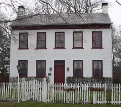 | Lewis Jones House | 1.2 miles | 1984 |
 | King-Dennis Farm | 1.4 miles | 2000 |
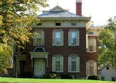 | Samuel G. Smith Farm | 1.5 miles | 1983 |
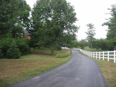 | Westcott Stock Farm | 2.1 miles | 1998 |
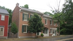 | Centerville Historic District | 2.4 miles | 1971 |
 | Oliver P. Morton House | 2.6 miles | 1975 |
| National Archives record | The nomination case file for reference 100004048 in Record Group 79. |
| Wayne County | All 40 listed properties in this county. |