Block
From the record
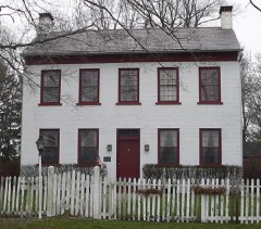
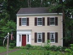
40 National Register listings published here, 1 of them a National Historic Landmark.
Sources: the county history on the Internet Archive · the National Register database, National Park Service
42 topographic sheets cover 36 settlements here, and 40 properties are on the National Register of Historic Places.
40 National Register listings published here, 1 of them a National Historic Landmark.
Sources: the county history on the Internet Archive · the National Register database, National Park Service
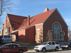
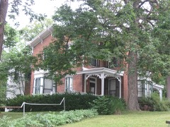
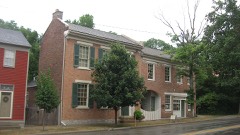
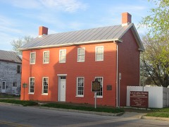
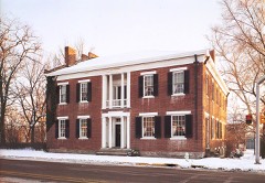
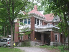
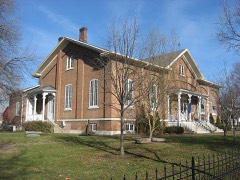
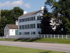
Every property in this county listed on the National Register of Historic Places, with the year it was listed and the federal nomination document.
The NOAA Storm Events Database holds 437 reports for this county, causing 1 death, 6 injuries and about $8,762,250 in recorded property damage. Each settlement page carries the reports that name it.
| Kind of event | Reports |
|---|---|
| Thunderstorm Wind | 265 |
| Hail | 82 |
| Flash Flood | 34 |
| Flood | 29 |
| Tornado | 22 |
| Heavy Rain | 3 |
| Lightning | 2 |
The most serious of them, by death, then injury, then recorded damage. The accounts are quoted exactly as the forecast office filed them.
| When | Event | Place named | Harm | What the report says |
|---|---|---|---|---|
| June 1998 | Flash Flood | Countywide | 1 killed | The second batch of heavy rainfall in less than 24 hours caused county creeks and streams to rise out of their banks. A boy was killed when he was swept into Clear Creek. |
| April 1961 | Tornado (F4) | not stated | 3 hurt, $2,500,000 | no account filed |
| June 2019 | Tornado (EF0) | East Richmond Arpt | 2 hurt, $225,000 | The tornado first touched down along South 37th Street, just to the south of Backmeyer Road, as indicated by swirl marks in an adjacent field. Two trees were snapped along South 37th Street.||The tornado then moved north-northeast, producing damage at the Brookdale Nursing Home on South A Street. Five to ten percent of the roof was removed. One tree, four inches in diameter, was knocked down and several smaller limbs from trees were also knocked down.||The most significant damage was observed at the Richmond Mall where several air handlers on the roof were removed and one was blown northeast onto U.S. 40. The parking lot was also full of debris and a large store on the southwest side of the mall had fifty percent of the glass blown in. On the east side of the mall, a brick wall seven feet high by thirty feet long was destroyed and some of the facade was starting to peel away from the roof. Around that same area, a garage door was blown in. Overall less than five percent of the roof of the mall was removed. On the inside of the mall approximately eight businesses experienced damage, primarily from windows blown out and merchandise blown around. Winds at the Richmond Mall were estimated to be around 85 mph, which is rated at the highest end for an EF0 tornado.||Some of the roof material from the mall landed in three to five businesses on the other side of US 40. Those businesses also received minor damage, with isolated windows being blown out and also some observed damage to signage and siding. A concrete table was moved several feet from its original position, and there was also minor small tree damage. In the service station at the intersection of US 40 and Hayes Arboretum Rd, an adult and a child were sitting in a car when the windows were blown in, causing minor injuries. They were taken to the hospital, treated and released.||Further northeast along Woodside Drive, a large hardwood tree fell to the southwest onto a house and also a tall metal television antenna fell the opposite direction onto the house. Extensive tree damage was also observed near the house, with several two foot diameter trees blown down. Debris from the signage of businesses was scattered throughout the property on Woodside Drive.||The property next door also experienced some damage, particularly with the garage being shifted and a tree limb also knocked down onto the house. Further down along Woodside Drive, several large tree limbs were knocked down. On Sycamore Drive, isolated two to three foot diameter trees were knocked down.||The last visible damage from this tornado appeared to be along Gravel Pit Road, where an additional one or two trees were knocked down. |
| October 1977 | Tornado (F1) | not stated | 1 hurt, $250,000 | no account filed |
| November 1992 | Tornado (F2) | not stated | $2,500,000 | no account filed |
| March 1976 | Tornado (F1) | not stated | $250,000 | no account filed |
| August 1972 | Tornado (F1) | not stated | $250,000 | no account filed |
| April 1956 | Tornado (F2) | not stated | $250,000 | no account filed |
| April 2024 | Tornado (EF0) | Spring Grove | $200,000 | The tornado developed near the intersection of Garr and Pleasant View Roads, where trees were broken off and uprooted on either side of Pleasant View Road. From there, the tornado caused mainly tree damage as it traveled northeast across Buttermilk Road, Weiss Road, and Interstate 70. After the tornado crossed Interstate 70, it widened briefly as it crossed Reservoir Road and Smyrna Road, where it caused tree and some structural damage on Smyrna Road. Here, several barns, outbuildings, and residential structures suffered damage and debris was thrown a considerable distance. One barn was very heavily damaged and several other barns lost some or major portions of their roofs, trailers were tipped over, and a porch was damaged on|a home. This represented the highest wind speed along the path, estimated at 80 mph based on numerous damage indicators on Smyrna Road. The tornado continued over open fields and then crossed Turner and Porterfield Roads before dissipating as it approached the Ohio/Indiana State line. |
| April 1999 | Thunderstorm Wind | Richmond | $200,000 | Six homes were damaged on the south side of Richmond. Also, a barn was reported blown over and several trees were knocked down. |
| December 2015 | Tornado (EF0) | Fountain City | $150,000 | A storm survey was conducted in northeast Wayne County Indiana, in coordination with the Wayne County Emergency Management Agency. Damage began near a property along East Fountain City Pike east of Fountain City, in which several outbuildings were destroyed. Some of the damage followed a southwest to northeast path, although there was evidence of rotation within the debris pattern, which would coincide with a weak tornado. The damage continued in a northeast path and crossed Elliott Road and continued northeast to Bethel. Additional outbuilding damage was surveyed at 2 properties along Elliott Road, in which small outbuildings were destroyed and there was additional damage to larger barns. The path continued northeast to Bethel, where a chimney collapse and roof damage occurred at a church in Bethel. |
| June 2009 | Hail | Jacksonburg | $100,000 | An expansive thunderstorm produced hail along a long swath across Wayne County, with the majority of reports coming from the more populated areas of Centerville and Richmond. Hail report sizes ranged from 0.75 inch to 1.75 inch along the swath. |
| May 1999 | Tornado (F0) | Centerville | $100,000 | A tornado was on the ground south of Centerville for a few miles. It destroyed a garage and caused minor damage to other structures but mainly moved through open fields. Elsewhere, strong thunderstorm winds toppled trees throughout the county causing some structural damage to a shopping center in Richmond. |
| May 1995 | Thunderstorm Wind | South half | $100,000 | A bow echo tracked east across the southern portion of Wayne County, causing numerous trees to be downed, some knocking down power lines, telephone lines, and onto roads. In Cambridge City, two mobile homes at a construction site of a school were turned over. In Dublin, trees were downed onto a roof of a mobile home, destroying the roof. 500 people were without electrical power for three to ten hours. |
| June 2012 | Thunderstorm Wind | Richmond | $80,000 | There were two reports of roofs blown of buildings in Richmond due to thunderstorm winds. A school and a house also sustained roof damage. Numerous trees, tree limbs, and power lines were downed in the area. |
| July 2011 | Thunderstorm Wind | Richmond | $60,000 | Four trees fell on a house. Numerous other trees were reported down in the area. A house sustained roof damage. A trailer was pushed onto a porch. The roof was blown off of a press box and a dugout at a stadium. These occurrences were due to damaging thunderstorm winds. |
| June 2014 | Flash Flood | Whitewater | $50,000 | State Route 227 was closed due to high rushing water caused by heavy rainfall between Whitewater Road and Wallace Road. A culvert was washed out along this segment of highway as a result of the flash flood. High water was also reported across much of the county with several additional road closures. |
| July 2001 | Thunderstorm Wind | Countywide | $50,000 | Trees were knocked down across the county. Also, a roof was blown off a fire station in Milton. |
| May 1993 | Thunderstorm Wind | not stated | $50,000 | Trees and power lines were downed, mainly in the Hagerstown and Fountain City areas. Two miles northwest of Fountain City the roof was blown off a barn. |
| July 2003 | Thunderstorm Wind | Countywide | $45,000 | Trees were downed across the county. A few trees fell on homes in Centerville and Richmond, causing minor damage. A horse stable was destroyed near Hagerstown. |
| June 2000 | Tornado (F0) | Centerville | $45,000 | A brief touchdown of 10 to 15 seconds occurred on Mineral Springs Road. Plastic lawn furniture penetrated the wall of a garage, a 28 foot RV trailer was destroyed as it was lifted and landed on a length of fencing. Several trees were also destroyed. Further down in the west end of Richmond, thunderstorm winds caused roof damage to two structures on the 2200 block of Peacock Road. Two large trees were split, and Hills Greenhouses had extensive damage. A semi trailer was also turned over and a patio enclosure was blown from one side of a house to another on Northwest B Street. |
| July 2024 | Thunderstorm Wind | Cambridge City | $40,000 | Numerous trees were downed in the Cambridge City area, affecting 30 to 40 properties. |
| June 2016 | Tornado (EF0) | Webster | $40,000 | The tornado appeared to first touch down along Indiana State Route|38 approximately 0.15 mile west of the intersection with Round Barn|Road. A barn here sustained substantial damage when a section of its|roof measuring approximately 45 feet by 20 feet was removed. The|wood and metal material was briefly lifted then dropped immediately|northeast of the structure. There were also several broken tree|limbs and slate roofing material from a smaller barn strewn across|this same property from southwest to northeast. All of the debris|here was confined to a narrow path no more than 75 feet wide, with|no divergent patterns noted.||The tornado next moved across an open field before crossing Round|Barn Road approximately 0.20 mile north of the intersection with|Indiana State Route 38. The circulation oriented corn debris from|the previous growing season in a parallel to slightly convergent|pattern approximately 40 feet wide on both sides of Round Barn Road.|This corridor was rather dramatic, with a quick transition to the|unaffected field debris occurring over just a few feet along the|edges of the path. Nearby residents related that a video posted to|several media outlets showing the tornado was actually recorded|looking south on Round Barn Road when the circulation crossed this|location.||The next area of damage occurred immediately east of Round Barn Road|as the tornado tracked northeast toward Tingler Road. The|circulation appeared to strengthen and widen at this point, with the|greatest intensity and path width likely realized. At least 6|residences appeared to sustain some level of property damage here|with many trees and limbs 10 to 14 inches in diameter broken, lifted|and carried by the wind as much as 100 yards. There were also|several locations in this damage area where debris was oriented at|opposing angles to storm motion, as well as in semi-circular|patterns. Additionally, grass and leaf spatter was observed on the|east-facing wall of large shed near the open field. Mainly minor|structural damage occurred to the homes in this area, with shingles|and siding most affected. One small shed approximately 12 feet|square was completely destroyed, though it did not appear to be|firmly anchored to the ground.||At least 3 residents in this area observed the tornado as it tracked|through both their yards and the open field immediately to the east.|They also described the rapid shift of wind direction counter-|clockwise from the northeast through to the southwest as the|circulation approached and passed by their location. One of these|residents also related how they were literally pinned briefly|against a door as the wind associated with the tornado passed|through their home, knocking down a number of objects inside the|home.||The tornado continued northeast across an open field to a crossing|with Tingler Road approximately 0.20 mile east of the intersection|with Round Barn Road. Much like the field to the southwest of this|location, plant material from the previous growing season was|observed to be oriented in a parallel to slightly convergent pattern|along the approximately 100 yard wide path. Debris from the Round|Barn Road residences was also visible in random spots along this|path. The tornado once again passed into an open field on the north|side of Tingler Road. A large tree in this field approximately 0.4|mile north of Tingler Road was snapped, though its health was|unclear as a close inspection wasn`t possible due to limited access.||The circulation continued on the ground to US Route 35 approximately|one-half mile north of the intersection with Tingler Road. Several|properties on both sides of the road sustained a number of broken|tree limbs and minor structural damage to shingles and wooden|fences. Broken tree branches appeared to be 6 inches in diameter or|less. The tornado appeared to finally lift immediately east of US|Route 35 and south of the town of Webster, where the last tree|damage was visible. |
| June 2000 | Tornado (F1) | Richmond | $40,000 | Trees were knocked down throughout the city. A roof was blown off of a church on the 4700 block of National Road. Both a hotel and a restaurant sustained roof damage, and the hotel had a sign destroyed. |
| May 2024 | Tornado (EF1) | Mt Auburn | $25,000 | The tornado began in Fayette County at 1908EST, about 3 miles northeast of Bentonville. The tornado moved northeast and entered Wayne County along Paul Road at 1910EST. The most concentrated area of damage was found along Wagner Road on the west side of Milton. Numerous trees were uprooted or snapped, consisting of low-end EF-1 damage. Minor tree damage was observed along South State Route 1 north of Milton and is considered to be the end of the tornado. |
| June 2021 | Thunderstorm Wind | Greens Fork | $25,000 | Numerous trees and power lines were downed across central and southeast portions of Wayne County. |
| October 1998 | Lightning | Richmond | $25,000 | Lightning struck a home causing significant structural damage. |
| May 1967 | Tornado (F2) | not stated | $25,000 | no account filed |
| June 1963 | Tornado (F1) | not stated | $25,000 | no account filed |
| April 1963 | Tornado (F1) | not stated | $25,000 | no account filed |
| June 1957 | Tornado (F1) | not stated | $25,000 | no account filed |
| July 2017 | Thunderstorm Wind | Centerville | $20,000 | Numerous trees and power lines were downed across Wayne County. Tree damage was reported in Milton, Centerville, Cambridge City and especially Richmond. |
| October 2013 | Thunderstorm Wind | Centerville | $20,000 | Trees were blown down on houses on Test Road due to thunderstorm winds. |
| July 2012 | Thunderstorm Wind | Webster | $20,000 | Numerous trees were reported down in the area. One of the trees fell on a house in Richmond. |
| April 2011 | Heavy Rain | Richmond | $20,000 | Basements were flooded due to heavy rainfall. |
| May 2011 | Thunderstorm Wind | Fountain City | $20,000 | Trees were reported down due to damaging thunderstorm winds. Siding, window, and garage damage occurred to a house as well due to the winds. |
| March 2026 | Thunderstorm Wind | Richmond | $15,000 | A roof was blown off of a building on South 8th Street. |
| March 2023 | Thunderstorm Wind | Richmond Arpt | $15,000 | Four large trees were downed. A barn was also destroyed. |
| April 2020 | Thunderstorm Wind | Cambridge City | $15,000 | Numerous power lines were knocked down along with a few smaller trees near Cambridge City and west of Milton. |
| October 2013 | Thunderstorm Wind | Richmond | $15,000 | A large tree fell on two cars in Richmond due to thunderstorm winds. |
| June 1995 | Tornado (F0) | Milton | $15,000 | A tornado touched down near Indiana State Route One, damaging a 40- by 120-foot barn. The tornado also downed several trees and power lines. |
| June 2016 | Thunderstorm Wind | Milton | $11,000 | Eleven trees were knocked down thoughout Wayne County. |
| July 2023 | Thunderstorm Wind | Abington | $10,000 | Several trees were downed in the Richmond and Abington areas. |
| April 2020 | Thunderstorm Wind | Centerville | $10,000 | There were reports of widespread powerlines downed and some small trees downed near Centerville. |
| July 2017 | Thunderstorm Wind | Richmond | $10,000 | Numerous trees were downed in and around Richmond. |
| June 2012 | Thunderstorm Wind | Mt Auburn | $10,000 | Trees and power lines were reported down from Dublin to Cambridge City due to thunderstorm winds. |
| September 2012 | Thunderstorm Wind | Milton | $10,000 | Trees and power lines were downed due to damaging thunderstorm winds. |
| May 2011 | Flash Flood | Cambridge City | $10,000 | Motorists were stranded in high water due to flash flooding caused by heavy rainfall. A road was closed due to a culvert washout. |
| July 2003 | Flash Flood | Richmond | $10,000 | Several homes sustained basement flooding. |
| July 2003 | Thunderstorm Wind | Hagerstown | $10,000 | A sign was blown off a hardware store, and a few trees were downed. |
| July 2001 | Thunderstorm Wind | Economy | $10,000 | A severe thunderstorm moved across the northwest and north-central part of the county downing trees between Economy and Greens Fork. Many of the trees fell across roads. Golf ball size hail also occurred in Economy. |
| April 2000 | Thunderstorm Wind | Centerville | $10,000 | Numerous trees downed from thunderstorm winds that were measured by a spotter in Centerville at 75 mph. |
| April 2000 | Flash Flood | Countywide | $10,000 | Several hours of showers and thunderstorms with very heavy rainfall caused numerous roads to be flooded across the county. |
| August 2000 | Thunderstorm Wind | Countywide | $10,000 | Thunderstorm winds knocked down numerous trees across the county. |
| November 2000 | Thunderstorm Wind | Countywide | $10,000 | Numerous trees downed across the county. |
| July 1998 | Thunderstorm Wind | Richmond | $10,000 | Numerous trees downed. |
| May 1997 | Flash Flood | Williamsburg | $10,000 | Persistent heavy rainfall caused Greens Fork Creek to rise out of its banks and across several roads. |
| May 2004 | Hail | Bethel | $10,000 | no account filed |
| June 2024 | Flash Flood | Jacksonburg | $8,000 | A culvert was washed out on Jacksonburg Road. |
| September 2024 | Thunderstorm Wind | Fountain City | $8,000 | A few trees and wires were downed. |
The Survey's mineral resources record lists 9 workings inside this county. 8 still produce and 1 is closed or unrecorded. Each settlement page carries the workings within five miles of it.
| Commodity | Workings |
|---|---|
| Sand and Gravel, Construction | 8 |
| Stone, Crushed/Broken | 1 |
The least common of them first, because a county's hundredth gravel pit says nothing its first ten did not.
| Where | Site | Commodity | Status | Recorded |
|---|---|---|---|---|
| Middleboro Stone Quarry | Stone, Crushed/Broken | Producer | ||
| A and D Excavation Company | Sand and Gravel, Construction | Producer | ||
| Cain's Lake Pit | Sand and Gravel, Construction | Producer | ||
| Cambridge City Pit | Sand and Gravel, Construction | Producer | ||
| Fountain City | Sand and Gravel, Construction | Producer | ||
| House Gravel Pit | Sand and Gravel, Construction | Producer | ||
| Hutchens Gravel Inc- Lynn Pit | Sand and Gravel, Construction | Producer | ||
| Middleboro Pit and Mill | Sand and Gravel, Construction | Producer | ||
| Richmond - #418 | Sand and Gravel, Construction | Past Producer |
History of Wayne County, Indiana : Together with Sketches of Its Cities, Villages and Towns devotes a chapter to each township: its boundaries and streams, who settled it and when, the mills, the schools and the churches. All 15 are reproduced here in full. Each row shows the township's own shape and where it lies in the county, drawn from the Census Bureau's boundary. Which settlements belong to which township is computed from that same boundary, not taken from the book.
| Shape and position in the county | Township | Settlements in it | Length | Sections |
|---|---|---|---|---|
| Abington Township | Abington | 659 words | 0 | |
| Boston Township | Boston, Locust Grove | 41,763 words | 4 | |
| Center Township | Centerville, Pinhook, West Grove | 12,705 words | 0 | |
| Clay Township | Greens Fork, Hoover Mill | 3,340 words | 0 | |
| Dalton Township | Dalton, Franklin | 12,981 words | 6 | |
| Franklin Township | Bethel, Whitewater | 3,760 words | 0 | |
| Green Township | Williamsburg | 20,364 words | 4 | |
| Harrison Township | College Corner, Jacksonburg | 8,432 words | 5 | |
| Jackson Township | Cambridge City, Dublin, East Germantown, Hiser, Mount Auburn, Pennville | 10,460 words | 0 | |
| Jefferson Township | Hagerstown | 5,660 words | 3 | |
| New Garden Township | Fountain City | 18,780 words | 5 | |
| Perry Township | Economy | 17,166 words | 10 | |
| Washington Township | Beesons, Milton | 22,771 words | 2 | |
| Wayne Township | Chester, East Haven, Greenwood, Middleboro, Richmond, South Richmond, Spring Grove, Spring Grove Heights | 58,967 words | 11 | |
| Webster Township | Wayne, Webster | 11,911 words | 7 |
3 books written about this county, cut here where the book itself is cut, at its printed chapters: 57 chapters in all. Every chapter is public domain, machine-read from the scan and reproduced complete. A chapter already given under one of the county's towns is not repeated in this list.
| Chapter | Length |
|---|---|
| The whole text | 241,450 words in 16 parts |
Named settlements recorded in the Geographic Names Information System, each with the topographic sheets covering it. Villages, hamlets and abandoned places alike. Each is shown with the nearest named watercourse or landform and the survey quadrangle it falls on.
Jackson township · 47327 · On Crietz Creek · Cambridge City quadrangle
8 sheets, 1953 to 1986
Harrison township · 47345 · On College Corner Branch · Jacksonburg quadrangle
9 sheets, 1953 to 1986
Jackson township · 47370 · On Dry Branch · Cambridge City quadrangle
8 sheets, 1953 to 1986
New Garden township · 47341 · On Fellow Brook · Fountain City quadrangle
9 sheets, 1915 to 1986
Jefferson township · 47346 · On Nettle Creek · Hagerstown quadrangle
8 sheets, 1953 to 1986
Washington township · 47357 · On Milton Drain · Cambridge City quadrangle
8 sheets, 1953 to 1986
Jackson township · 47327 · On Springs Run · Cambridge City quadrangle
8 sheets, 1953 to 1986
Wayne township · 47374 · On West Fork East Fork Whitewater River · Richmond quadrangle
10 sheets, 1915 to 1986
Wayne township · 47374 · On Short Creek · Richmond quadrangle
10 sheets, 1915 to 1986
Wayne township · 47374 · On Middle Fork East Fork Whitewater River · Richmond quadrangle
10 sheets, 1915 to 1986
Wayne township · 47374 · On Middle Fork East Fork Whitewater River · Richmond quadrangle
10 sheets, 1915 to 1986
Franklin township · 47374 · On White Creek · Whitewater quadrangle
11 sheets, 1915 to 1986
Green township · 47393 · On Morgan Creek · Fountain City quadrangle
9 sheets, 1915 to 1986