 Block
From the record
One of 9 National Register listings published here for Brown County · listed in 2020 · category: District.
Sources: the National Register database, National Park Service
Listed on the National Register of Historic Places in 2020.
One of 9 National Register listings published here for Brown County · listed in 2020 · category: District.
Sources: the National Register database, National Park Service
Regional context, not property-specific evidence. The federal wildfire occurrence database lists 7 fires within 5 miles of Brown County State Park between 1999 and 2010, burning about 48 acres in total. None started naturally. None was recorded as arson. Distance is straight-line from the map coordinates, so a fire counted here may appear on a neighbouring settlement's page as well.
| Reported cause | Fires |
|---|---|
| Recreation and ceremony | 3 |
| Debris and open burning | 3 |
| Smoking | 1 |
The most recent of them, most recent first, with the day each was reported and the service that recorded it.
| Date | Cause | Size | Reported by | Name on the report |
|---|---|---|---|---|
| 4 July 2003 | Debris and open burning | 1.0 acres | Hoosier National Forest | NEBO |
| 15 March 2009 | Recreation and ceremony | 5.0 acres | Hoosier National Forest | 135 CAMPFIRE |
| 4 November 2001 | Smoking | 2.0 acres | Hoosier National Forest | GREATHOUSE |
| 4 November 1999 | Recreation and ceremony | 37 acres | Hoosier National Forest | ORIENT |
| 14 November 2010 | Debris and open burning | under an acre | Hoosier National Forest | OAK FIRE |
| 6 October 2010 | Debris and open burning | 2.0 acres | Hoosier National Forest | SUZY AYERS |
| 23 October 1999 | Recreation and ceremony | 1.0 acres | Hoosier National Forest | ELKINSVILLE |
Regional context, not property-specific evidence. The federal mineral resources record lists 2 workings within 5 miles of Brown County State Park: 1 past producer, 1 producer. 1 still produces. What was taken out: Flagstone, Stone. Distance is straight-line from the map coordinates, so a quarry counted here may appear on a neighbouring settlement's page as well.
| Where | Site | Commodity | Status | Recorded |
|---|---|---|---|---|
| Brown County Highway Dept. | Stone | Producer | ||
| Brown County Stone Co Quarry | Flagstone | Past Producer |
Regional context, not property-specific evidence. The National Weather Service names Nashville, the town this property stands in, in 61 storm reports between 1996 and 2025: 34 thunderstorm wind, 17 hail, 7 flash flood, 1 lightning. The reports record 1 injury. Each account below is quoted exactly as the forecast office filed it, from the NOAA Storm Events Database, and each date opens the federal record of that event.
| When | Event | Place named | Harm | What the report says |
|---|---|---|---|---|
| May 1996 | Lightning | Nashville | 1 hurt | no account filed |
| April 2025 | Flash Flood | Nashville | $100,000 | Water flowing over a bridge on State Road 135. Several water rescues completed. Total rainfall ranged from 2.6 to 3.4 inches. |
| June 2019 | Flash Flood | Nashville | $50,000 | Dispatch reports a crew headed to rescue residents that were possibly trapped after a small dam failure due to thunderstorm heavy rainfall. |
| May 1996 | Tornado (F1) | Nashville | $50,000 | no account filed |
| March 2025 | Thunderstorm Wind | Nashville | $25,000 | Numerous tree tops downed and trees toppled at the west gate of the Brown County State Park. |
| January 2012 | Thunderstorm Wind | Nashville | $25,000 | Part of the roof on the Nashville Elementary School was blown off due to damaging thunderstorm wind gusts. Water damage occurred to some of the classrooms. |
| May 2002 | Flash Flood | Nashville | $25,000 | no account filed |
| June 2025 | Thunderstorm Wind | Nashville | $15,000 | Thunderstorm wind gusts blew down a tree blown onto a car with people. |
| June 2025 | Flash Flood | Nashville | $15,000 | Rainfall, reported as great as 3.35 inches west-northwest of Nashville, produced flash flooding in the Nashville area. Water flowed over a bridge near the Nashville General Store. |
| July 2015 | Thunderstorm Wind | Nashville | $10,000 | Multiple trees and power lines were downed due to damaging thunderstorm wind gusts. |
| July 2014 | Thunderstorm Wind | Nashville | $8,000 | Reports received of trees and power lines down near Highway 46 in Brown County due to damaging thunderstorm wind gusts. |
| July 2015 | Flash Flood | Nashville | $5,000 | Widespread flooding was occurring in Nashville due to heavy thunderstorm rainfall. |
| June 2008 | Flash Flood | Nashville | $5,000 | Roadways were covered and previous flooding conditions were exacerbated due to heavy rainfall that caused renewed flash flooding. |
| January 2008 | Thunderstorm Wind | Nashville | $2,000 | Trees and power lines were reported down blocking State Route 135 due to damaging thunderstorm winds. |
| July 2020 | Thunderstorm Wind | Nashville | $1,000 | Tree of unknown size downed due to thunderstorm wind gusts. |
| May 2011 | Thunderstorm Wind | Nashville | $1,000 | A two foot diameter tree was downed due to damaging thunderstorm wind gusts. |
| July 2008 | Thunderstorm Wind | Nashville | $1,000 | A transformer was damaged as a result of thunderstorm winds. |
| May 2002 | Thunderstorm Wind | Nashville | $1,000 | Trees down |
| July 1997 | Thunderstorm Wind | Nashville | $500 | Thunderstorm winds blew down trees in Trevelac. |
| July 1997 | Thunderstorm Wind | Nashville | $500 | Thunderstorm winds blew down trees and power lines. |
| July 1997 | Thunderstorm Wind | Nashville | $500 | Thunderstorm winds blew a few trees down in Belmont. |
| April 2017 | Hail | Nashville | - | This report was relayed by law enforcement. |
| April 2013 | Hail | Nashville | - | Hail, ranging in size from one to two inches, was observed in this location. |
| April 2007 | Thunderstorm Wind | Nashville | - | Trees were reported down due to damaging thunderstorm winds. |
| April 2006 | Hail | Nashville | - | No property damage estimates were available. |
| June 2006 | Thunderstorm Wind | Nashville | - | Trees were downed. |
| May 2005 | Thunderstorm Wind | Nashville | - | Several trees were blown down. |
| May 2005 | Thunderstorm Wind | Nashville | - | Trees were blown down. |
| August 2005 | Thunderstorm Wind | Nashville | - | Trees were downed. |
| July 2005 | Thunderstorm Wind | Nashville | - | Trees and power lines were downed. |
| November 2005 | Thunderstorm Wind | Nashville | - | Seven pine trees were downed in Yellowwood State Forest. |
| October 2004 | Thunderstorm Wind | Nashville | - | Trees were blown down near Brown County State Park. |
| July 2003 | Thunderstorm Wind | Nashville | - | Numerous trees down |
| April 2002 | Thunderstorm Wind | Nashville | - | Trees down |
| May 2025 | Hail | Nashville | - | no account filed |
| July 2024 | Hail | Nashville | - | no account filed |
| April 2015 | Hail | Nashville | - | no account filed |
| April 2013 | Hail | Nashville | - | no account filed |
| May 2012 | Hail | Nashville | - | no account filed |
| March 2012 | Funnel Cloud | Nashville | - | no account filed |
| March 2012 | Hail | Nashville | - | no account filed |
| May 2012 | Hail | Nashville | - | no account filed |
| July 2008 | Hail | Nashville | - | no account filed |
| April 2007 | Hail | Nashville | - | no account filed |
| April 2006 | Hail | Nashville | - | no account filed |
| June 2006 | Hail | Nashville | - | no account filed |
| June 2005 | Hail | Nashville | - | no account filed |
| November 2005 | Hail | Nashville | - | no account filed |
| May 2004 | Thunderstorm Wind | Nashville | - | no account filed |
| July 2004 | Thunderstorm Wind | Nashville | - | no account filed |
| July 2003 | Thunderstorm Wind | Nashville | - | no account filed |
| April 2002 | Hail | Nashville | - | no account filed |
| June 2001 | Thunderstorm Wind | Nashville | - | no account filed |
| June 2000 | Thunderstorm Wind | Nashville | - | no account filed |
| February 1999 | Thunderstorm Wind | Nashville | - | no account filed |
| May 1999 | Thunderstorm Wind | Nashville | - | no account filed |
| November 1998 | Thunderstorm Wind | Nashville | - | no account filed |
| March 1997 | Thunderstorm Wind | Nashville | - | no account filed |
| June 1996 | Thunderstorm Wind | Nashville | - | no account filed |
| May 1996 | Thunderstorm Wind | Nashville | - | no account filed |
No historic map-sheet match is published for this property yet. That does not mean no map exists. This record needs a coordinate-quality review before it can be joined to a sheet boundary. Browse the county's mapped places while that work is pending.
Other National Register properties close enough to walk or drive between, ordered by distance from this one. Both positions come from the same geocoding pass that matched these properties to their map sheets.
| Photograph | Property | Distance | Listed |
|---|---|---|---|
| Story Historic District | 3.4 miles | 2019 | |
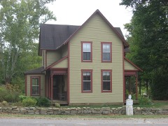 | Thomas A. Hendricks House and Stone Head Road Marker | 3.9 miles | 1984 |
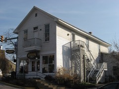 | F.P. Taggart Store | 4.4 miles | 1983 |
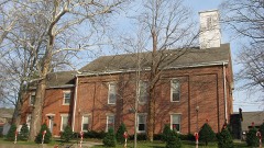 | Brown County Courthouse Historic District | 4.4 miles | 1983 |
| Nashville Historic District | 4.4 miles | 2022 | |
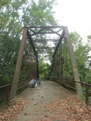 | Brown County Bridge No. 36 | 4.8 miles | 1993 |
| National Archives record | The nomination case file for reference 100005867 in Record Group 79. |
| Brown County | All 9 listed properties in this county. |