 Block
From the record
One of 19 National Register listings published here for Knox County · listed in 2021 · category: District.
Sources: the National Register database, National Park Service
Listed on the National Register of Historic Places in 2021.
One of 19 National Register listings published here for Knox County · listed in 2021 · category: District.
Sources: the National Register database, National Park Service
The chapter on Vincennes Township in A History of the City of Vincennes, Indiana, from 1702 to 1901, published 1902 names Vincennes. This is what it says, exactly as the scans read.
The country surrounding Yineennes gives the town a location unsurpassed for heauty. It was originally situated hetween two handsome prairies one above and the other below. The upper prairie extended about t^^'o miles from the limits of the town to Prairie Creek on the north. But this beautiful prairie has been encroached upon by the expansion of the city. Within the past two years it has l^een covered with manufacturing- plants^ Imsiness houses and dwellings and with the same.23rocess continued for a year or two longer it will present a city appearance. But the two prairies l)elow the town remain as they were when the town was settled. They are beautiful and fertile prairies extending from the lower limits of the city some six miles Ixdow. The land was originally granted to the early French settlers by the commandants of the fort. These prairie lands as well as the lots granted in the village were designated upon small slips of paper and no record kept or made of any of the grants so far as known. The titles of the French settlers and claimants rested wholly upon actual possession and occupancy. And the transfer of lots in the village and prairie lands from one to another was made without documentary or written evidence of transfer, but simply Ijy changing possession and occupancy in the same way personal property changed hands. This custom and transfer of real property without any written evidence of transfer gave the commissioners ap|)ointed by tbe Ignited States to examine and report upon the claims of the French to lots and lands much trouble and compelled them to rely upon verbal testimony in such cases. The lots in the village were not numbered, but onh' identified as adjoining lots of other persons. The same disposition of lands was made in the lower and Cathlinette prairies, which adjoin each other in the same imperfect manner and evidenced by descriptions on small slips of paper of which no record was made. The grants in the two prairies l)elow Vincennes except the first granted the church, which contains four arpents, all contain two arpents in front by forty arpents in depth, French measure. A French arpent is a little less than an English acre. The grants in the lov.er prairie were thus divided in small slips so that each proprietor could have a frontage on the Wabash river. The grants in the prairies were not numljered and in transferring them long after deeds were in use, were simply described as bonded by lands of different owners. These prairie lands were afterwards surveyed by the United States government, after it acquired the territor}', and numV)ered. The lower prairie containing b}^ the survey 52 tracts and the Cathlinette prairie 18 tracts. But for years after the survey and numljering of the lands in the two prairies iu all deeds, the same defective mode of conveyance was continued, causing much confusion. The lands in the two prairies below Vincennes were never enclosed by the Frencli. They were cultivated by the owners in a common field. They all lived in the town, French fashion, and went out to the fields each day to cultivate the lands. A turning row was allowed for between each grant to enable the adjoining owners to cultivate their respective portions without trespassing on his neighbor in turning his team. These prairie lands and lots in the town in that part called "French Town,*' were originally, and as late as 1850, owned l)y the French people. But since that time they have changed liands and passed into the possession of other proprietors and but few lots or lands are now owned by the descendants of the original French proprietors.
Passage source: A History of the City of Vincennes, Indiana, from 1702 to 1901, published 1902.
On the Illinois side of the Waljash Eiver a chain of hills rise near the river and extend along its bank about three miles above and which add much to the scenery surrounding Vincennes. On the Indiana side of the river the picturesque hills on which Fort Knox Avas erected, rise from the water's edge and add much to the scenery in that locality. And these hills commencing at Fort Knox with slight interruptions extend continuously in a circle around Vincennes, terminating with Bunker Hill below the limits of the city. Upon these hills thus surrounding the city, on the east and south, beautiful sites for sulmrban residences are afforded Avliich are being rapidly taken up by wealthy citizens and fine private residences erected thereon. And on these hills on the east is erected the Knox County Poor Asylum, a fine brick structure. On Avhat is usually called the ^'Highlands,'' a splendid structure has been built, some three miles from the city, but in full view from all parts of it, for St. Vincent's Orphan Asylum.
Passage source: A History of the City of Vincennes, Indiana, from 1702 to 1901, published 1902.
Machine-read from a century-old scan, so expect the errors a machine makes: misspelled names, dropped words, stray characters.
Read the whole chapter on Vincennes Township - 210,823 words on its settlement, mills, schools and churches.
Regional context, not property-specific evidence. The federal wildfire occurrence database lists 2 fires within 5 miles of Simpson Nursery Historic District in 2010, burning about 2 acres in total. None started naturally. None was recorded as arson. Distance is straight-line from the map coordinates, so a fire counted here may appear on a neighbouring settlement's page as well.
| Reported cause | Fires |
|---|---|
| Missing data/not specified/undetermined | 2 |
The most recent of them, most recent first, with the day each was reported and the service that recorded it.
| Date | Cause | Size | Reported by | Name on the report |
|---|---|---|---|---|
| 3 September 2010 | Missing data/not specified/undetermined | 1.0 acres | Illinois Division of Forestry Resources | ALLEN |
| 29 September 2010 | Missing data/not specified/undetermined | 1.0 acres | Illinois Division of Forestry Resources | GARTNER |
Regional context, not property-specific evidence. The federal mineral resources record lists 3 workings within 5 miles of Simpson Nursery Historic District: 2 past producers, 1 producer. 1 still produces. What was taken out: Sand and Gravel, Construction. Distance is straight-line from the map coordinates, so a quarry counted here may appear on a neighbouring settlement's page as well.
| Where | Site | Commodity | Status | Recorded |
|---|---|---|---|---|
| Knox County Pit | Sand and Gravel, Construction | Producer | ||
| Lenahans and Konen Pit | Sand and Gravel, Construction | Past Producer | ||
| Schlomer Sand and Gravel Pit | Sand and Gravel, Construction | Past Producer |
Regional context, not property-specific evidence. The National Weather Service names Vincennes, the town this property stands in, in 148 storm reports between 1996 and 2026: 86 thunderstorm wind, 27 hail, 17 flood, 11 flash flood. The reports record 1 death. Each account below is quoted exactly as the forecast office filed it, from the NOAA Storm Events Database, and each date opens the federal record of that event.
| When | Event | Place named | Harm | What the report says |
|---|---|---|---|---|
| July 1998 | Lightning | Vincennes | 1 killed | Lighning struck and killed a 45 year old male in a parking lot at the Southwest Indiana Regional Youth Village. |
| June 2008 | Flood | Vincennes | $10,000,000 | Flooding occurred along the Wabash River in Knox County, including near Vincennes, due to heavy rain and breaks in a levee. The Wabash River levee failed early on the 10th downstream of Vincennes. |
| April 2020 | Thunderstorm Wind | Vincennes | $500,000 | Multiple reports of structural damage reported in Vincennes with significant tree damage due to thunderstorm wind gusts across town. Widespread power outages also reported. |
| April 1996 | Tornado (F0) | Vincennes | $150,000 | no account filed |
| April 2020 | Thunderstorm Wind | Vincennes | $100,000 | Snow plows were needed to clear the volume of tree damage and debris from roads across town. Numerous tree and tree limbs snapped due to thunderstorm wind gusts. |
| March 2006 | Flood | Vincennes | $100,000 | no account filed |
| May 1999 | Thunderstorm Wind | Vincennes | $75,000 | no account filed |
| April 2024 | Thunderstorm Wind | Vincennes | $50,000 | Several trees and utility lines downed by thunderstorm wind gusts across Vincennes. |
| January 2008 | Thunderstorm Wind | Vincennes | $50,000 | A roof was blown off of a house due to damaging thunderstorm winds. Four used vehicles were damaged in a car lot and two trailers were damaged. On the south side of town a tractor sustained significant damage after a nearby building fell on top of it. Power lines and trees were reported down across the area. A FEMA trailer was blown over at a fire station due to the wins. At the VFW, the VFW sign fell onto a truck. Winds also caused an overhang of a building to be pulled away from the building. |
| May 2002 | Flash Flood | Vincennes | $50,000 | no account filed |
| April 2024 | Thunderstorm Wind | Vincennes | $25,000 | Semi truck was overturned by thunderstorm wind gusts across US Highway 41. |
| February 2019 | Flood | Vincennes | $20,000 | Water covered roads near this location due to heavy rainfall. Some cars were stalled in water. |
| May 2000 | Thunderstorm Wind | Vincennes | $20,000 | Newspaper reported a tree down on a home in Monroe City and numerous trees down elsewhere from Vincennes to Monroe City. |
| June 1998 | Thunderstorm Wind | Vincennes | $20,000 | A large open building at the Tractor Supply center was destroyed by high winds. Trees and power lines were also blown down by the thunderstorm. |
| August 2009 | Thunderstorm Wind | Vincennes | $15,000 | Two different areas in Vincennes saw many uprooted and snapped off trees due to thunderstorm wind gusts. One of the areas was a mile north of the Executive Inn and the other was about two miles southeast of the same inn. |
| April 2006 | Thunderstorm Wind | Vincennes | $15,000 | The brick veneer of a motel was blown off the building. |
| May 1996 | Tornado (F0) | Vincennes | $15,000 | no account filed |
| July 2024 | Thunderstorm Wind | Vincennes | $10,000 | Thunderstorm winds downed a tree onto a house in Vincennes before damaging a metal roof in Bruceville by peeling two sections of sheeting back. Wind gusts were estimated as high as 65 mph in Bicknell by Knox County EMA. |
| April 2020 | Thunderstorm Wind | Vincennes | $10,000 | Semi blown off of US 41 south of Vincennes due to thunderstorm wind gusts. |
| June 2019 | Thunderstorm Wind | Vincennes | $10,000 | Several trees and utility lines down throughout Knox County in the Bicknell, Bruceville, Edwardsport, and Vincennes areas due to damaging thunderstorm wind gusts. |
| May 2018 | Thunderstorm Wind | Vincennes | $10,000 | Numerous trees were downed across Vincennes due to damaging thunderstorm wind gusts. |
| June 2013 | Thunderstorm Wind | Vincennes | $10,000 | A large tree fell on a house around the 1100 block of Sycamore Street due to damaging thunderstorm wind gusts. Tree limbs, about ten inches in diameter and five feet long, were also reported down around the area. |
| July 2012 | Thunderstorm Wind | Vincennes | $10,000 | Numerous trees were reported down due to damaging thunderstorm wind gusts of an estimated 65 to 70 mph. |
| May 2011 | Thunderstorm Wind | Vincennes | $10,000 | Trees were reported down around Vincennes due to damaging thunderstorm wind gusts. |
| January 2008 | Flood | Vincennes | $10,000 | Flooding occurred along the Wabash River in Knox County, including near Red Skelton Bridge, due to heavy rain and snow melt. |
| January 2008 | Flood | Vincennes | $10,000 | Flooding occurred along the Wabash River in Knox County, including Vincennes, due to heavy rain and snow melt. |
| February 2008 | Flood | Vincennes | $10,000 | Flooding occurred along the Wabash River in Knox County, including near Red Skelton Bridge, due to heavy rain and snow melt. |
| March 2008 | Flood | Vincennes | $10,000 | Flooding occurred along the Wabash River in Knox County, including near Red Skelton Bridge, due to heavy rain. Flooding continued until April 14th at 04:36. |
| March 2008 | Flood | Vincennes | $10,000 | Flooding occurred along the Wabash River in Knox County, including near Vincennes, due to heavy rain. Flooding continued until April 16th at 15:00. |
| January 2007 | Flood | Vincennes | $10,000 | The Wabash River at Vincennes remained above flood for almost all of January. Crests were as high as 6.6 feet above flood stage. |
| March 2007 | Flood | Vincennes | $10,000 | Flooding finally came to the Wabash in Knox County in late March. Water remained high into April. Crests were over three feet above flood stage. |
| April 2006 | Thunderstorm Wind | Vincennes | $10,000 | Several trees were downed by high winds, one of which fell on a car. |
| December 2006 | Flood | Vincennes | $10,000 | The Wabash River flooded in Knox County. High water remained into January. |
| June 2010 | Thunderstorm Wind | Vincennes | $8,000 | Trees and limbs were reported down in this location due to damaging thunderstorm wind gusts. |
| January 2013 | Thunderstorm Wind | Vincennes | $7,000 | A tree went through a house in this location due to damaging thunderstorm wind gusts. |
| June 2010 | Thunderstorm Wind | Vincennes | $7,000 | Trees were reported down in three separate locations in Vincennes, due to thunderstorm wind gusts. |
| May 2013 | Thunderstorm Wind | Vincennes | $6,000 | A solid, mature maple tree was uprooted at Hart and 5th Streets due to damaging thunderstorm wind gusts. Several other trees were down in the same area. |
| June 2025 | Thunderstorm Wind | Vincennes | $5,000 | Numerous reports of thunderstorm wind gusts downing trees across Vincennes. |
| July 2023 | Thunderstorm Wind | Vincennes | $5,000 | Multiple trees downed by thunderstorm wind gusts on the southwest side of Vincennes. |
| October 2021 | Flood | Vincennes | $5,000 | One vehicle stalled in high water at the intersection of US Highway 41 and 6th Street. |
| June 2019 | Thunderstorm Wind | Vincennes | $5,000 | A Co-op Observer saw several large tree branches snapped and one medium sized tree uprooted in Gregg Park due to damaging thunderstorm wind gusts. |
| June 2013 | Thunderstorm Wind | Vincennes | $5,000 | Trees were reported down in Vincennes due to damaging thunderstorm wind gusts. |
| June 2006 | Thunderstorm Wind | Vincennes | $5,000 | Numerous trees and power lines were blown down. |
| March 2003 | Thunderstorm Wind | Vincennes | $5,000 | no account filed |
| June 1998 | Thunderstorm Wind | Vincennes | $5,000 | no account filed |
| July 1996 | Thunderstorm Wind | Vincennes | $5,000 | no account filed |
| September 1996 | Thunderstorm Wind | Vincennes | $5,000 | no account filed |
| April 2026 | Thunderstorm Wind | Vincennes | $3,000 | Thunderstorm wind gusts downed two trees. |
| August 2019 | Thunderstorm Wind | Vincennes | $3,000 | Emergency Management reports multiple trees downed due to thunderstorm wind gusts. Power outages due to downed power lines were also reported. |
| July 2010 | Thunderstorm Wind | Vincennes | $3,000 | A thunderstorm wind gust of 60 mph was estimated in Vincennes. Trees were reported down in this location as well. |
| January 2008 | Thunderstorm Wind | Vincennes | $3,000 | Damaging thunderstorm winds knocked down numerous trees and caused minor damage to nearby buildings. |
| April 2026 | Thunderstorm Wind | Vincennes | $2,000 | Tree downed over roadway by thunderstorm wind gusts. |
| June 2025 | Thunderstorm Wind | Vincennes | $2,000 | A tree or tree limbs were downed by thunderstorm winds. |
| June 2024 | Thunderstorm Wind | Vincennes | $2,000 | A utility line was blown down by thunderstorm winds near 6th Street and Sycamore Street. |
| July 2020 | Thunderstorm Wind | Vincennes | $2,000 | Trees downed due to thunderstorm wind gusts at Lester Square Memorial Park. |
| July 2013 | Thunderstorm Wind | Vincennes | $2,000 | A tree was reported down near the Knights of Columbus and on South 15th Street in Vincennes due to damaging thunderstorm wind gusts. |
| August 2006 | Flash Flood | Vincennes | $2,000 | A few cars stalled in high water flowing over city roadways. |
| July 2016 | Thunderstorm Wind | Vincennes | $1,500 | A tree was downed on power lines on Parkinson Street due to damaging thunderstorm wind gusts. |
| June 2025 | Thunderstorm Wind | Vincennes | $1,000 | Thunderstorm wind gusts downed a tree. |
| August 2024 | Thunderstorm Wind | Vincennes | $1,000 | Thunderstorm winds downed a tree. |
No historic map-sheet match is published for this property yet. That does not mean no map exists. This record needs a coordinate-quality review before it can be joined to a sheet boundary. Browse the county's mapped places while that work is pending.
Other National Register properties close enough to walk or drive between, ordered by distance from this one. Both positions come from the same geocoding pass that matched these properties to their map sheets.
| Photograph | Property | Distance | Listed |
|---|---|---|---|
 | Gregg Park | 1.4 miles | 2013 |
| Mont Clair | 1.9 miles | 2016 | |
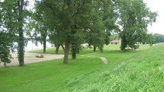 | Kimmell Park | 2.3 miles | 2013 |
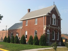 | Hack and Simon Office Building | 2.3 miles | 2003 |
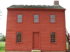 | Territorial Capitol of Former Indiana Territory | 2.6 miles | 1973 |
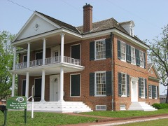 | William Henry Harrison Home | 2.6 miles | 1966 |
| National Archives record | The nomination case file for reference 100006564 in Record Group 79. |
| Knox County | All 19 listed properties in this county. |