 Block
From the record
19 National Register listings published here, 1 of them a National Historic Landmark.
Sources: the county history on the Internet Archive · the National Register database, National Park Service
90 topographic sheets cover 36 settlements here, and 19 properties are on the National Register of Historic Places.
19 National Register listings published here, 1 of them a National Historic Landmark.
Sources: the county history on the Internet Archive · the National Register database, National Park Service
Every property in this county listed on the National Register of Historic Places, with the year it was listed and the federal nomination document.
| Photograph | Property | Type | Listed | Reference |
|---|---|---|---|---|
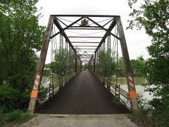 | County Bridge #45 | structure | 2006 | 06000856 |
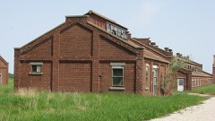 | Enoco Coal Mine | building | 2010 | 10001100 |
 | George Rogers Clark National Historical Park | district | 1966 | 66000007 |
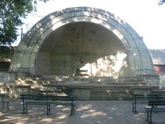 | Gregg Park | district | 2013 | 13000756 |
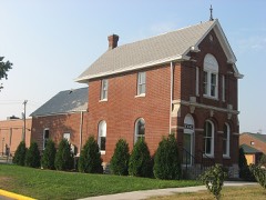 | Hack and Simon Office Building | building | 2003 | 03000141 |
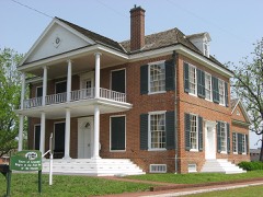 | William Henry Harrison Home | building | 1966 | 66000018 |
 | Kimmell Park | district | 2013 | 13000757 |
 | Kixmiller's Store | building | 1978 | 78000035 |
| Knox County Poor Asylum | building | 2018 | 100003183 | |
| Mont Clair | building | 2016 | 16000904 | |
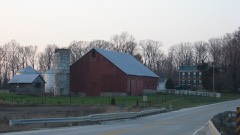 | Andrew Nicholson Farmstead | building | 2005 | 05000606 |
 | Old Cathedral Complex | building | 1976 | 76000025 |
 | Old State Bank | building | 1974 | 74000021 |
 | Shadowwood | building | 2001 | 01000618 |
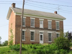 | Alfred Simonson House | building | 2009 | 09001131 |
| Simpson Nursery Historic District | district | 2021 | 100006564 | |
 | Territorial Capitol of Former Indiana Territory | building | 1973 | 73000021 |
 | Vincennes Fortnightly Club | building | 2000 | 00001133 |
 | Vincennes Historic District | district | 1974 | 74000022 |
The NOAA Storm Events Database holds 556 reports for this county, causing 1 death, 24 injuries and about $32,450,500 in recorded property damage. Each settlement page carries the reports that name it.
| Kind of event | Reports |
|---|---|
| Thunderstorm Wind | 289 |
| Hail | 99 |
| Flood | 90 |
| Flash Flood | 44 |
| Tornado | 27 |
| Heavy Rain | 4 |
| Lightning | 2 |
| Funnel Cloud | 1 |
The most serious of them, by death, then injury, then recorded damage. The accounts are quoted exactly as the forecast office filed them.
| When | Event | Place named | Harm | What the report says |
|---|---|---|---|---|
| July 1998 | Lightning | Vincennes | 1 killed | Lighning struck and killed a 45 year old male in a parking lot at the Southwest Indiana Regional Youth Village. |
| April 1963 | Tornado (F2) | not stated | 12 hurt, $2,500,000 | no account filed |
| January 1989 | Tornado (F4) | not stated | 5 hurt, $250,000 | no account filed |
| September 2002 | Tornado (F2) | Monroe City | 2 hurt, $1,000,000 | no account filed |
| May 1971 | Tornado (F2) | not stated | 1 hurt, $250,000 | no account filed |
| November 2013 | Tornado (EF2) | Beal | 1 hurt, $75,000 | At 1456EST, this EF-2 tornado touched down 4.5 miles west-northwest of Decker. The most extensive damage was found north of Decker along Old Decker Road, just to the east of Route 41. The second story of a home was removed with the exterior walls collapsed. This tornado continued until it was 6 miles southeast of Vincennes at 1506EST. The estimated maximum wind speed with this EF-2 tornado was 130 mph. |
| June 2010 | Thunderstorm Wind | Emison | 1 hurt, $30,000 | Numerous trees and power lines were reported down across western Knox County due to damaging thunderstorm wind gusts. A semi-truck overturned on US Highway 41, near The Big Peach. |
| February 1956 | Tornado (F2) | not stated | 1 hurt, $25,000 | no account filed |
| June 2011 | Thunderstorm Wind | Vincennes Oneal Arpt | 1 hurt, $16,000 | A tree fell on a mobile home on Ewing Avenue, temporarily trapping the occupant, due to damaging thunderstorm wind gusts. There was a possible injury in this location. |
| June 2008 | Flood | Vincennes | $10,000,000 | Flooding occurred along the Wabash River in Knox County, including near Vincennes, due to heavy rain and breaks in a levee. The Wabash River levee failed early on the 10th downstream of Vincennes. |
| June 2008 | Flood | Wheatland | $8,000,000 | Flooding occurred along the White River in Knox County, including near the Petersburg, Hazleton, and Edwardsport areas, due to heavy rain and levee breaches. Levee unit 8 failed in the Smother's Creek area near Edwardsport. The levee breach failure caused the White River to crest at Edwardsport. More than 20,000 acres of Daviess County flooded as a result of the levee failure. |
| June 1990 | Tornado (F4) | not stated | $2,500,000 | no account filed |
| June 1990 | Tornado (F4) | not stated | $2,500,000 | no account filed |
| May 2024 | Tornado (EF2) | Decker | $700,000 | The tornado with peak winds of 112 mph began near Decker where tree damage was found near the starting point. At the start, funnel clouds were jumping as most|of the damage was confined to the trees while houses remained|undamaged. The tornado quickly strengthened in producing low end|EF2 damage about a half mile east of Decker where a pole barn was|destroyed with debris found over a mile east of the original|damage location. In that same lot, a school bus was picked up and|moved about 20 yards away.||A sporadic damage path continued for about 2.5 miles northeast of|Decker with EF1 damage to mainly trees and one other small barn.|The sporadic damage path persisted through rural portions of|southern Knox County with EF0 tree and power line damage. About 3|miles southwest of Monroe City, the tornado hit another garage|structure, pushing in its bolted doors and causing the structure|to collapse. Debris from that structure was thrown about a mile|northeastward into a field, with drone footage capturing|circulations carved in the ground in that field. There were likely|a few circulations associated with the main tornado as additional|tree damage was found on the north side of this same property,|with no damage in between, leaving the house unaffected.||The tornado continued on its northeast path through southern Knox|County about a mile south of Monroe City, causing EF0 damage to|trees. The tornado lifted in rural portions of southeast Knox|County just prior to the Knox/Daviess County line. |
| April 2020 | Thunderstorm Wind | Vincennes | $500,000 | Multiple reports of structural damage reported in Vincennes with significant tree damage due to thunderstorm wind gusts across town. Widespread power outages also reported. |
| April 1962 | Tornado (F2) | not stated | $250,000 | no account filed |
| April 2011 | Tornado (EF1) | Decker | $206,000 | An EF-1 tornado touched down south of the town of Beal in Knox county. A 60 by 100 foot building was blown away on South Wabash River Road due to this tornado. Also, multiple high tension towers and lines were downed south of Beal. Another structure had windows blown in. |
| May 2022 | Tornado (EF1) | Orrville | $200,000 | Tornado crossed a county line 10 times in its 26.7-mile track from Illinois to Indiana, see below for lat/long/location/time details for each border crossing.||The tornado first entered the extreme southwestern corner of Knox County at 940 PM EST and proceeded to cause damage consistent with EF0/EF1 intensity: snapping two hardwood trees that fell onto power lines on South 1300 West at 13.4 miles west, breaking large hardwood tree branches on South County Road 1300 West at 18.3 miles south, and leaning two utility poles on South 1200 West at 19.9 miles south.||The tornado's center track then crossed the Knox-Gibson county line 4 times over a 1.4-mile segment roughly midway between Mt. Carmel, IL and Hazleton, IN before re-entering Knox County to cause damage consistent with EF0 intensity during 944-949 PM EST: breaking small hardwood tree limbs on South County Road 775 West at 18.6 miles south; and then along the 17.8 South parallel, blowing over 5 irrigation sections at 8.7 miles west, before blowing over two more irrigation sections and blowing in a barn door and tree damage at 8.1 miles west; and then breaking large hardwood tree branches along South County Road 775 West at both 17.0 miles south and 16.55 miles south.||The tornado track then entered the appendage of Gibson County west of Hazleton, IN for 0.5 miles before again re-entering Knox County to cause damage consistent with EF1 intensity at 952 PM EST: leaning utility poles and snapping several tree branches on West County Road 1750 South just west of Old US Route 41.||The tornado track then entered Gibson County for the final time while transecting the appendage north of Hazleton, IN for 1.0 miles before re-entering Knox County for the final time to cause damage consistent with EF0/EF1 intensity at 954 PM EST in the town of Decker, IN: uprooting large hardwood trees along Broadway Street near 3rd Street, with large hardwood branches snapped across southern and eastern portions of Decker.||The tornado continued to the northeast, next causing damage consistent with EF0/EF1 intensity during 955-959 PM EST: snapping branches of various sizes from both softwood and hardwood trees along Indiana Route 241 and East County Road 1250 South to the west of Iona, IN; as well as destroying an old barn on East 1250 South just east of South Decker Road by lifting the roof which allowed the walls to collapse.||The tornado's final observed damage was consistent with EF1 intensity during 1000-1003 PM EST : snapping several softwood trees on South Hart Road just northwest of Upper River Deshee, and fully destroying a barn on Southeast County Road 200 East east of Upper River Deshee, scattering debris several hundred feet to the northeast.||Further data regarding every county/state border crossing.|ILLINOIS: traveled 8.33 miles as EF0-EF2 before entering Gibson County Indiana.|INDIANA: traveled 18.36 miles as EF0-EF1: Gibson Co. (3.51 mi), Knox Co. (14.85 mi).|A, 38.410/-87.745, Mt. Carmel 1.1 ESE, 2139EST, Illinois to Indiana; |B, 38.417/-87.732, Mt. Carmel 1.8 E, 2140EST, Gibson to Knox; |C, 38.446/-87.674, Mt. Carmel 5.3 ENE, 2143EST, Knox to Gibson; |D, 38.448/-87.669, Mt. Carmel 5.6 ENE, 2143EST, Gibson to Knox; |E, 38.450/-87.664, Mt. Carmel 5.9 ENE, 2143EST, Knox to Gibson; |F, 38.455/-87.651, Mt. Carmel 6.7 ENE, 2144EST, Gibson to Knox; |G, 38.490/-87.586, Hazleton 2.3 W, 2150EST, Knox to Gibson; |H, 38.494/-87.577, Hazleton 1.9 W, 2150EST, Gibson to Knox; |I, 38.507/-87.546, Hazleton 1.2 N, 2152EST, Knox to Gibson; |J, 38.515/-87.530, Decker 0.4 SSW, 2153EST, Gibson to Knox;|K, 38.609/-87.400, Monroe City 2.5 WSW, 2203EST, End of track in Knox Co, IN. |
| February 2008 | Thunderstorm Wind | Freelandville | $200,000 | Two houses sustained significant damaged due to damaging thunderstorm winds. At one house the roof came off, the garage was destroyed, and both cars in the garage were destroyed. At the other house the garage was pulled away from the south side of the house and ended up on the north side. The garage doors were wrapped around trees and seven large pine trees were destroyed. The front porch also sustained damage. Several utility poles were also knocked down and damaged occurred to the roof of a high school. The scoreboard at the high school was destroyed. |
| April 1996 | Tornado (F0) | Vincennes | $150,000 | no account filed |
| March 2025 | Thunderstorm Wind | Bicknell | $100,000 | Thunderstorm winds downed an old communication tower onto a cable line and utility pole at 108 North Cleveland Street. These winds also downed a communication line down. |
| July 2022 | Flash Flood | Vincennes Oneal Arpt | $100,000 | A road was washed out by heavy rains along Pine Bluff Road with numerous other roads with high water across the county. Several vehicles were stranded on State Road 67 near Church Road with water rescues conducted. Rainfall amounted to over 6 inches in spots with the highest report north of Vincennes at 6.54 inches. |
| April 2020 | Thunderstorm Wind | Vincennes | $100,000 | Snow plows were needed to clear the volume of tree damage and debris from roads across town. Numerous tree and tree limbs snapped due to thunderstorm wind gusts. |
| February 2019 | Thunderstorm Wind | Beal | $100,000 | Damaging thunderstorm wind gusts produced damage to and/or downed high tension power lines. |
| June 2008 | Flash Flood | Wheatland | $100,000 | All four lanes of United States Highway 50 were under water due to heavy rainfall. Homes were flooded in Edwardsport. Water poured into the energy generating plant. Albert Street was flooded. |
| May 2002 | Flash Flood | Countywide | $100,000 | Culvert washed out under US 50, and numerous roads flooded |
| May 1995 | Thunderstorm Wind | Countywide | $100,000 | Numerous trees were blown down across the county. Baseball-size hail was reported along the Gibson and Knox county line. |
| March 2006 | Flood | Vincennes | $100,000 | no account filed |
| March 2006 | Flood | Decker | $100,000 | no account filed |
| May 1999 | Thunderstorm Wind | Vincennes | $75,000 | no account filed |
| April 2025 | Flash Flood | Monroe City | $50,000 | Law enforcement unit reports water over Old Bruceville Rd near Church Rd. Total rainfall was between 2.25 and 2.75 inches. |
| July 2025 | Thunderstorm Wind | Bicknell | $50,000 | Thunderstorm winds downed trees and lines at numerous spots in town, including roof damage to a structure on Lawton Street. |
| April 2024 | Thunderstorm Wind | Vincennes | $50,000 | Several trees and utility lines downed by thunderstorm wind gusts across Vincennes. |
| August 2023 | Flash Flood | Waymansville | $50,000 | Several strong to severe cells produced very heavy rain over north-central portions of Knox County, where 2.50 to 4.50 inches fell, with 4.13 measured from the same maximum rain axis at the Plainville 1.3 S CoCoRaHS site in northwestern Daviess County. Standing water was widespread along and near Indiana Route 67 between Bruceville and Edwardsport, with water in several basements. |
| July 2012 | Thunderstorm Wind | Vincennes Oneal Arpt | $50,000 | Numerous trees and power lines were downed throughout Vincennes due to damaging thunderstorm wind gusts. A roof collapsed on a apartment building on Autumn Ridge Lane. |
| January 2008 | Thunderstorm Wind | Vincennes | $50,000 | A roof was blown off of a house due to damaging thunderstorm winds. Four used vehicles were damaged in a car lot and two trailers were damaged. On the south side of town a tractor sustained significant damage after a nearby building fell on top of it. Power lines and trees were reported down across the area. A FEMA trailer was blown over at a fire station due to the wins. At the VFW, the VFW sign fell onto a truck. Winds also caused an overhang of a building to be pulled away from the building. |
| February 2006 | Thunderstorm Wind | Decker | $50,000 | What was determined to be downburst winds damaged outbuildings, power lines, and two homes along a swath near and east of US 41 between Decker and Vincennes. |
| May 2002 | Flash Flood | Bicknell | $50,000 | Roads flooded. |
| May 2002 | Flash Flood | Vincennes | $50,000 | no account filed |
| March 2025 | Thunderstorm Wind | Bicknell | $40,000 | A 70 mph thunderstorm wind gust was measured at this location. Nearby a tree was downed onto a car along with large tree branches falling on a house. |
| May 2022 | Thunderstorm Wind | St Thomas | $40,000 | Thunderstorm winds blew over a tractor-trailer on US Route 41 near the Fireman Road intersection. |
| June 2025 | Thunderstorm Wind | Bruceville | $30,000 | Trees blocking roads across town, trees on powerlines and report of a tree on a home due to thunderstorm wind gusts. |
| August 2000 | Thunderstorm Wind | Bruceville | $30,000 | no account filed |
| June 1999 | Thunderstorm Wind | Oaktown | $30,000 | no account filed |
| May 2024 | Thunderstorm Wind | Bruceville | $25,000 | Tree downed by thunderstorm wind gusts onto a house. |
| April 2024 | Thunderstorm Wind | Vincennes | $25,000 | Semi truck was overturned by thunderstorm wind gusts across US Highway 41. |
| June 2023 | Thunderstorm Wind | Edwardsport | $25,000 | Sections of roof on a barn lifted and thrown by thunderstorm wind gusts. |
| July 2023 | Thunderstorm Wind | Monroe City | $25,000 | Multiple reports of trees and powerlines downed by thunderstorm wind gusts across the southern portions of the county. |
| February 2019 | Flash Flood | Bicknell | $25,000 | Multiple roads were flooded all across the county due to flash flooding from heavy rainfall. |
| July 2009 | Thunderstorm Wind | Bicknell | $25,000 | Trees, approximately 16 inches in diameter, were reported downed and some on top of cars in Bicknell due to thunderstorm wind gusts. |
| July 1995 | Thunderstorm Wind | Countywide | $25,000 | Numerous trees and power lines were blown down across the county. |
| August 1991 | Tornado (F1) | not stated | $25,000 | no account filed |
| June 1990 | Tornado (F2) | not stated | $25,000 | no account filed |
| December 1967 | Tornado (F2) | not stated | $25,000 | no account filed |
| February 1959 | Tornado (F3) | not stated | $25,000 | no account filed |
| November 1955 | Tornado (F1) | not stated | $25,000 | no account filed |
| August 2023 | Thunderstorm Wind | Johnstown | $20,000 | Thunderstorm winds downed tree limbs and power lines in the Bicknell South Side Park. |
| July 2022 | Thunderstorm Wind | Edwardsport | $20,000 | A tree was blown by thunderstorm wind gusts onto a small vehicle at 4th Street and Shipping Street. |
| February 2019 | Flood | Vincennes | $20,000 | Water covered roads near this location due to heavy rainfall. Some cars were stalled in water. |
| June 2015 | Flash Flood | Bicknell | $20,000 | A water rescue was performed at a home surrounded by water near 4th and Thomas Street due to heavy thunderstorm rainfall. High water was also surrounding a trailer on Durbin Street. |
The Survey's mineral resources record lists 13 workings inside this county. 5 still produce and 8 are closed or unrecorded. Each settlement page carries the workings within five miles of it.
| Commodity | Workings |
|---|---|
| Sand and Gravel, Construction | 9 |
| Iron | 4 |
The least common of them first, because a county's hundredth gravel pit says nothing its first ten did not.
| Where | Site | Commodity | Status | Recorded |
|---|---|---|---|---|
| Unnamed Prospect | Iron | Occurrence | ||
| Unnamed Prospect | Iron | Occurrence | ||
| Unnamed Prospect | Iron | Occurrence | ||
| Unnamed Prospect | Iron | Occurrence | ||
| Knox County Pit | Sand and Gravel, Construction | Producer | ||
| Lenahans and Konen Pit | Sand and Gravel, Construction | Past Producer | ||
| North Knox Materials, Inc. | Sand and Gravel, Construction | Producer | ||
| Oaktown Pit | Sand and Gravel, Construction | Producer | ||
| Schlomer Sand and Gravel Pit | Sand and Gravel, Construction | Past Producer | ||
| St. Thomas Pit | Sand and Gravel, Construction | Producer | ||
| Valenco Pit | Sand and Gravel, Construction | Past Producer | ||
| White River Materials Pit | Sand and Gravel, Construction | Producer | ||
| White Sand and Gravel Pit | Sand and Gravel, Construction | Past Producer |
History of Old Vincennes and Knox County, Indiana devotes a chapter to each township: its boundaries and streams, who settled it and when, the mills, the schools and the churches. The one chapter is reproduced here in full. Each row shows the township's own shape and where it lies in the county, drawn from the Census Bureau's boundary. Which settlements belong to which township is computed from that same boundary, not taken from the book.
| Shape and position in the county | Township | Settlements in it | Length | Sections |
|---|---|---|---|---|
| Vincennes Township | Bandmill, Beal, Bloods Wood Crossing, Twin Bridges, Vincennes | 210,823 words | 270 |
Named settlements recorded in the Geographic Names Information System, each with the topographic sheets covering it. Villages, hamlets and abandoned places alike. Each is shown with the nearest named watercourse or landform and the survey quadrangle it falls on.
Vincennes township · 47591 · Saint Francisville quadrangle
18 sheets, 1915 to 1986
Washington township · 47512 · On Flat Creek · Wheatland quadrangle
14 sheets, 1944 to 1986
Johnson township · 47591 · On Upper River Deshee · Decker quadrangle
18 sheets, 1915 to 1986