 Block
From the record
One of 19 National Register listings published here for Fountain County · listed in 2021 · category: Structure · built in 1854.
Sources: the National Register database, National Park Service
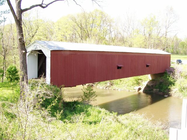
Built in 1854. Listed on the National Register of Historic Places in 2021.
One of 19 National Register listings published here for Fountain County · listed in 2021 · category: Structure · built in 1854.
Sources: the National Register database, National Park Service
The chapter on Wabash Township in History of Fountain County : Together with Historic Notes on the Wabash Valley, Gleaned from Early Authors, Old Maps and Manuscripts, published 1881 names Veedersburg. This is what it says, exactly as the scans read.
Samuel Cade, farmer and stock raiser, Veedersburg, is one of the old and respected citizens of Fountain county. He is a native of the county, and was born February 4, 1826, and is the son of William and Martha (Campbell) Cade. His father was born in Delaware October 4, 1788, and married his wife in Pickaway county, Ohio, in 1823. She was born January 8, 1801, and in October, 1823, they«migrated to Fountain county, Indiana, and settled in what is now Wabash town- ship. Tliey were among the very first settlers of the county. In an early day Mr. Cade used to run flat-boats down the Scioto river into the Ohio, thence to New Orleans, and has walked back from New Orleans three different times to the place of starting. After he caiao to Fountain county he took an active part in all improvements, and was a zealous worker in the cause of religion, having joined tlio Methodist church when a young man. He was called to try the reaii- '"^ ties of the ne.xt world November 14, 18i6, and his wife January 31 ' 18il. Samuel Cade, the subject of this notice, was raised on a farm in Wabash township. He has accumulated a large tract of land, consisting of 1,800 acres, all of which is due to h\i energy and a close attention to business. He now owns the 160 acres which his father bought at the land sales in 1822. He is also the owner of the Union mills since 1873. He has one sister, Jane, who was born in this county May 3, 182-1, and is probably the first born in the county. Slio married D. Pattoii, in 184-i, and is now a resident of Ford county, Illinois. Mr. Cade has been twice married: first time, in 1850, to Mary F. Conover. She died June 29, 1852. He married again, January 4, 1855, Miss Eliza J. Clark, daughter of David and Mary Clark. Mr. Cade has one child by first wife, William, and six by present wife: Mary F. (wife of M. Nixon), Fannie 0. (wife of H. Glasscock), Martha J., David S., Cliftbrd, and one deceased. (Carrie M).
Passage source: History of Fountain County : Together with Historic Notes on the Wabash Valley, Gleaned from Early Authors, Old Maps and Manuscripts, published 1881.
Machine-read from a century-old scan, so expect the errors a machine makes: misspelled names, dropped words, stray characters.
Read the whole chapter on Wabash Township - 6,175 words on its settlement, mills, schools and churches.
Regional context, not property-specific evidence. The federal mineral resources record lists 3 workings within 5 miles of Cades Mill Covered Bridge: 2 unknowns, 1 producer. 1 still produces. What was taken out: Sand and Gravel, Construction. Distance is straight-line from the map coordinates, so a quarry counted here may appear on a neighbouring settlement's page as well.
| Where | Site | Commodity | Status | Recorded |
|---|---|---|---|---|
| C. A. Miller Gravel Pit | Sand and Gravel, Construction | Unknown | ||
| F. I. Mitchell Gravel Pit | Sand and Gravel, Construction | Unknown | ||
| Triple G Gravel | Sand and Gravel, Construction | Producer |
Regional context, not property-specific evidence. The National Weather Service names Veedersburg, the town this property stands in, in 26 storm reports between 1996 and 2026: 14 thunderstorm wind, 8 hail, 2 tornado, 1 lightning. The reports record 1 death. Each account below is quoted exactly as the forecast office filed it, from the NOAA Storm Events Database, and each date opens the federal record of that event.
| When | Event | Place named | Harm | What the report says |
|---|---|---|---|---|
| May 2004 | Lightning | Veedersburg | 1 killed | A 24 year old male was hit by lightning on a baseball field and died shortly thereafter. |
| June 2023 | Thunderstorm Wind | Veedersburg | $350,000 | Large tree downed by thunderstorm wind gusts on a house. Numerous other reports of downed trees across the county with over 2500 power outages. |
| August 2025 | Thunderstorm Wind | Veedersburg | $30,000 | Thunderstorm winds downed power poles on West Public Service Road and blew metal roofing into fields on both sides of US Highway 136, one-eighth to one-quarter mile west of Interstate 74 overpass. |
| May 2019 | Thunderstorm Wind | Veedersburg | $20,000 | Trees and utility lines were blown down due to damaging thunderstorm wind gusts. Scattered reports came in from around the county of this type of damage. |
| September 2011 | Thunderstorm Wind | Veedersburg | $5,000 | Several trees, up to three feet in diameter, were downed due to damaging thunderstorm wind gusts. |
| August 2019 | Thunderstorm Wind | Veedersburg | $1,000 | Multiple large tree limbs downed due to thunderstorm wind gusts. |
| April 2018 | Tornado (EF0) | Veedersburg | $1,000 | This EF-0 tornado, with a max wind speed of 75 mph, primarily went across cornfields while glancing two homesteads, where a few large tree branches were downed and one large trash dumpster blown over in a direction opposite from the environmental wind at the time. |
| June 2006 | Thunderstorm Wind | Veedersburg | $1,000 | Trees and power lines downed. |
| October 1996 | Thunderstorm Wind | Veedersburg | $500 | no account filed |
| August 2020 | Thunderstorm Wind | Veedersburg | - | A 67 mph thunderstorm wind gust was measured at this location. |
| August 2019 | Thunderstorm Wind | Veedersburg | - | This was a public report of an estimated 60 mph thunderstorm wind gust in this location. |
| June 2010 | Funnel Cloud | Veedersburg | - | Movement of the funnel cloud was to the southeast. |
| May 2006 | Thunderstorm Wind | Veedersburg | - | Trees were downed. |
| September 2005 | Thunderstorm Wind | Veedersburg | - | Trees were downed. |
| May 2004 | Tornado (F0) | Veedersburg | - | State police reported a brief weak tornado touchdown in a field near Veedersburg. |
| March 2026 | Hail | Veedersburg | - | no account filed |
| May 2012 | Hail | Veedersburg | - | no account filed |
| March 2011 | Hail | Veedersburg | - | no account filed |
| June 2009 | Hail | Veedersburg | - | no account filed |
| September 2006 | Hail | Veedersburg | - | no account filed |
| July 2003 | Thunderstorm Wind | Veedersburg | - | no account filed |
| June 2002 | Thunderstorm Wind | Veedersburg | - | no account filed |
| May 2000 | Thunderstorm Wind | Veedersburg | - | no account filed |
| May 2000 | Hail | Veedersburg | - | no account filed |
| May 1998 | Hail | Veedersburg | - | no account filed |
| July 1996 | Hail | Veedersburg | - | no account filed |
No historic map-sheet match is published for this property yet. That does not mean no map exists. This record needs a coordinate-quality review before it can be joined to a sheet boundary. Browse the county's mapped places while that work is pending.
Other National Register properties close enough to walk or drive between, ordered by distance from this one. Both positions come from the same geocoding pass that matched these properties to their map sheets.
| Photograph | Property | Distance | Listed |
|---|---|---|---|
| Veedersburg First Christian Church | 4.3 miles | 2025 | |
| Veedersburg Clover Leaf Route Depot | 4.4 miles | 2020 | |
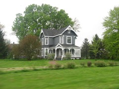 | Clinton F. Hesler Farm | 5.1 miles | 1989 |
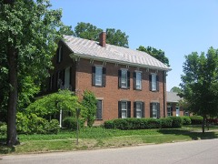 | William C. B. Sewell House | 6.7 miles | 1984 |
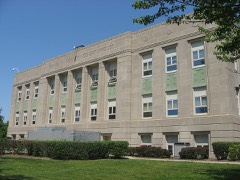 | Fountain County Courthouse | 6.7 miles | 2008 |
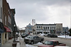 | Covington Courthouse Square Historic District | 6.7 miles | 2015 |
| National Archives record | The nomination case file for reference 100006570 in Record Group 79. |
| Fountain County | All 19 listed properties in this county. |