 Block
From the record
One of 7 National Register listings published here for Perry County · listed in 2023 · category: Building.
Sources: the National Register database, National Park Service
Listed on the National Register of Historic Places in 2023.
One of 7 National Register listings published here for Perry County · listed in 2023 · category: Building.
Sources: the National Register database, National Park Service
Regional context, not property-specific evidence. The federal wildfire occurrence database lists 16 fires within 5 miles of Tell City Carnegie Library between 1999 and 2014, burning about 187 acres in total. 1 started naturally. None was recorded as arson. Distance is straight-line from the map coordinates, so a fire counted here may appear on a neighbouring settlement's page as well.
| Reported cause | Fires |
|---|---|
| Debris and open burning | 9 |
| Missing data/not specified/undetermined | 4 |
| Recreation and ceremony | 2 |
| Natural | 1 |
The most recent of them, most recent first, with the day each was reported and the service that recorded it.
| Date | Cause | Size | Reported by | Name on the report |
|---|---|---|---|---|
| 26 September 1999 | Debris and open burning | 1.0 acres | Hoosier National Forest | BUS |
| 7 June 2000 | Missing data/not specified/undetermined | 1.0 acres | Hoosier National Forest | SCHOOL |
| 8 May 2009 | Natural | under an acre | Hoosier National Forest | EVENING FIRE |
| 28 April 2000 | Recreation and ceremony | 1.0 acres | Hoosier National Forest | ECHO |
| 10 April 2013 | Recreation and ceremony | 5.0 acres | Kentucky Division of Forestry | OAK ROAD |
| 18 March 2006 | Missing data/not specified/undetermined | 100 acres | Hoosier National Forest | LOST FIRE |
| 14 March 2014 | Debris and open burning | 1.0 acres | Hoosier National Forest | STRAWBERRY |
| 11 March 2001 | Debris and open burning | under an acre | Hoosier National Forest | BRUSHY FORK |
Regional context, not property-specific evidence. The federal mineral resources record lists 4 workings within 5 miles of Tell City Carnegie Library: 3 producers, 1 past producer. 3 still produce. What was taken out: Sand and Gravel, Construction, Aluminum, Contained or Metal, Stone. Distance is straight-line from the map coordinates, so a quarry counted here may appear on a neighbouring settlement's page as well.
| Where | Site | Commodity | Status | Recorded |
|---|---|---|---|---|
| Hawesville | Aluminum, Contained or Metal | Producer | ||
| Perry Co. Hwy. Dept. | Stone | Producer | ||
| No. 8 Dredge | Sand and Gravel, Construction | Producer | ||
| Tell City Dredge | Sand and Gravel, Construction | Past Producer |
Regional context, not property-specific evidence. The National Weather Service names Tell City, the town this property stands in, in 77 storm reports between 1998 and 2025: 36 thunderstorm wind, 21 flood, 11 hail, 8 flash flood. No death or injury is recorded in these reports. Each account below is quoted exactly as the forecast office filed it, from the NOAA Storm Events Database, and each date opens the federal record of that event.
| When | Event | Place named | Harm | What the report says |
|---|---|---|---|---|
| May 2004 | Thunderstorm Wind | Tell City | $200,000 | Thunderstorm winds caused extensive roof damage to two multi story warehouses. Flying debris caused additional damage to nearby buildings. Trees were blown on to homes and other buildings. Numerous trees were downed in the city. About 800 city residents were without power for up to four hours. |
| September 2018 | Tornado (EF0) | Tell City | $80,000 | The tornado touched down on Main Street in Tell City, midway between Steuben and Winkeireid Streets, doing minor damage to one roof and bending an amateur radio antenna tower. Moving east-northeast, the tornado damaged roofs and snapped several large tree limbs, as well as toppling a large but rotting tree that crushed the roof of a garage. A small shed was lofted out of its yard and became entangled in utility lines 30 yards to the northeast. As it crossed Winkeireid Street between 10th and 11th Streets, it buckled in a large overhead door and caused minor damage to the roof of the Indiana Southern Power building. Continuing to the northeast, a large metal carport was lifted and blown 50 feet north into neighboring trees, and more tree limbs were snapped, while a vinyl fence was blown northwest, as was a large trampoline and a patio umbrella, which was entangled in utility lines northwest of its origin.||The tornado continued to cause tree damage as it moved east of 14th street into a more rural area. On Brushy Fork Rd, the tornado snapped the trunks of three large trees, then continued northeast into a wooded area. The last evidence of the tornado was at the north end of Quaker Rd, where small branches were broken. |
| October 2001 | Thunderstorm Wind | Tell City | $75,000 | no account filed |
| July 2004 | Thunderstorm Wind | Tell City | $30,000 | The roof was blown off a house on Highway 145. |
| March 2006 | Thunderstorm Wind | Tell City | $25,000 | A thunderstorm wind gust blew a tree on to the roof of a home. |
| May 2020 | Flood | Tell City | $20,000 | Starlight Road, near Tell City, was down to one lane due to a partial culvert washout. |
| May 1998 | Thunderstorm Wind | Tell City | $2,000 | no account filed |
| January 2012 | Thunderstorm Wind | Tell City | $1,000 | Local law enforcement reported a roof blown off a building and onto an adjacent road. Several power outages occurred countywide. |
| April 2025 | Thunderstorm Wind | Tell City | - | There were trees down in Tell City. |
| May 2024 | Thunderstorm Wind | Tell City | - | Several trees were uprooted with branches snapped on the southeast side of Tell City. |
| May 2024 | Thunderstorm Wind | Tell City | - | A tree blew down on State Road 237, just south of Mozart Street. |
| August 2024 | Thunderstorm Wind | Tell City | - | There were several trees down, including along Troy Ridge Road and Brushy Fork Road. |
| March 2023 | Hail | Tell City | - | Quarter-sized hail fell in Tell City. |
| June 2021 | Thunderstorm Wind | Tell City | - | Trees were down in the Tell City area. One tree fell on a car in Tell City. No injuries were reported. |
| May 2020 | Flood | Tell City | - | Water rose from Windy Creek and caused part of State Road 37 to close. |
| June 2020 | Flash Flood | Tell City | - | Several roads in Tell City were reported to have high water flowing over them. |
| September 2020 | Flash Flood | Tell City | - | Water was over State Road 37 just north of Tell City. |
| June 2019 | Thunderstorm Wind | Tell City | - | A tree was reported down on Boyd Road near State Road 237. |
| February 2018 | Flood | Tell City | - | The Ohio River at Tell City went into moderate flood stage. The river crested at 49.3 feet which is 11.30 feet above flood stage. The river remained above flood stage at the end of the month. |
| May 2018 | Thunderstorm Wind | Tell City | - | There were a few trees reported down in the Tell City - Cannelton area of Indiana. |
| July 2018 | Thunderstorm Wind | Tell City | - | Law enforcement reported trees were down along State Road 66 between Tell City and Troy. |
| April 2016 | Thunderstorm Wind | Tell City | - | A trained spotter reported multiple trees and tree limbs down in the area due to severe thunderstorm winds. |
| May 2016 | Thunderstorm Wind | Tell City | - | Local law enforcement reported trees down in the area. |
| July 2016 | Thunderstorm Wind | Tell City | - | The public reported trees down in the area from severe thunderstorm winds. |
| May 2015 | Hail | Tell City | - | The Perry County emergency manager reported 1 inch hail. |
| May 2015 | Thunderstorm Wind | Tell City | - | The Perry County emergency manager reported numerous trees down with damage to vehicles. |
| March 2015 | Flood | Tell City | - | An unusually wet period with repeated rounds of heavy rain brought the Ohio River at Tell City into a long duration flood. The river went above flood stage March 7th, crested on March 17th and then fell below flood stage March 23rd. |
| December 2015 | Flood | Tell City | - | Heavy rain events during late December brought the Ohio River at Tell City into minor flood. The river reached a crest 42 feet during the afternoon on December 30. The river remained above flood stage through the end of December and into the first part of January 2016. |
| July 2014 | Thunderstorm Wind | Tell City | - | Several trees were downed near Tell City. |
| April 2014 | Flood | Tell City | - | The Ohio river at the Tell City water treatment plant barely crept over flood stage due to previous heavy rains across southern Indiana and central Kentucky. The Ohio reached 38.6 feet at Tell City during the early morning hours on the 6th. Flood stage is 38 feet. |
| May 2014 | Flash Flood | Tell City | - | Three and one quarter inches of rain fell in a 2 hour period in Tell City. Flowing water was reported on Franklin Street when Windy Creek exceeded its banks. |
| May 2014 | Flash Flood | Tell City | - | Many roads across Tell City and other locations in Perry County became impassable due to flash flooding. |
| December 2013 | Flood | Tell City | - | Water from Windy Creek covered the road at 16th and Pestalozzi Streets. Several other roads were also flooded. |
| December 2011 | Flood | Tell City | - | The Ohio River at Tell City crested around 38.0 feet early in the morning of December 1, and remained steady near that level through December 2. Flood stage at Tell City is 38 feet. Minor flooding occurs at this level with parts of Indiana Highway 66 covered by water. |
| March 2011 | Flood | Tell City | - | The Ohio River at Tell City crested at 44.4 feet around 6 AM EST on March 15. Moderate flooding occurs at this level, with the river reaching the base of the flood wall in Tell City. Flood stage at Tell City is 38 feet. The river had been above flood stage since early afternoon on February 28. |
| February 2011 | Flood | Tell City | - | The Ohio River at Tell City rose above flood stage around mid-day on February 28. With several additional heavy rain events in March, the river would not crest until March 15, and would remain above flood stage until March 21. |
| April 2011 | Thunderstorm Wind | Tell City | - | Trees and power lines were blown down across the city. |
| April 2011 | Flood | Tell City | - | The Ohio River at Cannelton crested around 43.4 feet at 345 AM EST on April 16. Flood stage at Cannelton is 42 feet. Minor flooding occurs at this level. |
| April 2011 | Flood | Tell City | - | The Ohio River at Tell City crested around 48 feet at 6 AM EST on April 28. Flood stage at Tell City is 38 feet. At this level, water reaches railroad tracks and parts of Main Street in Tell City. The river remained above flood stage into the month of May. |
| April 2011 | Flood | Tell City | - | Local TV meteorologists relayed a report that SR 37 as well as other side streets were flooded. The depth of the water on the road was unknown. |
| April 2011 | Flood | Tell City | - | The Ohio River at Cannelton crested at 49.3 feet around 2 AM EST on April 28. Flood stage at Cannelton is 42 feet. The river at Cannelton remained above flood stage into the month of May. |
| April 2011 | Thunderstorm Wind | Tell City | - | Local TV meteorologists relayed a report that trees were blown down on Boyd Rd. of of New IN-237. A truck was also flipped over and power lines downed. |
| May 2010 | Flood | Tell City | - | Reacting to the heavy rains of a few days before, the main stem of the Ohio River had some minor flooding. The Ohio River at Tell City crested around 40.8 feet at noon EST on May 7. Flood stage at Tell City is 38 feet. Minor flooding occurs at this level, with sections of Indiana Highway 66 closed between Rome and Derby, and above Cannelton. The floodwall begins to close at this level. |
| June 2010 | Thunderstorm Wind | Tell City | - | A tree was blown down on the outskirts of town. |
| February 2009 | Thunderstorm Wind | Tell City | - | Trees were reported down in Tell City. |
| May 2009 | Thunderstorm Wind | Tell City | - | A tree was down and blocking Troy Ridge Road. |
| March 2008 | Flood | Tell City | - | The Ohio River at Tell City crested at 40.5 feet around 700 AM EST on March 12. Flood stage at Tell City is 38 feet. Minor flooding occurs at this level, with Indiana Highway 66 closed between Rome and Derby. The Tell City flood wall is closed at this level. |
| February 2008 | Flood | Tell City | - | The Ohio River at Tell City crested at 39.6 feet around 7 AM EST on February 11. Flood stage at Tell City is 38 feet. Minor flooding occurs at this level, with the river overflowing both banks above and below the gage. Indiana Highway 66 floods between Rome and Derby. |
| April 2008 | Flood | Tell City | - | A few county roads were closed due to high water. |
| March 2008 | Flash Flood | Tell City | - | Numerous roads were flooded and closed due to heavy rains. |
| March 2008 | Flood | Tell City | - | The Ohio River at Cannelton crested at 45.4 feet around 230 AM EST on March 22. Flood stage at Cannelton is 42 feet. Minor flooding occurs at this level, with agricultural land flooded between Cloverport, KY and Tell City, IN. |
| January 2007 | Flood | Tell City | - | The Ohio River at Tell City crested at 38.0 feet around 7 PM EST on January 17. Flood stage at Tell City is 38 feet. At this level, Indiana Highway 66 is flooded between Rome and Derby. |
| December 2007 | Flood | Tell City | - | The Ohio River at Tell City crested at 39.0 feet around 7 AM EST on December 18. Flood stage at Tell City is 38 feet. At this level, the river begins to overflow its banks above the gage. Indiana Highway 66 floods between Rome and Derby. |
| April 2007 | Thunderstorm Wind | Tell City | - | Light poles were blown down in Tell City. Trees were down in parts of the county. |
| October 2007 | Thunderstorm Wind | Tell City | - | Trees and power lines were downed. Gas lines were ruptured. |
| March 2006 | Flash Flood | Tell City | - | State Highway 37 near Tell City was covered by water. Many other roads in the county were flooded, prompting the county to declare a state of emergency. |
| September 2006 | Thunderstorm Wind | Tell City | - | A number of trees were downed. |
| September 2006 | Flash Flood | Tell City | - | Water was up to the curbs in some streets in the downtown area. |
| May 2004 | Thunderstorm Wind | Tell City | - | Numerous large tree limbs were downed. Some were blown on to power lines, however no power outages were reported. |
| July 2004 | Thunderstorm Wind | Tell City | - | Trees were downed. |
No historic map-sheet match is published for this property yet. That does not mean no map exists. This record needs a coordinate-quality review before it can be joined to a sheet boundary. Browse the county's mapped places while that work is pending.
Other National Register properties close enough to walk or drive between, ordered by distance from this one. Both positions come from the same geocoding pass that matched these properties to their map sheets.
| Photograph | Property | Distance | Listed |
|---|---|---|---|
 | Cannelton Historic District | 2.8 miles | 1987 |
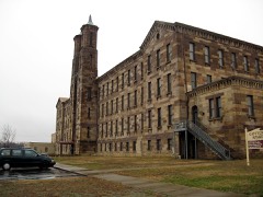 | Cannelton Cotton Mills | 2.9 miles | 1975 |
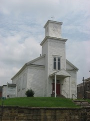 | St. Luke's Episcopal Church | 2.9 miles | 1983 |
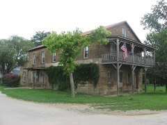 | Nester House | 3.7 miles | 1990 |
| National Archives record | The nomination case file for reference 100008664 in Record Group 79. |
| Perry County | All 7 listed properties in this county. |