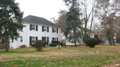
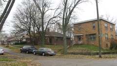
Listed on the National Register of Historic Places in 2010.
From the record
“Morgan-Skinner-Boyd Homestead, also known as Walnut Grove, is a historic home located at Merrillville, Indiana. The original section of the house was built in 1877, and is a two-story, Italianate style brick dwelling with a low pitched roof topped by a cupola.”
Wikipedia article Morgan-Skinner-Boyd Homestead, CC BY-SA 4.0.
One of 88 National Register listings published here for Lake County · listed in 2010 · category: Building.
National Register reference number.10001079- the number the National Park Service assigned this property when it was listed, and the key its nomination file is catalogued under at the National Archives.
Fires near this property
5 since 2001
Regional context, not property-specific
evidence. The
federal wildfire occurrence database
lists 5 fires within 5 miles of Morgan-Skinner-Boyd Homestead
between 2001 and 2020, burning about 32 acres in total. None started naturally. None was recorded as arson.
Distance is straight-line from the map coordinates, so a fire counted
here may appear on a neighbouring settlement's page as well.
Reported cause
Fires
Missing data/not specified/undetermined
2
Recreation and ceremony
1
Debris and open burning
1
Misuse of fire by a minor
1
The most recent of
them, most recent first, with the day each was reported and the service
that recorded it.
Regional context, not property-specific
evidence. The National Weather Service names
Merrillville, the town this property stands in, in 28 storm reports between 1996 and 2025: 12 hail, 12 thunderstorm wind, 2 tornado, 1 flash flood.
The reports record 3 injuries. Each account below is quoted exactly as the forecast office
filed it, from the NOAA Storm Events Database, and each date
opens the federal record of that event.
A tornado touched down in Merrillville just east of the intersection of Merrillville Road and 84th Street. There was spotty minor structural damage in an industrial park with some small trees broken or pushed over, damage to signs and a few broken windows. Many structures and trees in the path had no damage. Just west of I-65, parts of the roof and glass walls of a commercial building were damaged. East of I-65, just south of Route 30, there was more damage to signs. A semi was overturned. Two people were injured by broken glass at a restaurant in Hobart. Part of the roof and a section of a wall was blown out at a Kohl's department store. The tornado crossed Route 30 and caused minor structural damage, mostly to signs and glass, at a strip mall. Behind the shops, corn was flattened and trees were damaged. The tornado then moved into the Green Acres subdivision near Colorado Street and 78th Street. A garage collapsed and many large tree limbs were blown down through the neighborhood. The tornado then weakened. Only minor damage to a few tree limbs occurred around the 7600 block of Clay Street and just south and east of the intersection of Grand and 73rd. The average path width was 50 yards.
Several buildings were damaged along Broadway Street. A roof was lifted off part of one building. Two steel garage doors were pushed in on another building. An awning and two signs were blown down. Other buildings suffered minor damage. A guard shack was blown over. An 18 year old woman in the shack suffered knee and shoulder injuries.
Numerous large trees blown down...some on homes and cars, 30 to 40 inch diameter trees blown down, some uprooted and some snapped. Significant damage to some homes.
Utility poles bent at 45 degree angle on Route 30. Roof damage to a building on Broadway, part of the roof fell onto a car. Partial wall collapse at Radison Theater near Interstate 65 and Route 30.
A photo shared via Twitter shows five power poles either leaning or snapped due to the wind along US Rt. 30 just east of Taft St. Wind magnitude and time were estimated based on radar.
This tornado touched down north of U.S. Route 30 near Grant St. in Merrillville and then tracked eastward for roughly 3.3 miles before lifting over the far south side of Hobart along E 73rd Ave just east of Colorado St. The tornado blew out windows and tore sections of roofs off of multiple homes where its winds were able to compromise the residences' garage doors. The tornado also caused damage to power lines and several trees along its path.
No historic map-sheet match is published
for this property yet. That does not mean no map exists. This record needs
a coordinate-quality review before it can be joined to a sheet boundary.
Browse the county's mapped places while that work is
pending.
Listed places nearby
6 within 8 miles
Other National Register properties close
enough to walk or drive between, ordered by distance from this one. Both
positions come from the same geocoding pass that matched these properties
to their map sheets.
Listing record. National Park Service National Register of Historic Places, listed-properties dataset, current to 2026-05-22.
Map join. Address geocoded through the United States Census geocoder, then tested against the published boundary of every sheet in the USGS Historical Topographic Map Collection.
How this page is made. Listing fields come from federal records; map-sheet coverage is a labelled coordinate-to-boundary calculation, not a source-field claim.
Wildfire. Short, Karen C. 2022. Spatial wildfire occurrence data for the United States, 1992-2020 [FPA_FOD_20221014]. 6th Edition. Fort Collins, CO: Forest Service Research Data Archive. https://doi.org/10.2737/RDS-2013-0009.6 Collected with United States Government funding and usable without additional permissions or fees.
Storms. NOAA National Centers for Environmental Information, Storm Events Database https://www.ncei.noaa.gov/stormevents/ A work of the United States government, no copyright under 17 U.S.C. 105. Narratives are quoted verbatim from the National Weather Service report and are not edited or summarised.
 Block