| July 2024 | Thunderstorm Wind | Cedar Lake | 1 killed | Numerous large tree limbs were blown down just west of Cedar Lake including a few that fell onto houses. One large tree limb, approximately 20 inches in diameter and 70 feet tall fell onto a one story house on 141st Court. The tree caused significant structural damage to the house and pinned a 44 year old woman in a bed. She died a short time later. Two other people in the house at the time were not injured. |
| September 2013 | Lightning | Black Oak | 1 killed | A man working on a billboard in the 4700 Block of 27th Avenue was struck by lightning and later died from his injuries. |
| August 2001 | Rip Current | Gary | 1 killed | no account filed |
| August 1989 | Thunderstorm Wind | not stated | 1 killed | no account filed |
| November 1965 | Tornado (F3) | not stated | 14 hurt, $250,000 | no account filed |
| June 1974 | Tornado (F3) | not stated | 5 hurt, $250,000 | no account filed |
| August 2001 | Tornado (F1) | Merrillville | 2 hurt, $100,000 | A tornado touched down in Merrillville just east of the intersection of Merrillville Road and 84th Street. There was spotty minor structural damage in an industrial park with some small trees broken or pushed over, damage to signs and a few broken windows. Many structures and trees in the path had no damage. Just west of I-65, parts of the roof and glass walls of a commercial building were damaged. East of I-65, just south of Route 30, there was more damage to signs. A semi was overturned. Two people were injured by broken glass at a restaurant in Hobart. Part of the roof and a section of a wall was blown out at a Kohl's department store. The tornado crossed Route 30 and caused minor structural damage, mostly to signs and glass, at a strip mall. Behind the shops, corn was flattened and trees were damaged. The tornado then moved into the Green Acres subdivision near Colorado Street and 78th Street. A garage collapsed and many large tree limbs were blown down through the neighborhood. The tornado then weakened. Only minor damage to a few tree limbs occurred around the 7600 block of Clay Street and just south and east of the intersection of Grand and 73rd. The average path width was 50 yards. |
| June 2012 | Dust Devil | Maynard | 2 hurt | A dust devil formed at The Gate Church at 9900 Columbia Avenue in Munster and lasted about a minute. Four or five small vendor tents were picked up and tossed into the air causing a few minor injuries. One person had a bruise on the arm and another was hit in the head with a tent pole. |
| June 2002 | Lightning | Crown Pt | 2 hurt | no account filed |
| August 1998 | Thunderstorm Wind | Countywide | 2 hurt | no account filed |
| July 1992 | Thunderstorm Wind | not stated | 2 hurt | no account filed |
| June 1977 | Tornado (F2) | not stated | 1 hurt, $2,500,000 | no account filed |
| July 2006 | Thunderstorm Wind | Merrillville | 1 hurt, $400,000 | Several buildings were damaged along Broadway Street. A roof was lifted off part of one building. Two steel garage doors were pushed in on another building. An awning and two signs were blown down. Other buildings suffered minor damage. A guard shack was blown over. An 18 year old woman in the shack suffered knee and shoulder injuries. |
| June 2007 | Thunderstorm Wind | Lake Station | 1 hurt, $10,000 | A large tree was uprooted causing damage to pavement. Several tree limbs also blown down. A tree fell onto a car near 29th Avenue and Clay Street. One of the passengers in the car was taken to the hospital with injuries. |
| June 1961 | Tornado (F1) | not stated | 1 hurt, $2,500 | no account filed |
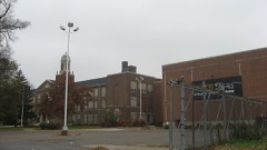
| March 2025 | Tornado (EF1) | Black Oak | 1 hurt | A tornado touched down near Morton Street between West 23rd Avenue and West 22nd Plaza in Gary. This brief tornado ripped the roof off Frankie Woods McCullough Academy's gymnasium, blew out the garage doors and ripped off the roofs of several homes on west 21st Avenue, and bent several power poles and light fixtures. Officials reported an adult female was injured due to part of the roof collapsing onto them. They were taken to the hospital and were reported to be in stable condition. The tornado dissipated just before the New Revelation Baptist Church on West 21st Avenue, just before Chase Street. |
| August 2020 | Thunderstorm Wind | Hammond | 1 hurt | A 64 year old woman was taken to a hospital after a tree fell on her car in Hammond. |
| August 2020 | Thunderstorm Wind | Lake Station | 1 hurt | Trees, tree limbs and power lines were blown down in Lake Station. Several homes were damaged. A man was pinned to his couch and trapped when a large tree fell on his home in Lake Station. Other people in the house were able to exit. The man was later taken to a hospital with non-life threatening injuries. |
| May 2007 | Lightning | Gary | 1 hurt | A 15 year old boy was standing near a tree when it was struck by lightning. The teenager received burns on his back. His clothes and shoes were ripped off. A relative standing near the teenager said she saw blue light reflected off of him. |
| May 1996 | Lightning | Cedar Lake | 1 hurt | no account filed |
| September 2008 | Flood | Munster | $15,000,000 | Record flooding occurred along the Little Calumet River and its tributaries in northwest Indiana. A record crest of 17.32 feet was set at Munster on the 14th. Record flooding also occurred along Hart Ditch. Nearly 190 patients were evacuated from the Munster Med-Inn. Major flooding was reported in Munster with over a thousand homes evacuated as a levee along the Little Calumet River failed. Interstate 80/94 was closed in northwest Indiana when levees were topped by flood waters. |
| September 2023 | Flash Flood | Whiting | $10,000,000 | Heavy rain fell across parts of far northwest Lake County causing significant flooding and flash flooding. In Hammond, numerous streets were flooded with cars stranded in the flood waters. At least 500 houses experienced some amount of flooding including basement flooding. The hardest hit area was roughly 3 square miles bounded by the Illinois/Indiana State line on the west, Detroit Street on the south, White Oak Avenue on the east and 137th Street on the north. Rainfall amounts included 4.79 inches in Hammond; 4.53 inches two miles west of East Chicago and 4.36 inches one mile north of Hammond. |
| September 2008 | Flash Flood | Illinoi | $10,000,000 | Flash flooding or significant flooding was reported across most of Lake County, including street closures due to flooding, basement flooding and creek, stream and river flooding. Interstate 80/94 was closed due to flooding between Cline and Calumet Avenues. Parts of Interstate 65 were closed due to flooding. In Lake Station, 300 to 400 homes were evacuated. In Merrillivlle, part of 73rd Avenue was washed away, where three cars were damaged. In Dyer, Hart Ditch overtopped its banks which flooded the Briar Ridge Subdivision. Flood waters were several feet deep in parts of Hobart after flood waters overflowed Lake George. Numerous vehicles were submerged or abandoned. |
| September 2006 | Flash Flood | Northwest Portion | $8,000,000 | Heavy rain fell across parts of northwest Lake County during the middle and late morning hours of September 13th, which caused major and significant flooding. Highland suffered some of the worse flooding with over 1,400 reports of flood damage and 14 homes condemned due to severe damage. At the height of the flooding, 90 percent of the streets in Highland were flooded. School buses were unable to take students home from school and one elementary school had to be evacuated by boat. Over 70 percent of the homes in Highland sustained some damage. Countless streets across northwest Indiana were flooded and impassible. Over 600 homes were damaged by flooding in East Chicago. Flood water was seen shooting out of storm drains and in a few cases, blew the manhole covers into the air. Numerous cars were stranded and floating in flood waters. Rainfall totals included 7.94 inches, 7.50 inches and 6.58 inches, all three in Highland; 6.56 inches in Schererville; 5.31 inches in Hammond; 4.06 inches in Munster and 3.53 inches in Crown Point. |
| August 2025 | Flash Flood | Whiting | $4,000,000 | Several instances of flash flooding took place around Gary, Hammond, Whiting, and East Chicago. A sewer storage facility exceeded capacity and overflowed. Multiple basements were flooded in Hammond. Up to three feet of water was reported on Indianapolis Blvd in Whiting from 120th to 129th Street. A portion of US-20 in East Chicago was closed due to flooding. Numerous reports of flooded basements, roads, and yards came out of the east side of Hammond and the west side of Gary. One private weather weather station in the area recorded 5.21 inches of rain while two others nearby recorded over three inches. An estimated 1,000 structures flooded around the area amounting to roughly $4 million in damages. |
| August 2007 | Flood | Dyer | $4,000,000 | St. Margaret Mercy Hospital in Dyer Indiana suffered significant flooding around noon on Friday, August 24th, about 20 hours after the heavy rains fell, when Hart Ditch overflowed it's banks. Sixty seven patients were evacuated from the healthcare center when it was apparent that floodwaters entering the building would submerge the Hospitals emergency generators and cutoff the buildings power supply. The first floor suffered significant water damage. More than 150 homes near the creek also sustained some type of flood damage. US 30 at Plum Creek was closed due to flooding. Numerous cars were also damaged by flood waters. |
| January 2008 | Flood | Schneider | $1,000,000 | Many roads were closed due to flooding. Numerous basements were also flooded. Creeks and streams overflowed their banks. The Broadfield subdivision in Merrillville suffered significant flooding. Lowell measured 2.81 inches of rainfall. |
| September 2008 | Flood | Shelby | $1,000,000 | Extensive flooding closed roads and inundated large areas near the river. A levee break caused extensive flooding of homes in Sumava Resorts. |
| August 2008 | Tornado (EF2) | Griffith | $1,000,000 | A tornado touched down just northeast of the Ridge Road and Cline Avenue intersection. Damage occurred at the Griffith Park Plaza Mall where windows were blown out of a row of stores and a portion of a roof was blown off of a vacant store. The damage path continued to the east, behind the mall. Two parked semi-trailers in the back of the mall were shifted eastward while a third was completely knocked over. The area to the east of this mall in the subdivision along and north of 37th Avenue near Lafayette Avenue and Rensselaer Avenue sustained some of the strongest wind damage from this tornado. Two houses on Lafayette Avenue had their roofs blown off with another house on Rensselaer Avenue also having its roof collapsed and a garage door pushed inward. Other significant damage that occurred was at the Habitat for Humanity storage building at Colfax and Ridge Road. Here, a cinder block storage building completely toppled to the ground. Although the building was knocked over, it appears as though the main cause of it faltering was due to a large tree that fell on top of it. At a nearby gas station within feet of this building, no damage occurred and people actually witnessed the tornado descend on the shelter. |
| August 2007 | Thunderstorm Wind | Gary Municipal Arpt | $1,000,000 | Measured gust to 58 mph at Gary Airport. A hangar under construction was damaged. |
| August 2007 | Flood | Hammond | $1,000,000 | Significant flooding occurred across parts of northwest Indiana due to heavy rains that fell during the evening of August 23rd, on top of already saturated soil. Interstate 80/94 at Kennedy Avenue was flooded with all eastbound lanes closed and two westbound lanes closed. In Merrillville, the Broadfield subdivision was flooded, several feet deep after retention ponds overflowed. Across northern Lake County, hundreds of basements were flooded and numerous roads were closed due to flooding. Many locations received 3 to 5 inches of rain. |
| August 2007 | Thunderstorm Wind | East Chicago | $1,000,000 | Widespread wind damage occurred in a three to five mile wide path from East Chicago and Gary in northeast Lake County through much of central Lake County to near Winfield and the Lake Porter County line. Numerous large trees uprooted and blown over, some falling onto buildings and cars, causing damage to roofs, siding and windows. Numerous power lines blown down. Trees were blown down on the Indiana Toll Road near milemarker 5 and on Interstate 94 near Broadway. A semi-trailer was blown over at US 30 and Indiana 51. Another semi-trailer was blown over at US 30 and Interstate 65. A large indoor horse riding arena was completed destroyed, but no horses were injured. A Merrillville police car was heavily damaged by hail. A homeless shelter in Gary suffered significant roof damage. The most intense damage was consistent with winds in excess of 100 mph. |
| September 2008 | Flash Flood | Munster | $500,000 | Basement flooding was reported in Highland. Street flooding with 2 to 8 inches of water was reported on Glenwood, Laporte, Grand and Duluth Roads. |
| August 2007 | Thunderstorm Wind | Merrillville | $500,000 | Numerous large trees blown down...some on homes and cars, 30 to 40 inch diameter trees blown down, some uprooted and some snapped. Significant damage to some homes. |
| July 2007 | Flash Flood | Hammond | $500,000 | no account filed |
| June 2011 | Thunderstorm Wind | Dinwiddie | $300,000 | The National Weather Service conducted an aerial survey and determined that the damage was spread out across a path approximately two miles wide. All trees and debris appeared to be blown down in the same direction, to the southeast.||The most intense damage occurred from just east of Interstate 65 and Route 2 southeast toward the Kankakee River and the Lake Porter county line. A semi truck was blown over near exit 240 and part of the roof of a weigh station was blown off near mile marker 243, both on Interstate 65. Hundreds of large trees were snapped or uprooted. Some detached garages, farm outbuildings and grain bins were destroyed or severely damaged. Homes suffered some loss of shingles. There were five metal tress electrical towers collapsed near Route 2 and Clay Street. Although the EF guide would suggest stronger winds may be required to collapse the towers, none of the other nearby observed damage was consistent with wind speeds higher than around 110 mph. |
| June 2014 | Tornado (EF2) | Lowell | $250,000 | This strong tornado touched down near the intersection of Clark St and Belshaw Rd and ended slightly east of Harrison St. Outbuildings as well as two large grain bins were destroyed, and numerous large high-tension wood power poles were snapped. There was also numerous trees snapped and uprooted along with crop damage. Maximum winds were estimated to 115 mph. |
| May 2012 | Thunderstorm Wind | Ross | $250,000 | A microburst with estimated maximum wind speeds of 85 to 90 mph occurred in portions of unincorporated Gary. The damage path had a width of approximately a third of a mile and was confined to areas between 41st Avenue and 45th Avenue near Cleveland Street. Severe damage to a strip mall occurred with windows shattered and the cinder block walls completely collapsing on the south end of the building. A nearby tent was blown into power lines. Numerous trees in the area were snapped or uprooted, with some subsequently falling onto homes and cars causing damage. |
| June 1981 | Tornado (F1) | not stated | $250,000 | no account filed |
| July 1957 | Tornado (F2) | not stated | $250,000 | no account filed |
| November 1951 | Tornado (F2) | not stated | $250,000 | no account filed |
| June 2007 | Thunderstorm Wind | Merrillville | $200,000 | Utility poles bent at 45 degree angle on Route 30. Roof damage to a building on Broadway, part of the roof fell onto a car. Partial wall collapse at Radison Theater near Interstate 65 and Route 30. |
| June 2014 | Tornado (EF1) | North Hayden | $128,000 | This tornado began near Kankakee County Highway 13 in Illinois and crossed into Indiana just south of E. 10500N Rd. A house under construction (but sealed) had an exterior wall of the garage blown out, part of a second story exterior wall blown in, and a portion of roof removed. A barn also had substantial roof damage along with numerous large trees snapped, uprooted, and partially stripped of their branches. The tornado dissipated south of Lowell, Indiana near Colfax St. Maximum winds were estimated to 110 mph. |
| June 2014 | Thunderstorm Wind | Schneider | $100,000 | A semi truck was blown off Highway 41 near Schneider. Trees and limbs were blown down in Schneider, including some that fell onto cars. A roof was blown off of a house in Shelby. |
| July 2012 | Thunderstorm Wind | Lottaville | $100,000 | Large sections of roof were blown off of two apartment buildings at 57th Avenue and Hayes Street. Roof debris damaged at least six vehicles in the parking lot. Trees were also damaged. Several trees were uprooted and power lines blown down near the intersection of 57th Avenue and Grant Street. |
| July 2003 | Thunderstorm Wind | Hobart | $100,000 | no account filed |
| June 2014 | Tornado (EF1) | North Hayden | $86,000 | This tornado started slightly east of the Illinois-Indiana state line and crossed U.S. Highway 41 before ending just east of Austin St. There were multiple large hardwood trees snapped and uprooted because of this tornado, as well as roof damage to a barn. Maximum winds were estimated to be 100 mph. |
| September 2013 | Lightning | Gary | $75,000 | A house at 1180 Jefferson Court was struck by lightning starting a fire which engulfed about 50 percent of the home. An adult and a 9-month-old child were home at the time of the fire. The adult was killed and the baby was in critical condition as it was transported to the hospital. An investigator said that there were no signs that the adult had been struck by lightning and that they died due to smoke inhalation. |
| June 2014 | Tornado (EF1) | Schneider | $60,000 | A tornado started near Colfax St. and tracked through the south side of Shelby, through DeMotte, and ended slightly east of N. 600W Rd. A large barn was completely destroyed, and damage was done to houses in both Shelby and DeMotte. In addition, numerous hardwood trees were snapped and uprooted. Maximum winds were estimated to 110 mph. |
| May 2007 | Thunderstorm Wind | Gary | $60,000 | Fifteen large pine trees were uprooted at the Indiana University Northwest campus in Gary. Some of the trees fell on several cars. Windows in some buildings were also blown out. |
| June 2015 | Hail | Schererville | $50,000 | Golf ball size hail fell across Schererville causing damage to vehicles. |
| August 2014 | Flash Flood | Dyer | $50,000 | Multiple cars stalled on flooded roadways in Dyer. A USGS River Gage measured 3.65 inches of rain. |
| June 2013 | Thunderstorm Wind | Range Line | $50,000 | Multiple high tension wires were blown down. Roofs were blown off of barns. A small garage was destroyed. There was significant damage to two metal silos. Trees were blown down and blocking roads. Winds were estimated between 90 and 100 mph. |
| July 2012 | Thunderstorm Wind | Black Oak | $50,000 | A downburst caused wind damage from Ralston and 11th Street southeast to near Clark and 17th Street. Trees and limbs were blown down. A garage was destroyed. A church had a section of its roof torn off and a shed was damaged. |
| March 2009 | Flood | Ogden Dunes | $50,000 | Heavy rain fell across northwest Indiana from March 8th through March 10th. By March 10th, a period of heavy rain caused widespread flooding across much of northern Lake County including the city of Gary. Numerous ditches, creeks and streams overflowed their banks. Standing water was reported in many areas. Basement flooding was also reported. Several streets were flooded and some were closed. Lowell measured a three day rainfall total of 4.28 inches and Crown Point measured a total of 3.78 inches. |
| July 2006 | Lightning | Gary | $50,000 | A home near 48th Place and Whitcomb Street in Calumet Township was struck by lightning, which started a fire on the second floor. Two bedrooms, a bathroom and the attic were gutted. |
| April 1994 | Tornado (F1) | Beecher IL | $50,000 | The tornado moved from Illinois into Indiana four miles west of Cedar Lake at 0940 EST and lifted three miles west of Cedar Lake at 0943 EST. The tornado damaged several farm buildings and knocked down a row of pine trees. |
| August 2008 | Thunderstorm Wind | Cole Arpt | $35,000 | A garage and part of a house along Wisconsin Street were ripped apart by strong winds. |
| June 2005 | Thunderstorm Wind | Schererville | $35,000 | A tractor trailer was blown off the road and trees were blown down. Several dugouts, fencing and a set of bleachers were damaged at a youth baseball complex at Rohrman Park. |
| June 2014 | Thunderstorm Wind | Range Line | $30,000 | Hardwood and softwood trees were snapped and uprooted. Shingles were ripped from a roof and there was damage to siding and downspouts. There was a measured wind gust of 75 mph from a home weather station before electricity went out. |
 Block