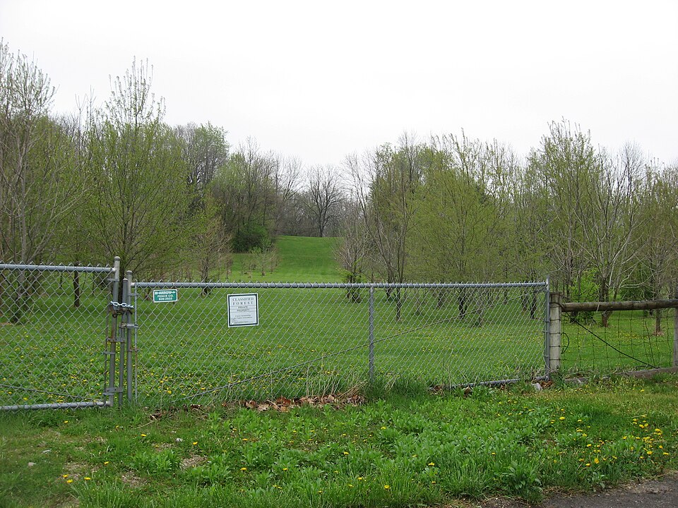
Listed on the National Register of Historic Places in 2014.
From the record
“Parsons Farmstead, also known as the Parsons / Vapor Farmstead, is a historic farm and national historic district located at Washington Township, Hendricks County, Indiana. The district encompasses eight contributing buildings, four contributing structures, and seven contributing objects on a farmstead developed between about 1880 and 1920.”
Wikipedia article A.A. Parsons Farmstead, CC BY-SA 4.0.
One of 22 National Register listings published here for Hendricks County · listed in 2014 · category: District.
National Register reference number. 14000803 - assigned by the National Park Service when the property was listed.
The ground it stands on
9,569 words
The chapter on Washington Township in History of Hendricks County, Indiana, published 1885 names Avon. This is what it says, exactly as the scans read.
The first church organized in Washington Township was at the house of Robert Wilson, in 1823. This is now the Shiloh Church, and it was the first Methodist Episcopal church organization in the i county, and the fourth one of any denomination. There are now in Washington Township three Methodist Episcopal churches - Shiloh and Wesley and Barlett's chapels - ana two Regular | Baptist - Abner's Creek and Salem. The Indianapolis &St. Louis Railroad passes nearly through the center of the township, and the only postoffice in it is at the village of Avon, a station on this rail¬ road.
Seth T. Huron is a native of Hendricks County, Ind., born in Washington Township, June 26, 1850, a son of Benjamin A. and Katherine Huron. He was reared and educated in his native county, and for about four years was one of its corps of school¬ teachers. In 1872 he went to Atchison, Kas., where he was employed as clerk in a store two years, and in 1874 returned to Hen¬ dricks County. He has devoted his attention to agricultural pur¬ suits and now owns a tine farm near Avon. In the spring of 1884 he was elected Justice of the Peace, and assumed the duties of his office the following November. Mr. Huron was married Aug. 2, I 1876, to Mary E. Farmer, daughter of David Farmer, formerly of j Hendricks County, now of Putnam County, Mo. To them have been born four children - Mary E., born May 3, 1877; Frank P., born Juue 16, 1880, died March 16, 1881; Irma R., born April 30,
Regional context, not property-specific
evidence. The
federal wildfire occurrence database
lists 4 fires within 5 miles of A.A. Parsons Farmstead
between 2003 and 2007, burning about 2 acres in total. None started naturally. None was recorded as arson.
Distance is straight-line from the map coordinates, so a fire counted
here may appear on a neighbouring settlement's page as well.
Reported cause
Fires
Smoking
2
Missing data/not specified/undetermined
2
The most recent of
them, most recent first, with the day each was reported and the service
that recorded it.
Regional context, not property-specific
evidence. The federal mineral resources record lists
1 working within 5 miles of A.A. Parsons Farmstead: 1 past producer.
None of them still produces. What was taken out: Sand and Gravel, Construction. Distance is straight-line from the
map coordinates, so a quarry counted here may appear on a neighbouring
settlement's page as well.
Regional context, not property-specific
evidence. The National Weather Service names
Avon, the town this property stands in, in 54 storm reports between 1996 and 2026: 28 hail, 22 thunderstorm wind, 2 flash flood, 1 lightning.
No death or injury is recorded in these reports. Each account below is quoted exactly as the forecast office
filed it, from the NOAA Storm Events Database, and each date
opens the federal record of that event.
Damaging thunderstorm winds caused significant damage to ten homes and minor damage to nearly fifty homes near County Road 800 East and 100 North along Captain Drive.
Very intense rainfall led to brief flash flooding across portions of Avon and Plainfield. Several roads had water over the curb while also rapidly flowing. Avon High school was partially flooded after the roof began to leak. 2 reports of rainfall over 4 inches were received with the rainfall occurring over a period of less than 2 hours.
A building was destroyed along US Route 36, west of Ronald Reagan Parkway, due to damaging thunderstorm wind gusts. A few other structures and barns were heavily damaged or destroyed across the county.
Storms Wednesday led to some major damage in Hendricks County, toppling the batting cages at baseball fields managed by the Avon Junior Athletic Association.||Poles were ripped up from the ground and left in a pile. Nets for the batting cages were strewn about.||The storm came quickly Wednesday night and was gone just as suddenly. Video provided to FOX59 showed strong winds churning up what appeared to be a gustnado, according to the National Weather Service.
Numerous reports of tree damage due to thunderstorm wind gusts across Hendricks county with most concentrated damage in Avon. Several larger trees were also either snapped or damaged, but most showed some amounts of rot.
Heavy rainfall draining into White Lick Creek caused the creek to overflow. A mobile home park near 600 East and 100 North was in the process of evacuation due to concern of a possible dam break. Damage estimate is greatly estimated.
A tree, twenty inches in diameter, and power lines were downed at Highway 267 and 200 North in Avon due to thunderstorm wind gusts. The time of this event has been estimated.
The hail stones were mostly half inch sized, with several three quarter inch sized stones as well. The event started at 531 PM EDT and lasted 10 minutes.
No historic map-sheet match is published
for this property yet. That does not mean no map exists. This record needs
a coordinate-quality review before it can be joined to a sheet boundary.
Browse the county's mapped places while that work is
pending.
Listed places nearby
6 within 8 miles
Other National Register properties close
enough to walk or drive between, ordered by distance from this one. Both
positions come from the same geocoding pass that matched these properties
to their map sheets.
Listing record. National Park Service National Register of Historic Places, listed-properties dataset, current to 2026-05-22.
Map join. Address geocoded through the United States Census geocoder, then tested against the published boundary of every sheet in the USGS Historical Topographic Map Collection.
How this page is made. Listing fields come from federal records; map-sheet coverage is a labelled coordinate-to-boundary calculation, not a source-field claim.
Wildfire. Short, Karen C. 2022. Spatial wildfire occurrence data for the United States, 1992-2020 [FPA_FOD_20221014]. 6th Edition. Fort Collins, CO: Forest Service Research Data Archive. https://doi.org/10.2737/RDS-2013-0009.6 Collected with United States Government funding and usable without additional permissions or fees.
Mines and quarries. USGS Mineral Resources Data System (MRDS) https://mrdata.usgs.gov/mrds/ A work of the United States government, no copyright under 17 U.S.C. 105.
Storms. NOAA National Centers for Environmental Information, Storm Events Database https://www.ncei.noaa.gov/stormevents/ A work of the United States government, no copyright under 17 U.S.C. 105. Narratives are quoted verbatim from the National Weather Service report and are not edited or summarised.
 Block