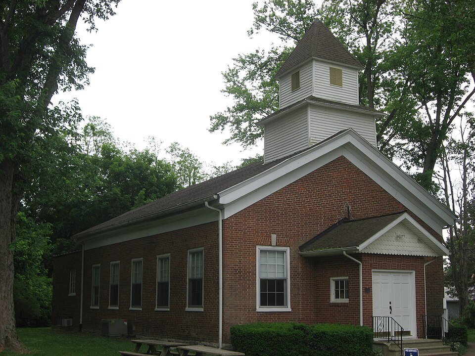
Listed on the National Register of Historic Places in 1984.
From the record
“Putnamville Presbyterian Church, also known as Putnamville Methodist Church, is a historic Presbyterian church on IN 243 in Putnamville, Indiana. It was built in 1834, and is a one-story, Greek Revival style brick church.”
Wikipedia article Putnamville Presbyterian Church, CC BY-SA 4.0.
One of 33 National Register listings published here for Putnam County · listed in 1984 · category: Building.
National Register reference number.84001242- the number the National Park Service assigned this property when it was listed, and the key its nomination file is catalogued under at the National Archives.
One of the marked features of the township is an excellent stone quarry one-half mile west of Putnamville. on the National road. The ledges of rock in this quarry vary from two inches to five feet in thickness. The following analysis of this stone is given by Professor Cox. state geologist : "Lime, twenty per cent; sand, twenty per cent: gray granite, sixty per cent: almost, if not exactly, like what is called 'English firestone.' He also says, "Granite will last three hundred years, but this stone will last as long as time. lM)r foundation stone, there is probably none superior in America. It is not affected by any change of temperature, and can be f(uarried in winter just as well as summer."
Putnamville is the only postoffice town in the township. Westland, which was laid out soon after Putnamville. had one store for a short time, but now has no inisiness house of any kind. A few houses in close proximity on either side of the National road are the only indications left to remind the passer-by of its former existence.
Regional context, not property-specific
evidence. The federal mineral resources record lists
10 workings within 5 miles of Putnamville Presbyterian Church: 8 producers, 1 plant, 1 past producer.
9 still produce. What was taken out: Stone, Crushed/Broken, Limestone, Dimension, Fire Clay (Refractory), Clay. Distance is straight-line from the
map coordinates, so a quarry counted here may appear on a neighbouring
settlement's page as well.
Regional context, not property-specific
evidence. The National Weather Service names
Putnamville, the town this property stands in, in 9 storm reports between 1993 and 2021: 4 thunderstorm wind, 3 hail, 1 tornado, 1 flood.
The reports record 1 injury. Each account below is quoted exactly as the forecast office
filed it, from the NOAA Storm Events Database, and each date
opens the federal record of that event.
No historic map-sheet match is published
for this property yet. That does not mean no map exists. This record needs
a coordinate-quality review before it can be joined to a sheet boundary.
Browse the county's mapped places while that work is
pending.
Listed places nearby
6 within 8 miles
Other National Register properties close
enough to walk or drive between, ordered by distance from this one. Both
positions come from the same geocoding pass that matched these properties
to their map sheets.
Listing record. National Park Service National Register of Historic Places, listed-properties dataset, current to 2026-05-22.
Map join. Address geocoded through the United States Census geocoder, then tested against the published boundary of every sheet in the USGS Historical Topographic Map Collection.
How this page is made. Listing fields come from federal records; map-sheet coverage is a labelled coordinate-to-boundary calculation, not a source-field claim.
Mines and quarries. USGS Mineral Resources Data System (MRDS) https://mrdata.usgs.gov/mrds/ A work of the United States government, no copyright under 17 U.S.C. 105.
Storms. NOAA National Centers for Environmental Information, Storm Events Database https://www.ncei.noaa.gov/stormevents/ A work of the United States government, no copyright under 17 U.S.C. 105. Narratives are quoted verbatim from the National Weather Service report and are not edited or summarised.
 Block