BlockBefore
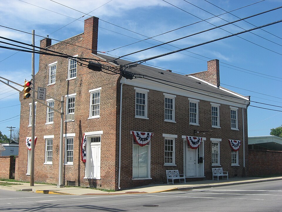
Photograph of George Makepeace House
Photograph by Nyttend, Public domain. Via Wikimedia Commons.

George Makepeace House

Listed on the National Register of Historic Places in 1985.

From the record

“George Makepeace House, also known as the Makepeace-Cornelius-McCallister House, is a historic home located at Chesterfield, Indiana. It was built in 1850, and is a five-bay, rectangular, Federal style brick commercial / residential building.”

Wikipedia article George Makepeace House, CC BY-SA 4.0.

One of 19 National Register listings published here for Madison County · listed in 1985 · category: Building.

Sources: the Wikipedia article · the case file at the National Archives · the National Register database, National Park Service
The listing

  • What is counted as historic. The nomination lists 1 building as contributing to the listing.
  • Listed as. Makepeace, George, House - the National Register files a house under its owner's surname.
  • Address. 5 W. Main St., Chesterfield, 46017
  • When was it listed? March 1985
  • Category. building
  • Township. Union township
  • Architectural style. Federal architecture
  • National Register reference number. 85000596 - the number the National Park Service assigned this property when it was listed, and the key its nomination file is catalogued under at the National Archives.

The ground it stands on

3,022 words

The chapter on Union Township in History of Madison County, Indiana, from 1820 to 1874 : Giving a General Review of Principal Events, Statistical and Historical Items, Derived from Official Sources, published 1874 names Chesterfield. This is what it says, exactly as the scans read.

This township is the smallest in the county. It is six and one-half miles from north to south, and three miles from east to west, containing nineteen and one-half square miles. It derived its name from the fact that it joins Delaware and Henry county on the east. Although the smallest in the county, its history is interesting, \yithin its borders are the famous Indian mounds. The Bellefontaine, and the Cincinnati and Chicago Railroads, the White river, and the hydraulic canal pass through this township. Chesterfield is the place of voting. Among the first settlers were Allen Makepeace, Frederick Bronenburg, Sr., Daniel Noland, Amasa Makepeace, William Diltz, John Suman, Brasleton Noland, Henry and Jacob Shimer, Dr. Godwin, William Johns, John Richardson, and George Makepeace. Among the first merchants were Allen Makepeace, Jacob Shimer, and George Makepeace. The first postmaster was Amasa Makepeace. The first physicians were Dr. Godwin, Samuel Weddiugton and G. W. Beninggall. The first blacksmith was John Rozell. The first shoemaker was Solomon Sawyer. The first grist mill was built at Chester- field by Amasa Makepeace, in the year 1827. A tan yard was started at Chesterfield about the same time by Russell & Brother, and was afterward owned by Amasa Makepeace ; next by Mr. Williams, and in 1869 was discontinued. In 1848, the school house in Chesterfield was built. It is a frame two stories in hight, and at that time was a very creditable house. The lower story has been used for a schoolroom, and the upper one for a Masonic hall. It is now old and dilapidated, and is not considered safe to meet in it. Among the first justices were Amasa Makepeace and Lewis Shroyer. The present ones are George Carpenter and William T. Trueblood. On the completion of the Bellefontaine railroad, in 1852, an impetus was given to Chesterfield ; a depot was established ; a warehouse was erected, and a large amount of wheat shipped from here. Soon after B. Noland built the grist mill near the railroad, and J, B. Anderson built the steam saw mill, both of which did a large business. The latter was moved away in 1870. Union township has at present two grist mills, one saw mill, eight miles oi railroad, two churches, one Masonic Lodge, one Grange Lodge, and five school houses, which cost six hundred dollars each. The number of school children in 1858 was two hundred and 14, and in 1874 it was two hundred and eighty-eight. The population in 1850 was six hundred and twenty-three; in 1860 it was eight hundred and fifty -eight; in 1870 it was eight hundred and fifty-one. It has a small swamp prairie extending south from Chesterfield, and containing several hundred acres. It is being redeemed, and soon will be the best land in the township. About one-third of this township lies north of the river, and the other two-thirds south. Within this township were committed two of the most diabolical murders that have ever occurred in the county, of which a separate account will be given in another part of this work. The general surface of the township is level, with the exception of the bluffs of White river. It is well adapted to the raising of wheat, and the prairie spoken of above is one of the best corn-raising regions in the county. There is yet in the southern part a large body of excellent timber.

Passage source: History of Madison County, Indiana, from 1820 to 1874 : Giving a General Review of Principal Events, Statistical and Historical Items, Derived from Official Sources, published 1874.

Are situated in an open piece of woods in Union township, midway between Anderson and Chesterfield, north and in sight of the wagon road, and one-half mile north of the Bellefontaine railroad, on tne land of Fredrick Branenburg. These mounds are annually visited by pleasure seekers from different parts of the State. Many picnics and celebrations are held here. It is a beautiful place in May. An hour can be profitably passed here, seeing and reflecting. The query naturally comes up. When and by whom were these mounds built? The author does not propose answering either of these. One thing, however, is apparent : it has been many hundred years since this vast work was done; for we find large trees, three and four feet in diameter, which have flourished, fallen and decayed upon the wall. It is said that the Indians who inhabited the county at the time of its settlement by the whiles knew nothing of their origin. The largest of these mounds (for there are three) we will undertake a description of: It is of circular form, three hundred and forty yards in circumference. The wall is fifteen feet high, with an open gap or space at the south, twenty feet wide, which seems to be a doorway, or place of ingress and egress. The interior of this wall is not scooped out, as one might suppose. There is, however, a deep trench extending along on the inside of the wall, leaving the center beautifully rounded up, being a little higher than the outer wall itself. It must originally have been very uniform in its finish, as it still has this appearance. The trench above alluded to must have been at one time quite deep, for the annual dropping of leaves, decayed vegetation, washing, etc., must have filled it up materially. A few years ago a few persons made an opening in the center of this mound, for the purpose of making some discovery, as the supposition had long existed that the remains of some ancient race lay buried here. The result of this undertaking seems to have confirmed the above supposition.

Passage source: History of Madison County, Indiana, from 1820 to 1874 : Giving a General Review of Principal Events, Statistical and Historical Items, Derived from Official Sources, published 1874.

Machine-read from a century-old scan, so expect the errors a machine makes: misspelled names, dropped words, stray characters.

Read the whole chapter on Union Township - 3,022 words on its settlement, mills, schools and churches.

Mines and quarries near this property

3 within 5 miles

Regional context, not property-specific evidence. The federal mineral resources record lists 3 workings within 5 miles of George Makepeace House: 2 producers, 1 past producer. 2 still produce. What was taken out: Sand and Gravel, Construction. Distance is straight-line from the map coordinates, so a quarry counted here may appear on a neighbouring settlement's page as well.

Where SiteCommodity StatusRecorded
Anderson Pit & Mill No. 2Sand and Gravel, ConstructionPast Producer
Anderson Pit-Irving Materials, Inc.Sand and Gravel, ConstructionProducer
Chesterfield PitSand and Gravel, ConstructionProducer

Every working recorded in Madison County

Storms near this property

6 since 1994

Regional context, not property-specific evidence. The National Weather Service names Chesterfield, the town this property stands in, in 6 storm reports between 1994 and 2018: 5 thunderstorm wind, 1 lightning. The reports record 1 injury. Each account below is quoted exactly as the forecast office filed it, from the NOAA Storm Events Database, and each date opens the federal record of that event.

WhenEvent Place namedHarm What the report says
August 2001Thunderstorm WindChesterfield1 hurt, $10,000no account filed
July 2018Thunderstorm WindChesterfield$6,000Some damage to a barn occurred due to damaging thunderstorm wind gusts.
December 2015Thunderstorm WindChesterfield$6,000Power poles were downed due to damaging thunderstorm wind gusts.
May 1994Thunderstorm WindChesterfield$5,000Power lines and trees were blown down.
August 2007LightningChesterfield$100Lightning struck a retirement home in Chesterfield.
November 2005Thunderstorm WindChesterfield-no account filed

Every storm recorded in Madison County

Map coverage status

No historic map-sheet match is published for this property yet. That does not mean no map exists. This record needs a coordinate-quality review before it can be joined to a sheet boundary. Browse the county's mapped places while that work is pending.

Listed places nearby

6 within 8 miles

Other National Register properties close enough to walk or drive between, ordered by distance from this one. Both positions come from the same geocoding pass that matched these properties to their map sheets.

Photograph PropertyDistance Listed
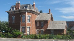
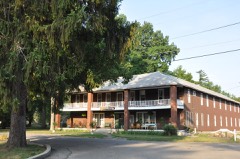
Chesterfield Spiritualist Camp District0.3 miles2002
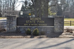
Mounds State Park1.6 miles1973
Gruenewald House4.3 miles1976
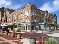
Paramount Theater Building4.4 miles1991
Anderson Bank Building4.4 miles1984
Carnegie Public Library4.5 miles1985

Sources for this property

National Archives recordThe nomination case file for reference 85000596 in Record Group 79.
Wikipedia articleCommunity-written account of this property, licensed CC BY-SA.
Madison CountyAll 19 listed properties in this county.

Provenance

  • Listing record. National Park Service National Register of Historic Places, listed-properties dataset, current to 2026-05-22.
  • Map join. Address geocoded through the United States Census geocoder, then tested against the published boundary of every sheet in the USGS Historical Topographic Map Collection.
  • How this page is made. Listing fields come from federal records; map-sheet coverage is a labelled coordinate-to-boundary calculation, not a source-field claim.
  • Mines and quarries. USGS Mineral Resources Data System (MRDS) https://mrdata.usgs.gov/mrds/ A work of the United States government, no copyright under 17 U.S.C. 105.
  • Storms. NOAA National Centers for Environmental Information, Storm Events Database https://www.ncei.noaa.gov/stormevents/ A work of the United States government, no copyright under 17 U.S.C. 105. Narratives are quoted verbatim from the National Weather Service report and are not edited or summarised.