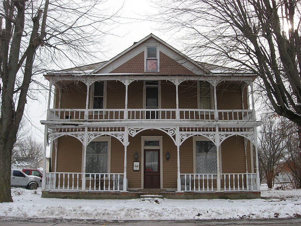
Listed on the National Register of Historic Places in 1987.
From the record
“Roads Hotel is a historic hotel building located at Atlanta, Indiana. It was built in 1893, and is a two-story, rectangular, Queen Anne style frame building.”
Wikipedia article Roads Hotel, CC BY-SA 4.0.
One of 31 National Register listings published here for Hamilton County · listed in 1987 · category: Building.
Architectural style. Queen Anne style architecture in the United States
National Register reference number.87002187- the number the National Park Service assigned this property when it was listed, and the key its nomination file is catalogued under at the National Archives.
The ground it stands on
6,516 words
The chapter on Jackson Township in History of Hamilton County Indiana, published 1915 names Atlanta. This is what it says, exactly as the scans read.
In 1836 Michael Shiel came to the county and settled near the present site of Atlanta. Allen Sumner and George Tucker settled near the Shiel cabin on the opposite side of the line later followed by the Lake Erie & Western railway. Later comers included James Thompson, Alexander Smith, John Ehrman, Frederick Smelce and Caleb Sparger. Sparger's land joined Shiel's on the west. Later both Sparger and Shiel laid out a town, calling them, respectively, Spargerville and Shielville, which towns later were merged into one called Buena Vista, and which at present is called Atlanta. Other settlers included the following: Phillip Roads, Peter Miller, Daniel Smith, Daniel and William Haskett, John Harrington, John and Jacob Crull, George Hives and Jacob Whistler.
Jackson township is unique in one respect, as it has within its limits more towns and settlements than any other township in Hamilton county. Cicero, Arcadia and Atlanta are about equal distance apart, along the eastern part of the township, with Deming, a village in the southwestern part, and the Roberts settlement slightly northwest of the center of the township.
Regional context, not property-specific
evidence. The federal mineral resources record lists
2 workings within 5 miles of Roads Hotel: 2 producers.
All of them still produce. What was taken out: Stone, Stone, Crushed/Broken. Distance is straight-line from the
map coordinates, so a quarry counted here may appear on a neighbouring
settlement's page as well.
Regional context, not property-specific
evidence. The National Weather Service names
Atlanta, the town this property stands in, in 5 storm reports between 2004 and 2024: 2 tornado, 2 hail, 1 thunderstorm wind.
No death or injury is recorded in these reports. Each account below is quoted exactly as the forecast office
filed it, from the NOAA Storm Events Database, and each date
opens the federal record of that event.
At 1605EST, this EF-1 tornado touched down a half mile south-southwest of Atlanta. The tornado tracked through the town of Atlanta, producing damage to structures in town. At 1607EST, the tornado path crossed into south-central Tipton County and ended to the east of Cicero Creek, just north of the Hamilton-Tipton County line at 1608EST.
No historic map-sheet match is published
for this property yet. That does not mean no map exists. This record needs
a coordinate-quality review before it can be joined to a sheet boundary.
Browse the county's mapped places while that work is
pending.
Listed places nearby
2 within 8 miles
Other National Register properties close
enough to walk or drive between, ordered by distance from this one. Both
positions come from the same geocoding pass that matched these properties
to their map sheets.
Listing record. National Park Service National Register of Historic Places, listed-properties dataset, current to 2026-05-22.
Map join. Address geocoded through the United States Census geocoder, then tested against the published boundary of every sheet in the USGS Historical Topographic Map Collection.
How this page is made. Listing fields come from federal records; map-sheet coverage is a labelled coordinate-to-boundary calculation, not a source-field claim.
Mines and quarries. USGS Mineral Resources Data System (MRDS) https://mrdata.usgs.gov/mrds/ A work of the United States government, no copyright under 17 U.S.C. 105.
Storms. NOAA National Centers for Environmental Information, Storm Events Database https://www.ncei.noaa.gov/stormevents/ A work of the United States government, no copyright under 17 U.S.C. 105. Narratives are quoted verbatim from the National Weather Service report and are not edited or summarised.
 Block