 Block
From the record
One of 6 National Register listings published here for Harrison County · listed in 1989 · category: District.
Sources: the case file at the National Archives · the National Register database, National Park Service
Listed on the National Register of Historic Places in 1989.
One of 6 National Register listings published here for Harrison County · listed in 1989 · category: District.
Sources: the case file at the National Archives · the National Register database, National Park Service
Regional context, not property-specific evidence. The federal mineral resources record lists 5 workings within 5 miles of Corydon Historic District (Boundary Increase): 4 producers, 1 occurrence. 4 still produce. What was taken out: Stone, Crushed/Broken, Stone, Fluorine-Fluorite. Distance is straight-line from the map coordinates, so a quarry counted here may appear on a neighbouring settlement's page as well.
| Where | Site | Commodity | Status | Recorded |
|---|---|---|---|---|
| Unnamed Fluorite Occurrence | Fluorine-Fluorite | Occurrence | Fluorite | |
| Corydon Quarry | Stone | Producer | ||
| Corydon Stone Quarry | Stone, Crushed/Broken | Producer | ||
| Harrison Co. Hwy. Dept. | Stone | Producer | ||
| Mathes Stone Quarry | Stone, Crushed/Broken | Producer |
Regional context, not property-specific evidence. The National Weather Service names Corydon, the town this property stands in, in 99 storm reports between 1996 and 2025: 57 thunderstorm wind, 24 hail, 9 flash flood, 6 flood. No death or injury is recorded in these reports. Each account below is quoted exactly as the forecast office filed it, from the NOAA Storm Events Database, and each date opens the federal record of that event.
| When | Event | Place named | Harm | What the report says |
|---|---|---|---|---|
| August 2020 | Flash Flood | Corydon | $150,000 | Flood waters made it into numerous homes and businesses, and a water rescue took place on Budd Road. Cost of damages estimated. |
| April 2003 | Thunderstorm Wind | Corydon | $30,000 | A tree was blown on to a house. Another tree was blown on to power lines. Part of a garage roof was blown off. |
| May 2006 | Thunderstorm Wind | Corydon | $20,000 | The roof was blown off a barn. |
| October 2007 | Thunderstorm Wind | Corydon | $10,000 | A tree was blown on to a house in Corydon. |
| January 2000 | Thunderstorm Wind | Corydon | $10,000 | Several barns destroyed |
| July 1996 | Tornado (F1) | Corydon | $10,000 | no account filed |
| June 2015 | Thunderstorm Wind | Corydon | $5,000 | The Harrison County emergency manager reported that severe thunderstorm winds brought down power lines on State Road 62 approximately 1/2 mile east of Corydon. |
| June 2001 | Thunderstorm Wind | Corydon | $5,000 | Trees were uprooted, and trailer underpinnings were torn out. |
| September 2009 | Thunderstorm Wind | Corydon | $2,000 | Some trees were downed with pea size hail. Wind speed estimate from radar. |
| February 1996 | Thunderstorm Wind | Corydon | $2,000 | no account filed |
| May 2004 | Hail | Corydon | $1,000 | Branches were downed and windows were broken by golf ball size hail. |
| May 2025 | Thunderstorm Wind | Corydon | - | INDOT site IN040 1.9 N Corydon measured a 62 mph wind gust. |
| April 2025 | Thunderstorm Wind | Corydon | - | The IN040 RWIS site measured a 50 knot wind gust. |
| July 2024 | Thunderstorm Wind | Corydon | - | Trees were blown down onto a house by strong winds. |
| July 2024 | Thunderstorm Wind | Corydon | - | A tree was blown down and several power lines were brought down northeast of Corydon near Interstate 64. |
| March 2023 | Thunderstorm Wind | Corydon | - | Trees were blown down in Corydon. |
| April 2023 | Thunderstorm Wind | Corydon | - | There was significant roof damage to a commercial building along State Road 337. Roofing material was blown eastward into vehicles parked at nearby duplexes. There was also minor damage at a duplex. |
| April 2023 | Thunderstorm Wind | Corydon | - | A tree blew down on a driveway. |
| May 2022 | Thunderstorm Wind | Corydon | - | A tree fell on power lines and blocked Williar Avenue. |
| July 2021 | Thunderstorm Wind | Corydon | - | There were multiple broken large tree limbs. |
| June 2019 | Thunderstorm Wind | Corydon | - | Multiple trees were reported down in Corydon. |
| June 2018 | Thunderstorm Wind | Corydon | - | A Bradford pear tree broke in half with the upper half blocking southbound Edsel Lane at Federal Drive. |
| May 2018 | Thunderstorm Wind | Corydon | - | There were numerous trees blocking roadways throughout the county causing several roads to be closed. |
| July 2018 | Hail | Corydon | - | Hail fell for 30 minutes in downtown Corydon. The largest hail was golf ball size. |
| September 2018 | Flash Flood | Corydon | - | Major flooding was reported in Corydon. Water covered roads that do not normally flood. |
| June 2016 | Thunderstorm Wind | Corydon | - | The public reported that windows were blown out of the Walmart store in Corydon. |
| June 2016 | Hail | Corydon | - | In addition to the hail, the trained spotter reported winds near 50 mph. |
| May 2016 | Thunderstorm Wind | Corydon | - | Trained spotters reported trees down in the area. |
| July 2016 | Thunderstorm Wind | Corydon | - | Local law enforcement reported trees down in the area due to severe thunderstorm winds. |
| March 2015 | Flood | Corydon | - | Little Indian Creek overflowed Mulberry Street in Corydon. |
| June 2015 | Hail | Corydon | - | A broadcast meteorologist relayed to the NWS a report of hail up to 3/4 inch in diameter. |
| April 2015 | Thunderstorm Wind | Corydon | - | A state official reported trees down. |
| April 2015 | Hail | Corydon | - | The public reported silver dollar size hail in Corydon. |
| July 2015 | Hail | Corydon | - | A trained spotter reported 1 inch diameter hail. |
| December 2015 | Hail | Corydon | - | A broadcast meteorologist relayed a report of 1 inch diameter hail. |
| December 2015 | Flood | Corydon | - | An amateur radio operator reported to the NWS that several Harrison County low water crossings were flooded, including Highway 337 just north of I-64. |
| July 2013 | Thunderstorm Wind | Corydon | - | Harrison County law enforcement reported trees down county wide, including the town of Corydon. |
| April 2011 | Tornado (EF0) | Corydon | - | An NWS storm survey confirmed an EF-0 tornado with wind speeds estimated at 65 mph. The path length was approximately 0.3 miles with a width of 50 yards. Numerous hardwood and softwood trees were either snapped or uprooted along the northern bank of Indian Creek. |
| April 2011 | Thunderstorm Wind | Corydon | - | A trained spotter reported trees were blown down. |
| April 2011 | Thunderstorm Wind | Corydon | - | Trees and power lines were blown down. |
| April 2011 | Flood | Corydon | - | Widespread road closures were reported countywide. |
| April 2011 | Flood | Corydon | - | Both Big and Little Indian Creeks in downtown Corydon were flooding out of their banks with water over the nearby street. The water was entering parking lots and approaching businesses. |
| May 2011 | Thunderstorm Wind | Corydon | - | Sixty mph winds were estimated along leading edge of a squall line. |
| August 2011 | Thunderstorm Wind | Corydon | - | The public reported several trees down in the Corydon area. |
| February 2009 | Thunderstorm Wind | Corydon | - | A roof was blown off a business and power poles were snapped on the northwest side of Corydon. |
| June 2009 | Thunderstorm Wind | Corydon | - | Trees were downed across the county. Some trees were down on power lines and roads. Emergency Manager estimated wind gusts around 60 mph. |
| June 2009 | Thunderstorm Wind | Corydon | - | Numerous power lines were downed across the county. |
| September 2009 | Heavy Rain | Corydon | - | Three inches of rain fell between 4:30 pm and 5:30 pm EST. Total rain for the day through 5:30 pm EST was 3.30 inches. |
| March 2008 | Flood | Corydon | - | The Big Indian Creek near Corydon flooded a campground. Trailers and vehicles were submerged in high water. Several creeks and streams were out of their banks near Palmyra. |
| June 2008 | Thunderstorm Wind | Corydon | - | Numerous trees and power lines down all across the county. |
| July 2008 | Thunderstorm Wind | Corydon | - | Trees were reported down across the county. |
| July 2008 | Thunderstorm Wind | Corydon | - | Trees were downed on Highways 111, 62, 337 and 11 and also in Corydon. |
| December 2007 | Flood | Corydon | - | Parts of Indiana Highway 11 were closed. There was high water in spots in the town of Corydon. |
| August 2007 | Thunderstorm Wind | Corydon | - | Trees and power lines were downed. |
| March 2006 | Thunderstorm Wind | Corydon | - | A spotter reported a 60 MPH wind gust on the south side of Corydon. Trees were downed on Highway 135. |
| July 2006 | Flash Flood | Corydon | - | Swift flowing water was reported at Walnut and Capitol Streets. |
| May 2004 | Flash Flood | Corydon | - | Corydon-Ramsey Road was closed due to high water. |
| July 2004 | Thunderstorm Wind | Corydon | - | Trees were blown down. |
| April 2003 | Thunderstorm Wind | Corydon | - | Trees were downed. |
| June 2003 | Flash Flood | Corydon | - | Some streets in downtown Corydon were impassable due to flood waters. |
No historic map-sheet match is published for this property yet. That does not mean no map exists. This record needs a coordinate-quality review before it can be joined to a sheet boundary. Browse the county's mapped places while that work is pending.
Other National Register properties close enough to walk or drive between, ordered by distance from this one. Both positions come from the same geocoding pass that matched these properties to their map sheets.
| Photograph | Property | Distance | Listed |
|---|---|---|---|
 | Corydon Historic District | under 500 feet | 1973 |
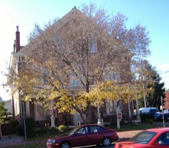 | Kintner House Hotel | 0.2 miles | 1987 |
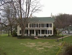 | Kintner-McGrain House | 0.4 miles | 1983 |
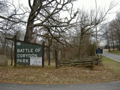 | Corydon Battle Site | 0.9 miles | 1979 |
| National Archives record | The nomination case file for reference 89000243 in Record Group 79. |
| Harrison County | All 6 listed properties in this county. |