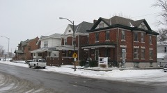
| October 1996 | Thunderstorm Wind | Logansport | 3 hurt, $200,000 | no account filed |
| June 1996 | Lightning | Logansport | 1 hurt | no account filed |
| July 1998 | Flash Flood | Logansport | $500,000 | THE LOGANSPORT IMPLEMENT STORE WAS INUNDATED WITH WATER UP TO FOUR FEET DEEP. SEVERAL HOMES IN TOWN SUSTAINED FLOODED BASEMENTS. ONE RESIDENT IN THE TOWN OF GALVESTON HAD THEIR BASEMENT WALL COLLAPSE DUE TO THE PRESSURE OF THE WATER. |
| September 1993 | Thunderstorm Wind | Logansport | $500,000 | A microburst on the south side of Logansport ripped the roof from a warehouse. The debris was scattered downwind, and caused damage to several other buildings in the immediate area. A few people received some minor bumps and bruises. Damage was estimated at $100,000. |
| July 2006 | Thunderstorm Wind | Logansport | $125,000 | At least a dozen homes suffered damage, several of them having tree limbs fall onto part of the residence. One limb punched thorugh a roof causing extensive damage. 6 cars had tree limbs fall onto them. A brand new truck was totalled from a large limb crushing the vehicle. Numerous other trees, tree limbs and power poles were blown down in and around Logansport. Damage was estimated by Emergency Management at around $125,000. |
| December 1998 | Thunderstorm Wind | Logansport | $100,000 | STRONG WINDS CAUSED PART OF THE THIRD STORY OF THE TOTAL DISCOUNT STORE IN LOGANSPORT TO COLLAPSE. THE SOUTHWEST CORNER OF THE BUILDING FELL ONTO HAP'S DOWNTOWNER, A RESTAURANT LOCATED NEXT DOOR. ELECTRICAL POWER POLES WERE BROKEN, CAUSING POWER OUTAGES. NUMEROUS TREE LIMBS WERE ALSO KNOCKED DOWN, RESULTING IN DAMAGE TO TWO AUTOMOBILES. TO THE SOUTHEAST OF LOGANSPORT, IN WALTON, A GRAIN BIN WAS APPARENTLY BLOWN OVER BY THE WIND. |
| June 2006 | Thunderstorm Wind | Logansport | $80,000 | About a dozen homes with trees down on them, causing structural damage. Power lines and power poles blown down resulting in widespread power outages across much of southeast Cass County. |
| July 2010 | Thunderstorm Wind | Logansport | $50,000 | Emergency management officials reported a large tree fell onto a house, penetrating the roof and causing significant damage. Rainfall entered the home through the opening adding to the damage. Damage is estimated at around $50,000. Other trees and tree limbs were reported down in the New Waverly area as well. |
| June 2008 | Thunderstorm Wind | Logansport | $50,000 | Emergency management officials reported numerous trees and power lines down across the county. In addition, a home in the city of Logansport had two of its windows shattered. |
| June 2010 | Thunderstorm Wind | Logansport | $30,000 | The roof of Tom Haynes Automotive was blown onto main feeder lines for Logansport municipal utilities which caused extensive power outages in Logansport. Numerous trees were downed across town that blocked roadways. |
| June 2006 | Thunderstorm Wind | Logansport | $30,000 | Five homes with trees blown down on them causing structural damage. |
| May 2000 | Thunderstorm Wind | Logansport | $30,000 | Barn destroyed. Trees down on cars and homes. Power lines down. |
| August 2009 | Thunderstorm Wind | Logansport | $25,000 | The local newspaper reported a large tree falling onto a garage at a residence on 17th Street. The garage was destroyed from a combination of the tree damage and being shifted off its foundation. A Jeep was trapped in the garage, but no information on the amount of damage was given. Damage to the garage is estimated at $25,000. |
| June 2007 | Thunderstorm Wind | Logansport | $25,000 | A 20 inch tree was blown over into a house just north of Logansport. |
| May 2007 | Thunderstorm Wind | Logansport | $25,000 | Numerous trees, tree limbs, power lines reported down in and around Logansport. At least 4 homes were reported to have trees down onto them, suffering minor damage. Some structures also sustained shingle and siding damage. A tree fell onto a car as well. |
| November 1998 | Thunderstorm Wind | Logansport | $25,000 | MANY TREES...POWER LINES AND POLES WERE BLOWN DOWN IN TOWN WITH SEVERAL RESIDENTIAL STREETS BLOCKED FOR A TIME. |
| May 2006 | Thunderstorm Wind | Logansport | $20,000 | Numerous reports were received of trees down between Logansport and Anoka. Vehicles as well as a few homes were reported damaged from falling trees in both Logansport and Anoka. Damage amounts are estimated. |
| March 2009 | Thunderstorm Wind | Logansport | $15,000 | Emergency management officials reported the back half of a roof was ripped off a local business. No injuries were reported. Damage is estimated at $15,000. |
| April 2006 | Thunderstorm Wind | Logansport | $15,000 | Numerous trees and power lines were blown down. A house was shifted off its foundation. |
| July 2024 | Thunderstorm Wind | Logansport | $10,000 | Numerous trees and power lines down in an around Logansport. Locations include, 1225 S 800 E, High Street at Roselawn and 22nd, 250E and 125 N. |
| June 2005 | Thunderstorm Wind | Logansport | $10,000 | Trees and power lines were reported down in both Logansport and Walton. |
| July 2006 | Lightning | Logansport | $8,000 | A bolt of lightning blew a hole in the center of a chimeny on the Logansport Public Library. Bricks from the blast were thrown into a nearby alley, as well as embedded in the roof of the library and a nearby garage. Damage is estimated at $8,000. |
| April 2003 | Thunderstorm Wind | Logansport | $6,000 | Emergency management reported a roof blown off a barn...some roof damage to a house...and trees and power poles down near Logansport. |
| July 2022 | Thunderstorm Wind | Logansport | $5,000 | Multiple trees down on the 1500 block of 3rd St. in Logansport. |
| June 2004 | Flash Flood | Logansport | $5,000 | Emergency management reported US 24 flooded with large boulders from landscaping swept onto highway causing auto accidents. |
| October 1996 | Thunderstorm Wind | Logansport | $5,000 | no account filed |
| May 2004 | Thunderstorm Wind | Logansport | $2,000 | Law enforcement reported damage to a church northeast of Logansport. |
| April 2025 | Thunderstorm Wind | Logansport | $1,000 | Tree down on Hawthorne Lane. |
| July 2001 | Thunderstorm Wind | Logansport | $1,000 | Large tree blown onto garage. |
| May 2024 | Thunderstorm Wind | Logansport | $500 | Large tree limbs now. |
| March 2022 | Thunderstorm Wind | Logansport | - | The public reported a tree of unknown size fell onto power lines. |
| March 2022 | Thunderstorm Wind | Logansport | - | The public reported a tree of unknown size fell onto a parked vehicle. |
| March 2022 | Thunderstorm Wind | Logansport | - | The AWOS at the Logansport Airport recorded a 58 mph wind gust. |
| July 2020 | Thunderstorm Wind | Logansport | - | Em reports trees and power lines down across the county. |
| July 2019 | Thunderstorm Wind | Logansport | - | Emergency management officials reported a 18 inch diameter tree was blown down at the intersection of Burlington Ave and Dewey St. |
| July 2019 | Thunderstorm Wind | Logansport | - | Emergency management officials reported two trees were blown down on Burlington Ave near Third St. One tree was around 18 inches in diameter, with the other slightly smaller. |
| May 2019 | Thunderstorm Wind | Logansport | - | An off duty NWS employee reported one to three foot diameter trees were blown down onto a house on High Street. The home sustained roof damage. |
| May 2019 | Thunderstorm Wind | Logansport | - | Emergency management officials relayed numerous reports of damage to trees, structures and vehicles around Logansport. |
| August 2016 | Thunderstorm Wind | Logansport | - | Trees and tree limbs were blown down in the vicinity of the high school in Logansport. |
| June 2015 | Thunderstorm Wind | Logansport | - | Trees down on powerlines. |
| September 2015 | Thunderstorm Wind | Logansport | - | Local officials reported several tree limbs down in the city of Logansport. |
| September 2015 | Thunderstorm Wind | Logansport | - | Emergency management officials reported numerous down trees and tree limbs form Logansport east. |
| June 2015 | Thunderstorm Wind | Logansport | - | Dime sized hail was reported. |
| June 2010 | Thunderstorm Wind | Logansport | - | Trees downed throughout county with some flash flooding. Trees fell down onto two houses and one car. |
| May 2009 | Flash Flood | Logansport | - | Emergency management officials reported a creek just north of the intersection of State Route 17 and County Road 400 North, going out of its banks, resulting in high flowing water over several roads. A few vehicles were reported to be stalled in the flood waters. Spotters in the area reported two to three inches of rain. |
| June 2008 | Hail | Logansport | - | Law enforcement officials reported hail up to the size of quarters covering the ground. |
| August 2007 | Thunderstorm Wind | Logansport | - | Numerous trees and tree limbs were blown down. |
| June 2007 | Flash Flood | Logansport | - | Emergency Management officials reported 2.8 inches of rain fell in under 2 hours over the city of Logansport, causing widespread flooding of roads in and around town. |
| June 2006 | Thunderstorm Wind | Logansport | - | Several large trees down. |
| May 2005 | Hail | Logansport | - | Several reports of penny to quarter size hail around Logansport. |
| May 2004 | Thunderstorm Wind | Logansport | - | Emergency management reported numerous trees down in Logansport. |
| June 2004 | Flash Flood | Logansport | - | Emergency management reported over 1 foot of water still flowing over 3 roads in Logansport. |
| June 2004 | Flash Flood | Logansport | - | Emergency management reported roads closed with water flowing across roadways. 4 to 5 roads had water over 2 feet deep flowing across them. |
| July 2004 | Thunderstorm Wind | Logansport | - | Three dozen trees knocked down and some reported blocking roads near Route 24. Tree fell on trailer in France Park Campground. County EM estimated 60 to 70 mph winds. |
| August 2003 | Thunderstorm Wind | Logansport | - | Tree down. |
| July 2003 | Thunderstorm Wind | Logansport | - | Law enforcement reported trees down west of Logansport. |
| July 2003 | Thunderstorm Wind | Logansport | - | Law enforcement reported trees and power lines down in Logansport. |
| July 2003 | Flash Flood | Logansport | - | Emergency management reported over 2 feet of water over many roads with numerous road closures due to flash flooding across the county. |
| July 2003 | Thunderstorm Wind | Logansport | - | Law enforcement reported trees and power lines down countywide. |
| April 2001 | Thunderstorm Wind | Logansport | - | Large tree blown down. |
 Block