BlockBefore
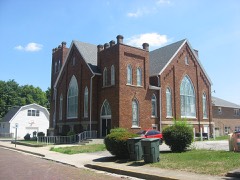
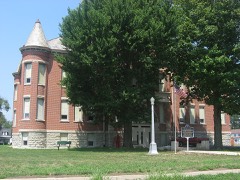
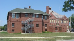
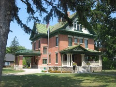
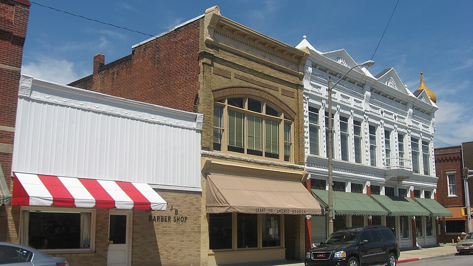
Photograph of Fairmount Commercial Historic District
Photograph by Nyttend, Public domain. Via Wikimedia Commons.

Fairmount Commercial Historic District

Listed on the National Register of Historic Places in 1999.

From the record

“Fairmount Commercial Historic District is a national historic district located at Fairmount, Indiana. It encompasses 31 contributing buildings in the central business district of Fairmount.”

Wikipedia article Fairmount Commercial Historic District, CC BY-SA 4.0.

One of 23 National Register listings published here for Grant County · listed in 1999 · category: District.

Sources: the Wikipedia article · the case file at the National Archives · the National Register database, National Park Service


The listing

What happened here

An account from the chapter on Fairmount township. The inset identifies its exact source book and publication year.

From The Making of a Township, Being an Account of the Early Settlement and Subsequent Development of Fairmount Township, Grant County, Indiana, 1829 to 1917, Based Upon Data Secured by Personal Interviews, from Numerous Communications and Various Other Reliable Sources of Information Concerning Local History;, published 1917 - Fairmount Township

Hon. John T. Strange

"The valiant Campbell, for whom General Harrison predicted such a bright future, was promoted in the following year for his success in the Mississinewa expedition. In April, 1814, he was commissioned a Colonel in the Eleventh Infantry, but was fatally wounded in the battle of Chippewa, on July 5th, of that year, and died August 29th, following."

Read the rest of this passage

The ground it stands on

158,658 words

The chapter on Fairmount Township in History of Grant County, Indiana, published 1886 names Fairmount. This is what it says, exactly as the scans read.

At that time he went to Cincinnati and worked for a time in a daily newspaper office. After this he followed his trade in Indianapolis, Chicago, Philadelphia, and in October, 1883, went to New York City. He remained in the last place until January, 1885, and attended Cooper Institute during the evenings. He again spent a few months as a journeyman printer in Washington, Cincinnati, Indianapolis, Lafayette and Chicago, arriving home in May, 1885. In the latter part of that month he succeeded Charles Stout as proprietor of the Fairmount News, a paper he has conducted with vigor and success ever since.

Passage source: History of Grant County, Indiana, published 1886.

Ellis is the daughter of Daniel H. and Rachael (Hockett) Moon. Prof. Ellis was born on the 19th of April, 1857. He spent the first fourteon years of his life in Ohio, and at the age of seven years began attending the common schools, in which he made rapid progress, completing the common branches in his eleventh year. He afterward attended the academy at West Elkton, Ohio, of which his brother was principal,and in the winter of 1874-75 taught his first school near Jonesboro, Grant County. He afterward attended the Jonesboro school aud the normal school at Marion, and in the winter of 1875-76 taught his first public school in Mill Township. He taught five consecutive years in Mili Township, three years at the Back Creek school, and sinco that time has been connected with the Fairmount schools. He was principal of the high school at Fairmount for two years, and in the fall of 1885 became principal of the academy at the same place, a position he still retains. Prof, Ellis is one of the leading teachers of Grant County, and his reputation as an instructor is much more than local. He served one term as trustee of Mill Township, and discharged the duties of that oflice in an-erainently satisfactory manner. He was married, March 28, 1878, to Miss Ida Hussey, who was born in Jonesboro June 21, 13850. To this marriage has been born two children: Arthur W. and Dora M. Ellis. Prof. Hillis is an able minister in the Society of Friends and a Republican in politics.

Passage source: History of Grant County, Indiana, published 1886.

Machine-read from a century-old scan, so expect the errors a machine makes: misspelled names, dropped words, stray characters.

Read the whole chapter on Fairmount Township - 158,658 words on its settlement, mills, schools and churches.

Storms near this property

25 since 1996

Regional context, not property-specific evidence. The National Weather Service names Fairmount, the town this property stands in, in 25 storm reports between 1996 and 2025: 13 thunderstorm wind, 9 hail, 2 tornado, 1 lightning. No death or injury is recorded in these reports. Each account below is quoted exactly as the forecast office filed it, from the NOAA Storm Events Database, and each date opens the federal record of that event.

WhenEvent Place namedHarm What the report says
June 1998Tornado (F1)Fairmount$1,000,000THIS TORNADO TRACK WAS A CONTINUATION OF THE TORNADO WHICH BEGAN NEAR THE TOWN OF ELWOOD IN MADISON COUNTY. THE TORNADO WAS WEAKENING AS IT CROSSED INTO GRANT COUNTY BUT CAUSED EXTENSIVE DAMAGE TO SEVERAL FARMS. ONE FARMSTEAD SUFFERED A DESTROYED BARN AND AN OVERTURNED JUNK BUS. ANOTHER FARMSTEAD HAD A VERY LARGE METAL OUTBUILDING DESTROYED AND 3 LARGE SILOS WERE BLOWN INTO THE FARM HOUSE WHICH SUFFERED MAJOR DAMAGE. ANOTHER FARM LOST MOST OF ITS OUTBUILDINGS WITH THE ROOF OF THE HOUSE DAMAGED. ANOTHER FARM NEAR FAIRMOUNT SUFFERED SEVERE DAMAGE WITH 2 BARNS DESTROYED AND THE HOUSE LOST ITS ROOF.MANY TREES AND OUTBUILDINGS IN FOWLERTON WERE DAMAGED WERE THE TORNADO FINALLY LIFTED.
March 2025LightningFairmount$35,000Barn caught on fire due to a lightning strike.
May 2024Thunderstorm WindFairmount$14,000Powerlines are down, blocking some roads.
May 2025Thunderstorm WindFairmount$10,000Report of power lines down.
July 2005Thunderstorm WindFairmount$10,000A power pole was blown down onto county road 1000 south, west of Fairmount. A driver heading westbound on the road did not see the pole and struck it. Power lines were reported on the vehicle after it was struck, trapping the driver. The pole broke out one of the back windows and caused some other damage.
March 1996Thunderstorm WindFairmount$10,000no account filed
June 2008Thunderstorm WindFairmount$5,000State police reported some trees and power lines down near State Route 9 and 1050 South.
July 2022Thunderstorm WindFairmount$2,000Tree down on a power line.
May 2024Thunderstorm WindFairmount$1,000A few trees down and a few large limbs down.
June 2017Thunderstorm WindFairmount-A trained spotter estimated wind gusts to 65 mph.
November 2016Thunderstorm WindFairmount-The public reported power lines were blown down onto a car with people trapped inside. No reports of injuries.
November 2016Thunderstorm WindFairmount-The public reported a tree down, as well as power lines.
April 2011Thunderstorm WindFairmount-Emergency management officials reported numerous power lines down on County Road 1050 South.
August 2008HailFairmount-A few gas stations in the Fairmount area reported hail to the size of nickels falling just before 10 pm.
June 2008Thunderstorm WindFairmount-Law enforcement officials reported a tree fell onto a house, sparking a fire. No information on the condition of the house was available.
April 2004Tornado (F0)Fairmount-NWS storm survey team found F0 damage to trees and power lines with a few power poles snapped off from east of Fairmount to near Upland. The tornado was skipping along the 4 mile path length and was around 100 yards wide.
May 2000Thunderstorm WindFairmount-Power lines down. 4 inch diameter tree down.
June 2018HailFairmount-no account filed
May 2011HailFairmount-no account filed
April 2006HailFairmount-no account filed
June 2006HailFairmount-no account filed
May 2005HailFairmount-no account filed
August 2001HailFairmount-no account filed
May 1998HailFairmount-no account filed

Every storm recorded in Grant County

Map coverage status

No historic map-sheet match is published for this property yet. That does not mean no map exists. This record needs a coordinate-quality review before it can be joined to a sheet boundary. Browse the county's mapped places while that work is pending.

Listed places nearby

6 within 8 miles

Other National Register properties close enough to walk or drive between, ordered by distance from this one. Both positions come from the same geocoding pass that matched these properties to their map sheets.

Photograph PropertyDistance Listed
J.W. Patterson House and Office (Boundary Increase)under 500 feet1985
J.W. Patterson Houseunder 500 feet1979
Baldwin Addition Historic District0.2 miles1999
West Ward School5.4 miles1985
Gas City High School5.4 miles2004
Thompson-Ray House5.6 miles2009

Sources for this property

National Archives recordThe nomination case file for reference 99000295 in Record Group 79.
Wikipedia articleCommunity-written account of this property, licensed CC BY-SA.
Grant CountyAll 23 listed properties in this county.

Provenance

  • Listing record. National Park Service National Register of Historic Places, listed-properties dataset, current to 2026-05-22.
  • Map join. Address geocoded through the United States Census geocoder, then tested against the published boundary of every sheet in the USGS Historical Topographic Map Collection.
  • How this page is made. Listing fields come from federal records; map-sheet coverage is a labelled coordinate-to-boundary calculation, not a source-field claim.
  • Storms. NOAA National Centers for Environmental Information, Storm Events Database https://www.ncei.noaa.gov/stormevents/ A work of the United States government, no copyright under 17 U.S.C. 105. Narratives are quoted verbatim from the National Weather Service report and are not edited or summarised.