Block
From the record
22 National Register listings published here.
Sources: the National Register database, National Park Service
55 topographic sheets cover 24 settlements here, and 22 properties are on the National Register of Historic Places.
22 National Register listings published here.
Sources: the National Register database, National Park Service
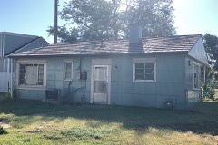
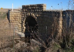
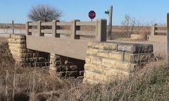
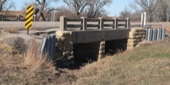
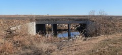
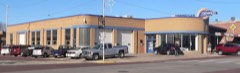
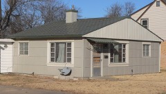
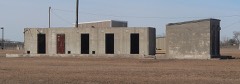
Every property in this county listed on the National Register of Historic Places, with the year it was listed and the federal nomination document.
Every wildfire the federal occurrence database records inside this county: 193 of them, burning about 12,153 acres. 4 started naturally and 14 were recorded as arson. Each settlement page carries the fires within five miles of it.
| Reported cause | Fires |
|---|---|
| Missing data/not specified/undetermined | 90 |
| Debris and open burning | 26 |
| Equipment and vehicle use | 21 |
| Smoking | 19 |
| Arson/incendiarism | 14 |
| Misuse of fire by a minor | 8 |
| Power generation/transmission/distribution | 6 |
| Fireworks | 5 |
| Natural | 4 |
The five largest, by the area the report gives. One of them was set deliberately.
| Date | Cause | Size | Reported by | Name on the report |
|---|---|---|---|---|
| 25 April 1996 | Arson/incendiarism | 6,000 acres | Quivira National Wildlife Refuge | GATTON |
| 16 March 1994 | Missing data/not specified/undetermined | 4,960 acres | Quivira National Wildlife Refuge | SYLVIA |
| 18 April 1996 | Smoking | 340 acres | Quivira National Wildlife Refuge | DEER STAND |
| 1 July 2017 | Debris and open burning | 155 acres | Barton County | 2017041 |
| 24 November 2015 | Equipment and vehicle use | 80 acres | Kansas Forest Service | 7 |
| 18 February 2017 | Debris and open burning | 80 acres | Barton County | 17008 |
| 4 March 1994 | Equipment and vehicle use | 75 acres | Quivira National Wildlife Refuge | SMITH |
| 26 June 2020 | Missing data/not specified/undetermined | 35 acres | Kansas Forest Service | not named |
Every settlement page carries the fires within five miles of it - see the settlement index below.
The NOAA Storm Events Database holds 1,104 reports for this county, causing 2 deaths, 61 injuries and about $109,758,930 in recorded property damage. Each settlement page carries the reports that name it.
| Kind of event | Reports |
|---|---|
| Hail | 527 |
| Thunderstorm Wind | 394 |
| Tornado | 104 |
| Flood | 35 |
| Flash Flood | 27 |
| Heavy Rain | 13 |
| Lightning | 3 |
| Funnel Cloud | 1 |
The most serious of them, by death, then injury, then recorded damage. The accounts are quoted exactly as the forecast office filed them.
| When | Event | Place named | Harm | What the report says |
|---|---|---|---|---|
| April 2001 | Tornado (F4) | Hoisington | 1 killed, 28 hurt, $43,000,000 | Initial touchdown occurred 1 mile southwest of Hoisington. The tornado rapidly achieved F3 intensity as it entered the west side of town. Moving northeast around 20 mph, the tornado intensified to F4 within 2-3 minutes. While crossing northwest Hoisington, the tornado inflicted a path about 2 miles long and about 2 blocks wide of almost complete destruction. Damage summary: 182 homes destroyed, 52 homes with major damage, 180 homes with minor to moderate damage, 12 businesses destroyed, tore the roof off the hospital, and severed power to most (if not all) areas on the northwest and north sides of town. As the tornado exited through the north side of town it weakened rapidly, inflicting F1-F2 damage as it approached Deception Creek which runs in a southeast to northwest manner 3 miles northeast of town. Once the tornado crossed the creek, it suddenly turned toward the northwest where it damaged two farmsteads shortly before dissipating.One man, 69 years of age, was killed when a minivan fell on him. There were 28 injuries of which 3 were critical. |
| September 1955 | Tornado (F0) | not stated | 1 killed | no account filed |
| August 2005 | Thunderstorm Wind | Great Bend | 12 hurt, $5,000,000 | Extensive damage throughout Great Bend! Ten buildings sustained major roof or structural damage. One such casualty was the Travelodge, where the roof was peeled and twisted off part of the motel resulting in water damage to an unspecified number of upstairs guest rooms. In a few instances, the structures were completely unroofed. Numerous vehicles sustained broken windows. Twelve people suffered minor injuries, all of which required treatment at Central Kansas Medical Center. One such injury occurred when the driver of a 2003 Acura had parked his car in the Travelodge parking lot shortly before part of it's roof struck the vehicle. The car's roof and windshield were smashed, trapping him for approximately 15 minutes. Tree damage was extensive and occurred throughout the community, with many trees uprooted. Power lines and power poles downed in and around the city. Power was severed to approximately 5,500 residences. Of the estimated $5 million damage, $750,000 was inflicted upon equipment maintained by Midwest Energy, while an estimated $200,000 to $250,000 was inflicted upon electrical wires maintained by Aquila Electric.(Narrative courtesy of Great Bend Tribune and Hutchinson News.) |
| June 2000 | Hail | Great Bend | 5 hurt, $20,000,000 | The baseball-sized hail caused widespread damage to approximately 8,000 residences, 400 businesses and 2,500 vehicles. Damage included smashed windows, roofs, siding and air conditioners. Among the vehicles damaged were those of the Barton County Sheriff's Department in which nearly all of the windows were smashed. Crop damage was major to alfalfa, sorghum, corn and soybeans with 18 to 20 percent of these crops destroyed. All reported injuries were minor. Area newspapers contributed to this report. |
| May 1990 | Tornado (F3) | not stated | 4 hurt, $250,000 | no account filed |
| July 1982 | Tornado (F1) | not stated | 3 hurt, $25,000 | no account filed |
| May 2017 | Tornado (EF3) | Pawnee Rock | 2 hurt, $658,000 | This long track tornado moved in from Pawnee County. Law Enforcement reported the tornado just south of the county line near Pawnee Rock and then followed it as it moved to the NE. The tornado moved through the west side of Pawnee Rock causing sporadic EF1 and isolated EF2 damage to several homes and one school type facility. The tornado continued to move to the NNE causing EF2 damage to a couple of homes on West Barton County Road. One residence was a mobile home that lost the far east side of the structure and all roofing material. One injury was noted at that location as they did not seek shelter. The home just to the west lost the east half of structure with the occupants seeking refuge in the basement. Of note, a Ford F-150 was thrown or rolled approximately 75 to hundred yards away from its original location. Further to the NE, the tornado strengthened considerably as noted by complete destruction of an 1890 farm house. With the age of the home and no anchoring being present due to the structure resting on cinder blocks along with a lack of debarking, a higher rating could not be justified though the amount of devastation to the structure itself pointed towards a possible higher rating. Three occupants sought refuge in the basement and were unharmed. The next door neighbor's home was also considerably damaged with all of the structure being demolished except for one corner section. The tornado then continued to the NE over open country damaging trees and power lines along the way before dissipating NW of Hoisington. A total of 44 parcels were affected. Ten homes were deemed total losses. The estimated property value losses were estimated at $658,000. |
| June 2009 | Tornado (EF0) | Great Bend | 2 hurt, $75,000 | A brief tornado touchdown caused some damage to roofs, garage doors, windows, siding trees, power lines and fences across western portions of Great Bend. Two injuries were reported, including a 38-year old man receiving cuts from flying broken glass, and a 53-year old woman being hit in the head by a falling tree limb. The Great Bend Tribune contributed to this report. |
| May 2011 | Tornado (EF1) | Ellinwood | 1 hurt, $250,000 | The tornado touched down just outside of Ellinwood and moved to the northwest. The tornado caused considerable damage at one farmstead and moderate damage at two others. Most of the damage was limited to outbuildings such as barns and sheds. However, the residences did sustain some minor damage as well. One person was injured (direct). |
| October 1956 | Tornado (F3) | not stated | 1 hurt, $250,000 | no account filed |
| August 1966 | Tornado (F2) | not stated | 1 hurt, $25,000 | no account filed |
| June 1964 | Tornado (F2) | not stated | 1 hurt, $25,000 | no account filed |
| April 1956 | Tornado (F3) | not stated | 1 hurt, $25,000 | no account filed |
| May 2007 | Flash Flood | Great Bend | $30,000,000 | Flash flooding was reported throughout the county. Highway 96 9 miles west of Great Bend was closed as water started flowing over the road. An observer in the area reported 3.22 inches of rain in just 3 hours. Highway 56 in Pawnee Rock was closed due to flood water. In Hoisington the intersection of 3rd Street and Main was closed due to high water. An observer reported approximately 3 inches of rain in 3 hours in that part of Barton County. 70 to 80 homes were flooded on the north side of Ellinwood. According to Barton County Emergency Management, the county documented roughly 30 million dollars in damage. This includes damages to private property including crop damage, damage to farm equipment, farmsteads and public roads. The Great Bend Tribune contributed to this narrative. |
| May 2007 | Tornado (EF1) | Claflin | $2,000,000 | The tornado damaged large trees at several locations along its path. Two barns were destroyed and several outbuildings were also severely damaged. Five 100,000 bushel grain bins were also destroyed with two of them flung onto the local Dillon's grocery store causing damage to that structure. Damage to a church steeple and out building also occurred at the beginning of the tornado path. Tornado was probably descending down directly onto the church. |
| May 2007 | Tornado (EF1) | Great Bend | $1,000,000 | The tornado caused some tree damage and damaged several center pivot irrigation devices. The tornado also damaged a gasoline pipeline terminal and specialized trailer company near the intersection of U.S. 56 and K-156. |
| April 2005 | Hail | Great Bend | $500,000 | Approximately 70 cars damaged at one dealership, while a second dealership sustained only minor damage. Many homes sustained roof damage and broken windows. Some wheat was also damaged but details were provided as of this writing. (Narrative courtesy Hutchinson News.) |
| August 2005 | Tornado (F0) | Great Bend | $500,000 | Significant damage at Great Bend Airport. Hangars were unroofed and an unspecified number of aircraft were overturned. This proved to be an anxious moment for Great Bend! After causing extensive damage to the airport, the tornado was moving toward the city when it lifted. The funnel passed directly over the city at tree-top level. The funnel subsequently touched down east of Great Bend, striking two farmsteads five miles east of Barton County Community College. (See 1544 CST entry for details.) (Narrative courtesy Great Bend Tribune.) |
| July 1994 | Thunderstorm Wind | Albert | $500,000 | Strong thunderstorm winds blew across the county. The strongest winds and most damage was across the northern half of the county. In Susank, buildings were damaged and large tree limbs were knocked down. A barn was completely destroyed while other sheds received damage on a farm near Hoisington. Two miles east of Elinwood, the roof was blown off an aluminum shed and 300 gallon tank was blown over. |
| July 2010 | Thunderstorm Wind | Olmitz | $360,000 | Damaging winds knocked down 23 power poles along Kansas Highway 4 just to the north of Olmitz and Bison. This knocked out power to six small towns in the area. Kansas Highway 4 was closed for a short time because of the damage and power remained out for almost 12 hours. |
| August 2013 | Flash Flood | Great Bend | $350,000 | Numerous stalled cars were reported across town from high water. Some water rescues occurred in town from people in stalled cars. Great Bend Airport reported 4.49 inches of rainfall in less than a 6 hour period. |
| May 1998 | Hail | Galatia | $300,000 | A 4-mile wide swath of hail ranging from marble to golfball-sized stretched from Galatia to Odin. Wheat planted in this area was a total loss. |
| August 2005 | Tornado (F1) | Great Bend | $250,000 | Extensive damage to two farmsteads. The damage survey revealed the tornado achieved a strong F-1 rating, meaning it's rotational velocities were around 110 mph. (Narrative courtesy of Wichita Eagle and Hutchinson News.) |
| June 2000 | Hail | Olmitz | $250,000 | Damage included broken windows (to both buildings and vehicles), siding, and roofs. |
| June 2000 | Hail | Galatia | $250,000 | Damage included broken windows (to both buildings and vehicles), siding and roofs. The damage estimate also includes that caused by the two-inch diameter hail reported at 2031 CST. |
| May 1975 | Tornado (F3) | not stated | $250,000 | no account filed |
| November 1973 | Tornado (F1) | not stated | $250,000 | no account filed |
| June 1964 | Tornado (F2) | not stated | $250,000 | no account filed |
| April 1964 | Tornado (F3) | not stated | $250,000 | no account filed |
| May 1950 | Tornado (F4) | not stated | $250,000 | no account filed |
| May 1999 | Hail | Albert | $175,000 | Golfball-sized hail damaged farm dwellings and approximately 70% of total acreage. |
| July 2003 | Thunderstorm Wind | Great Bend | $150,000 | Amateur radio tower toppled. Fence leveled. Two miles east of Great Bend: Metal shed blown across U.S.56/HIghway 156 intersection. Traffic blocked. Trailer at construction site overturned and destroyed. Great Bend Tribune contributed greatly to this narrative. |
| May 2008 | Tornado (EF1) | Ellinwood | $125,000 | A house was pushed off of its foundation, and a barn was completely destroyed. |
| August 2023 | Flash Flood | Pawnee Rock | $100,000 | Multiple Roads flooding the city of Great Bend. Numerous cars flooded out. Some water considered fast moving. |
| August 2013 | Flash Flood | Ellinwood | $100,000 | Several homes reported basement flooding. Several roads were closed between Ellinwood and Great Bend due to high water flowing over the road. |
| June 2006 | Flash Flood | Hoisington | $100,000 | An isolated but intense slow moving thunderstorm dumped 4 to 6 inches of rain between roughly 1700 and 1900 CST across the southern two-thirds of Barton County. Widespread flooding occurred from Hoisington to Great Bend to near the Stafford County line. High water forced the closure of Highway 281 four miles south of Hoisington for two hours. Numerous rural and city roads and intersections, especially those in and around Hoisington and Great Bend, were barricaded due to high water. Several businesses and homes received water damage, a handful of which was rather extensive. Unofficially, Lake Barton Golf Course received nearly 6.50 inches of rain. Fortunately, no one was injured. |
| May 1999 | Tornado (F1) | Claflin | $100,000 | In Claflin, one farmstead sustained damage where top half of barn was destroyed, grainery destroyed, grain bin disappeared, and chicken house lost nearly 2/3 of it's roof. |
| August 2002 | Thunderstorm Wind | Ellinwood | $75,000 | Shed damaged, one house damaged (unspecified), windmill twisted, and door blown off a barn. In addition, power lines downed on west side of town with trees downed in various locations. |
| June 2008 | Tornado (EF1) | Hitschmann | $65,000 | A seven mile long track tornado caused minor damage to three homesteads in the northeast section of the county. Damage was mainly to trees and powerlines, but a metal building and a metal silo and feed bin received damage as well. |
| May 2007 | Tornado (EF1) | Odin | $60,000 | The tornado caused some tree damage and minor damage to several barns west of Odin. Several power lines were also blown down. |
| May 2007 | Tornado (EF1) | Claflin | $57,000 | The tornado caused significant damage to trees and power lines along its path and also caused minor structual damage to one residence. |
| July 2023 | Thunderstorm Wind | Great Bend | $50,000 | Part of a the roof of a church was torn off in Great Bend. The report was relayed via broadcast media KAKE and KSN. |
| September 2015 | Thunderstorm Wind | Great Bend | $50,000 | Eighty percent of the roof was blown off the gymnasium at Lincoln Elementary. |
| September 2014 | Thunderstorm Wind | Galatia | $50,000 | Law enforcement reported power lines and trees down. Eight outbuildings were also damaged. The home has exterior damage and two vehicles were damaged. Some livestock was also reported missing. |
| April 2008 | Thunderstorm Wind | Dartmouth | $50,000 | One metal grain bin was destroyed at the Pawnee County Coop. |
| July 2003 | Thunderstorm Wind | Great Bend | $50,000 | Downed branches, reaching 4-5 inches in diameter, blocked neighborhood streets. Unspecified number of homes sustained roof damage and a few outbuildings were destroyed. Great Bend Tribune contributed greatly to this narrative. |
| July 2003 | Thunderstorm Wind | Great Bend | $50,000 | Unspecified number of homes sustained roof damage. Widespread tree damage including a few that were uprooted. Great Bend Tribune contributed to this narrative. |
| February 2000 | Thunderstorm Wind | Great Bend | $50,000 | Estimated 70 mph winds hit northwest Great Bend damaging a telephone pole, fences and a chimney (blown down). |
| May 1998 | Thunderstorm Wind | Great Bend | $50,000 | Store-front windows blown out of several businesses, uprooted a large tree, toppled over a light standard at an athletic field. |
| May 1993 | Tornado (F1) | Great Bend | $50,000 | This tornado touched down just long enough to cause some roof and structural damage to a manufacturing plant just to the west of Great Bend. |
| May 1993 | Hail | Galatia | $50,000 | no account filed |
| May 2019 | Tornado (EF1) | Ellinwood | $40,000 | Minimal damage to a residence was noted. However, significant damage to a few grain bin silos were noted. |
| October 2017 | Thunderstorm Wind | Ellinwood | $40,000 | Power poles were snapped along highway 56 blocking the road. |
| September 2015 | Thunderstorm Wind | Great Bend | $40,000 | A trained spotter reported multiple 3 to 4 inch tree limbs down. Large trees were also knocked down. |
| August 2011 | Thunderstorm Wind | Beaver | $40,000 | Winds estimated around 70 to 80 mph produced extensive damage to a church in Dubuque in northern Barton county. An outbuilding was damaged, along with the church steeple. Additionally, several windows were broken out of the sacristy, and a wall of a quonset hut was blown away. Just east of Dubuque, the storm produced damage to some homes in the form of broken windows, damaged siding and shredded roofs. Consequently, hail likely occurred at times with the wind, but exact hail size remains unknown. However, reports further northwest in Russell county suggest hail could have been up to golfball size. Some area crops were also heavily damaged, but damage estimates are unknown. Property damage amounts are rough estimates. The Great Bend Tribune was the sole contributor to this report. |
| September 2014 | Thunderstorm Wind | Galatia | $35,000 | A few trees were blown over and power lines were knocked down. |
| September 2015 | Thunderstorm Wind | Great Bend | $30,000 | Roof damage occurred to a nursing home. |
| April 2015 | Thunderstorm Wind | Ellinwood | $25,000 | Several power poles were snapped in half, across the southeast part of the county. |
| September 2015 | Thunderstorm Wind | Great Bend | $25,000 | Multiple reports of power outages, with power poles and trees down. |
| May 2007 | Tornado (EF1) | Dundee | $25,000 | The tornado caused minor roof damage to one residence but tore the roof of of the garage and an out buiding. Several other out buildings sustained minor to moderate damage. |
The Survey's mineral resources record lists 2 workings inside this county. All of them still produce. Each settlement page carries the workings within five miles of it.
| Commodity | Workings |
|---|---|
| Clay | 1 |
| Sand and Gravel, Construction | 1 |
The least common of them first, because a county's hundredth gravel pit says nothing its first ten did not.
| Where | Site | Commodity | Status | Recorded |
|---|---|---|---|---|
| Arkansas Sand Co Old Moo | Sand and Gravel, Construction | Producer | ||
| Kansas Brick & Tile Pit & Tile Plt | Clay | Producer |
Named settlements recorded in the Geographic Names Information System, each with the topographic sheets covering it. Villages, hamlets and abandoned places alike. Each is shown with the nearest named watercourse or landform and the survey quadrangle it falls on.