Block
From the record
21 National Register listings published here.
Sources: the National Register database, National Park Service
47 topographic sheets cover 14 settlements here, and 21 properties are on the National Register of Historic Places.
21 National Register listings published here.
Sources: the National Register database, National Park Service
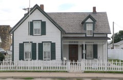
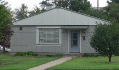
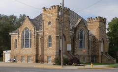
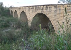
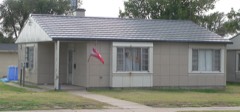
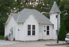
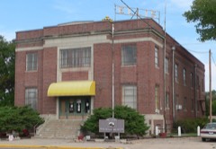
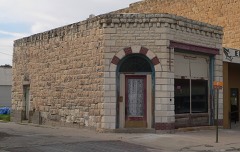
Every property in this county listed on the National Register of Historic Places, with the year it was listed and the federal nomination document.
Every wildfire the federal occurrence database records inside this county: 198 of them, burning about 20,151 acres. 17 started naturally and 6 were recorded as arson. Each settlement page carries the fires within five miles of it.
| Reported cause | Fires |
|---|---|
| Missing data/not specified/undetermined | 83 |
| Equipment and vehicle use | 43 |
| Debris and open burning | 27 |
| Natural | 17 |
| Smoking | 11 |
| Arson/incendiarism | 6 |
| Fireworks | 5 |
| Misuse of fire by a minor | 3 |
| Recreation and ceremony | 1 |
| Power generation/transmission/distribution | 1 |
| Other causes | 1 |
The five largest, by the area the report gives. None of them was recorded as arson.
| Date | Cause | Size | Reported by | Name on the report |
|---|---|---|---|---|
| 11 April 1996 | Missing data/not specified/undetermined | 7,600 acres | Ellis County | not named |
| 7 March 2017 | Equipment and vehicle use | 7,500 acres | Ellis County | 017-065 |
| 10 April 2018 | Equipment and vehicle use | 1,513 acres | Kansas Forest Service | 101 |
| 15 March 2014 | Missing data/not specified/undetermined | 1,200 acres | Ellis County | 170TH AND HOMESTEAD |
| 27 June 2012 | Missing data/not specified/undetermined | 1,200 acres | Kansas Counties | 1700 SALINE RIVER |
| 6 March 2018 | Equipment and vehicle use | 105 acres | Kansas Forest Service | 50 |
| 8 April 2015 | Missing data/not specified/undetermined | 100 acres | Kansas Forest Service | 15-0056 |
| 6 March 2017 | Missing data/not specified/undetermined | 75 acres | Ellis County | 017-059 |
Every settlement page carries the fires within five miles of it - see the settlement index below.
The NOAA Storm Events Database holds 1,026 reports for this county, causing 1 death, 12 injuries and about $9,646,000 in recorded property damage. Each settlement page carries the reports that name it.
| Kind of event | Reports |
|---|---|
| Hail | 539 |
| Thunderstorm Wind | 306 |
| Tornado | 66 |
| Heavy Rain | 59 |
| Flash Flood | 27 |
| Flood | 17 |
| Lightning | 7 |
| Funnel Cloud | 5 |
The most serious of them, by death, then injury, then recorded damage. The accounts are quoted exactly as the forecast office filed them.
| When | Event | Place named | Harm | What the report says |
|---|---|---|---|---|
| November 1999 | Lightning | Pfeifer | 1 killed, 1 hurt | An eleven year old girl was killed and a twelve year old girl was injured from a lightning bolt. The girls were in the yard behind the house near their horses, when the lightning strike occurred. The deceased was struck by the bold while the injured girl was standing within inches. CPR was unsuccessful. What makes this event even more sadening was the fact that no other lightning or thunder were reported. |
| April 1979 | Tornado (F1) | not stated | 2 hurt, $250,000 | no account filed |
| April 1998 | Tornado (F1) | Schoenchen | 2 hurt, $50,000 | There was damage to a metal building and a quonset hut. Two young boys were injured when the door blew off of the building. A chicken house blew away. |
| September 2003 | Lightning | Hays | 2 hurt | Two Fort Hays students (female) received minor injuries when light struck a tree about 20 feet away. They were treated and released from an area hospital. |
| October 1998 | Tornado (F3) | Yocemento | 1 hurt, $1,200,000 | Tornado that began in eastern Trego county, steadily moved northeast before dissipating north of Hays. The tornado hit several farms in rural Ellis county and slammed into sparsely populated Yocemento. After leaving Yocemento, the tornado tore through a feedyard and on across other parts of rural Ellis county. Fortunately, the tornado stayed just west and north of populated Hays where a high school football game was in progress. The tornado damaged or destroyed 10 homes, a grain elevator, many outbuildings, a tractor and a feedlot. During the weaker moments of the tornado, it moved a 14,000 pound tractor 30 yards. One modular constructed home on a concrete slab was completely destroyed with the remains carried 1/2 of a mile. A steel I-beam from a concrete building travelled several hundred yards, eventually crashing into a grain elevator. Three empty anhydrous ammonia tanks were moved causing a leak of a benign amount of vapour. An injury occurred to a male driving a tractor-trailer rig on Interstate 70. |
| May 1955 | Tornado (F1) | not stated | 1 hurt, $2,500 | no account filed |
| May 2008 | Tornado (EF1) | Ellis | 1 hurt | This tornado produced EF1 damage to outbuildings, a storage tank, power poles and houses in Ellis. A female was injured when she went out to get her horse and was hit by flying debris from the tornado. |
| July 2004 | Thunderstorm Wind | Hays | 1 hurt | A door flew open and injured one person |
| July 1986 | Hail | not stated | 1 hurt | no account filed |
| April 1990 | Tornado (F3) | not stated | $2,500,000 | no account filed |
| August 2010 | Thunderstorm Wind | Hays | $1,500,000 | The most expensive damage was at Fort Hays State University, where the high winds blew off most of the roof from Weist Hall. Vehicles in an adjacent parking lot were damaged by roof debris. Extensive water damage occurred to the interior of the building. Some students and offices were relocated as a consequence of the damage. |The rainfall was so heavy that drains on Lewis Field were overwhelmed, and water accumulated under the special astro turf covering the field and lifted it from the field. |salvaged. |
| June 2003 | Hail | Ellis | $1,500,000 | no account filed |
| June 2010 | Thunderstorm Wind | Ellis | $500,000 | The city manager reported multiple buildings destroyed and numerous buildings with partial damage. Forty percent of the headstones in the cemetery were turned over by the high wind. Also, big trees were snapped. |
| May 1998 | Hail | Schoenchen | $300,000 | Much of the wheat and corn were mowed down. |
| May 1995 | Hail | Gorham | $300,000 | Wind of 70 to 80 mph with the hail. A grain bin was destroyed by the winds while numerous cars and homes were damaged by the hail. |
| October 1980 | Tornado (F0) | not stated | $250,000 | no account filed |
| October 1980 | Tornado (F3) | not stated | $250,000 | no account filed |
| August 1972 | Tornado (F2) | not stated | $250,000 | no account filed |
| April 2001 | Tornado (F2) | Ellis | $150,000 | A tornado moved in from Trego county at 2209 and moved into Rooks county at 2238. It took out 50 power poles in Ellis county and damaged 13 farms. Roofs were removed on several homes and there was extensive damage done to several outbuildings and trailers. Two semis were overturned on I-70 west of Ellis causing several minor injuries. Reports of the infamous "roar" were noted in the Ellis community. |
| September 2016 | Flash Flood | Catharine | $100,000 | Water about 80 yards wide was rushing over several roads along Little Big Creek. |
| May 1995 | Hail | Hays | $50,000 | Wind gusts of 60 to 70 mph reported. Lots of broken glass. |
| August 1993 | Thunderstorm Wind | Hays | $50,000 | Roof damage occurred on some buildings at the Ft. Hays State Historic Site. Large trees were uprooted and snapped in the Hays area. A wind gust to 70 mph was recorded at the Hays Airport. |
| September 1994 | Hail | Schoenchen | $50,000 | no account filed |
| May 1995 | Tornado (F1) | Antonino | $40,000 | Damage was $1 million done to crops across the county. |
| May 1995 | Thunderstorm Wind | Ellis | $40,000 | A silo was destroyed and power lines down. |
| April 2001 | Thunderstorm Wind | Ellis | $30,000 | Two semis overturned on I70 |
| June 1976 | Tornado (F1) | not stated | $25,000 | no account filed |
| April 1972 | Tornado (F2) | not stated | $25,000 | no account filed |
| May 1972 | Tornado (F2) | not stated | $25,000 | no account filed |
| June 1966 | Tornado | not stated | $25,000 | no account filed |
| August 1964 | Tornado (F3) | not stated | $25,000 | no account filed |
| October 1954 | Tornado (F3) | not stated | $25,000 | no account filed |
| May 1951 | Tornado (F1) | not stated | $25,000 | no account filed |
| August 1995 | Thunderstorm Wind | Hays | $20,000 | Several roofs blown off by wind of at least 70 kt. |
| July 1996 | Thunderstorm Wind | Ellis | $15,000 | no account filed |
| June 1995 | Hail | Walker | $15,000 | no account filed |
| August 2010 | Thunderstorm Wind | Hays | $10,000 | Twenty power poles were blown down. |
| June 1999 | Thunderstorm Wind | Hays | $7,000 | Dugout moved off foundation and football shed demolished. |
| April 1998 | Flash Flood | Schoenchen | $5,000 | A quick rise on the Smoky Hill River submerged a front end loader. |
| June 1997 | Lightning | Hays | $5,000 | Lightning bold destroyed a chimney. The debris fell on a car. |
| June 1997 | Thunderstorm Wind | Walker | $5,000 | Power lines blown down...few trees uprooted. |
| July 1994 | Hail | Victoria | $5,000 | no account filed |
| June 1997 | Thunderstorm Wind | Munjor | $4,000 | Eight power poles blown down. |
| June 2013 | Thunderstorm Wind | Victoria | $2,500 | Five power poles were blown down by the high wind. |
| May 1991 | Tornado (F0) | not stated | $2,500 | no account filed |
| May 1960 | Tornado (F1) | not stated | $2,500 | no account filed |
| June 1951 | Tornado (F1) | not stated | $2,500 | no account filed |
| May 1951 | Tornado (F1) | not stated | $2,500 | no account filed |
| June 1997 | Thunderstorm Wind | Victoria | $2,000 | Power poles blown down. |
| May 2010 | Thunderstorm Wind | Ellis | $1,500 | A roof was blown off a medium sized utility building and a power pole was snapped in half. |
| August 2009 | Thunderstorm Wind | Victoria | $750 | A power pole was blown down. |
| July 2002 | Thunderstorm Wind | Hays | $500 | A power pole was blown down which started a small fire in the back yard. |
| May 1960 | Tornado (F2) | not stated | $250 | no account filed |
| August 2025 | Thunderstorm Wind | Yocemento | - | Mesonet station UP856 0.8 E Yocemento (UPR) recorded a 57 mph wind gust. |
| August 2025 | Thunderstorm Wind | Ellis | - | A public weather station KKSELLIS46 recorded a 68 mph wind gust. |
| August 2025 | Thunderstorm Wind | (Hys)Hays Muni Arpt | - | AWOS station KHYS Hays Regional Airport recorded a 61 mph wind gust. |
| May 2025 | Hail | Ellis | - | Public report of 1.75 inch hail. |
| June 2025 | Thunderstorm Wind | Yocemento | - | A report received from the public of gusts estimated at 72 mph. |
| July 2025 | Thunderstorm Wind | Hog Back | - | A mesonet station measured 65 mph gusts. |
| July 2025 | Thunderstorm Wind | Pfeifer | - | Reported by the Public. |
The Survey's mineral resources record lists 5 workings inside this county. All of them still produce. Each settlement page carries the workings within five miles of it.
| Commodity | Workings |
|---|---|
| Sand and Gravel, Construction | 3 |
| Stone, Crushed/Broken | 2 |
The least common of them first, because a county's hundredth gravel pit says nothing its first ten did not.
| Where | Site | Commodity | Status | Recorded |
|---|---|---|---|---|
| Allied Incorporated Limestone Quarr | Stone, Crushed/Broken | Producer | ||
| Wolf Quarry | Stone, Crushed/Broken | Producer | ||
| Beiker Sand Pit | Sand and Gravel, Construction | Producer | ||
| Larry Werth Sand Pit | Sand and Gravel, Construction | Producer | ||
| Werth Sand Pit | Sand and Gravel, Construction | Producer |
Named settlements recorded in the Geographic Names Information System, each with the topographic sheets covering it. Villages, hamlets and abandoned places alike. Each is shown with the nearest named watercourse or landform and the survey quadrangle it falls on.
Big Creek township · 67667 · Near Lookout Hollow · Liebenthal quadrangle
14 sheets, 1896 to 1985