 Block
From the record
15 National Register listings published here.
Sources: the National Register database, National Park Service
54 topographic sheets cover 6 settlements here, and 15 properties are on the National Register of Historic Places.
15 National Register listings published here.
Sources: the National Register database, National Park Service
Every property in this county listed on the National Register of Historic Places, with the year it was listed and the federal nomination document.
| Photograph | Property | Type | Listed | Reference |
|---|---|---|---|---|
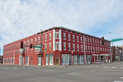 | Bartell House | building | 1980 | 80001466 |
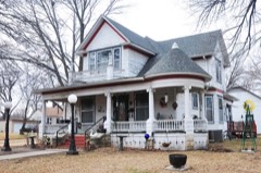 | Brown, George T, House | building | 2006 | 06001167 |
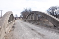 | Conroe Bridge | site | 1983 | 83000427 |
 | James Dixon House | building | 1998 | 98000265 |
| First Presbyterian Church of Junction City | building | 2021 | 100007028 | |
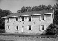 | First Territorial Capitol | building | 1970 | 70000249 |
 | Grand Army of the Republic (GAR) Memorial Arch | structure | 2017 | 100000512 |
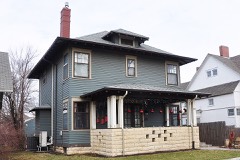 | Jackson-McConnell House | building | 2012 | 12000204 |
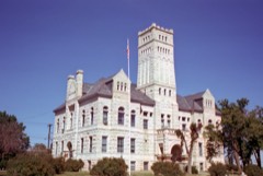 | Junction City Downtown Historic District | district | 2006 | 06000623 |
| Leithoff-Powers Ranch Historic District | district | 1995 | 95000946 | |
| Lyon Creek Rainbow Arch | structure | 2020 | 100005949 | |
| Main Post Area, Fort Riley | district | 1974 | 74000837 | |
 | Old Junction City High School | building | 1981 | 81000278 |
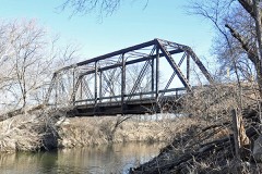 | Old Katy Bridge | structure | 2003 | 03000370 |
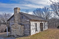 | Christian Wetzel Cabin | building | 1973 | 73000757 |
Every wildfire the federal occurrence database records inside this county: 194 of them, burning about 20,715 acres. 1 started naturally and 10 were recorded as arson. Each settlement page carries the fires within five miles of it.
| Reported cause | Fires |
|---|---|
| Missing data/not specified/undetermined | 69 |
| Debris and open burning | 67 |
| Equipment and vehicle use | 20 |
| Smoking | 14 |
| Arson/incendiarism | 10 |
| Fireworks | 6 |
| Other causes | 4 |
| Misuse of fire by a minor | 3 |
| Natural | 1 |
The five largest, by the area the report gives. None of them was recorded as arson.
| Date | Cause | Size | Reported by | Name on the report |
|---|---|---|---|---|
| 22 August 2012 | Missing data/not specified/undetermined | 8,000 acres | Kansas Counties | SKIDDY WEST ROAD |
| 5 April 2016 | Missing data/not specified/undetermined | 5,000 acres | Geary County | BURLEY HILL |
| 21 April 2006 | Missing data/not specified/undetermined | 2,000 acres | Kansas Counties | MCDOWELL |
| 15 March 2014 | Missing data/not specified/undetermined | 1,000 acres | Geary County | MOYER RANCH |
| 3 November 2020 | Missing data/not specified/undetermined | 800 acres | Geary County | 170 MP 311 |
| 15 March 2014 | Missing data/not specified/undetermined | 700 acres | Geary County | WOLF CREEK |
| 11 April 2014 | Missing data/not specified/undetermined | 650 acres | Geary County | HOWARD/NELSON FIRE |
| 5 March 2018 | Missing data/not specified/undetermined | 600 acres | Geary County | I-70 MILEPOST 310 |
Every settlement page carries the fires within five miles of it - see the settlement index below.
The NOAA Storm Events Database holds 484 reports for this county, causing no deaths, 16 injuries and about $5,428,700 in recorded property damage. Each settlement page carries the reports that name it.
| Kind of event | Reports |
|---|---|
| Thunderstorm Wind | 211 |
| Hail | 209 |
| Flash Flood | 32 |
| Tornado | 20 |
| Lightning | 9 |
| Heavy Rain | 1 |
| Flood | 1 |
| Funnel Cloud | 1 |
The most serious of them, by death, then injury, then recorded damage. The accounts are quoted exactly as the forecast office filed them.
| When | Event | Place named | Harm | What the report says |
|---|---|---|---|---|
| June 2010 | Thunderstorm Wind | Milford | 5 hurt | Trained spotters, law enforcement officers, and emergency management reported 60 to 70 mph wind gusts near Milford Lake in Geary County. In Junction City power lines and transformers were damaged. |
| July 1994 | Thunderstorm Wind | Milford Lake | 4 hurt, $5,000 | High winds that turned over and damaged/destroyed campers and tents injured four people. None were serious, but three were taken to local hospitals for minor treatment. Heavy rains accompanied the high winds. |
| July 1997 | Tornado (F1) | Junction City | 3 hurt, $200,000 | no account filed |
| May 2013 | Thunderstorm Wind | Milford | 2 hurt | One camper flipped over with 2 minor injuries and another camper flipped. Most of the area without power. |
| June 2024 | Thunderstorm Wind | (Fri)Marshall Aaf Ft | 1 hurt | KHP reported a semi was blown into the median of I-70 due to strong winds. |
| May 1995 | Hail | Junction City | 1 hurt | A man riding a bike was caught in a hail storm west of Junction City. He was knocked from the bike and took refuge in a ditch, but was pelted by the wind driven large hail. He was treated and then released from the local community hospital. |
| March 1990 | Tornado (F2) | not stated | $2,500,000 | no account filed |
| June 2004 | Flash Flood | Junction City | $500,000 | Heavy rain caused flash flooding with water covering roadways. Considerable damage occurred to farmland due to errosion. Many roads and bridges were also heavily damaged. |
| June 2005 | Flash Flood | Junction City | $400,000 | Up to six inches of rain brought widespread flooding around the city. Some cars were swept away with numerous roads closed and cars stalled. Fortunately, no injuries were reported. |
| May 1986 | Tornado (F1) | not stated | $250,000 | no account filed |
| May 2007 | Flash Flood | Ft Riley | $200,000 | Flash flooding from over 5 inches of rain closed a number of county roads. A locomotive fell through a trestle that collapsed after being weakened by the flooding on Ft. Riley. No one on the train was injured. |
| September 2001 | Tornado (F1) | Milford | $170,000 | The tornado mentioned above entered Geary county at 4:34 pm 5 miles southsouthwest of Milford and moved northeast across Lake Milford before dissipating 3 miles east of the town of Milford. A powerline substation was destroyed along with a 5,100 square foot maintenance facility near Lake Milford. A farmstead along the path of the tornado suffered considerable damage. |
| June 2004 | Hail | Junction City | $130,000 | Large hail did considerable damage to a number of houses and vehicles in Junction City. |
| May 1995 | Hail | Ft Riley Military | $125,000 | Large hail with by high winds caused widespread damage to roofs, cars and windows. The supercell thunderstorm that produced the damage began near Salina and moved quickly east to north of Lawrence before diminishing. |
| June 2005 | Flash Flood | Junction City | $100,000 | K-57 highway had at least 6 inches of fast flowing water across road. |
| June 2005 | Flash Flood | Junction City | $100,000 | 8 to 10 inches of fast flowing water across highway 57. |
| November 2005 | Tornado (F1) | Junction City | $100,000 | This tornado touched down on Fort Riley Army Base approximately 3 miles northeast of Junction City and moved north for one mile before crossing into Riley county approximately 4 miles northeast of Junction City. It produced F1 damage to trees and headstones in the Fort Riley cemetery area. The Fort was without power for several hours. The parent thunderstorm was a mini-supercell. |
| August 2005 | Flash Flood | Junction City | $80,000 | Clarks creek flooding roads south of Interstate 70. |
| August 2005 | Flash Flood | Junction City | $70,000 | Fast flowing water deep enough to close rural roads. |
| May 2007 | Flash Flood | Junction City | $50,000 | Water reported flowing over the road on old Milford highway off of US 77. Reported to be several inches deep. |
| May 2007 | Flash Flood | Grandview Plaza | $50,000 | Water reported over Clarks Creek Rd. about one foot deep. |
| May 2007 | Flash Flood | Ft Riley | $50,000 | Flash flooding due to over 4 inches of rain closed several roads on Ft. Riley. |
| June 2005 | Heavy Rain | Milford | $50,000 | Small stream and lowland flooding with ponding of water on roads in Fort Riley. |
| July 1994 | Thunderstorm Wind | Junction City | $50,000 | High winds estimated well over 65 mph caused widespread damage to Junction City and most of the county. Numerous downed trees, tree limbs and power lines occurred. At one time, an estimated 15,000 people were without power in Geary and Riley Counties. Significant damage was also reported at Ft. Riley Military base and Milford Lake where four injuries occurred. |
| November 2005 | Tornado (F0) | Junction City | $40,000 | Tornado touched down at 3:21 PM 4 miles ESE of Junction City and moved north for about 2 miles before dissipating. The tornado moved across Interstate 70 near exit 307 and produced F0 damage to a hay barn, and also destroyed an indoor horse riding barn. Pieces of the barn landed a half mile away. Sufficient warning was given to allow authorities to close Interstate 70 for a short time until the tornado passed. The parent thunderstorm was a mini-supercell. |
| August 2001 | Lightning | Junction City | $35,000 | Lightning struck a church and ignited a fire that destroyed the sanctuary. |
| May 1996 | Flash Flood | Junction City | $25,000 | no account filed |
| May 1996 | Lightning | Junction City | $25,000 | no account filed |
| April 1997 | Lightning | Junction City | $18,000 | Lightning struck an antenna on the roof of a house. The house suffered damage from the resulting fire. |
| June 2004 | Lightning | Junction City | $15,000 | Lightning struck a building and started a fire that did considerable damage to the upper part of the building. |
| June 2004 | Flash Flood | Junction City | $15,000 | Heavy rains produced flash flooding. A county road was washed out. |
| October 2002 | Thunderstorm Wind | Grandview Plaza | $10,000 | Strong winds blew windows and a door out of a trailer. Another trailer was blow atop a parked vehicle. A van had windows blown out. |
| July 2002 | Thunderstorm Wind | Junction City | $8,000 | Strong winds destroyed a camper trailer. |
| June 2000 | Thunderstorm Wind | Milford | $8,000 | Strong winds destroyed a doublewide and blew down trees and power lines. |
| May 1995 | Hail | Junction City | $8,000 | Large hail caused damage to buildings and vehicles near the Grandview Plaza. |
| May 1995 | Thunderstorm Wind | Junction City | $6,000 | High winds and hail to one inch caused property and power line damage. |
| February 2004 | Thunderstorm Wind | Junction City | $5,000 | Strong winds destroyed 2 outbuildings. |
| May 1995 | Hail | Junction City | $5,000 | Damage by both wind and hail to crops is estimated. |
| June 2000 | Thunderstorm Wind | Junction City | $4,000 | Strong winds blew down tree limbs and power lines which resulted in some power outages. Two mobile homes were severely damaged. |
| May 1995 | Hail | Ft Riley Base | $3,000 | Large hail fell in Custer Hill area of the military base. |
| July 1996 | Thunderstorm Wind | Ft Riley | $3,000 | no account filed |
| March 1954 | Tornado (F1) | not stated | $2,500 | no account filed |
| July 2012 | Thunderstorm Wind | Grandview Plaza | $2,000 | A pole barn was damaged 4 miles south of Interstate 70 near Junction City, Kansas. |
| July 2011 | Thunderstorm Wind | Grandview Plaza | $2,000 | Near Junction City, two trees blew down at a residence with power pole damage. Also near Junction City a shed was blown 30 feet into a tree. |
| August 2010 | Thunderstorm Wind | Brant | $2,000 | A tree 24 inches in the diameter was reported uprooted on the west side of Highway 77 near Geary County Lake. Time of the report was estimated by radar. |
| August 2002 | Lightning | Junction City | $1,200 | Lightning struck a boat and ignited a fire doing some damage to the boat as well as a nearby boat. |
| May 2003 | Thunderstorm Wind | Junction City | $1,000 | Strong winds damaged a traffic light in Junction City. |
| June 2001 | Lightning | Junction City | $1,000 | Lightning struck a house and ignited a fire in the attic which did minor damage. |
| May 1999 | Tornado (F0) | Milford | $1,000 | A tornado touched down near Milford Lake and did minor damage to a marina. |
| July 1996 | Thunderstorm Wind | Junction City | $1,000 | no account filed |
| August 1998 | Lightning | Junction City | $500 | Lightning struck a tree blowing off bark which struck a nearby car and dented the side. |
| July 1996 | Lightning | Milford Res | $500 | no account filed |
| July 1996 | Thunderstorm Wind | Junction City | $500 | no account filed |
| October 1961 | Tornado (F0) | not stated | $250 | no account filed |
| May 1951 | Tornado (F2) | not stated | $250 | no account filed |
| May 2025 | Hail | Junction City | - | Quarter size hail southwest side of Junction City. |
| August 2025 | Thunderstorm Wind | Junction City | - | Large tree limbs down across Junction City. |
| August 2025 | Thunderstorm Wind | Camp Whitside | - | Four to six inch tree limbs down around Fort Riley. |
| April 2025 | Thunderstorm Wind | Alida | - | Estimated wind gust. |
| March 2024 | Hail | Olson | - | Report of golf ball sized hail via trained spotter. |
The Survey's mineral resources record lists 2 workings inside this county. None of them still produces: all are closed or unrecorded. Each settlement page carries the workings within five miles of it.
| Commodity | Workings |
|---|---|
| Limestone, General | 2 |
The least common of them first, because a county's hundredth gravel pit says nothing its first ten did not.
| Where | Site | Commodity | Status | Recorded |
|---|---|---|---|---|
| John D. Gray | Limestone, General | Unknown | ||
| Walker Cut Stone Co. | Limestone, General | Unknown |
Named settlements recorded in the Geographic Names Information System, each with the topographic sheets covering it. Villages, hamlets and abandoned places alike. Each is shown with the nearest named watercourse or landform and the survey quadrangle it falls on.
Jefferson township · 66441 · On Franks Creek · Junction City quadrangle
25 sheets, 1886 to 1990
Junction City city · 66441 · Near Price Ravine · Junction City quadrangle
25 sheets, 1886 to 1990