 Block
From the record
One of 15 National Register listings published here for Geary County · listed in 1995 · category: District.
Sources: the National Register database, National Park Service
Listed on the National Register of Historic Places in 1995.
One of 15 National Register listings published here for Geary County · listed in 1995 · category: District.
Sources: the National Register database, National Park Service
Regional context, not property-specific evidence. The federal wildfire occurrence database lists 22 fires within 5 miles of Leithoff-Powers Ranch Historic District between 2014 and 2019, burning about 7,349 acres in total. None started naturally. None was recorded as arson. Distance is straight-line from the map coordinates, so a fire counted here may appear on a neighbouring settlement's page as well.
| Reported cause | Fires |
|---|---|
| Missing data/not specified/undetermined | 11 |
| Debris and open burning | 8 |
| Smoking | 2 |
| Equipment and vehicle use | 1 |
The most recent of them, most recent first, with the day each was reported and the service that recorded it.
| Date | Cause | Size | Reported by | Name on the report |
|---|---|---|---|---|
| 2 July 2018 | Equipment and vehicle use | 3.0 acres | Kansas Forest Service | 110 |
| 27 June 2018 | Missing data/not specified/undetermined | 2.0 acres | Kansas Forest Service | 107 |
| 14 June 2017 | Missing data/not specified/undetermined | 1.0 acres | Geary County | 18 |
| 5 April 2016 | Missing data/not specified/undetermined | 5,000 acres | Geary County | BURLEY HILL |
| 19 April 2018 | Debris and open burning | 2.0 acres | Kansas Forest Service | 68 |
| 11 April 2017 | Debris and open burning | 30 acres | Geary County | 53 |
| 11 April 2017 | Debris and open burning | 8.0 acres | Geary County | 51 |
| 11 April 2014 | Missing data/not specified/undetermined | 650 acres | Geary County | HOWARD/NELSON FIRE |
Regional context, not property-specific evidence. The National Weather Service names Junction City, the town this property stands in, in 176 storm reports between 1993 and 2026: 92 hail, 53 thunderstorm wind, 18 flash flood, 7 lightning. The reports record 4 injuries. Each account below is quoted exactly as the forecast office filed it, from the NOAA Storm Events Database, and each date opens the federal record of that event.
| When | Event | Place named | Harm | What the report says |
|---|---|---|---|---|
| July 1997 | Tornado (F1) | Junction City | 3 hurt, $200,000 | no account filed |
| May 1995 | Hail | Junction City | 1 hurt | A man riding a bike was caught in a hail storm west of Junction City. He was knocked from the bike and took refuge in a ditch, but was pelted by the wind driven large hail. He was treated and then released from the local community hospital. |
| June 2004 | Flash Flood | Junction City | $500,000 | Heavy rain caused flash flooding with water covering roadways. Considerable damage occurred to farmland due to errosion. Many roads and bridges were also heavily damaged. |
| June 2005 | Flash Flood | Junction City | $400,000 | Up to six inches of rain brought widespread flooding around the city. Some cars were swept away with numerous roads closed and cars stalled. Fortunately, no injuries were reported. |
| June 2004 | Hail | Junction City | $130,000 | Large hail did considerable damage to a number of houses and vehicles in Junction City. |
| June 2005 | Flash Flood | Junction City | $100,000 | K-57 highway had at least 6 inches of fast flowing water across road. |
| June 2005 | Flash Flood | Junction City | $100,000 | 8 to 10 inches of fast flowing water across highway 57. |
| November 2005 | Tornado (F1) | Junction City | $100,000 | This tornado touched down on Fort Riley Army Base approximately 3 miles northeast of Junction City and moved north for one mile before crossing into Riley county approximately 4 miles northeast of Junction City. It produced F1 damage to trees and headstones in the Fort Riley cemetery area. The Fort was without power for several hours. The parent thunderstorm was a mini-supercell. |
| August 2005 | Flash Flood | Junction City | $80,000 | Clarks creek flooding roads south of Interstate 70. |
| August 2005 | Flash Flood | Junction City | $70,000 | Fast flowing water deep enough to close rural roads. |
| May 2007 | Flash Flood | Junction City | $50,000 | Water reported flowing over the road on old Milford highway off of US 77. Reported to be several inches deep. |
| July 1994 | Thunderstorm Wind | Junction City | $50,000 | High winds estimated well over 65 mph caused widespread damage to Junction City and most of the county. Numerous downed trees, tree limbs and power lines occurred. At one time, an estimated 15,000 people were without power in Geary and Riley Counties. Significant damage was also reported at Ft. Riley Military base and Milford Lake where four injuries occurred. |
| November 2005 | Tornado (F0) | Junction City | $40,000 | Tornado touched down at 3:21 PM 4 miles ESE of Junction City and moved north for about 2 miles before dissipating. The tornado moved across Interstate 70 near exit 307 and produced F0 damage to a hay barn, and also destroyed an indoor horse riding barn. Pieces of the barn landed a half mile away. Sufficient warning was given to allow authorities to close Interstate 70 for a short time until the tornado passed. The parent thunderstorm was a mini-supercell. |
| August 2001 | Lightning | Junction City | $35,000 | Lightning struck a church and ignited a fire that destroyed the sanctuary. |
| May 1996 | Flash Flood | Junction City | $25,000 | no account filed |
| May 1996 | Lightning | Junction City | $25,000 | no account filed |
| April 1997 | Lightning | Junction City | $18,000 | Lightning struck an antenna on the roof of a house. The house suffered damage from the resulting fire. |
| June 2004 | Lightning | Junction City | $15,000 | Lightning struck a building and started a fire that did considerable damage to the upper part of the building. |
| June 2004 | Flash Flood | Junction City | $15,000 | Heavy rains produced flash flooding. A county road was washed out. |
| July 2002 | Thunderstorm Wind | Junction City | $8,000 | Strong winds destroyed a camper trailer. |
| May 1995 | Hail | Junction City | $8,000 | Large hail caused damage to buildings and vehicles near the Grandview Plaza. |
| May 1995 | Thunderstorm Wind | Junction City | $6,000 | High winds and hail to one inch caused property and power line damage. |
| February 2004 | Thunderstorm Wind | Junction City | $5,000 | Strong winds destroyed 2 outbuildings. |
| May 1995 | Hail | Junction City | $5,000 | Damage by both wind and hail to crops is estimated. |
| June 2000 | Thunderstorm Wind | Junction City | $4,000 | Strong winds blew down tree limbs and power lines which resulted in some power outages. Two mobile homes were severely damaged. |
| August 2002 | Lightning | Junction City | $1,200 | Lightning struck a boat and ignited a fire doing some damage to the boat as well as a nearby boat. |
| May 2003 | Thunderstorm Wind | Junction City | $1,000 | Strong winds damaged a traffic light in Junction City. |
| June 2001 | Lightning | Junction City | $1,000 | Lightning struck a house and ignited a fire in the attic which did minor damage. |
| July 1996 | Thunderstorm Wind | Junction City | $1,000 | no account filed |
| August 1998 | Lightning | Junction City | $500 | Lightning struck a tree blowing off bark which struck a nearby car and dented the side. |
| July 1996 | Thunderstorm Wind | Junction City | $500 | no account filed |
| May 2025 | Hail | Junction City | - | Quarter size hail southwest side of Junction City. |
| August 2025 | Thunderstorm Wind | Junction City | - | Large tree limbs down across Junction City. |
| March 2024 | Hail | Junction City | - | One inch hail reported in Junction City. |
| March 2024 | Hail | Junction City | - | Ping pong ball size hail reported at Highway 77 exit of I-70 in Junction City. |
| March 2024 | Hail | Junction City | - | Report from mping. |
| March 2024 | Hail | Junction City | - | On northwest side of Junction City. |
| March 2024 | Hail | Junction City | - | Two inch hail at the Grandview Plaza exit on I-70. |
| May 2024 | Hail | Junction City | - | Nickel size hail reported in Junction City. |
| May 2024 | Thunderstorm Wind | Junction City | - | From video on social media. Also small hail. |
| June 2024 | Thunderstorm Wind | Junction City | - | Delayed social media report that shows a small shed turned on its side. Time estimated from radar. |
| June 2024 | Thunderstorm Wind | Junction City | - | From Cleary Drive and 9th street. At two different residences, one-foot diameter tree limbs snapped and fell onto house, causing part of the roof to cave in. Time estimated from radar. |
| June 2024 | Thunderstorm Wind | Junction City | - | Photos from Monroe and 12th street. One to two feet diameter tree uprooted, another 1-2 feet diameter tree with trunk snapped and fell down on house. Time estimated radar. |
| June 2024 | Thunderstorm Wind | Junction City | - | EM sent photos of tree damage on Grant Ave. One-foot diameter trees uprooted with limbs snapped. Roof blown off structure. Time estimated from radar. |
| June 2024 | Flash Flood | Junction City | - | Numerous streets flooded across Junction City. EM reported at least one water rescue. |
| June 2024 | Flash Flood | Junction City | - | Flash flooding ongoing in Junction City with over a foot of water reported on roadways and in parking lots. |
| April 2023 | Hail | Junction City | - | Quarter sized hail reported. |
| April 2023 | Thunderstorm Wind | Junction City | - | Report from social media. |
| May 2023 | Thunderstorm Wind | Junction City | - | Large tree trunk about 18 to 24 inches in diameter snapped off. |
| July 2023 | Hail | Junction City | - | Quarter sized hail report from mping. |
| July 2023 | Thunderstorm Wind | Junction City | - | Mping report of small tree limbs down. |
| July 2023 | Thunderstorm Wind | Junction City | - | Measured on a personal weather station. |
| May 2022 | Thunderstorm Wind | Junction City | - | The emergency manager reported thee damage spanning four blocks with one home damaged from falling tree limbs. |
| May 2022 | Funnel Cloud | Junction City | - | Report from emergency manager on K-18, 5 miles west of Junction City looking north. |
| May 2022 | Hail | Junction City | - | Half dollar sized hail reported. |
| June 2022 | Thunderstorm Wind | Junction City | - | Two healthy trees that were 2 to 3 feet in diameter blown down, winds estimated between 70 and 80 mph. |
| May 2021 | Thunderstorm Wind | Junction City | - | EM reports 70 mph wind gust. |
| August 2021 | Thunderstorm Wind | Junction City | - | Healthy tree 2 feet in diameter blown down. |
| December 2021 | Thunderstorm Wind | Junction City | - | Report from public of metal signs bent, siding blown off buildings, and damage to hangers at the Junction City Airport. |
| May 2020 | Hail | Junction City | - | Quarter size hail reported by public. |
No historic map-sheet match is published for this property yet. That does not mean no map exists. This record needs a coordinate-quality review before it can be joined to a sheet boundary. Browse the county's mapped places while that work is pending.
Other National Register properties close enough to walk or drive between, ordered by distance from this one. Both positions come from the same geocoding pass that matched these properties to their map sheets.
| Photograph | Property | Distance | Listed |
|---|---|---|---|
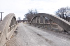 | Conroe Bridge | 4.4 miles | 1983 |
 | Bartell House | 6.6 miles | 1980 |
 | Brown, George T, House | 6.7 miles | 2006 |
| First Presbyterian Church of Junction City | 6.7 miles | 2021 | |
 | Grand Army of the Republic (GAR) Memorial Arch | 6.7 miles | 2017 |
| Main Post Area, Fort Riley | 6.7 miles | 1974 |
| National Archives record | The nomination case file for reference 95000946 in Record Group 79. |
| Geary County | All 15 listed properties in this county. |